
Ryan somehow got a 3 day weekend the weekend before 4th of July, so we had to take advantage of the time off and plan a trip. I have wanted to backpack on the coast for a long time now. We faxed in our permit application for Ozette Triangle (old school) and within a day we got an email confirmation that we got the permits we wanted! Permits are $8/ person/ day. We would camp one night on the Ozette Triangle (Cape Alava) and then one night at Yellow Banks to extend it a bit and add in some more miles. Friday we left very early to make a 8:30 or so ferry. I will never drive around the peninsula and not take the ferry now. Even though it is a little price, it's so worth it and an experience in itself. We got to Port Angeles by 11:00 and stopped at the ranger station. For all permits you have to stop here to pick up your physical permit. I was annoyed we had to do this at first, but the ranger was super helpful in giving us all the information we would need to know about this trip like best campsites, water sources, toilets, ect. He gave us a tide chart as well and explained when it would be safe to head out. We recently bought a bear canister, so this was full of our food, but we picked up wine and more food so borrowed another one for free from the ranger station. A little excessive, but needed for all our food, wine and toiletries. They are big and annoying but also nice to not deal with hanging food. They also double as a chair as well. Score.
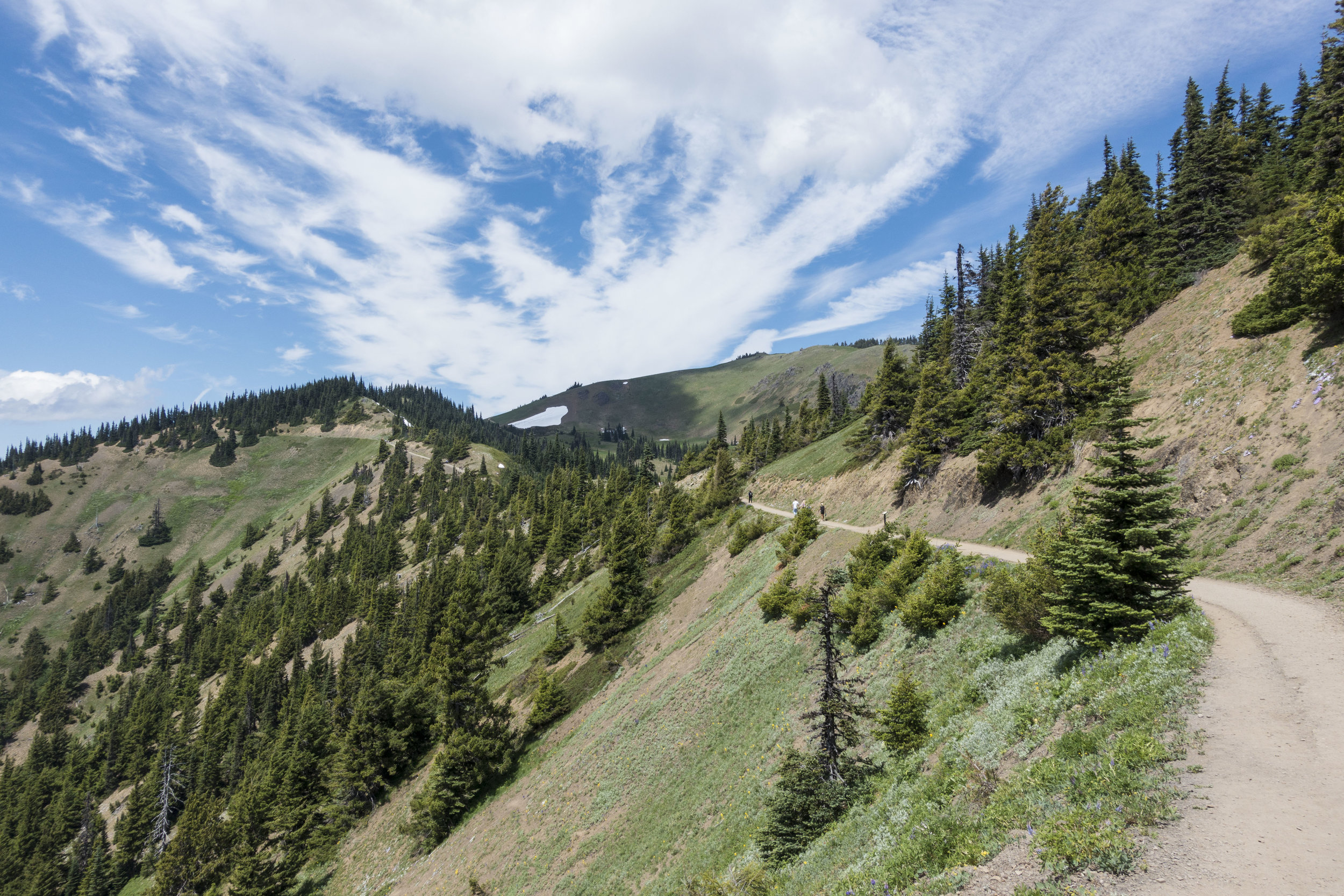
It was beautiful out so we took a pitstop to Hurricane Ridge that is right by the ranger station. It's about a 20-25 min drive up with expansive views of the Olympic Mountains. We did Hurricane Hill hike that was 3 miles/ 1000 EG. Such a beautiful hike.


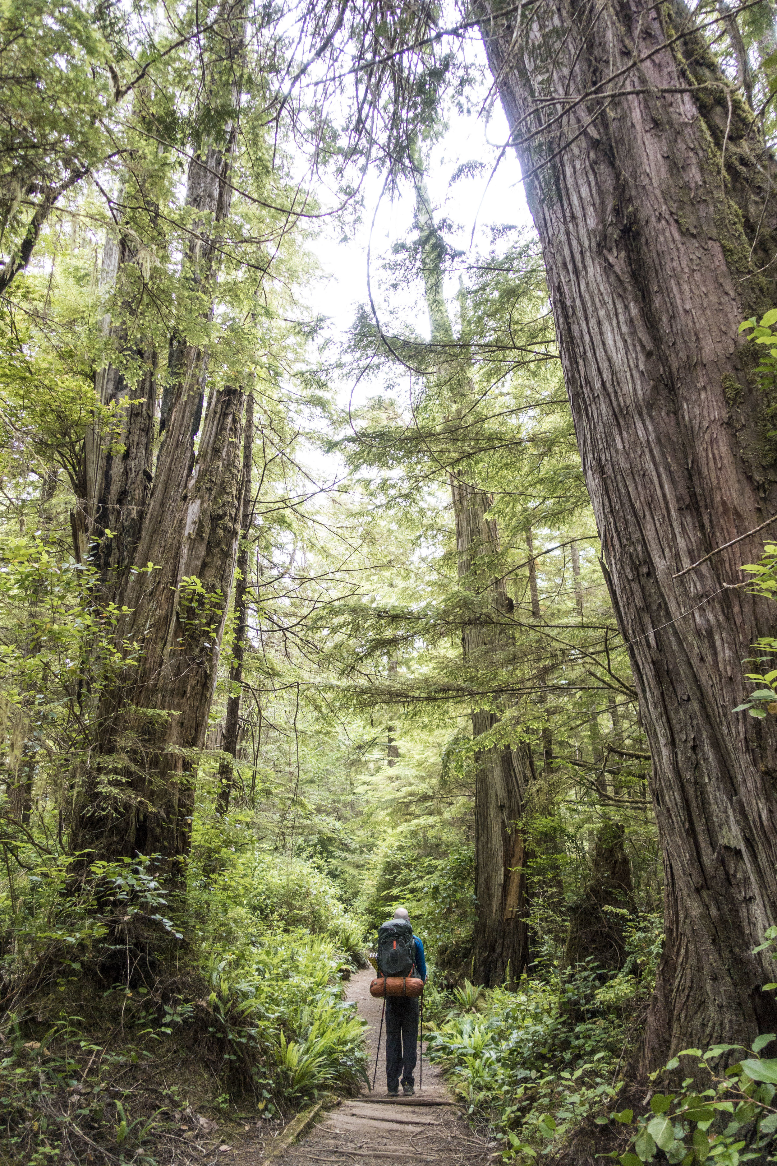
After this it was a 2 hour drive still to the coast. 4.5 total from Seattle. This road is long and takes forever as you can't go very fast, but we finally pulled into the parking lot. There is a camp ground here if you need to plan to pull in late and sleep there the night before. It was now 6:00 or so and with packs loaded we hit the trail. The 3 miles to the coast is mostly boardwalk, flat and old growth forest.

We made it to the coast and ran into a ranger right away that checked our permits. A first in the backcountry for me. She said most of the spots up ahead were taken, so to take one that was pretty much by the entrance. It was right on the trail but also 7:30 at this point so we didn't feel like looking and set up camp there. It wasn't the worst spot, but annoying being on trail with no privacy.

Once camp was set up, we strolled the beach to take in the little sunset there was. There were plenty of taken, better spots further down. Some right on the beach. You are allowed to camp anywhere on the beach as long as you aren't camping where high tide comes in.

We woke up the next morning and had our nutritious breakfast of poptarts and coffee. Backcountry dining at it's finest. We hit the trail by 9:00 something for the 5.5 mile trek to yellow banks. The tide would be low 10-6, so no rush to get over there. The first part to wedding rocks was very rocky and slow going. Walking on low tide pools mostly and not beach as we had to navigate around many large down trees. If you were to cross some of these sections during high tide there are overland passes, but not everywhere.


We stopped for lunch at Sand point. This is where the triangle meets on the other side. The campsites here are in the woods. As we hiked on we hiked past South Sand point campsites and these were much nicer on the beach. If someone where to camp on the triangle I would recommend camping here. Huge beautiful beaches that stretched forever. We didn't get much sun this day, mostly overcast which I'm ok with as the usual prediction for the coast it lots of rain. We got no rain on this trip!

The nice easy beach walking ended as we approached yellow banks. Had to climb some big/ slippery rocks here. Very important to do this at low tide. We also relied on our app on our phone for GPS as to where we were and what bank was yellow banks.

The ranger in Port Angeles had told us of a campground at yellow banks that was amazing. He said it would be the first one when you come in. When we got there all we saw was beach and bluffs. We were very confused on where this site was. We hiked a little further and I saw a faint trail go up a bluff with a rope to get up it (was very steep). We went up there and found our own little oasis. There were 2 large plank platforms, one more sturdy than the other to set up a tent on. A perfect spot for a hammock as well. We couldn't believe no one else had claimed this by 1:00, but it was also really hard to find.


We set up camp, had ramen, a 1.5 hour nap in the hammock, then set out to filter some water. We carried in 3 liters each and were just now running out. There is a water source at Cape Alava, but the water there was brown and murky. We hiked half way down the beach and found a good stream coming in and filtered 4 liters of water. This lasted us the rest of the trip. We could not see any more campsites even walking down the beach that far. The rest are at the other end of the beach in the woods or on the sand I assume. We saw a group of 7 stroll in at 6 or so and make their way down there to the other end. It basically felt like we had the beach to ourselves. The ranger said there are permits for 12 on this beach. We made another mountain house meal then gathered drift wood for a fire. Fires are allowed at Cape Alava and Yellow Banks, but no where between. There was so much drift wood at yellow banks. This was our first beach fire and it was amazing!

Wine, fire and the ocean. What's better?!

The ranger said the next morning we wouldn't be able to leave between 7-9 because of high tide. So we slept in and were out of there by 9:40. Yellow banks also has no toilets, so be aware of this. It was rough getting over the tough rocks getting out of Yellow Banks, but the rest of the 5.5 miles back to the car were smooth going. On this trip we heard a seal barking Friday night, but never saw it. We saw lots of crabs, eagles, hawks and deer. We saw seals just before leaving as someone pointed them out laying on rocks. We brought binoculars with that were perfect to watch them. We also saw a fox on the beach just before exiting to the woods as well.

Overall about 15 miles of easy/ moderate hiking. The tough part was our heavy packs. Need to work on that before the wonderland. I would love to come back to the coast to explore other parts of it as well. Washington is so magical and never disappoints no matter what adventure you choose.