

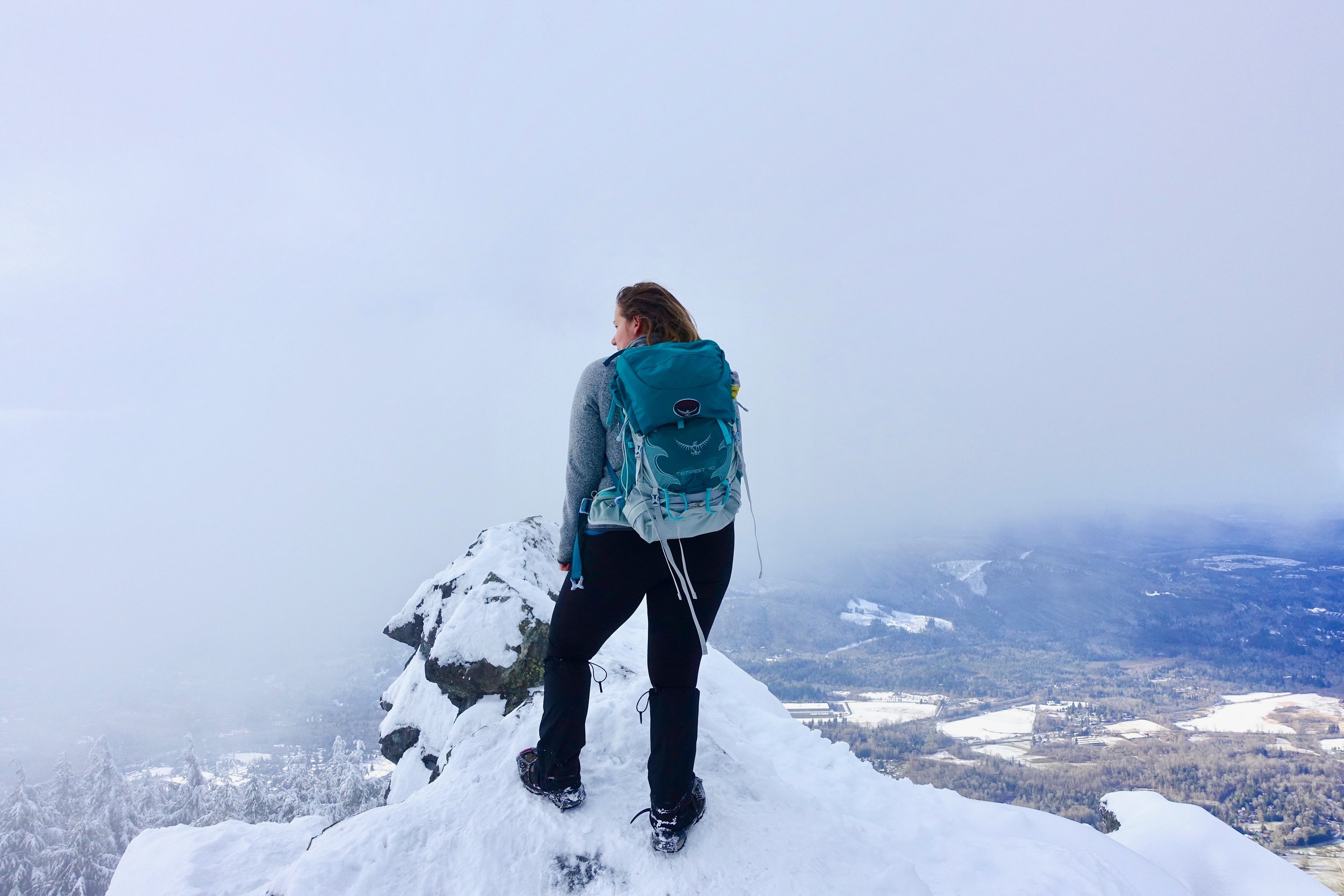
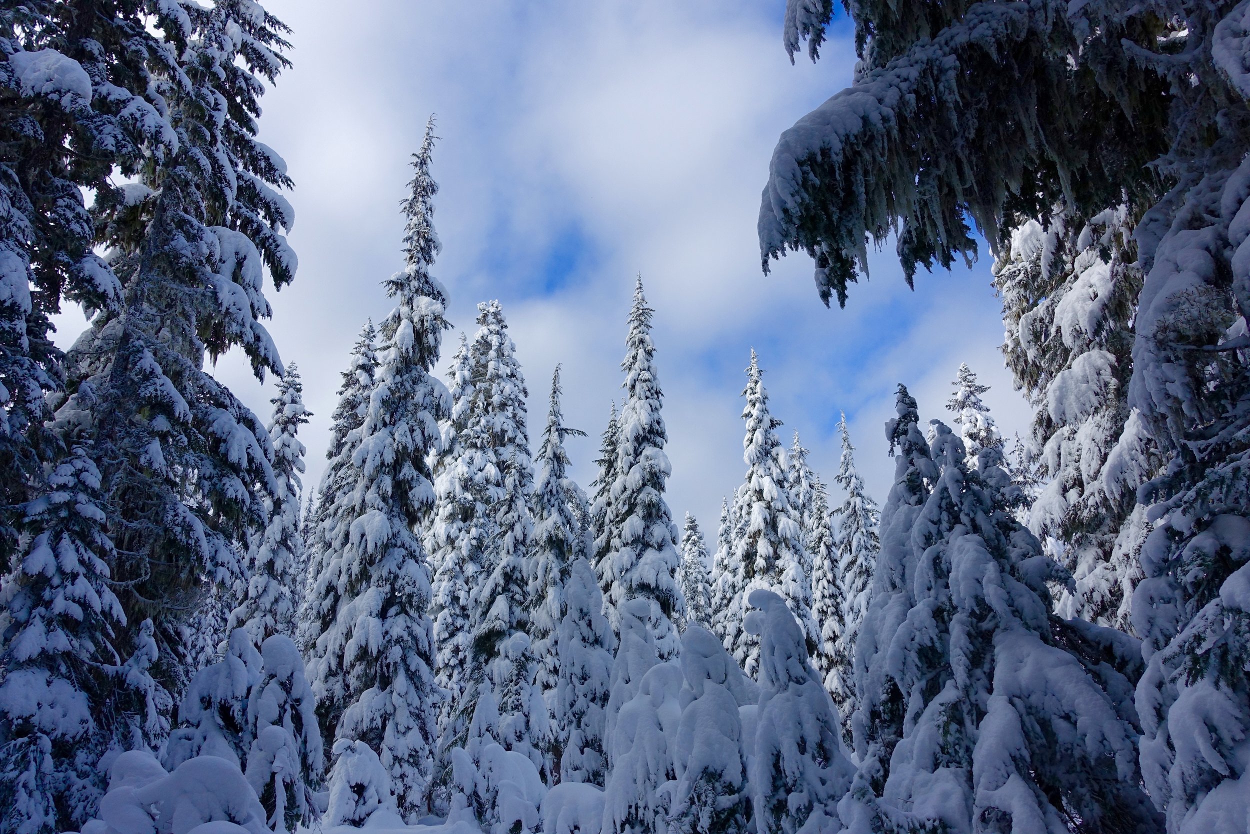
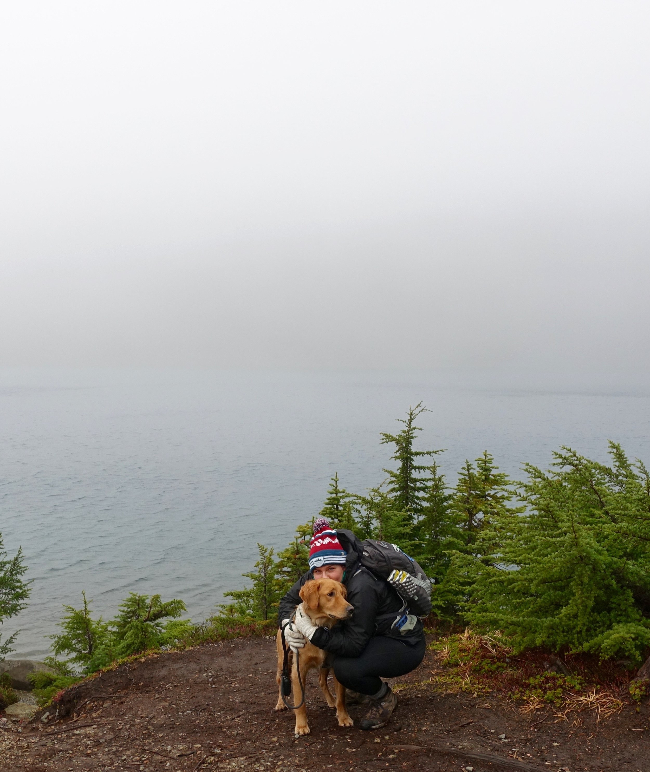
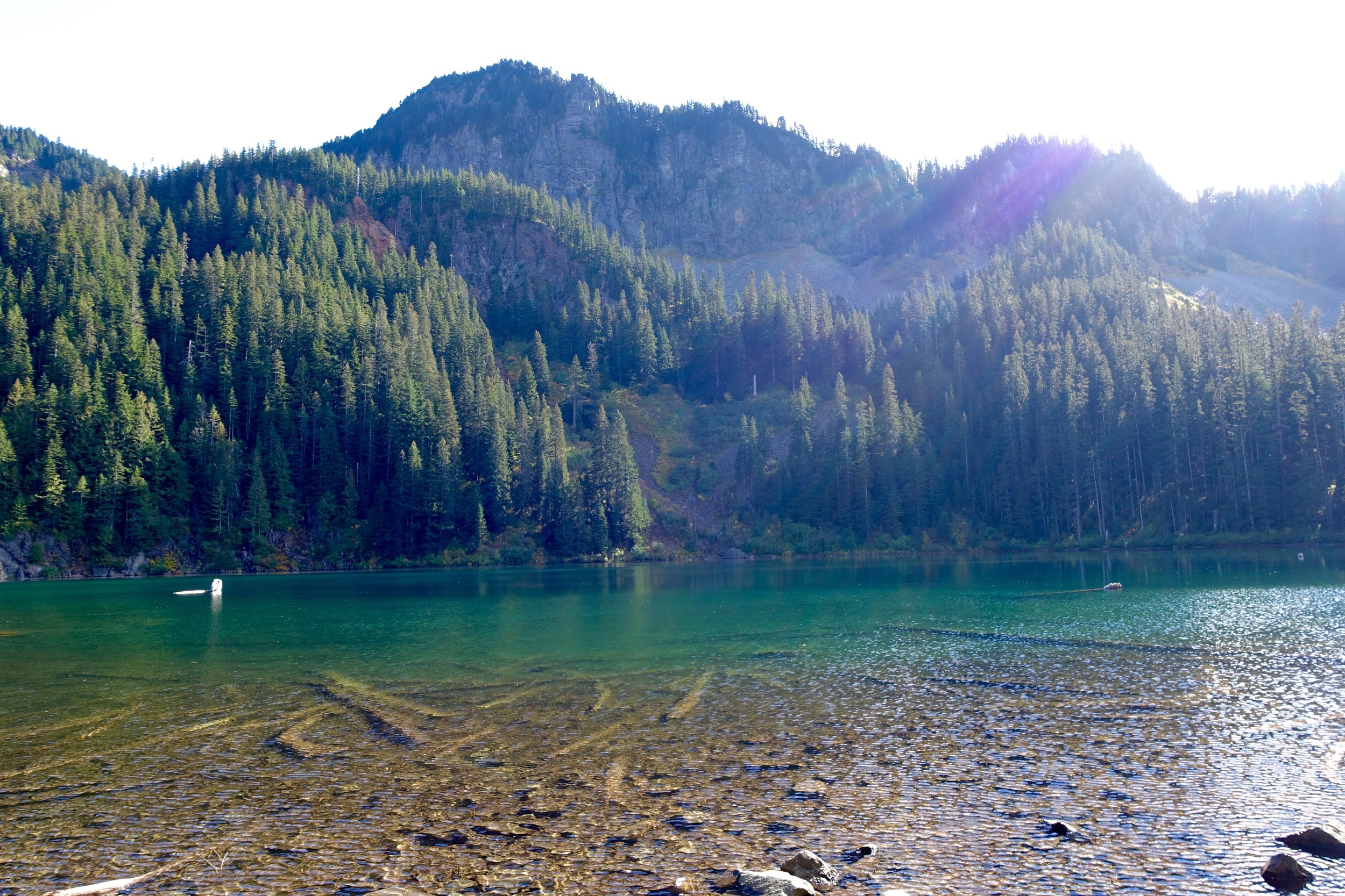
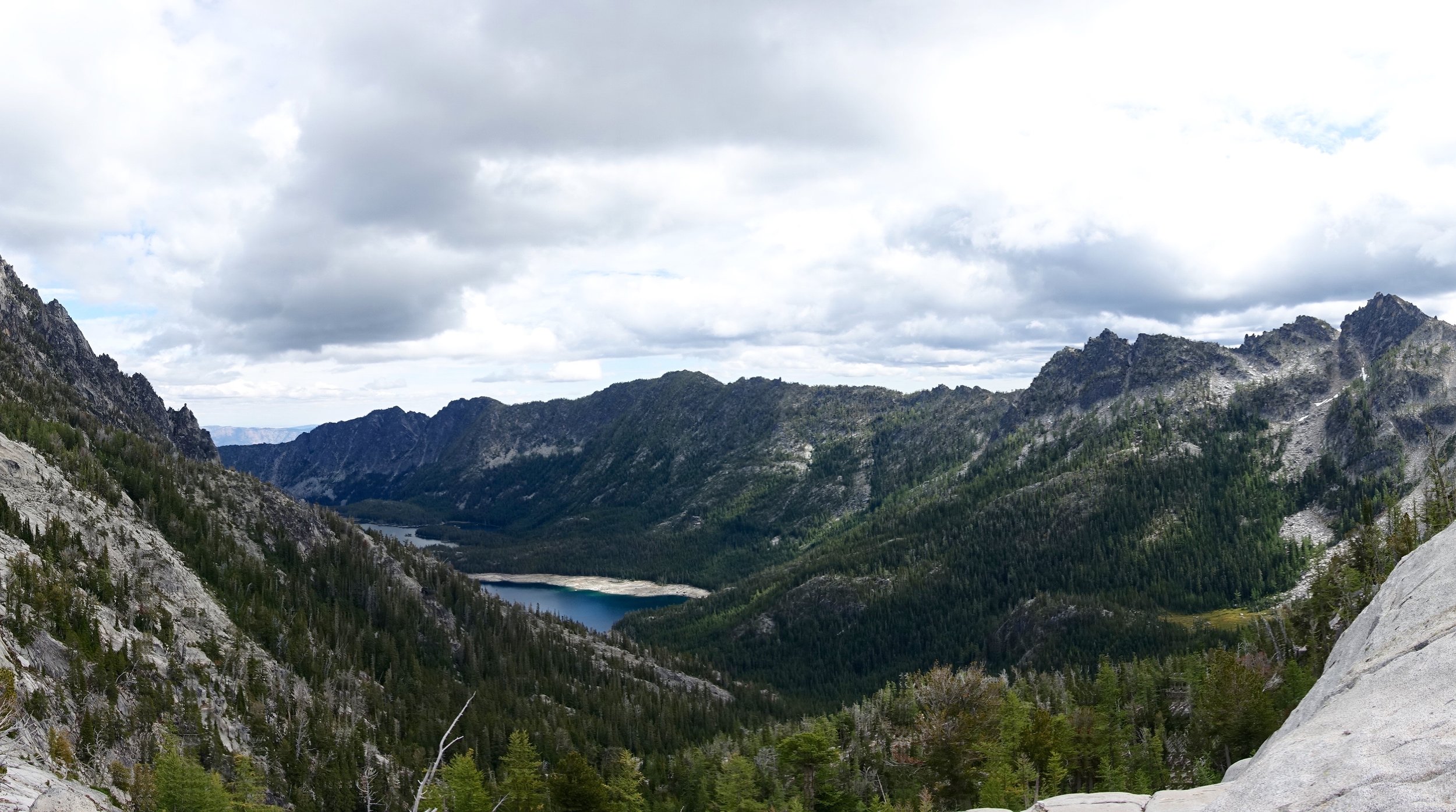
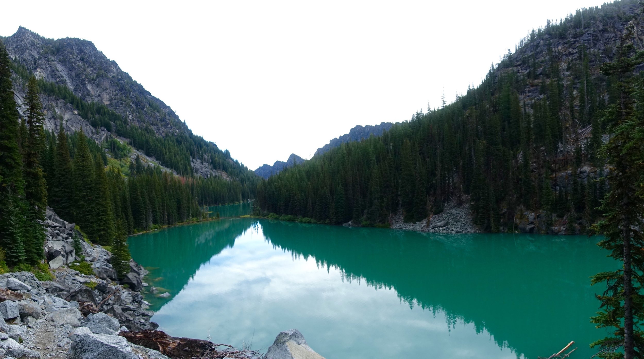
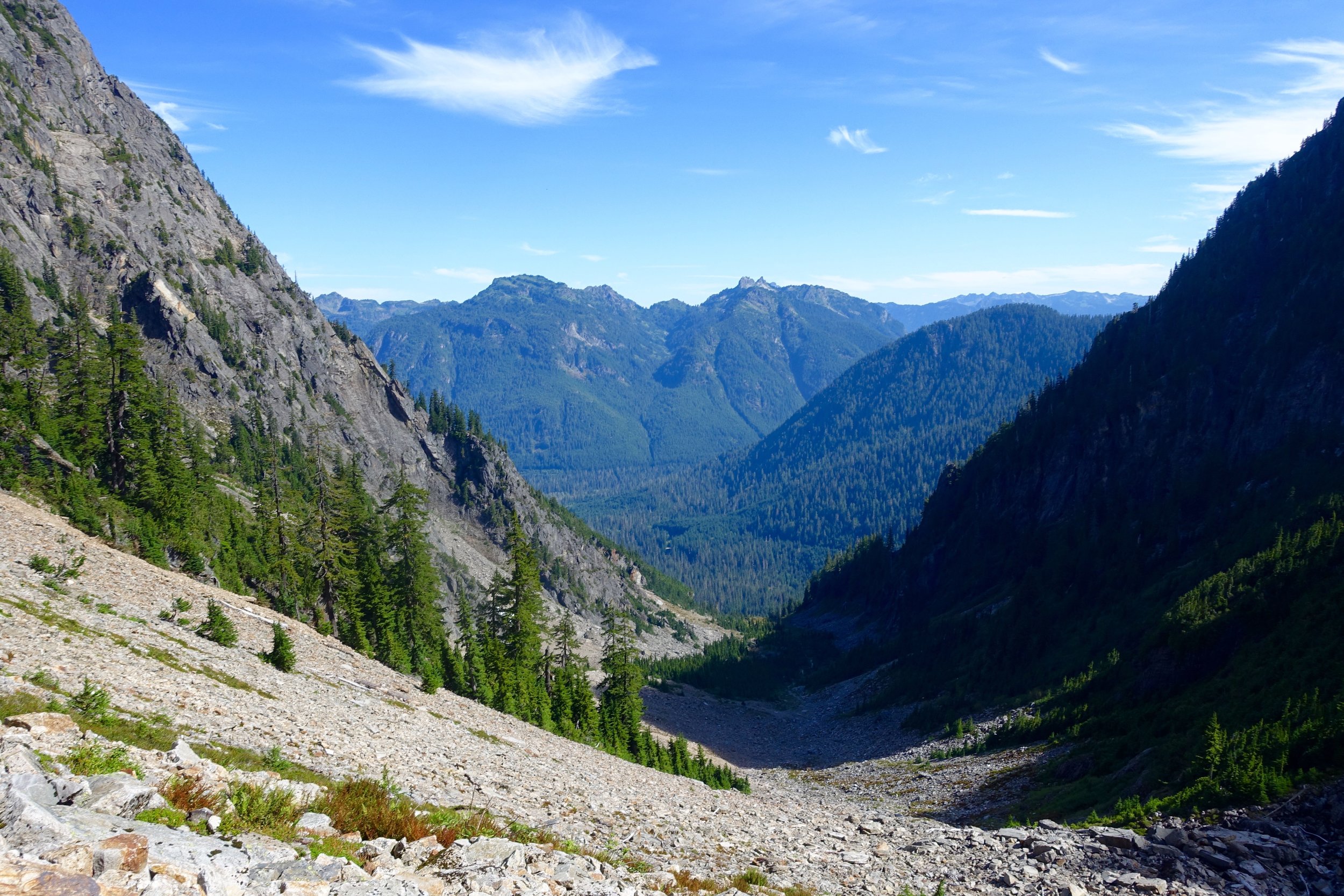
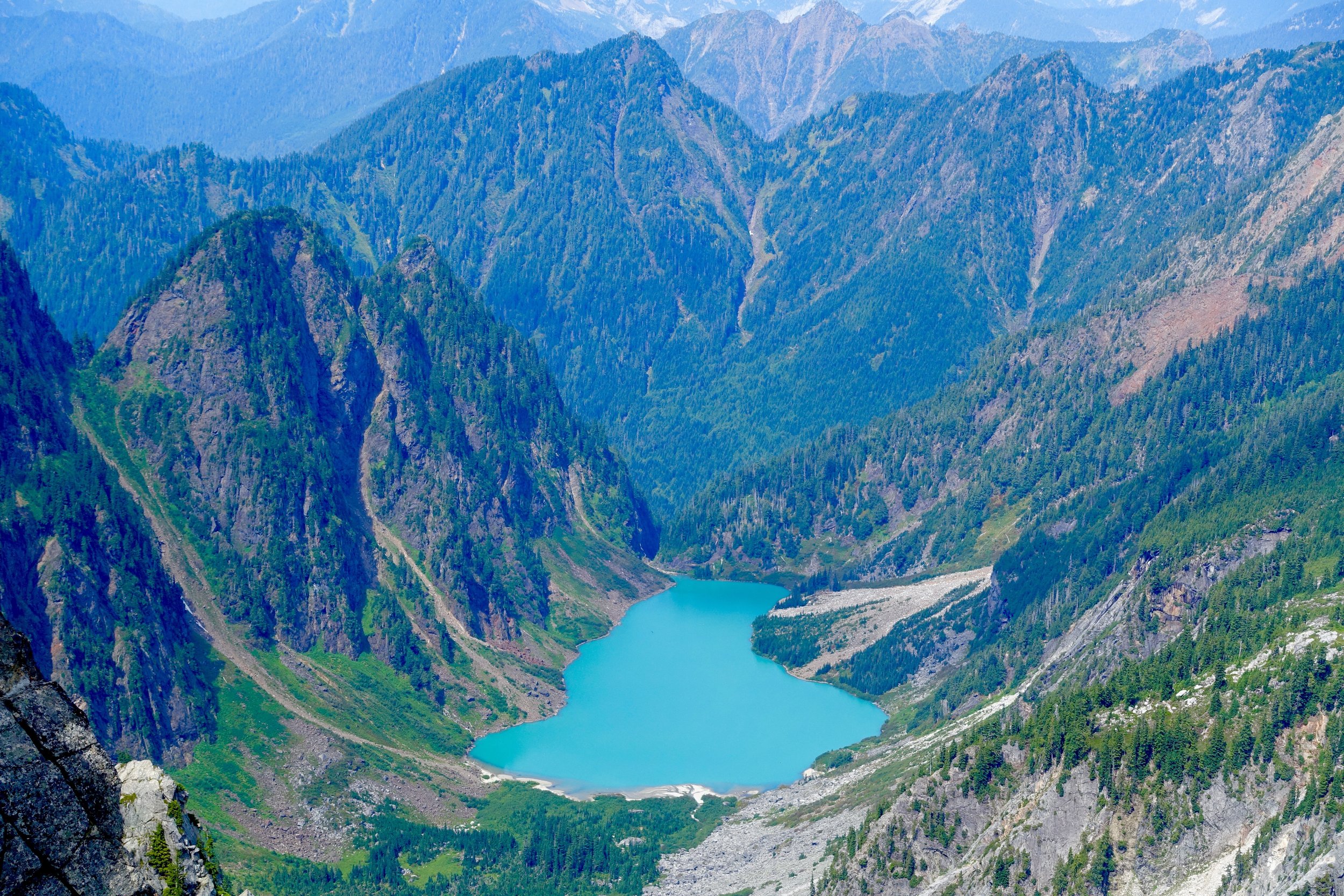
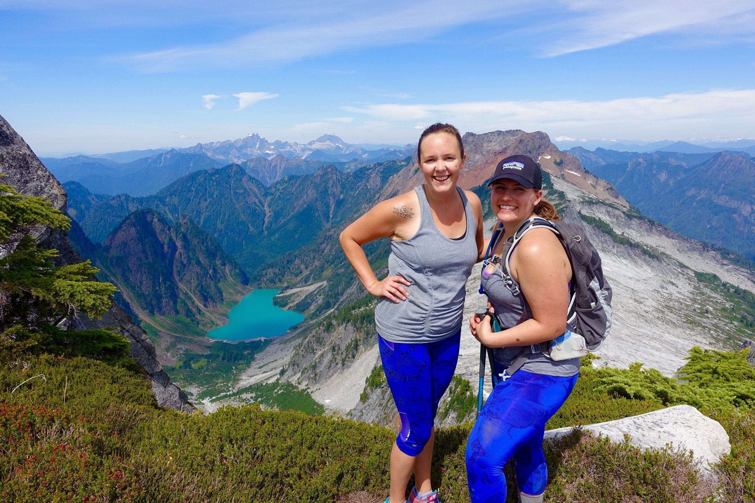
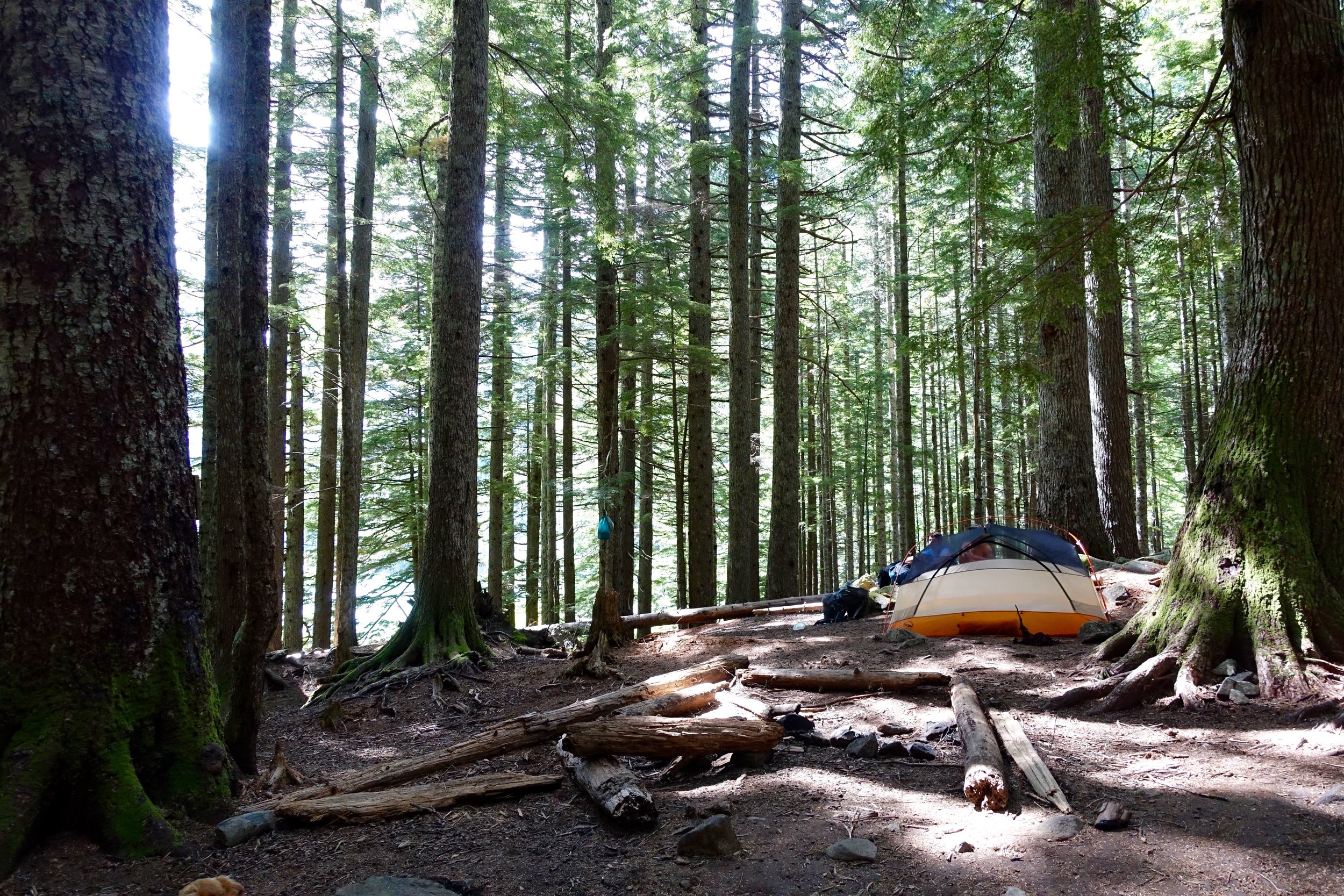
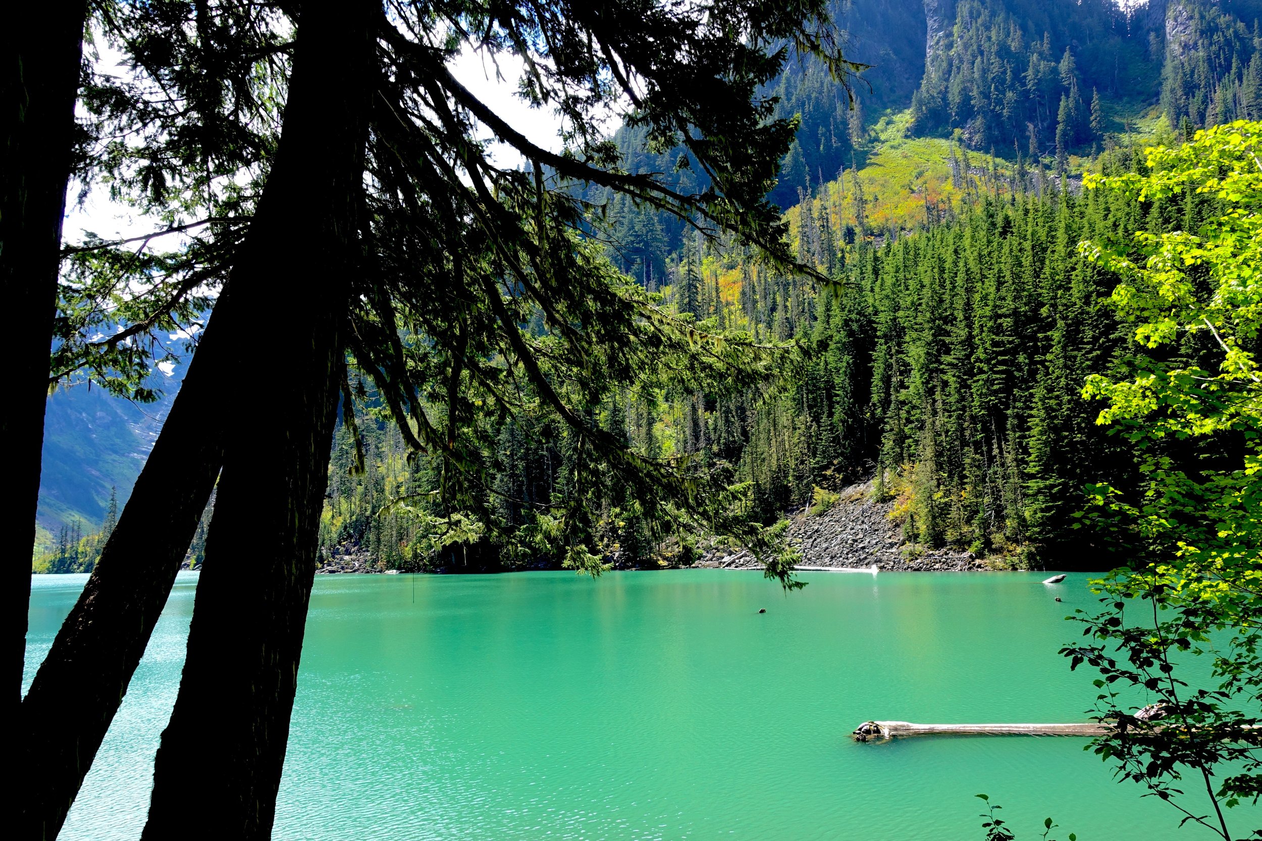
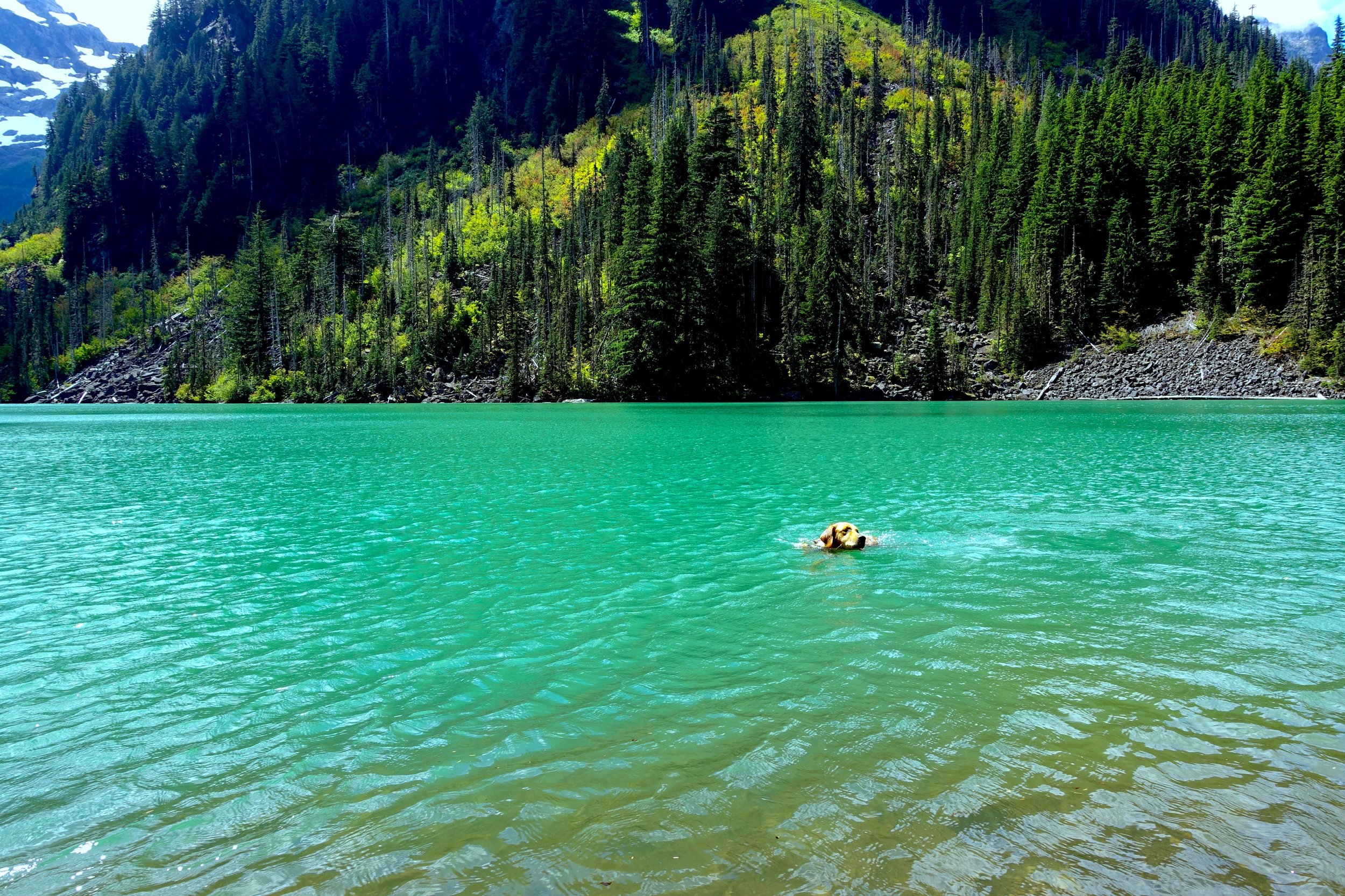
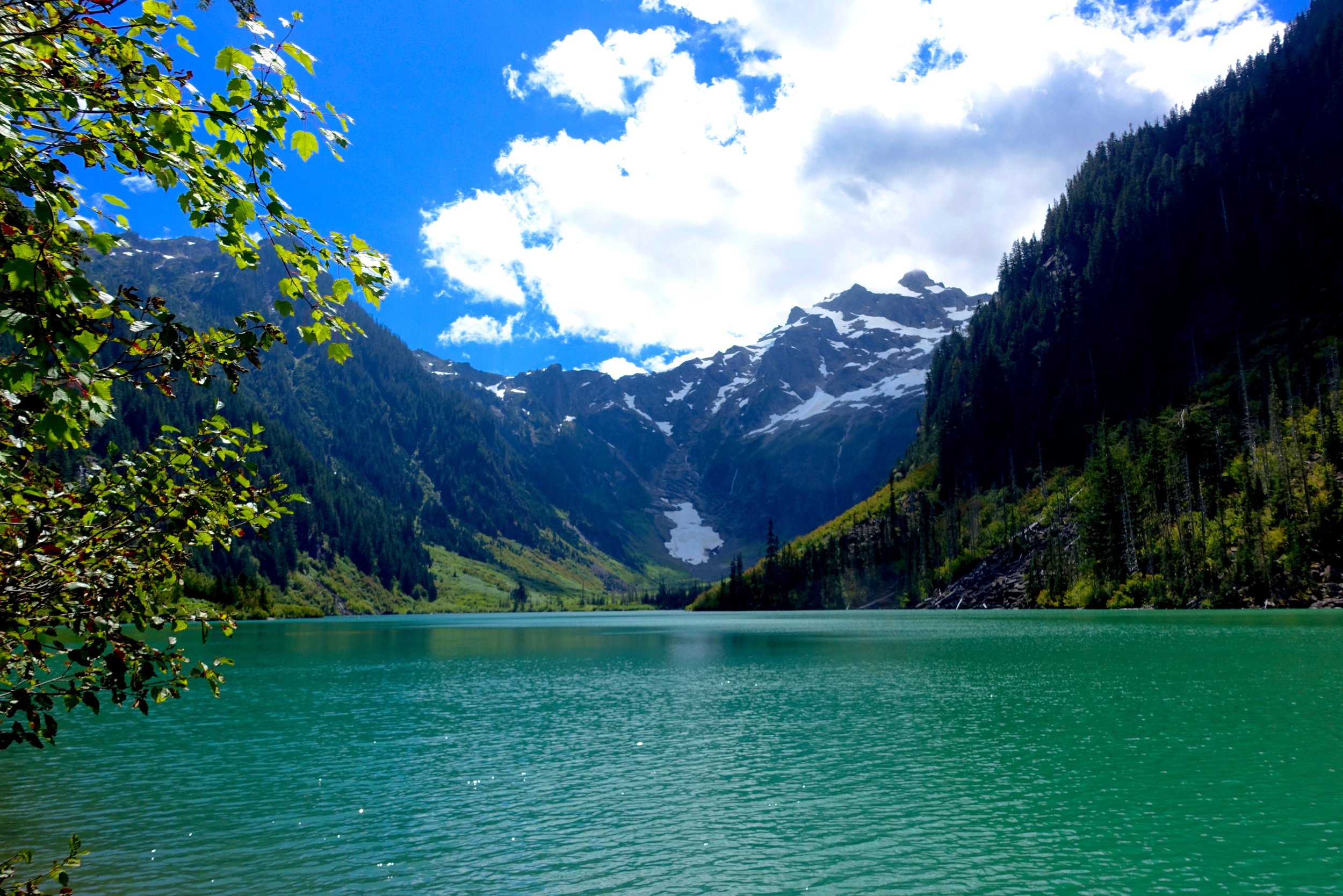
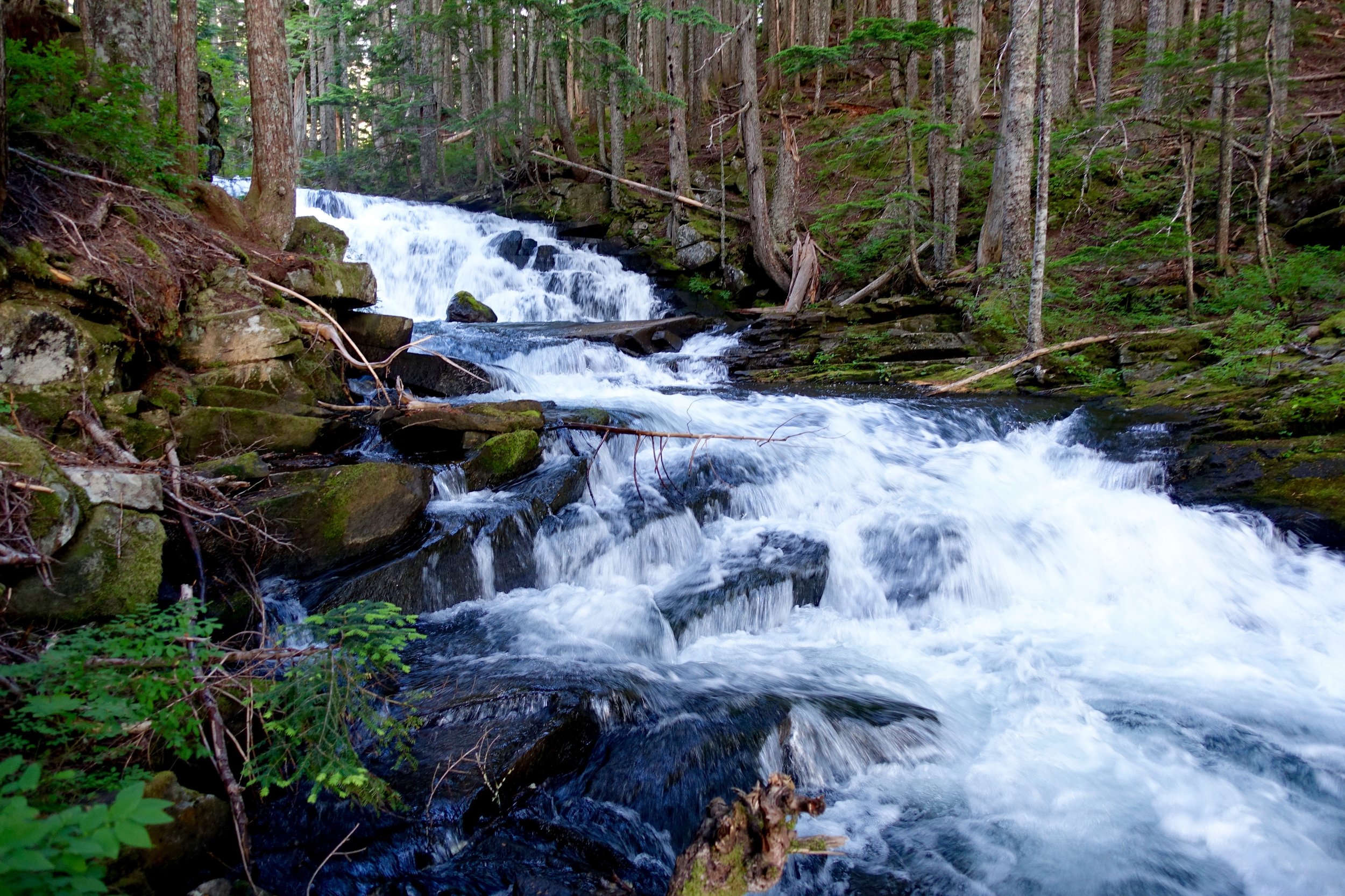
A one night backpacking trip near Whistler, British Columbia. The hike from Helm Creek is 19 miles and 4,319 feet of elevation gain. This hike brings you to beautiful views of the Black Tusk and Garibaldi Lake from Panorama Ridge.
Read MoreBackpacking Ozette Triangle to Yellow Banks
Ryan somehow got a 3 day weekend the weekend before 4th of July, so we had to take advantage of the time off and plan a trip. I have wanted to backpack on the coast for a long time now. We faxed in our permit application for Ozette Triangle (old school) and within a day we got an email confirmation that we got the permits we wanted! Permits are $8/ person/ day. We would camp one night on the Ozette Triangle (Cape Alava) and then one night at Yellow Banks to extend it a bit and add in some more miles. Friday we left very early to make a 8:30 or so ferry. I will never drive around the peninsula and not take the ferry now. Even though it is a little price, it's so worth it and an experience in itself. We got to Port Angeles by 11:00 and stopped at the ranger station. For all permits you have to stop here to pick up your physical permit. I was annoyed we had to do this at first, but the ranger was super helpful in giving us all the information we would need to know about this trip like best campsites, water sources, toilets, ect. He gave us a tide chart as well and explained when it would be safe to head out. We recently bought a bear canister, so this was full of our food, but we picked up wine and more food so borrowed another one for free from the ranger station. A little excessive, but needed for all our food, wine and toiletries. They are big and annoying but also nice to not deal with hanging food. They also double as a chair as well. Score.
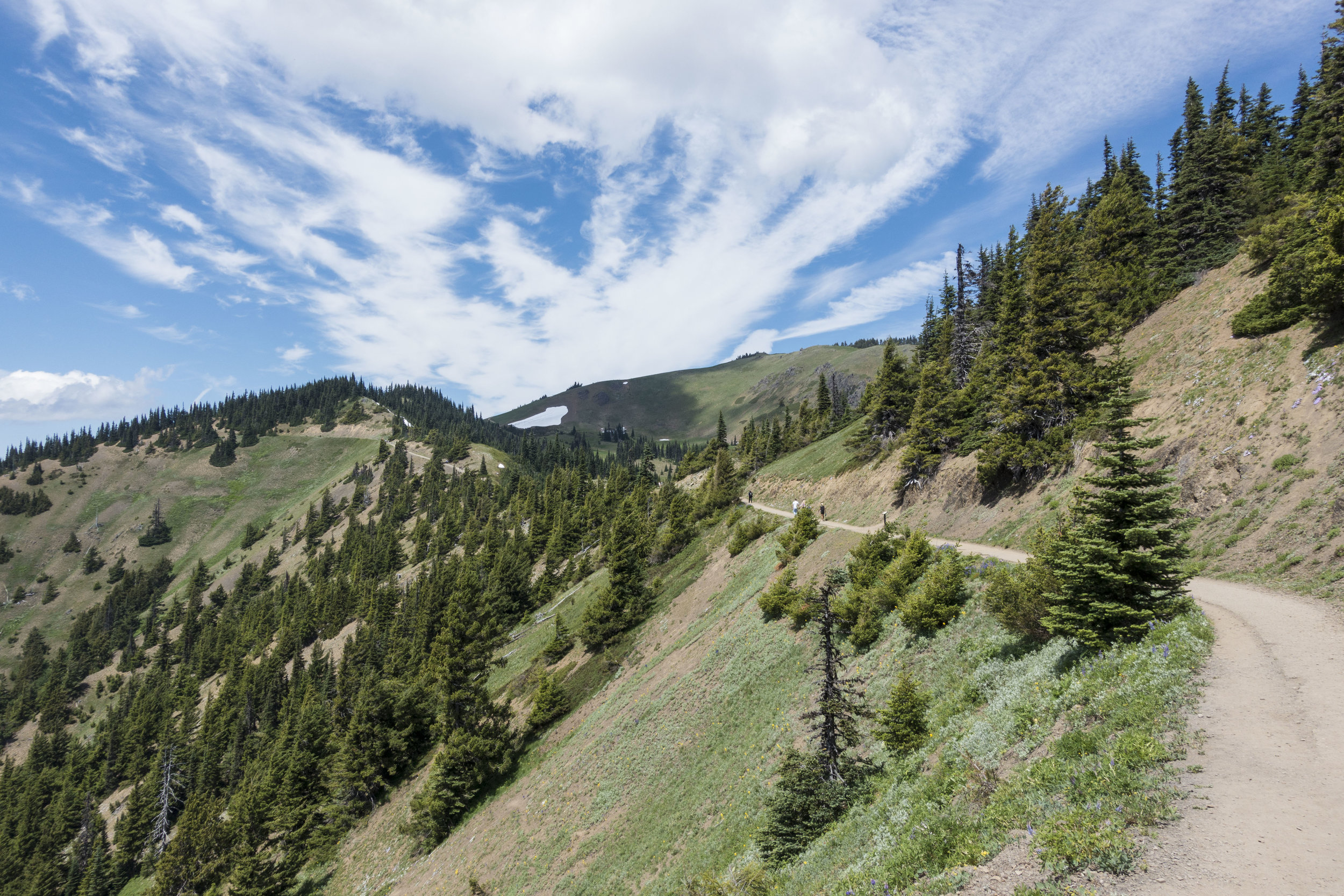
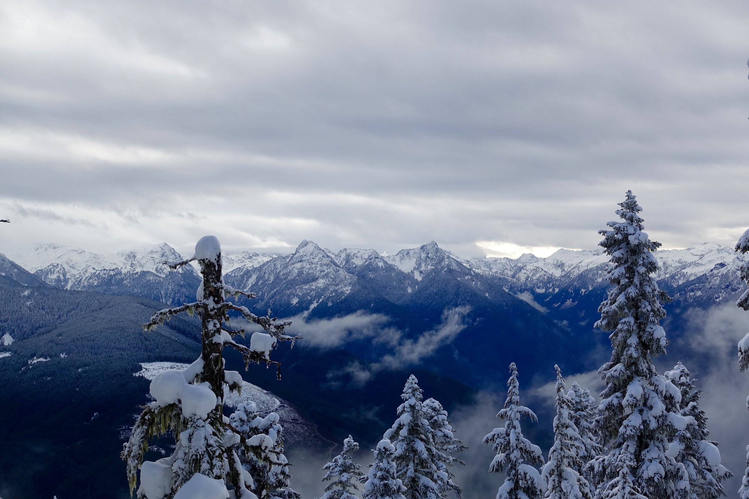
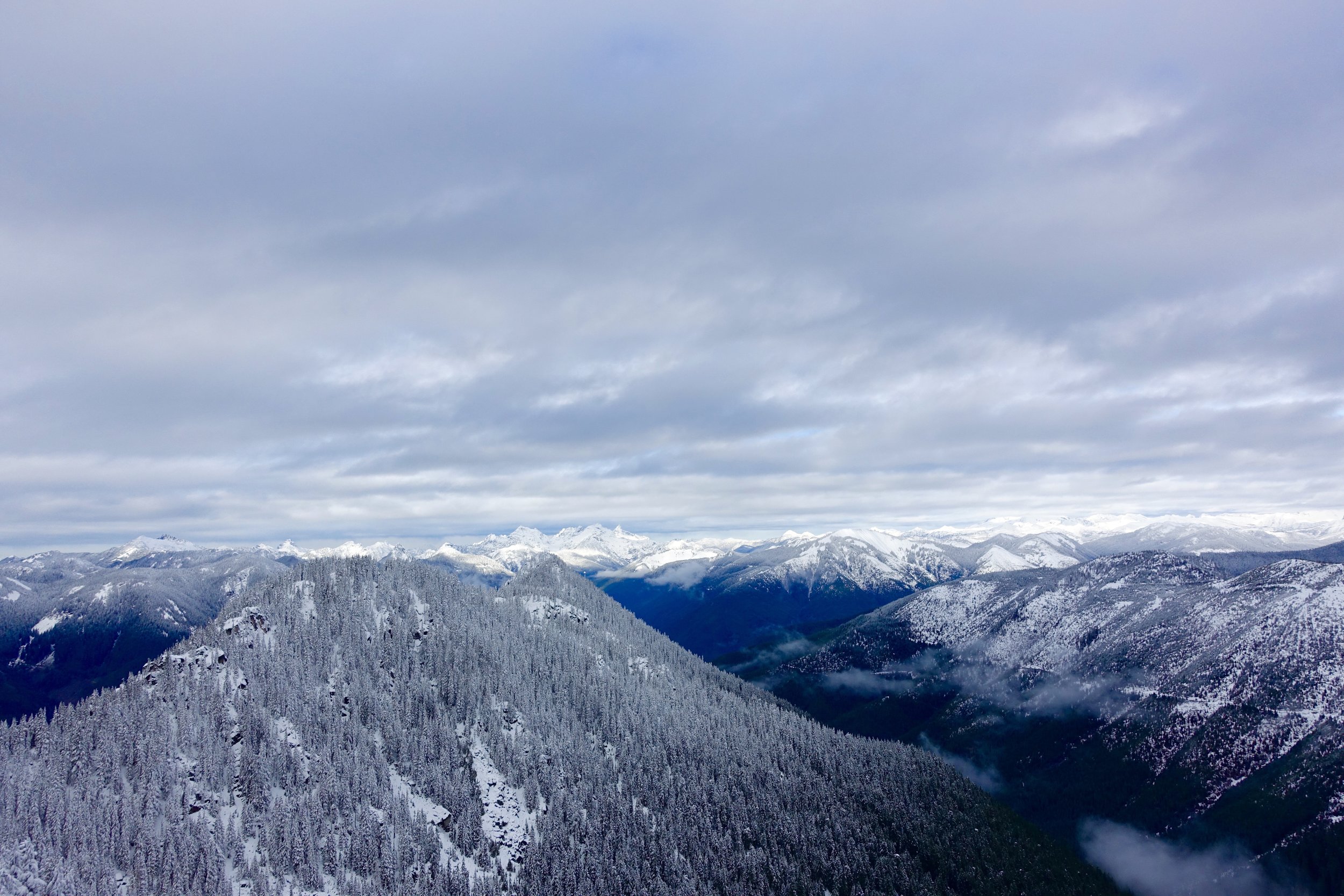
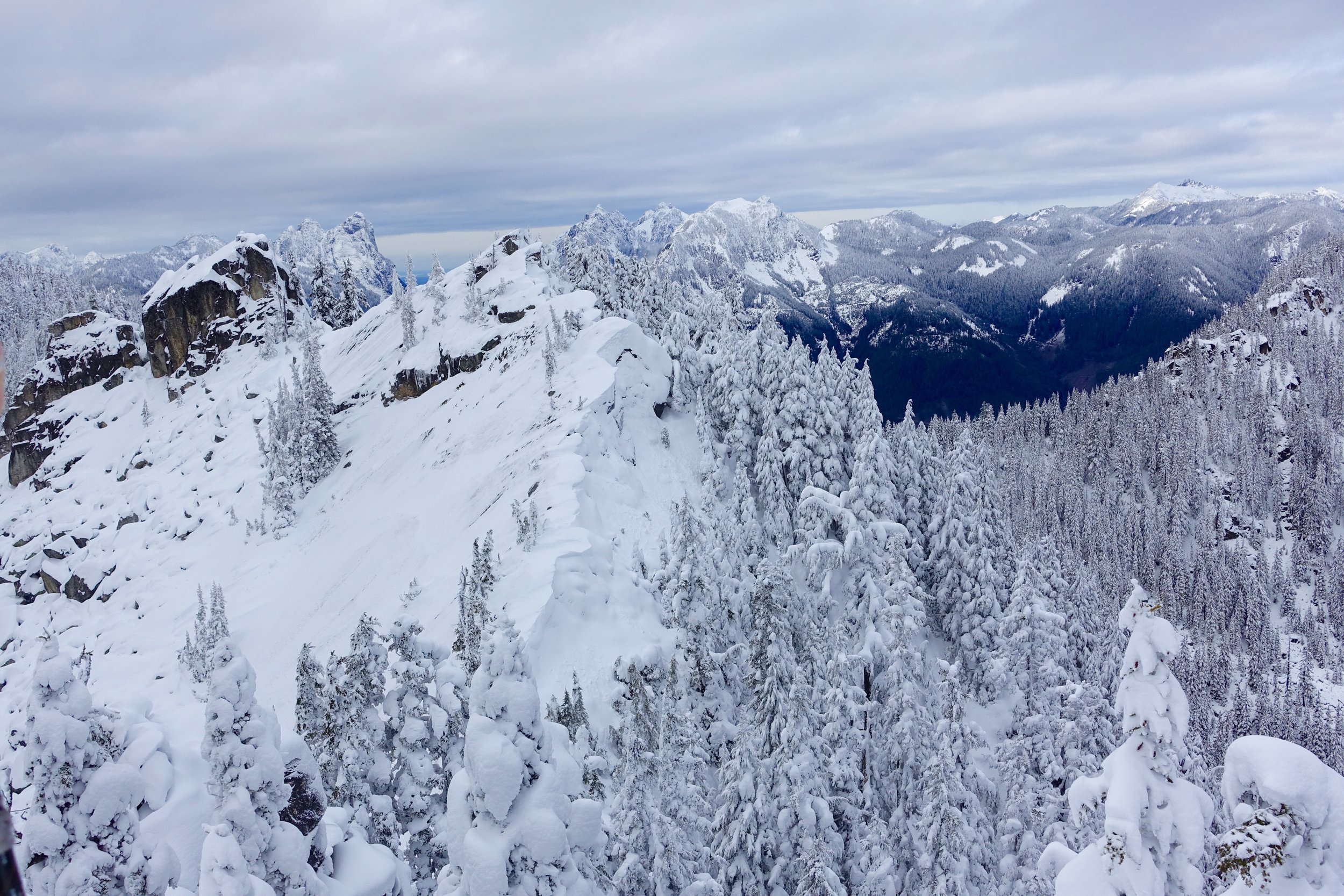
It was beautiful out so we took a pitstop to Hurricane Ridge that is right by the ranger station. It's about a 20-25 min drive up with expansive views of the Olympic Mountains. We did Hurricane Hill hike that was 3 miles/ 1000 EG. Such a beautiful hike.
DSC08428

DSC08479

19620345_10154856980668940_5015863611653000345_o

IMG_9065

DSC08481
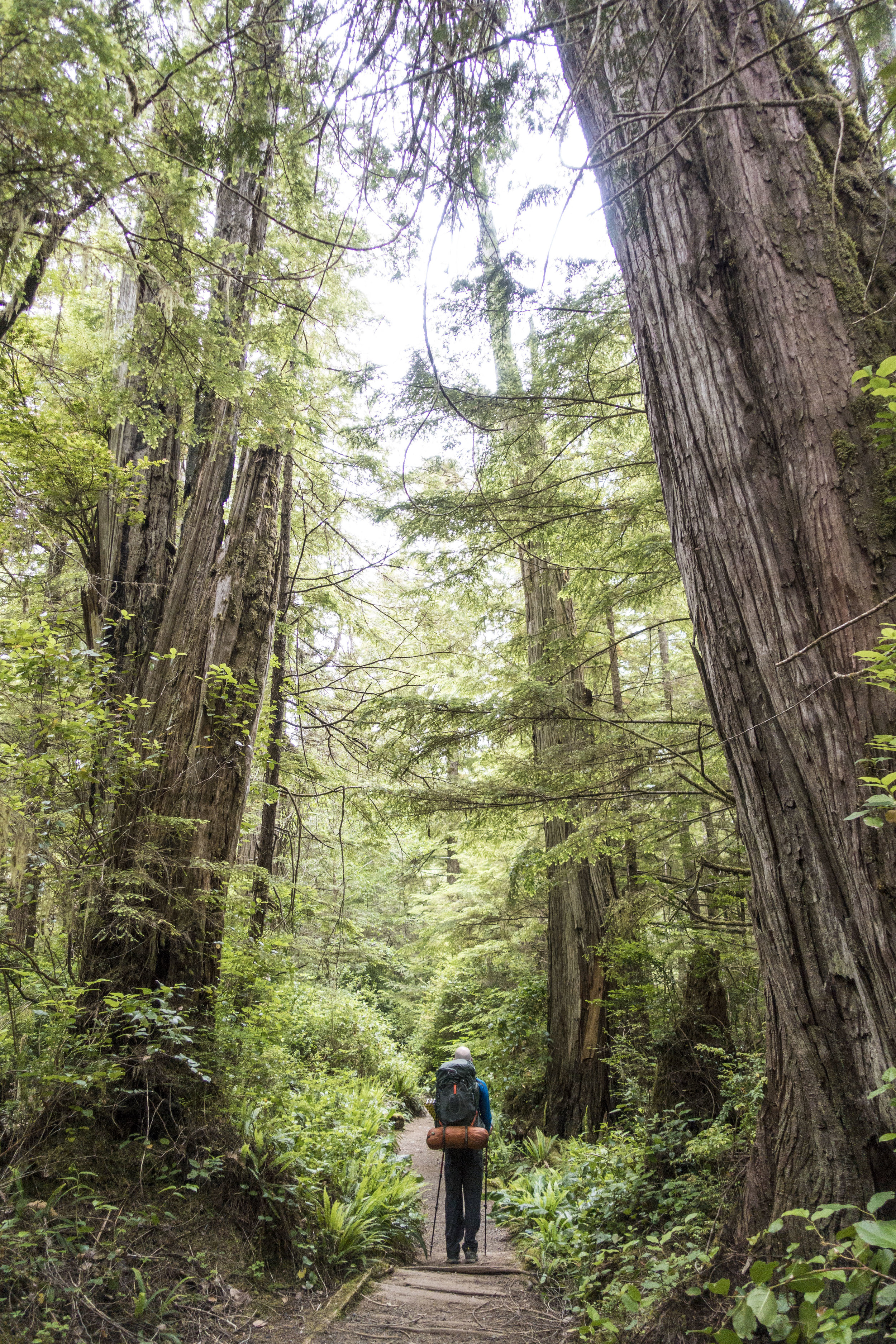
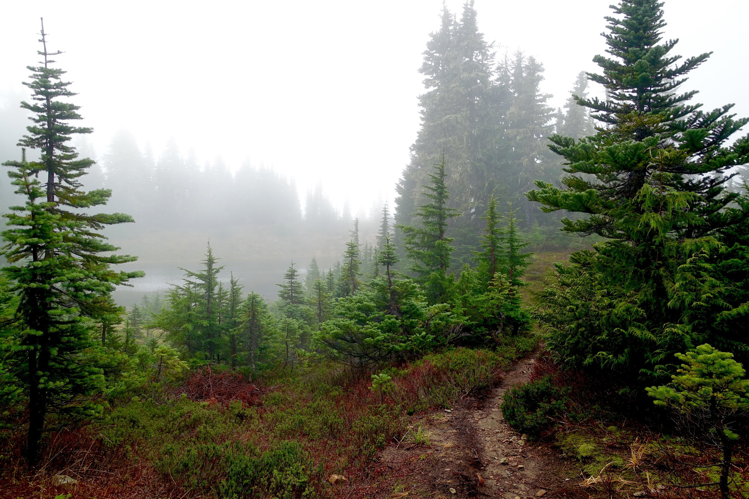
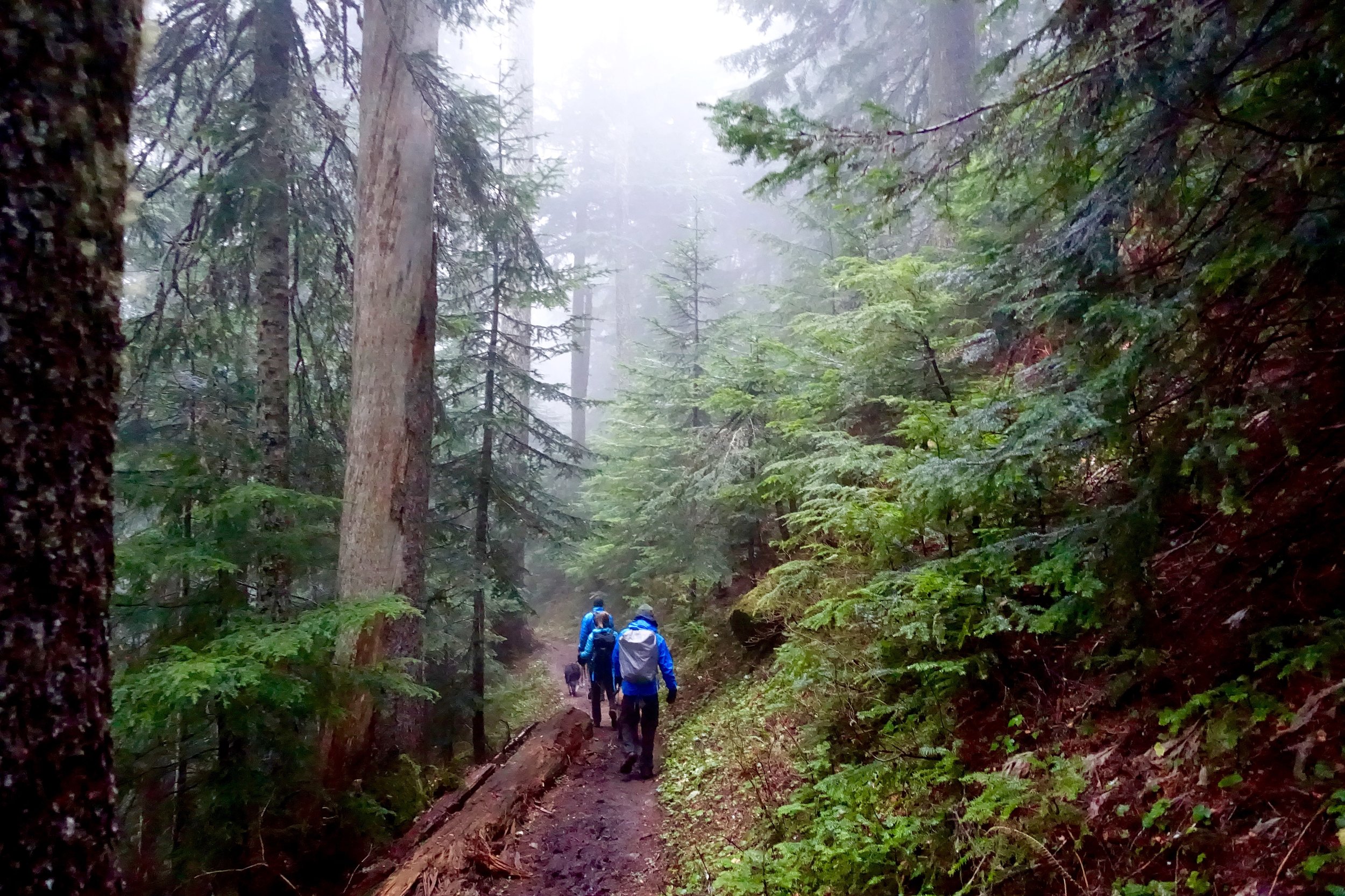
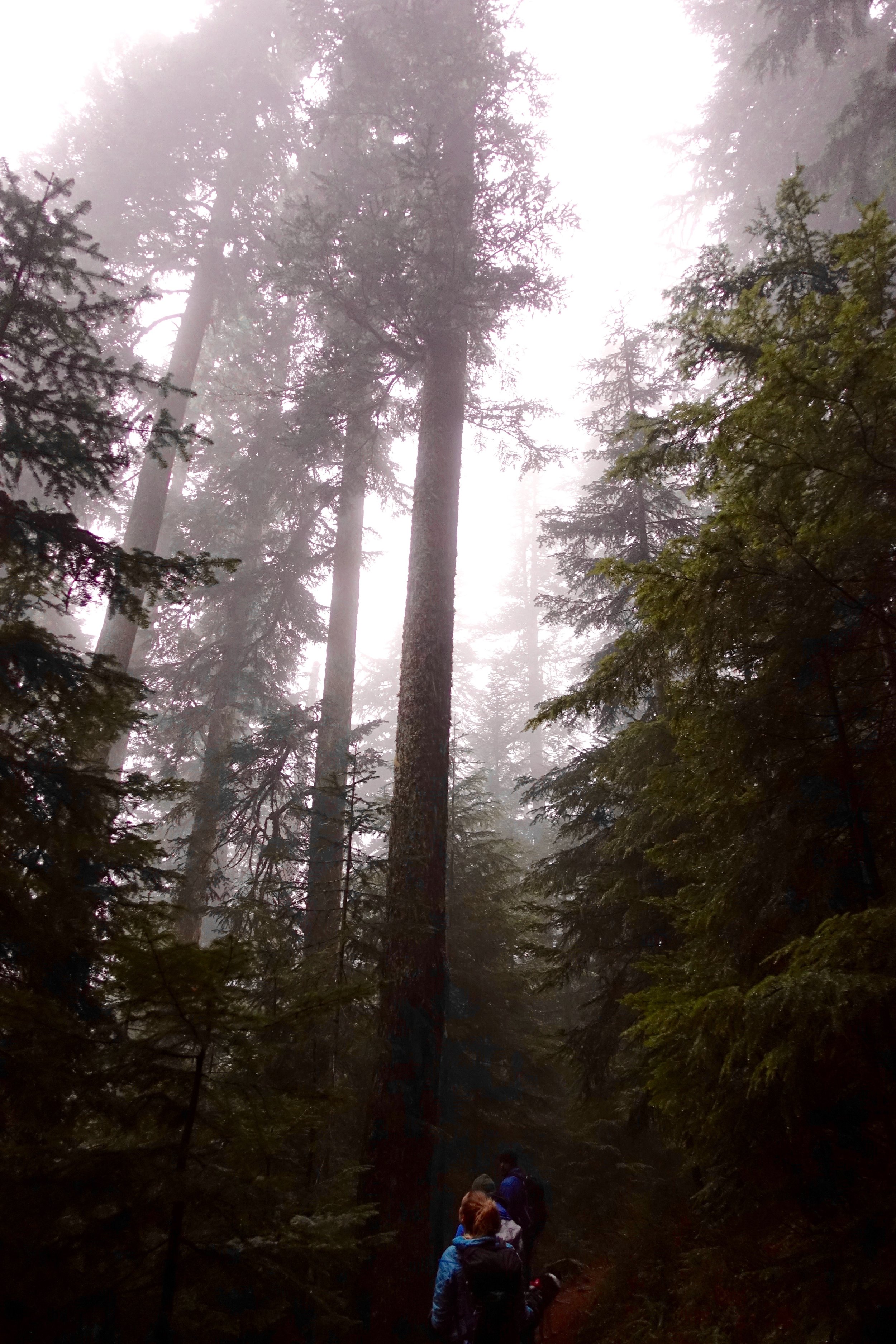
After this it was a 2 hour drive still to the coast. 4.5 total from Seattle. This road is long and takes forever as you can't go very fast, but we finally pulled into the parking lot. There is a camp ground here if you need to plan to pull in late and sleep there the night before. It was now 6:00 or so and with packs loaded we hit the trail. The 3 miles to the coast is mostly boardwalk, flat and old growth forest.

DSC08507
DSC08510
We made it to the coast and ran into a ranger right away that checked our permits. A first in the backcountry for me. She said most of the spots up ahead were taken, so to take one that was pretty much by the entrance. It was right on the trail but also 7:30 at this point so we didn't feel like looking and set up camp there. It wasn't the worst spot, but annoying being on trail with no privacy.

DSC08538
Once camp was set up, we strolled the beach to take in the little sunset there was. There were plenty of taken, better spots further down. Some right on the beach. You are allowed to camp anywhere on the beach as long as you aren't camping where high tide comes in.

DSC08550
We woke up the next morning and had our nutritious breakfast of poptarts and coffee. Backcountry dining at it's finest. We hit the trail by 9:00 something for the 5.5 mile trek to yellow banks. The tide would be low 10-6, so no rush to get over there. The first part to wedding rocks was very rocky and slow going. Walking on low tide pools mostly and not beach as we had to navigate around many large down trees. If you were to cross some of these sections during high tide there are overland passes, but not everywhere.

DSC08599

DSC08600
We stopped for lunch at Sand point. This is where the triangle meets on the other side. The campsites here are in the woods. As we hiked on we hiked past South Sand point campsites and these were much nicer on the beach. If someone where to camp on the triangle I would recommend camping here. Huge beautiful beaches that stretched forever. We didn't get much sun this day, mostly overcast which I'm ok with as the usual prediction for the coast it lots of rain. We got no rain on this trip!

DSC08629
The nice easy beach walking ended as we approached yellow banks. Had to climb some big/ slippery rocks here. Very important to do this at low tide. We also relied on our app on our phone for GPS as to where we were and what bank was yellow banks.

DSC08632
The ranger in Port Angeles had told us of a campground at yellow banks that was amazing. He said it would be the first one when you come in. When we got there all we saw was beach and bluffs. We were very confused on where this site was. We hiked a little further and I saw a faint trail go up a bluff with a rope to get up it (was very steep). We went up there and found our own little oasis. There were 2 large plank platforms, one more sturdy than the other to set up a tent on. A perfect spot for a hammock as well. We couldn't believe no one else had claimed this by 1:00, but it was also really hard to find.

DSC08642

DSC08650

DSC08665

DSC08683

DSC08686

FullSizeRender 2

FullSizeRender
We set up camp, had ramen, a 1.5 hour nap in the hammock, then set out to filter some water. We carried in 3 liters each and were just now running out. There is a water source at Cape Alava, but the water there was brown and murky. We hiked half way down the beach and found a good stream coming in and filtered 4 liters of water. This lasted us the rest of the trip. We could not see any more campsites even walking down the beach that far. The rest are at the other end of the beach in the woods or on the sand I assume. We saw a group of 7 stroll in at 6 or so and make their way down there to the other end. It basically felt like we had the beach to ourselves. The ranger said there are permits for 12 on this beach. We made another mountain house meal then gathered drift wood for a fire. Fires are allowed at Cape Alava and Yellow Banks, but no where between. There was so much drift wood at yellow banks. This was our first beach fire and it was amazing!

IMG_5219
Wine, fire and the ocean. What's better?!

IMG_5225
The ranger said the next morning we wouldn't be able to leave between 7-9 because of high tide. So we slept in and were out of there by 9:40. Yellow banks also has no toilets, so be aware of this. It was rough getting over the tough rocks getting out of Yellow Banks, but the rest of the 5.5 miles back to the car were smooth going. On this trip we heard a seal barking Friday night, but never saw it. We saw lots of crabs, eagles, hawks and deer. We saw seals just before leaving as someone pointed them out laying on rocks. We brought binoculars with that were perfect to watch them. We also saw a fox on the beach just before exiting to the woods as well.

IMG_5228
Overall about 15 miles of easy/ moderate hiking. The tough part was our heavy packs. Need to work on that before the wonderland. I would love to come back to the coast to explore other parts of it as well. Washington is so magical and never disappoints no matter what adventure you choose.
Summiting Mt. St. Helens
Since I got into hiking I have had Mt. St. Helen's on my radar. The permits open up for it every year in February. You have to get online right away to claim yours as within the first couple of hours all the weekends of the season get taken. I had originally gotten permits for a May date, but with 20+ inches of fresh snow that week and day, there was no chance of us going. Still determined to hike this mountain this year, I got in with another group as a permit opened up for me. They are $22/ piece. You can buy/sell them on purmit.com as well, so not all hope is lost if you get bad weather. The training:
I was recently asked can anyone hike this and how do you do it?! It can be an overwhelming goal if you are starting from scratch, so that's why I put a lot of work into training and conditioning to make this a reality. I consistently try to hike every weekend and try to increase my mileage/ elevation gain as well if I am training for something. A couple weeks before I did Camp Muir, which is a great training hike for this. During the week I tried to lift 2X a week and do cardio 2-3 extra times running, stairs or elliptical.
The weekend:
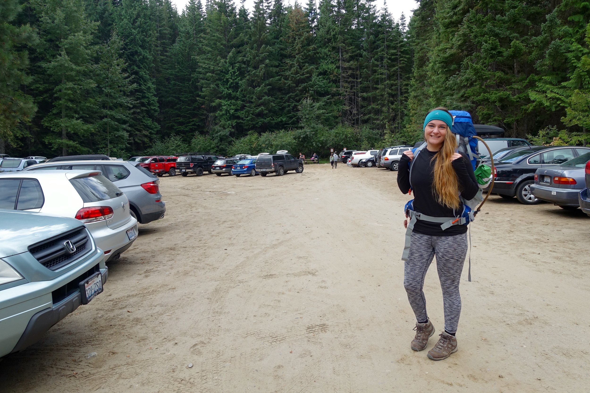
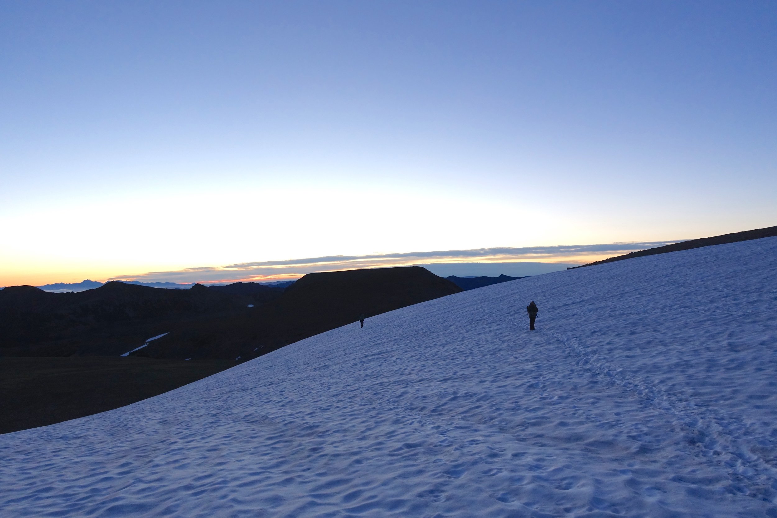
A group of 8 of us headed down to Mt. St. Helen's on 6/23/17. I drove from Seattle and it took 4.5 hours with lots of traffic. The summer route was still not open yet, so we had to take the winter route and go to the sno-park. Catherine and I decided to sleep in the back of my outback, which proved to be rather comfortable. 2 more rolled in and we tried to wait for the rest of the group, but we hit the hay by 11:00. Wake up time was 3:15 and we were all fed and caffeinated and ready to go by 4:30. It was already getting light and and we barely had to hike with our headlamps on. My pack was super heavy with 5 liters of water, lots of food, glissading/snow gear, an ice axe and more. I weighed it before leaving and it was 23 pounds. My actual gear list for Helen's is as follows:
- buff
- gloves
- rain jacket
- rain pants
- gaiters
- ice axe
- spikes
- poles + snow baskets
- pack cover
- head lamp + batteries
- sit pad
- glacier sunglasses
- base ball cap
- external battery charger for phone
- camera
- sunscreen/ chap stick with SPF
- enough food for 10-11 hours of hiking
- 5 liters of water
- Extra pair os socks
The first 3 miles went quickly all on dirt. We enjoyed the sunrise over Mt. Hood and the valley surrounding us.

DSC08254

DSC08257

DSC08269
We continued to hike up a ridge line and it got to be more rocky/ scree like. This stuff was very annoying to hike on as it just took forever and slid around a lot.

DSC08285

DSC08293

DSC08297

DSC08314
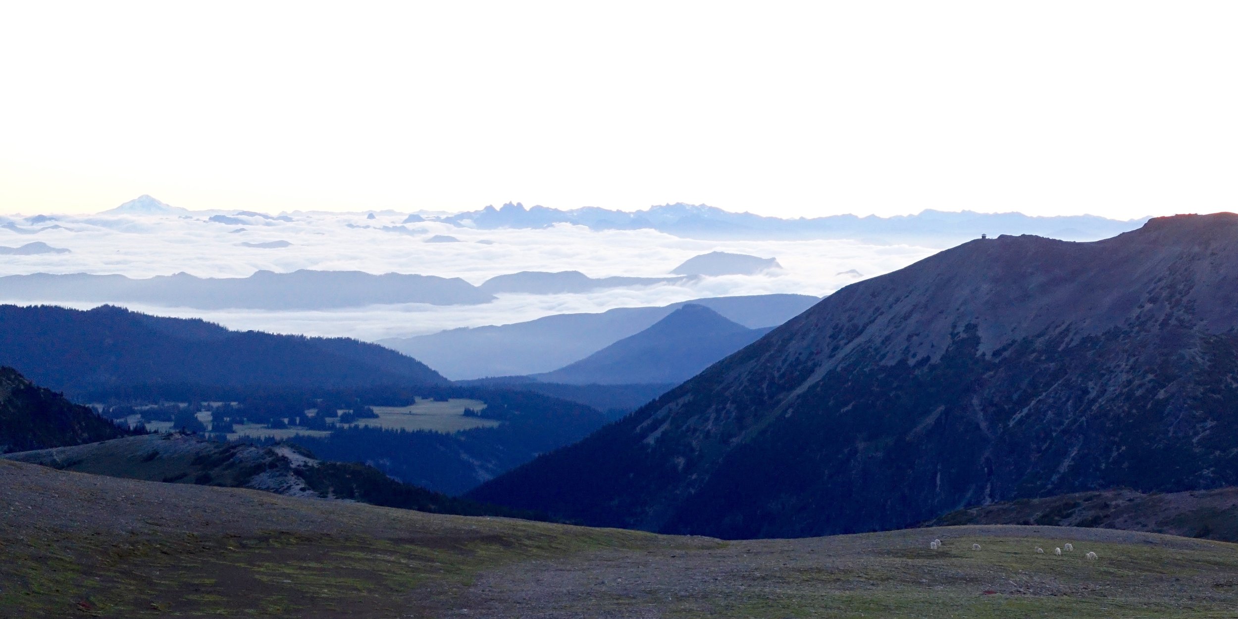
Another big marker is hitting the weather station. After this it was mostly snowfields all the way up. Two in our group turned around shortly after this as one wasn't feeling well. The 6 of us continued on our way up the mountain.

DSC08346

DSC08358
There was only one very steep section and it was on the way up to the false summit. There was good kick steps made on the way up until a snowshoer went ahead of me and ruined them making it dangerous for me to get footing.

DSC08369
One last push to the real summit!

DSC08372
Views from the summit with 6 other volcanoes in sight. Amazing!

DSC08377

DSC08378

DSC08382

DSC08392

DSC08398
This was the longest day hike I have ever done at 12 miles/ 5,700 elevation gain. It took me almost 4 hours 30 min to get up, hung out at the top for almost 2 hours, and then we started our way down. The safest and fasted way down is to glissade. To do this you need an ice axe and waterproof protection over your pants. I am still getting the hang of glissading and find it rather terrifying most of the time. We went down one super steep section that was hard to control speed on that was very scary. It is important to know how to self arrest in these situations if need be. Thousands of glissading down and we got the the rock sections again, which were even slower going on the way down with trying not to slip and fall. By this time it was 90 degrees and we were ready to be off the mountain! Doris and I were off the mountain by 4:30, so 12 hours on the mountain total. I drank 3.5/5 liters of water. This day is what we call type 2 fun. So many moments were grueling/ mental game/ struggle fest, but looking back at it, it was so awesome to see what we accomplished together and what our bodies are possible of. I would do this hike again, but would want more snow to not deal with the rock/scree fields.
One volcano down, more to come? We shall see.
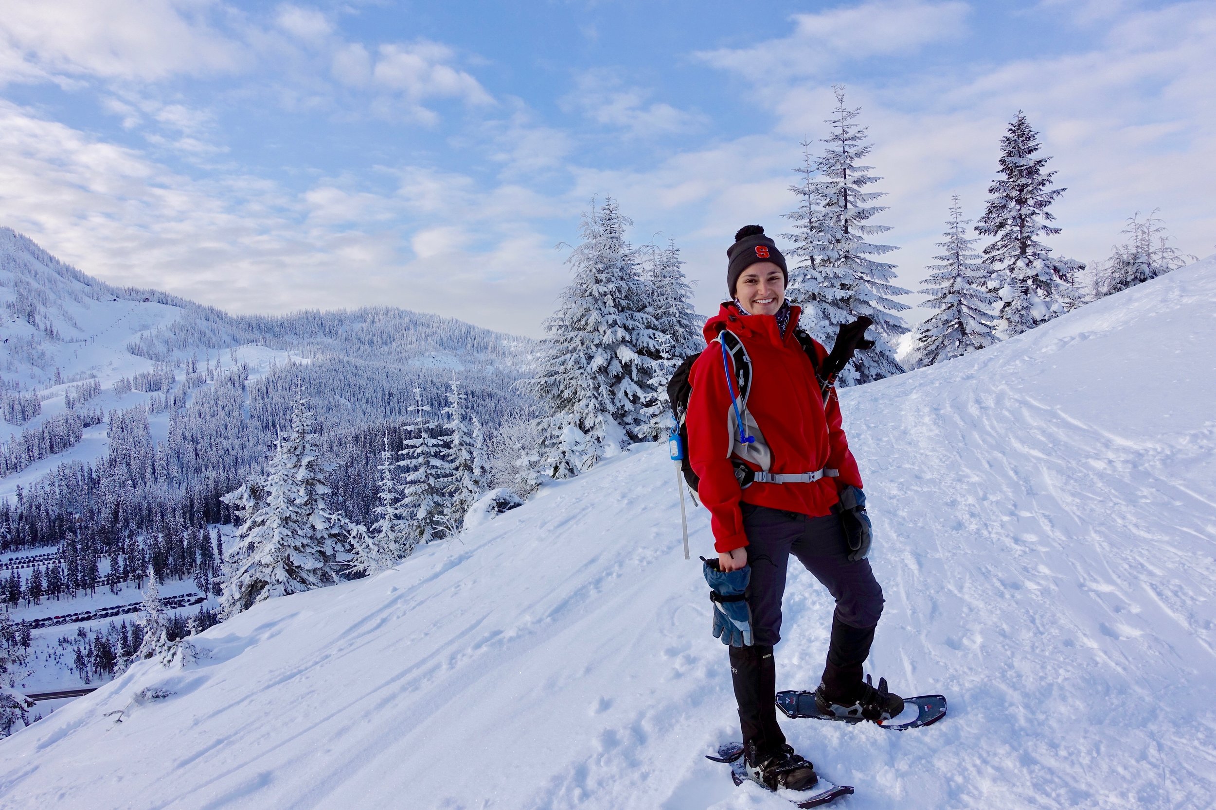
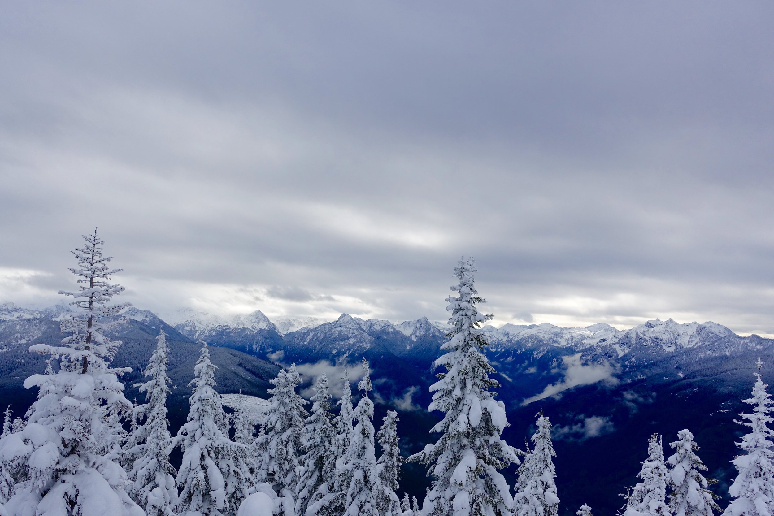
Mt. Rainier Snow Camping
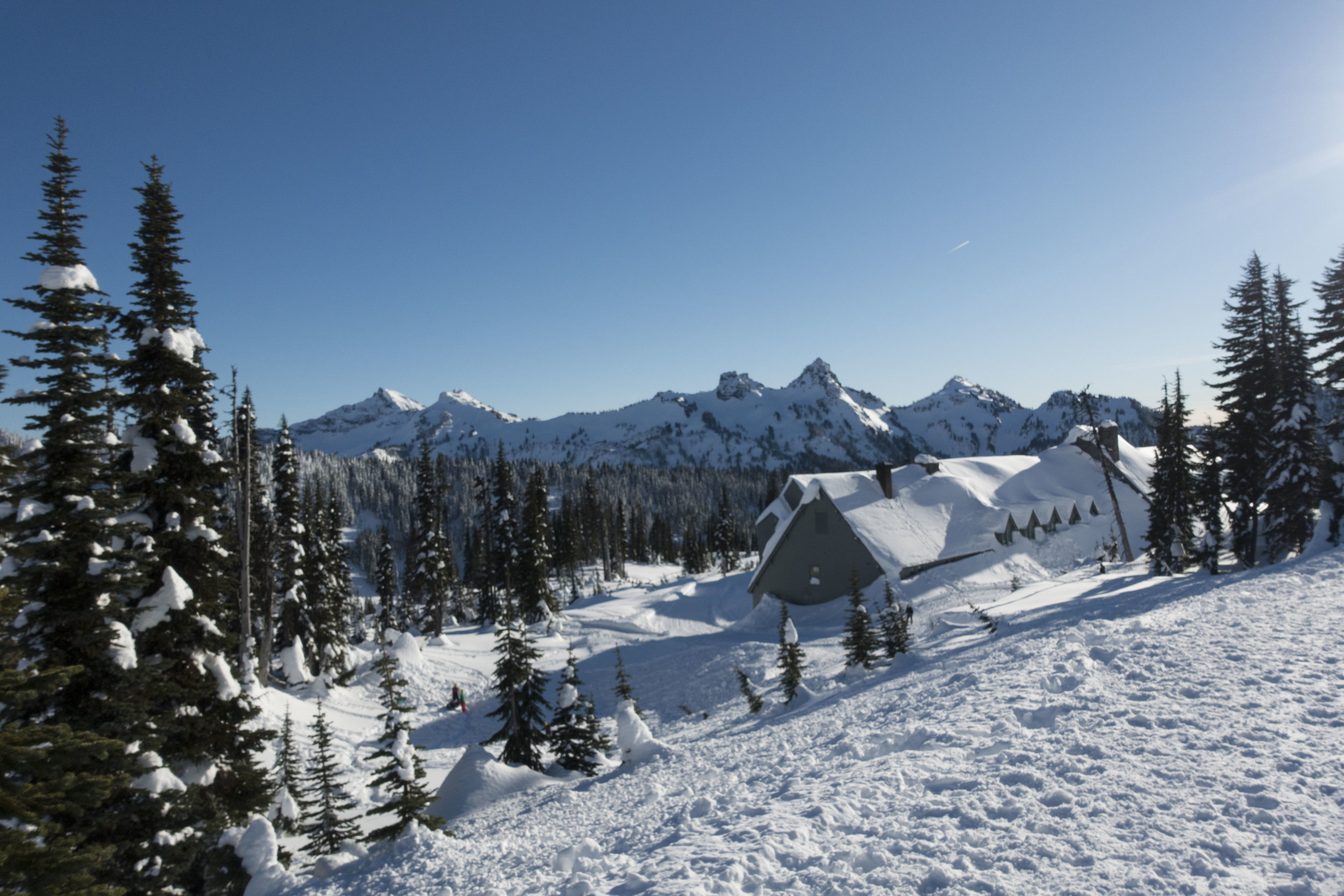
 Location: Paradise, Mt. Rainier (2.5 hours from Seattle)
Where do I begin, my friend Doris and I have been talking about snow camping with the PNW Outdoor Women's group since at least last summer. We have multiple friends that did it last year and only had good things to say so we put it on our to-do list.
November came around and Teresa, the amazing coordinator of this event, put out the link to sign up and Doris and I were lucky enough to get a spot within the one minute it sold out. Talk about competitive. So this was for sure happening and I analyzed the gear list and figured out what I had and needed to get. Let me remind you I am not even a year into backpacking yet, so taking on snow camping while being a newb at 3 season camping, seemed way over my head. Things I bought which I didn't previously have were synthetic puffy booties for sleeping (these turned out to be one of the best purchases and kept us warm all night), new smartwool pants/ top (needed these anyways), I bought a new Enlightened Equipment quilt- not specifically for this event but got one that went to 10 degrees (no more mummy bag)!, snow stakes and I borrowed a bear canister and shovel from a friend. Overall wasn't too bad to prepare for. If you have been 3 season backpacking, you should have most of the gear.
Here was my final gear list:
- pack +pack rain cover
- sleeping pad
- down quilt + straps
- costco down blanket
- down booties
- headlamp + batteries
- 2 Nalgene's
- stove + fuel
- snow stakes
- pillow
- bowl + spoon
- Coffee mug + instant coffee, cocoa
- lighter/matches
- sunscreen
- first aid kit
- ear plugs
- toiletries
- heat packs/ hand warmer
- spikes
- snowshoes
- poles
- sit pad
- sun glasses
- base ball cap + warm hat
- smartwool top and bottom
- fleece lined leggings
- snow pants
- 2 pairs hiking socks
- patagonia fleece zip up
- light down jacket
- heavy duty ski jacket
- 2 pairs of gloves (light pair/heavy pair)
- toilet paper
- External battery charger for phone
- camera + batteries
- America Beautiful Pass
Like I said- PNW Outdoor Women's group hosted this event and did all of the ground work for us in securing permits for Mt. Rainier. In the winter, for groups 12 or more, you need to get a group permit ahead of time, for groups under 12 you can go day of and get one and pick any spot you'd like (300 ft from parking lot and trails). Such a unique experience to be able to camp in places you'd never be able to any other time of the year.
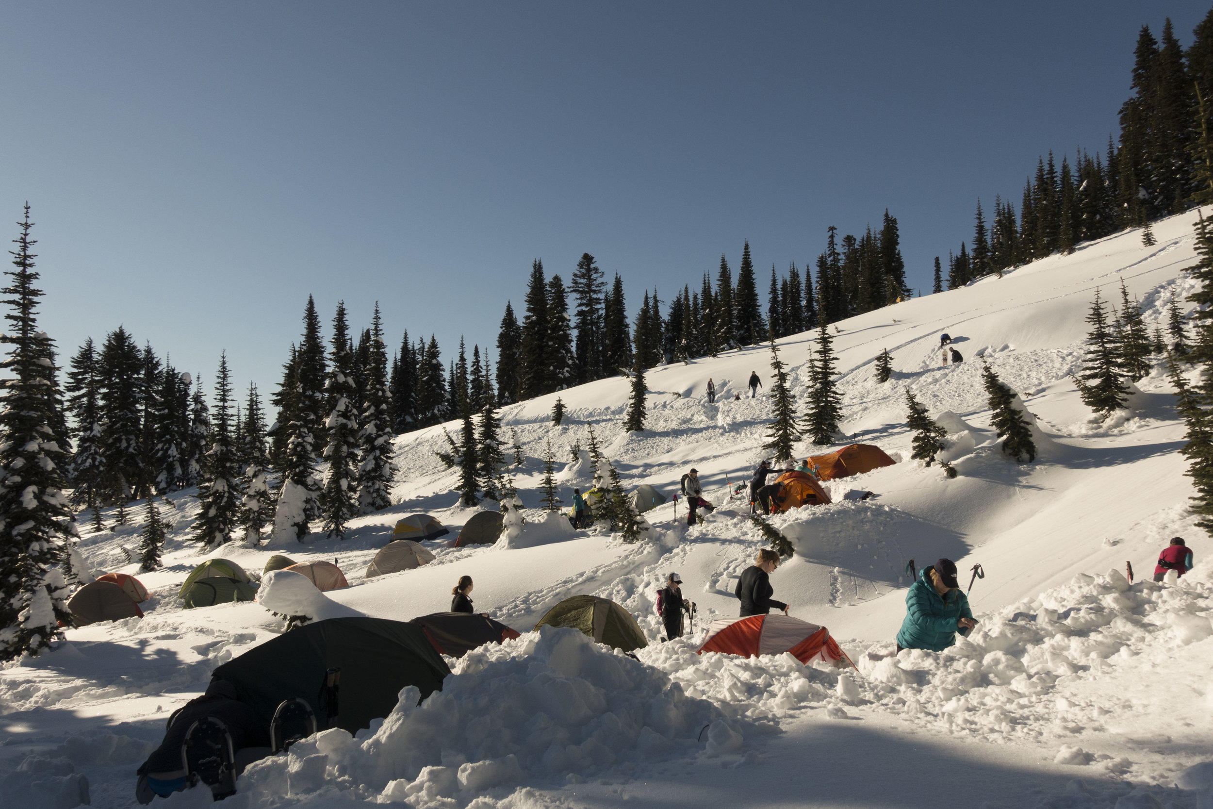
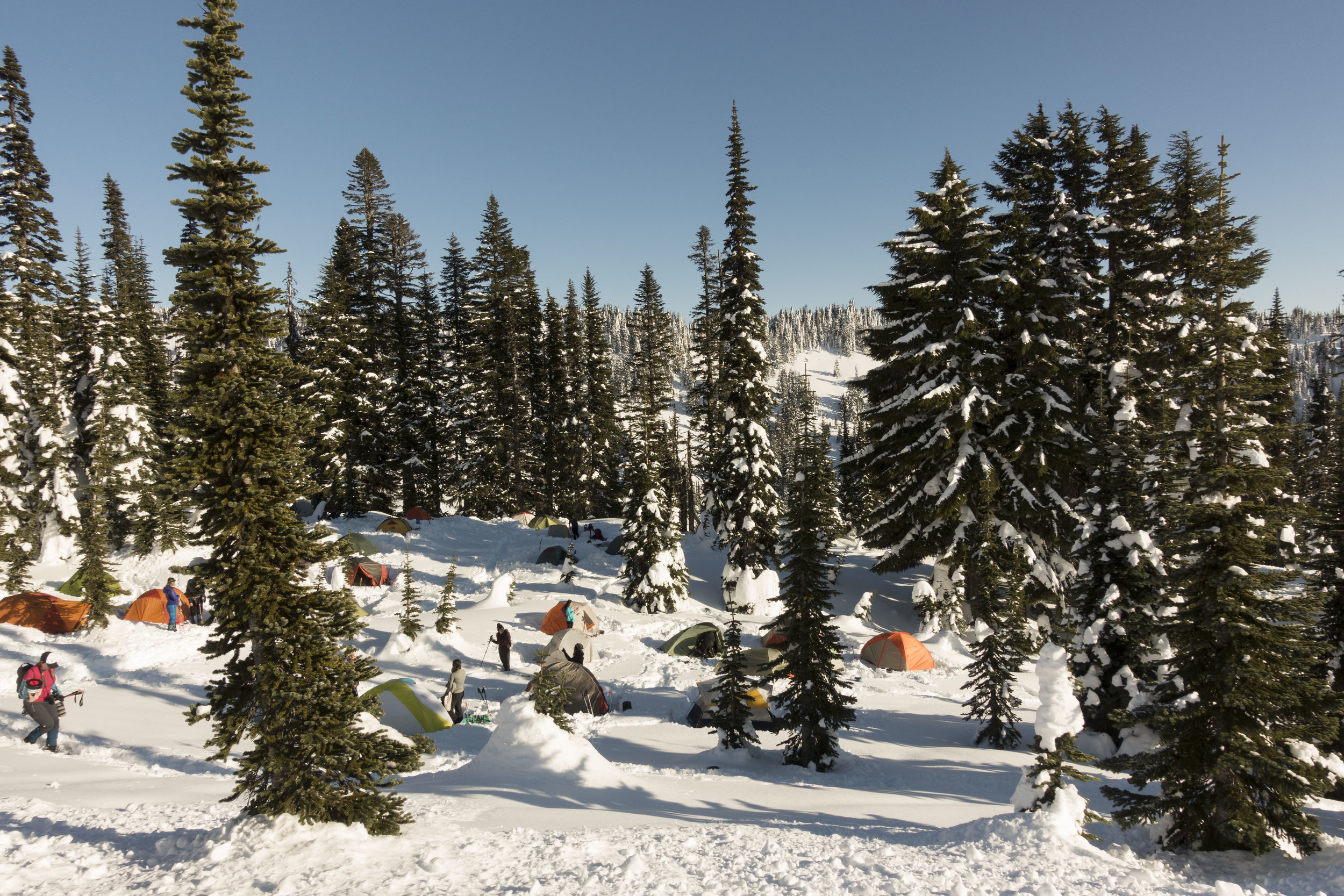
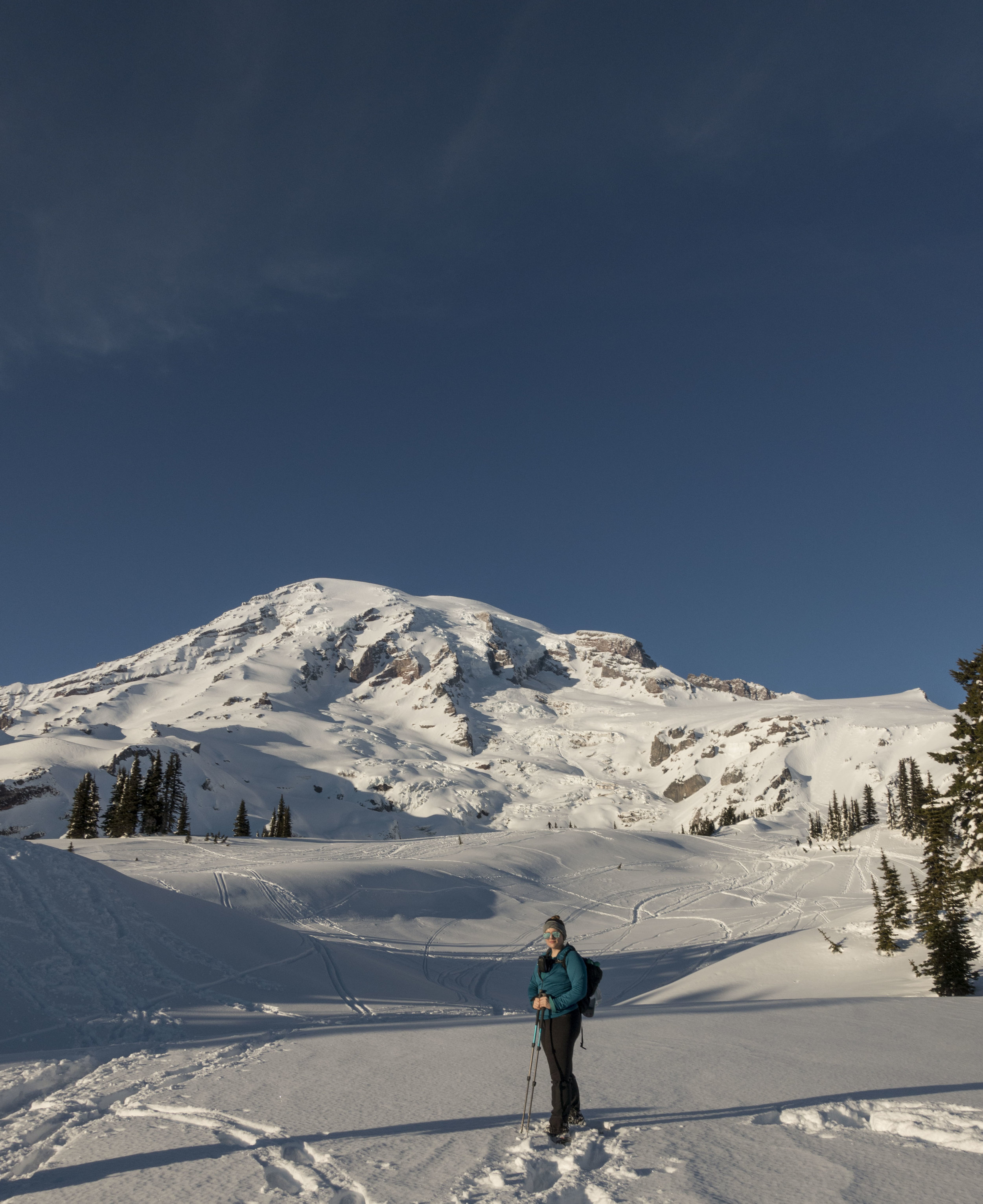
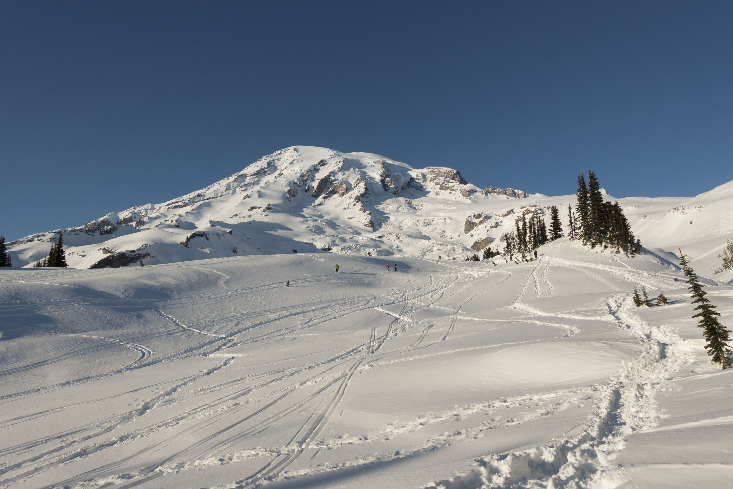
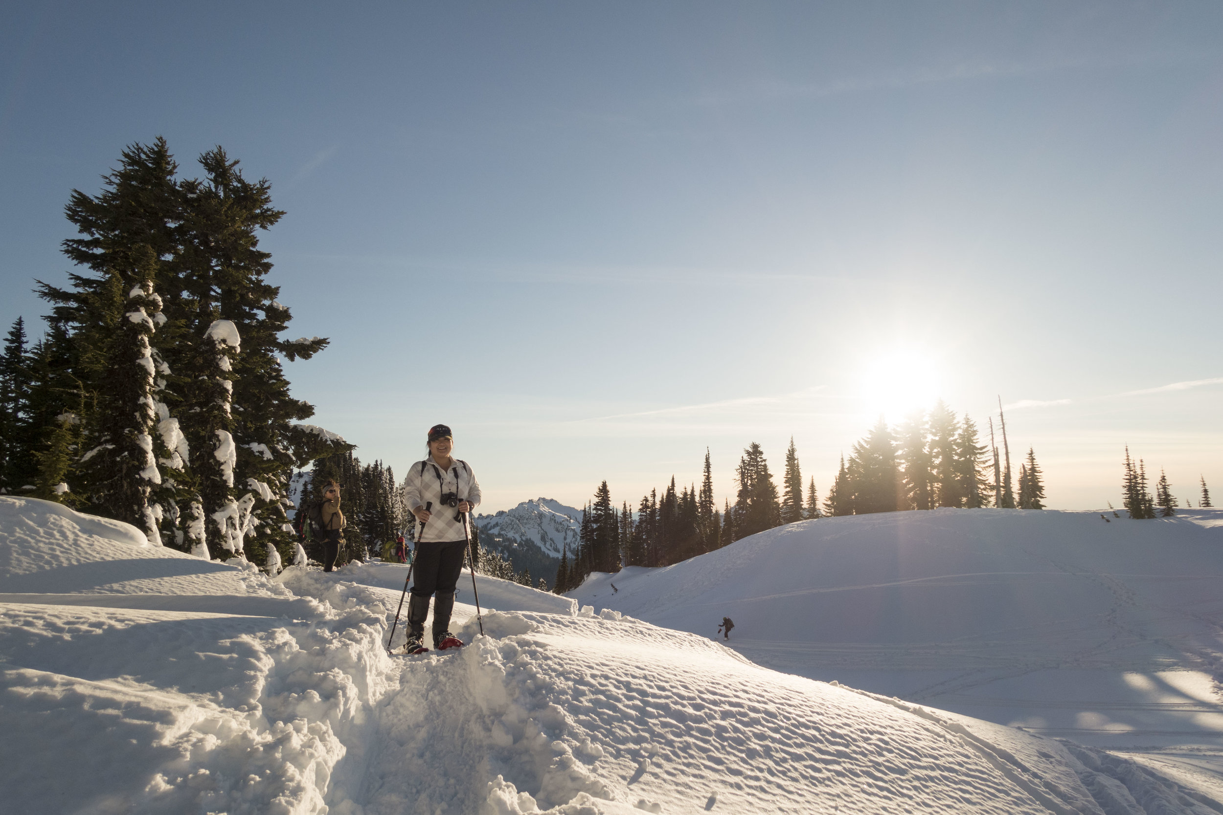
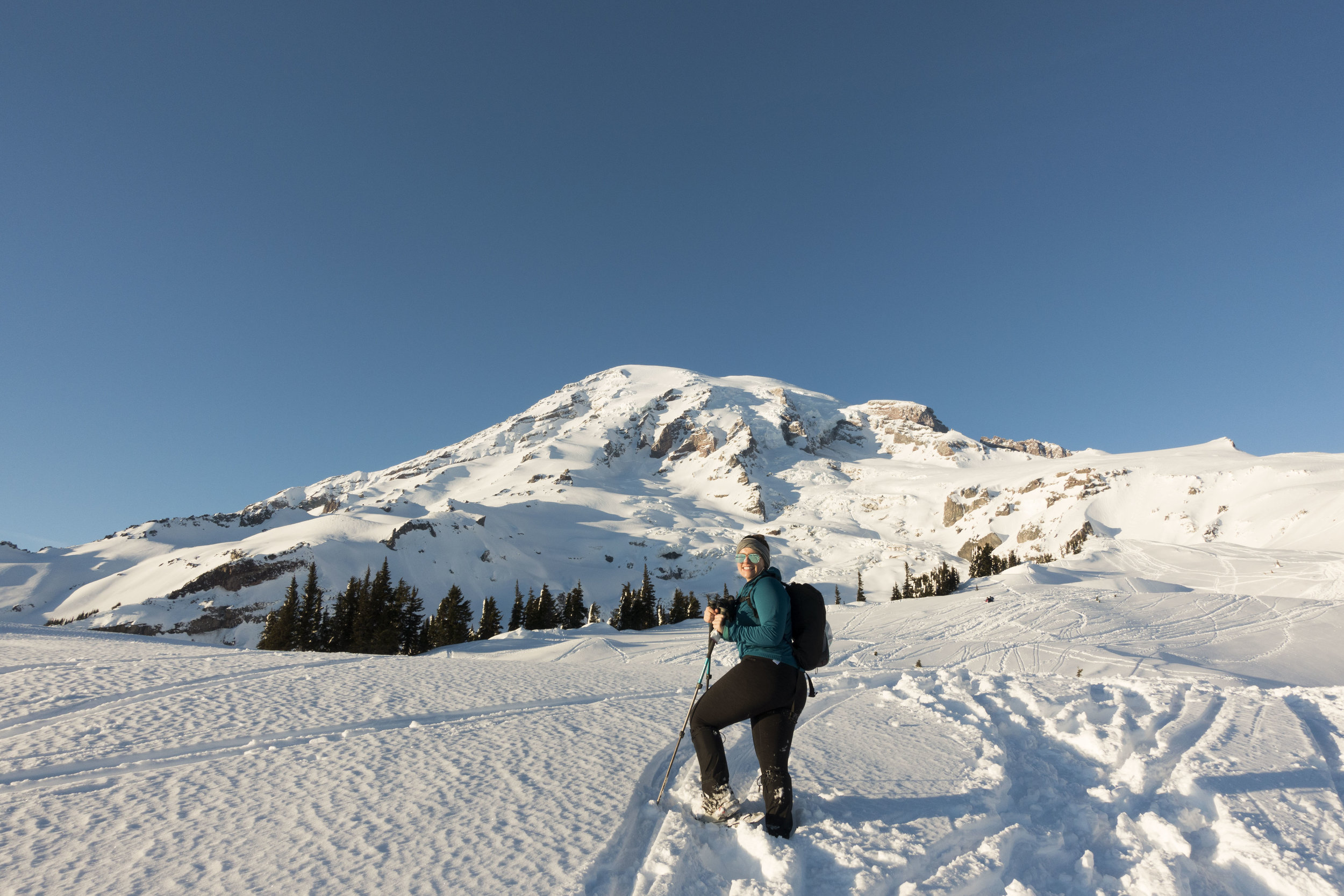
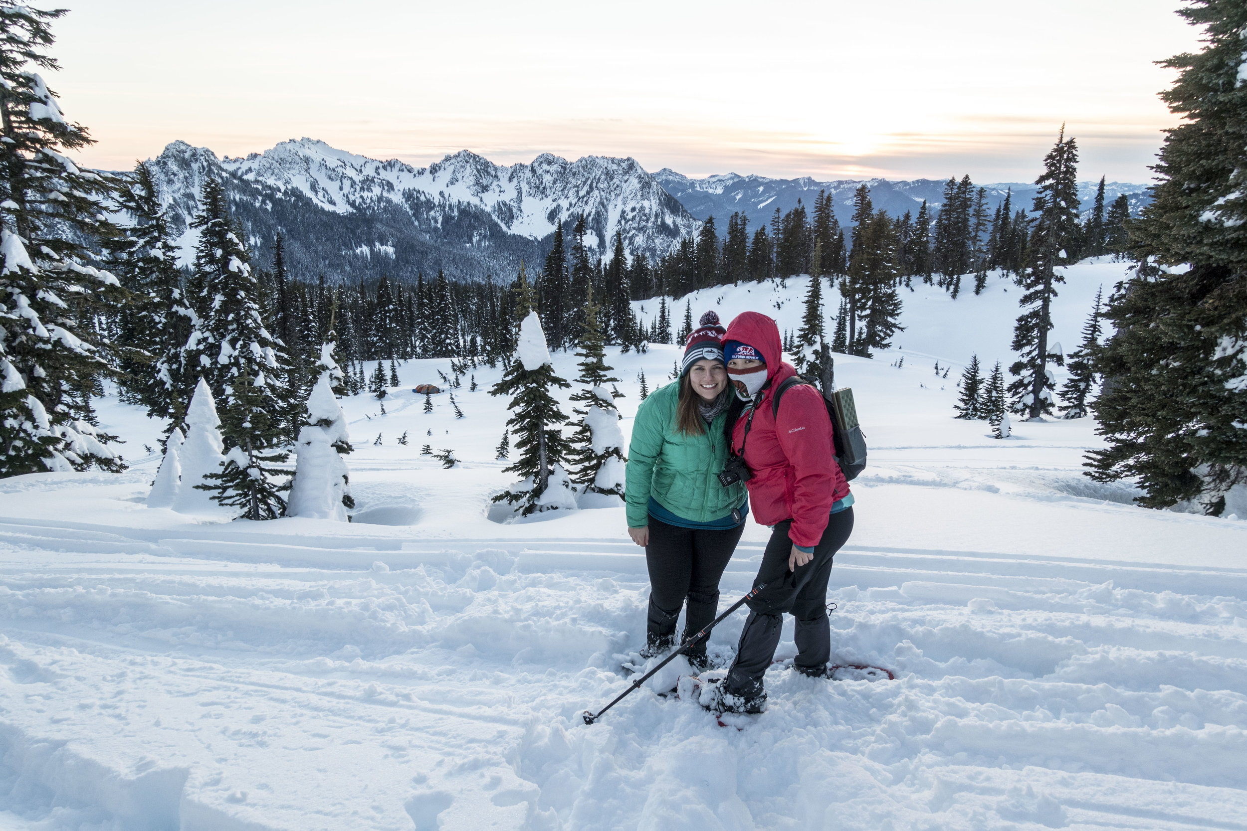
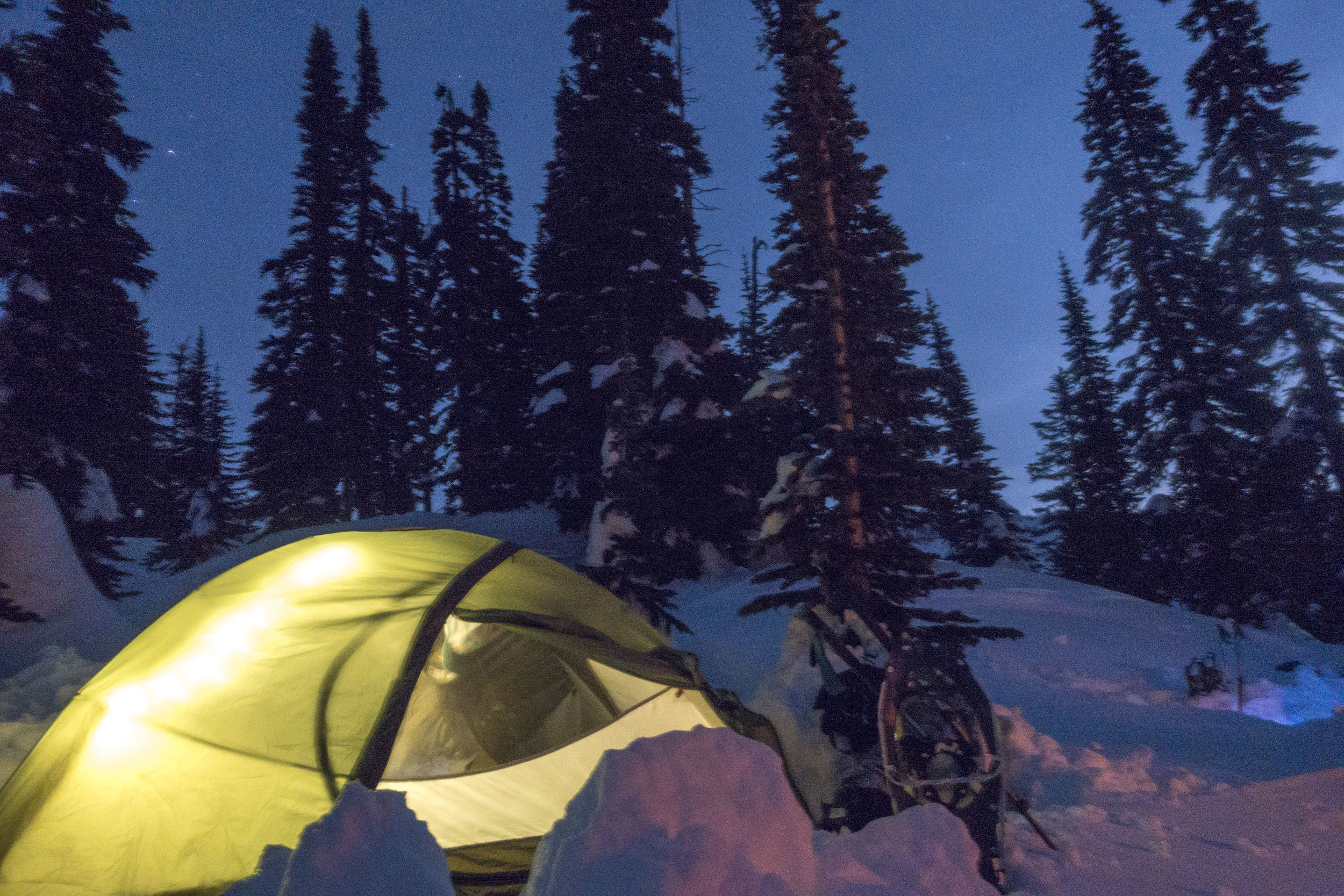
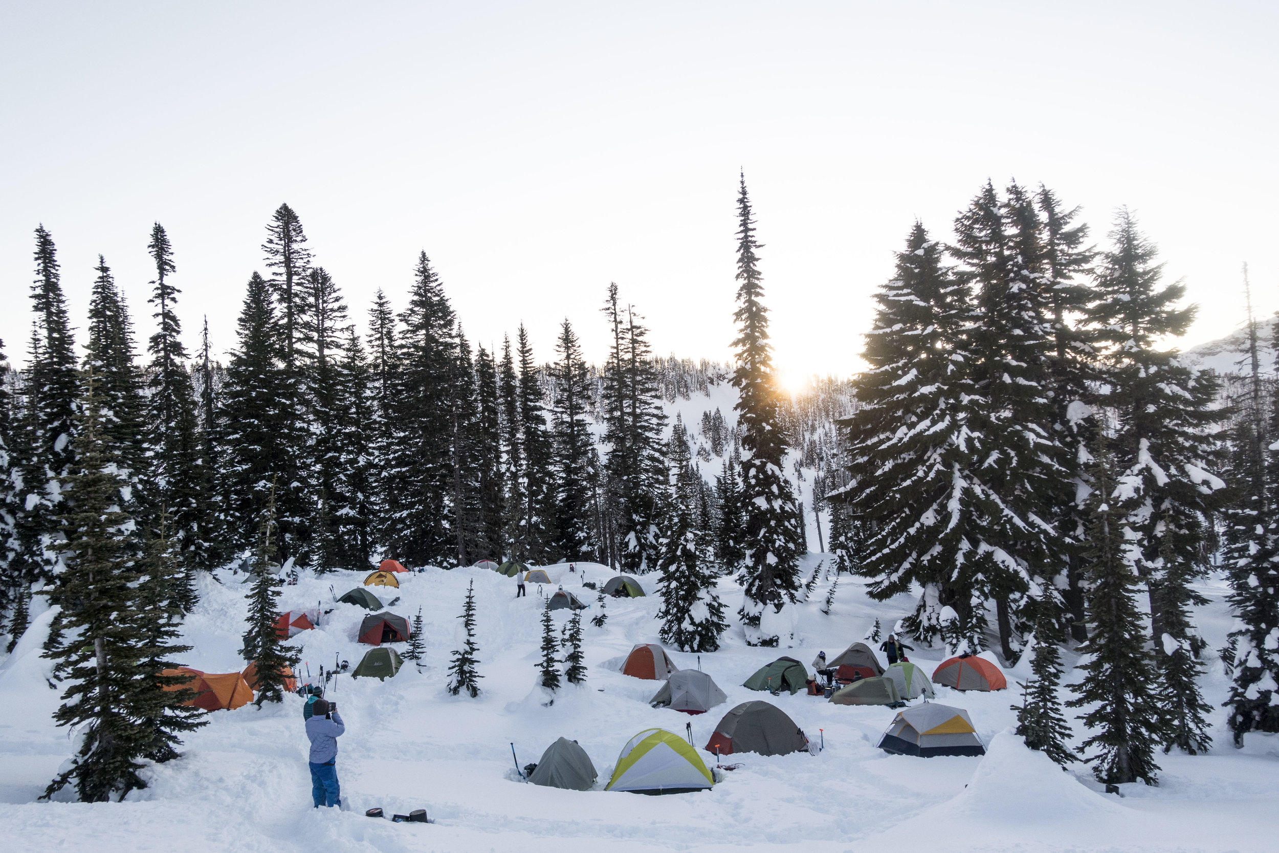
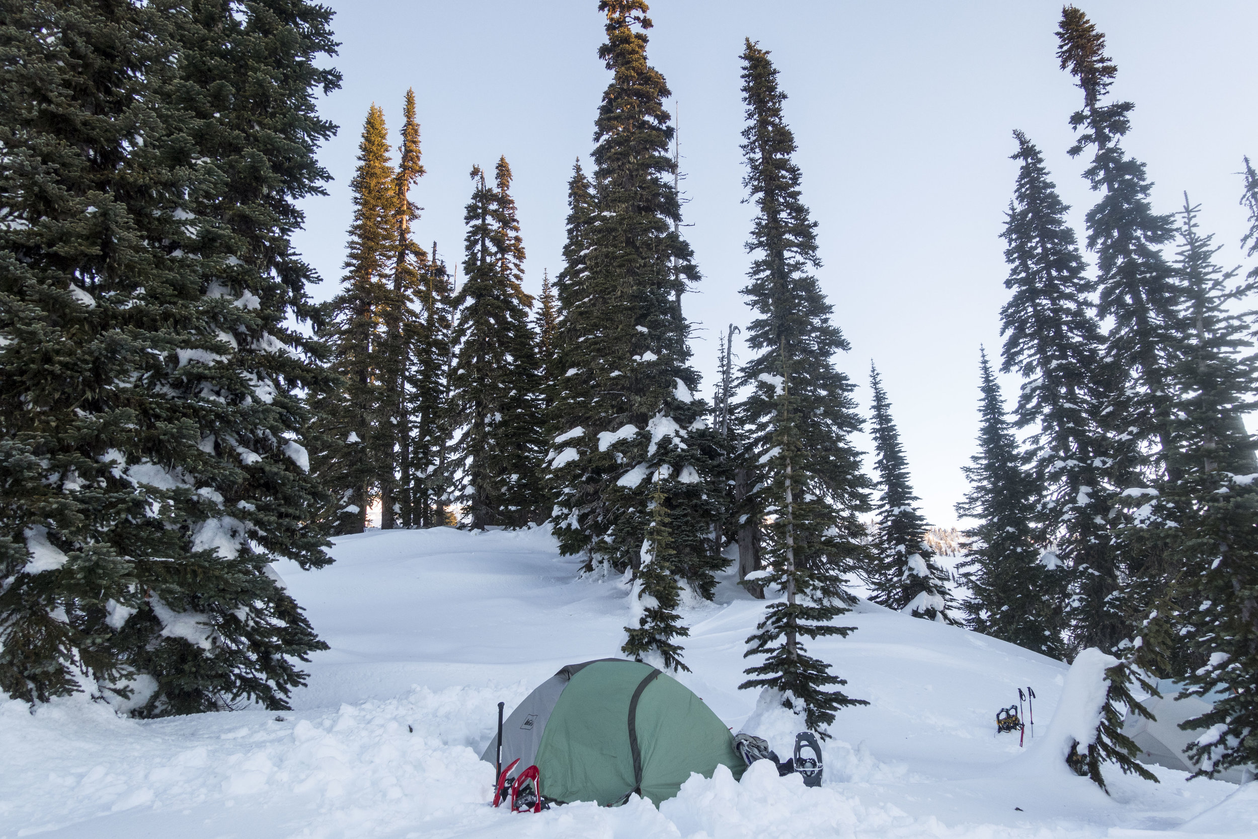
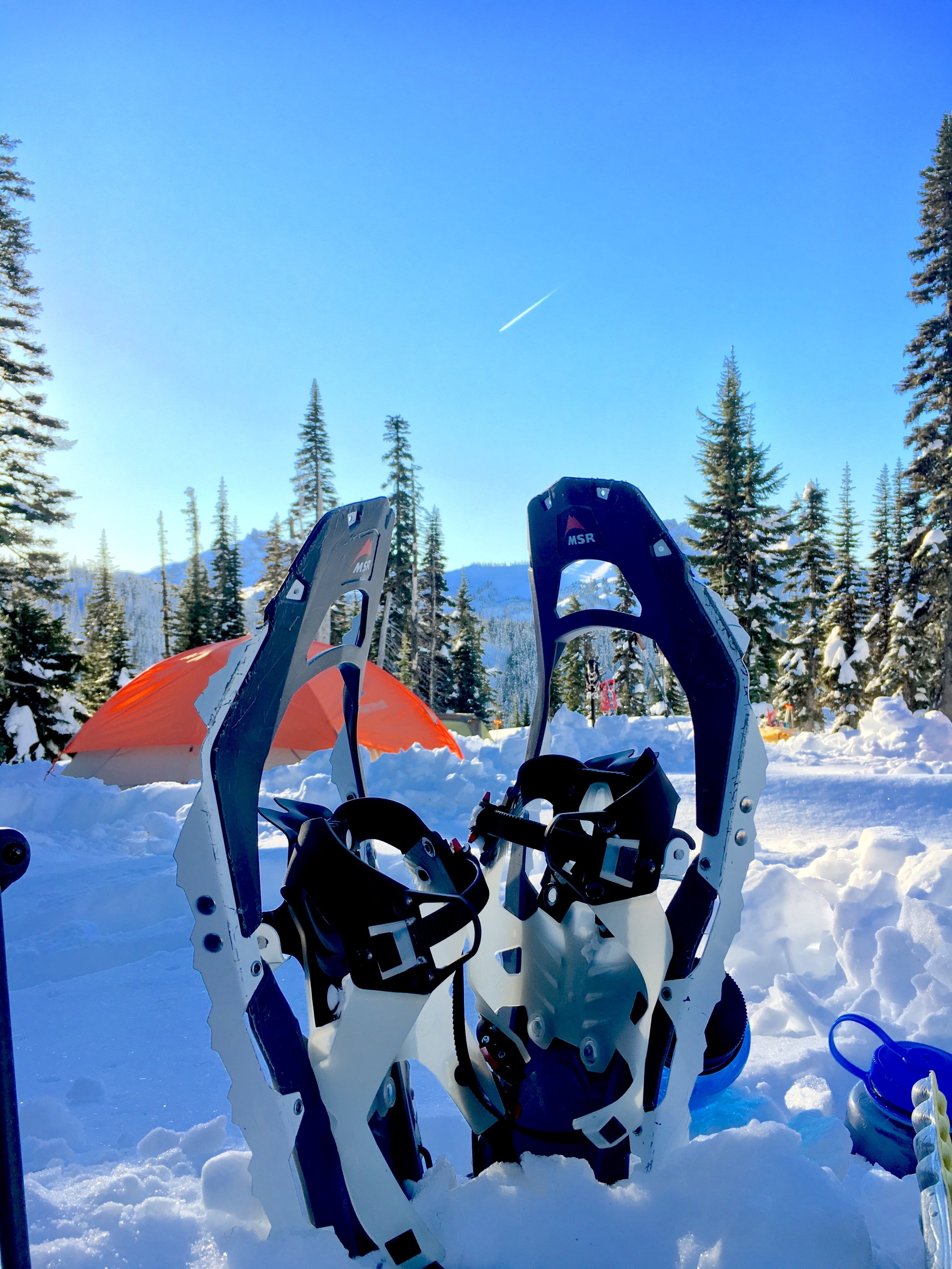
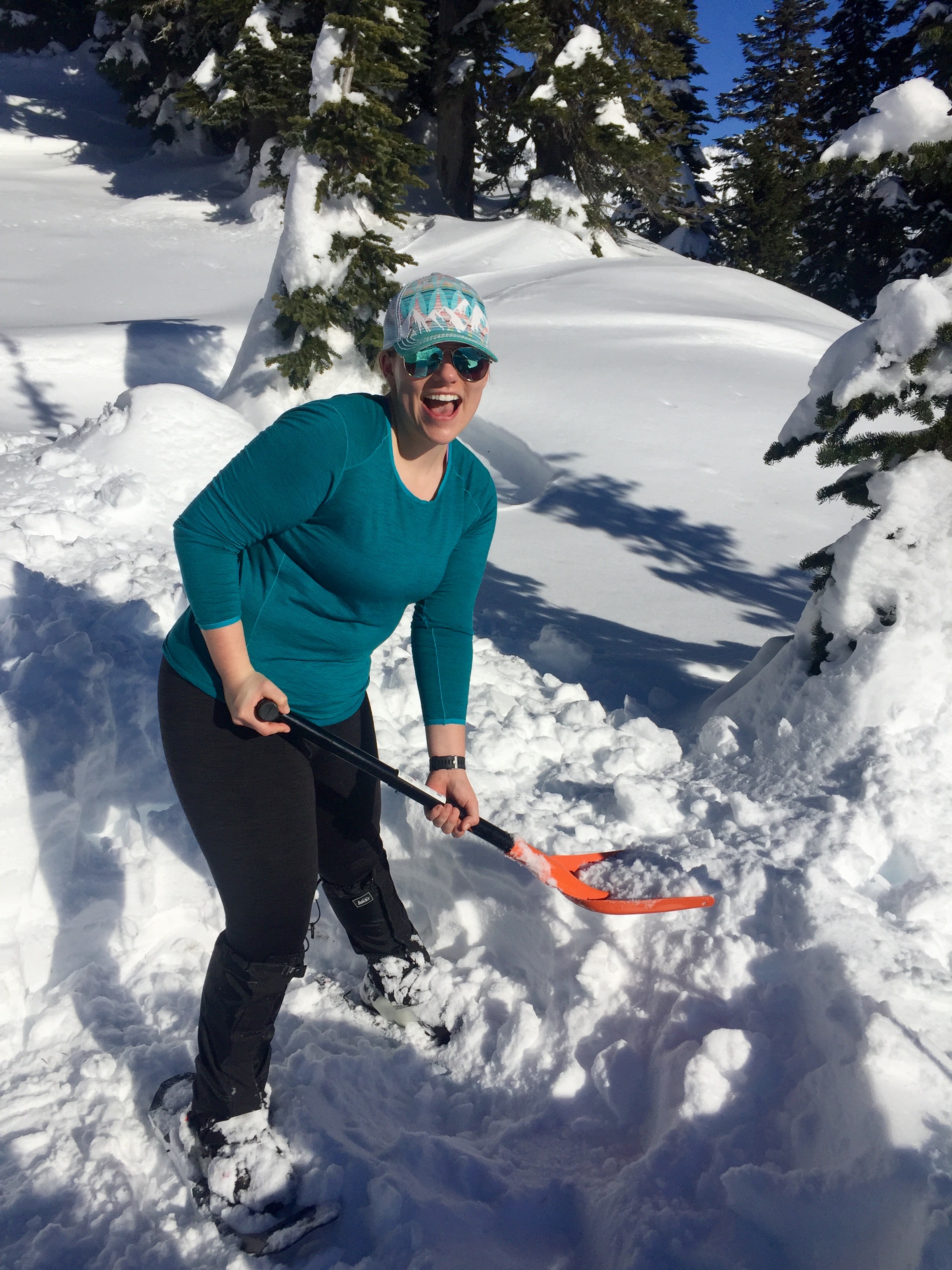
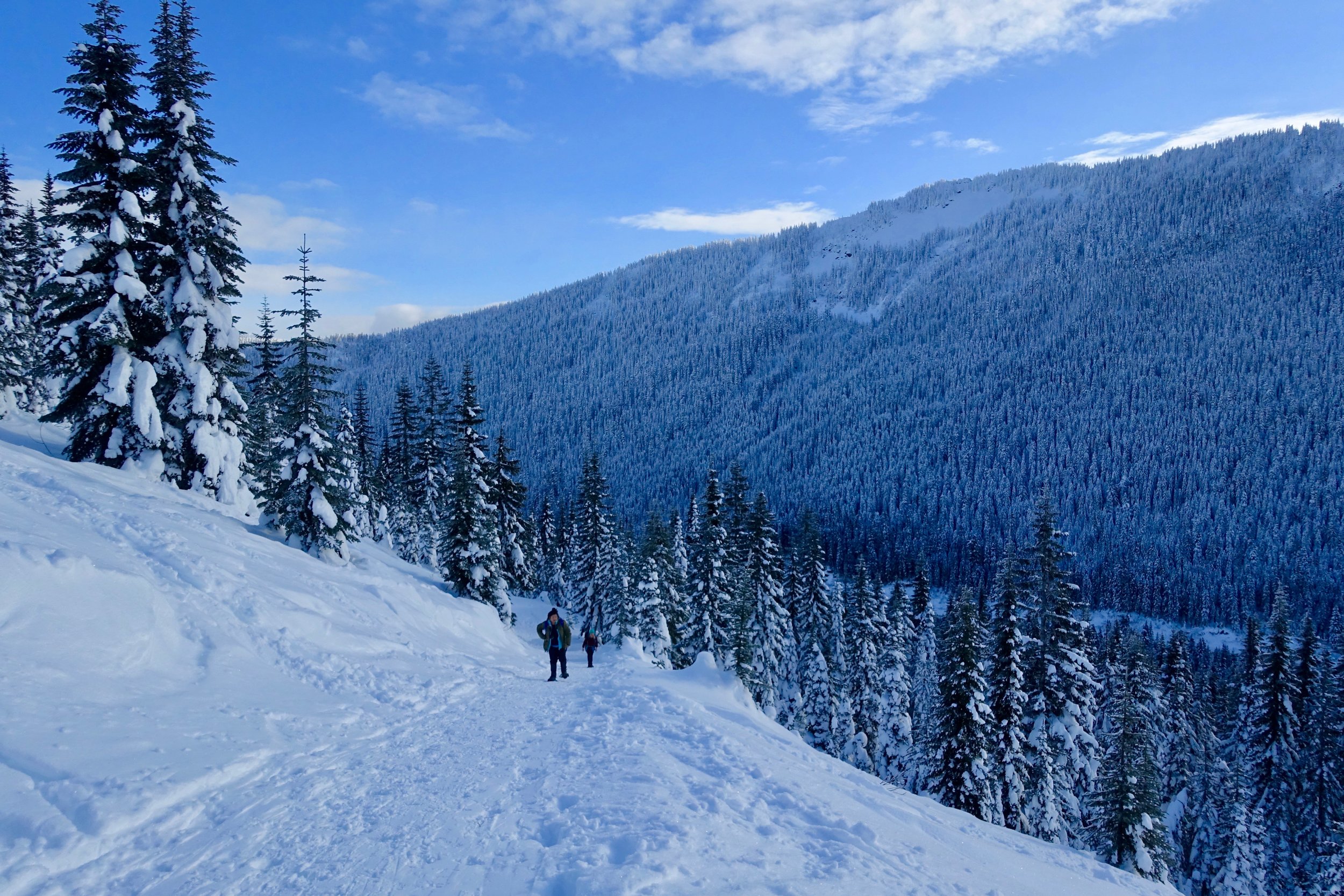
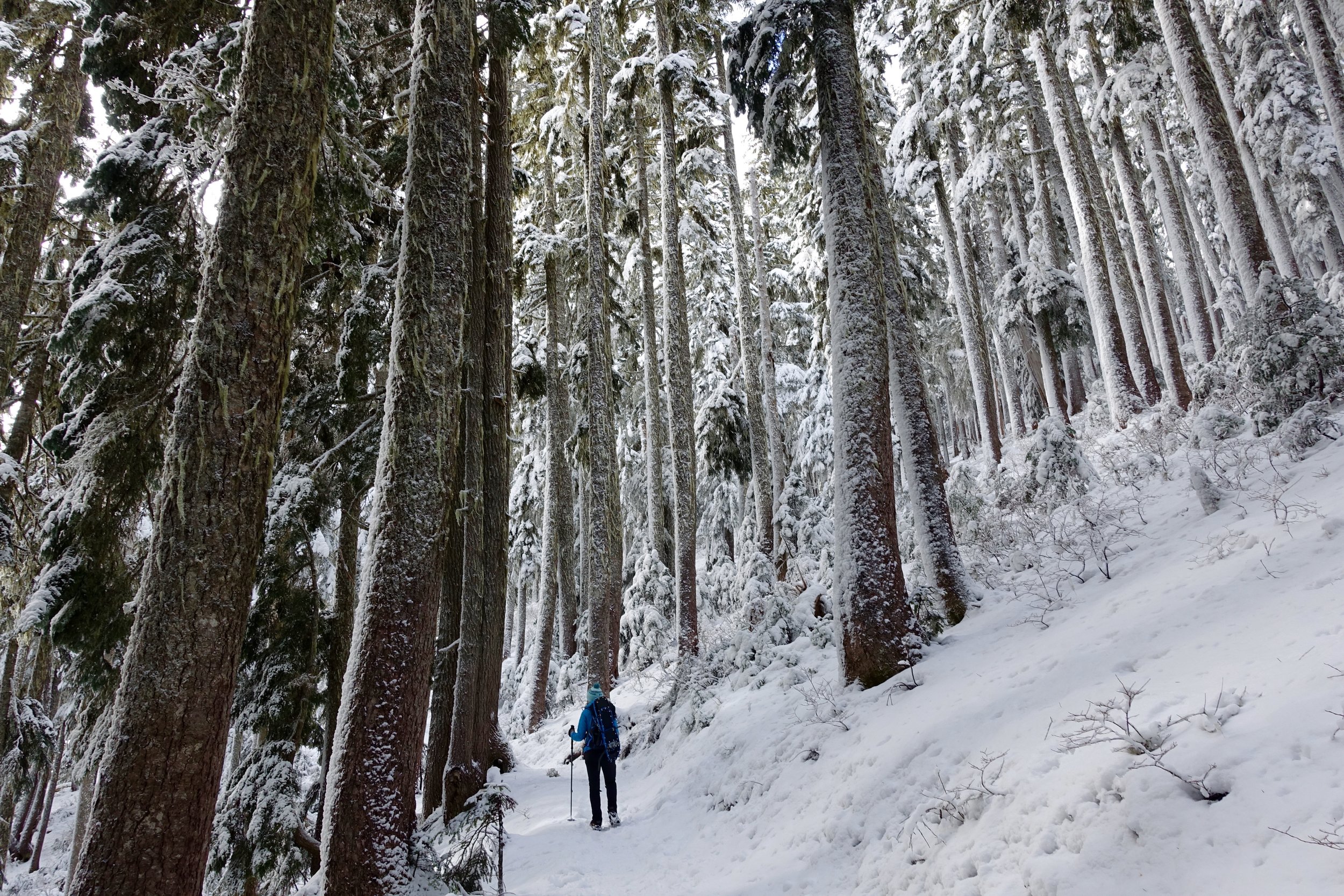
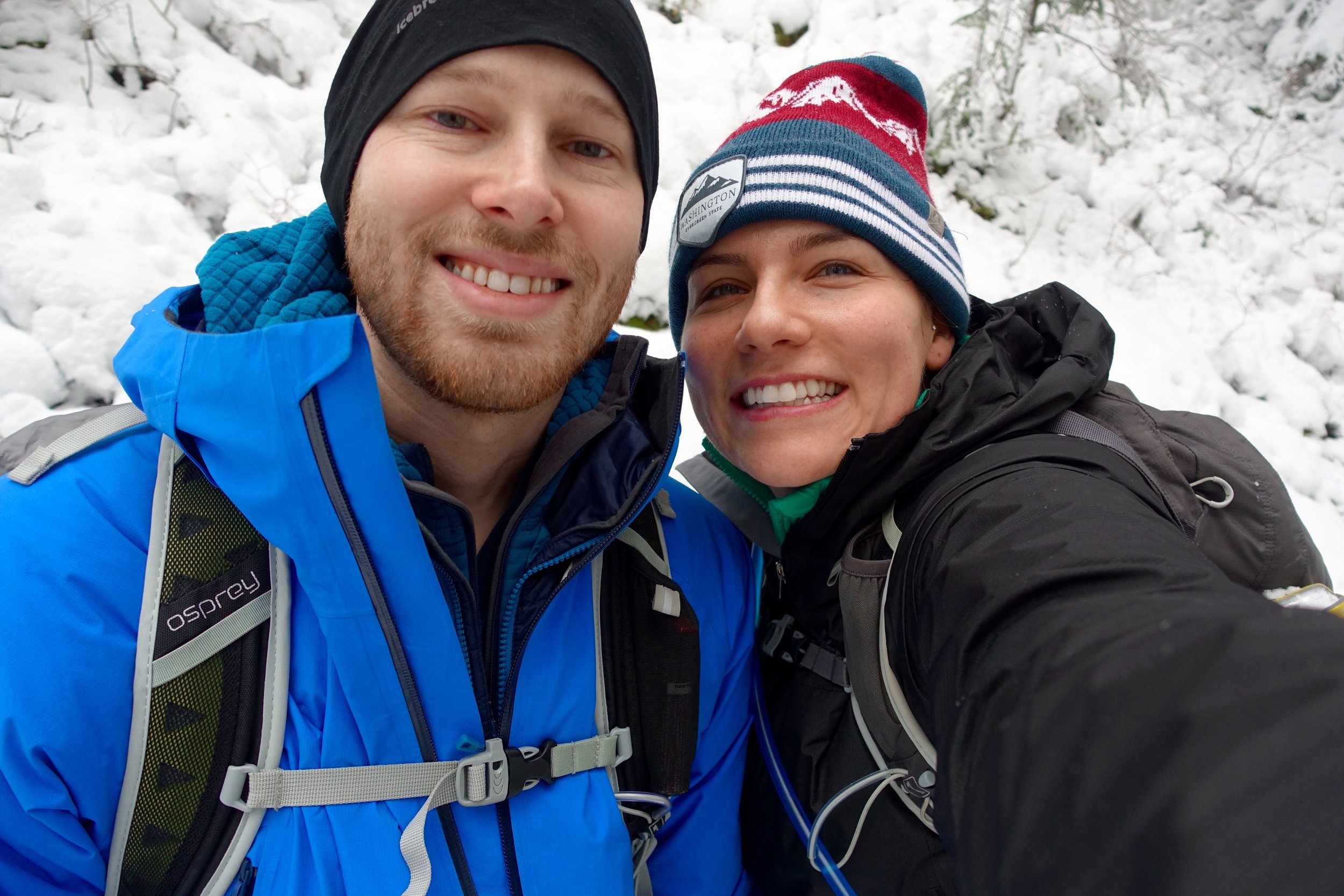
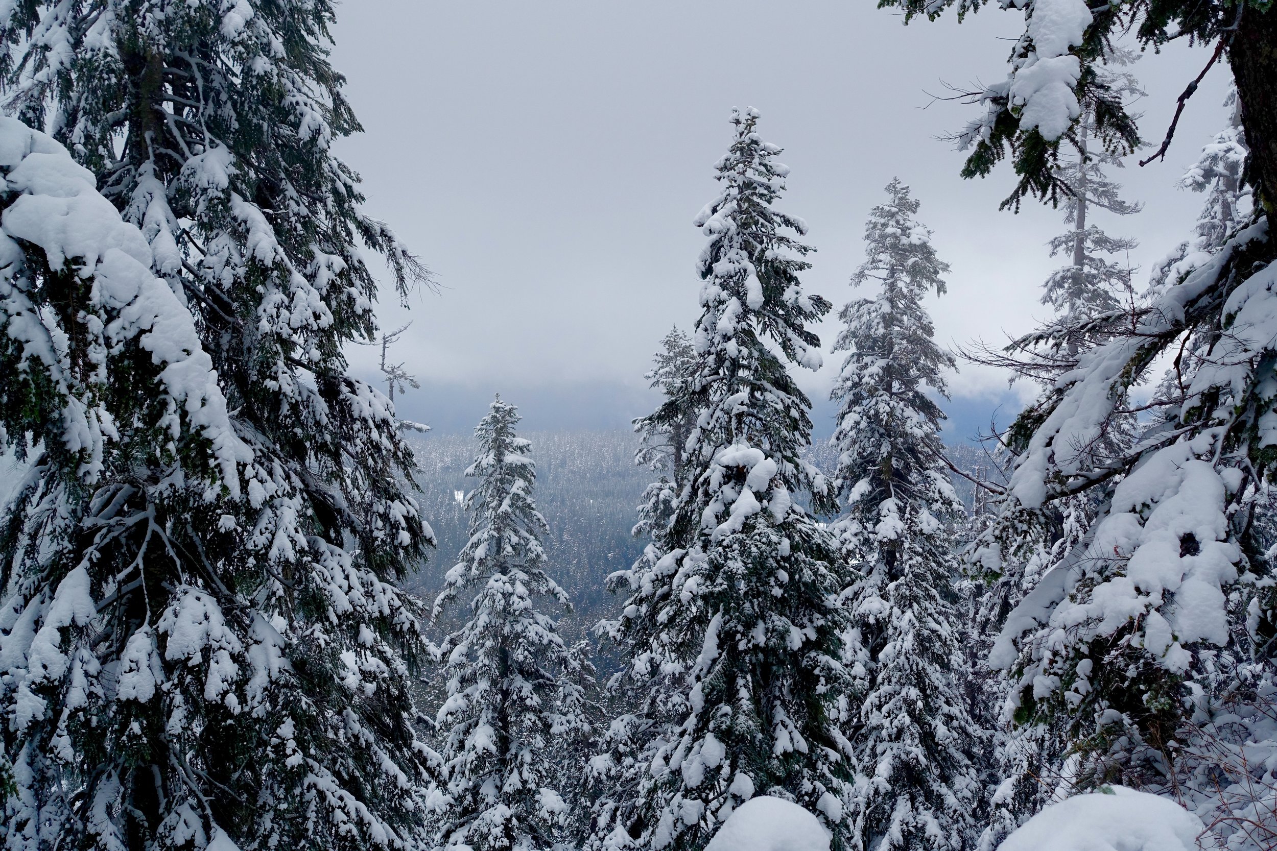
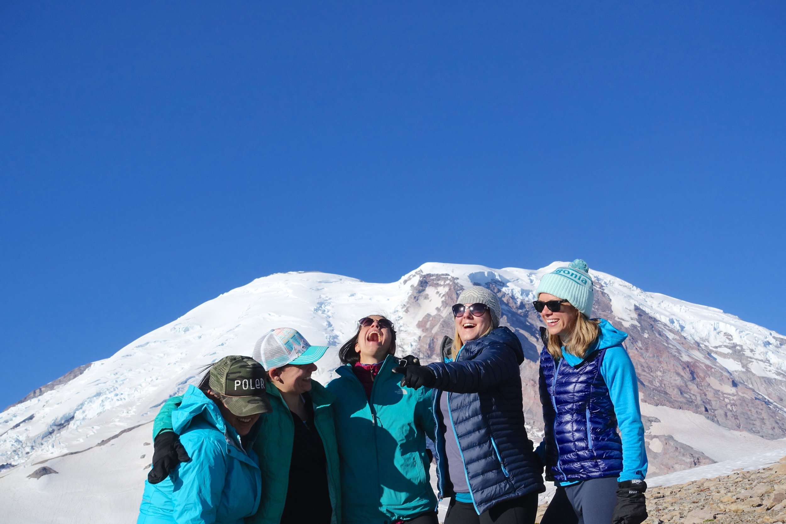
So the actual day of.. we carpooled with our new friend Heidi and met up with everyone at Longmire and did introductions and went over a few things. We made the icy, long, beautiful trek up to Paradise after that. All cars are required to carry chains in the winter, even AWD and 4WD. We didn't need to put them on but had them with. Make sure to park in the overnight parking section if you plan on spending the night up there. We all put on our huge packs, for which we got questions of how long we would be out there.. oh just one night, but you need a lot of gear! There ended up being 37 of us and we hit the trail, for about .25 mile and then set up camp behind the Paradise Lodge. My pack was over 40 pounds, so I'm glad we didn't have to cary it too far.
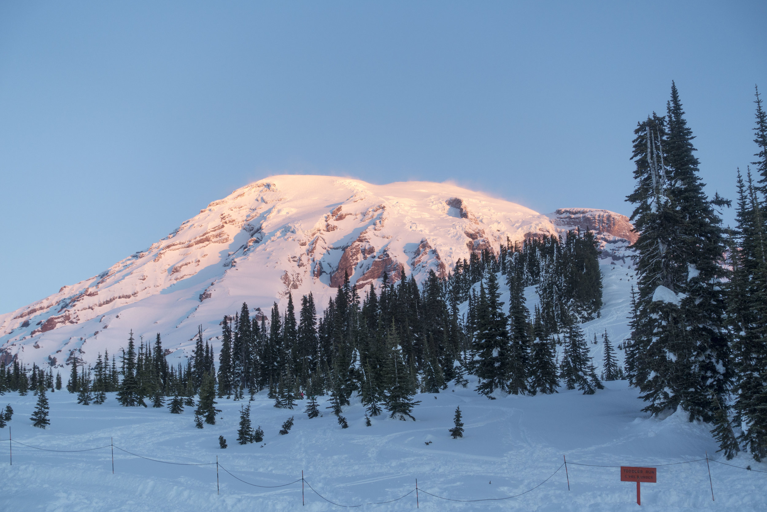
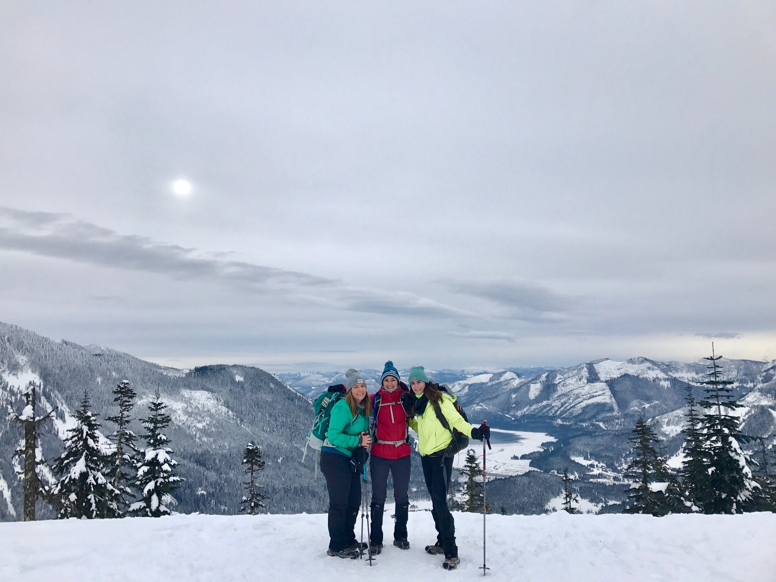
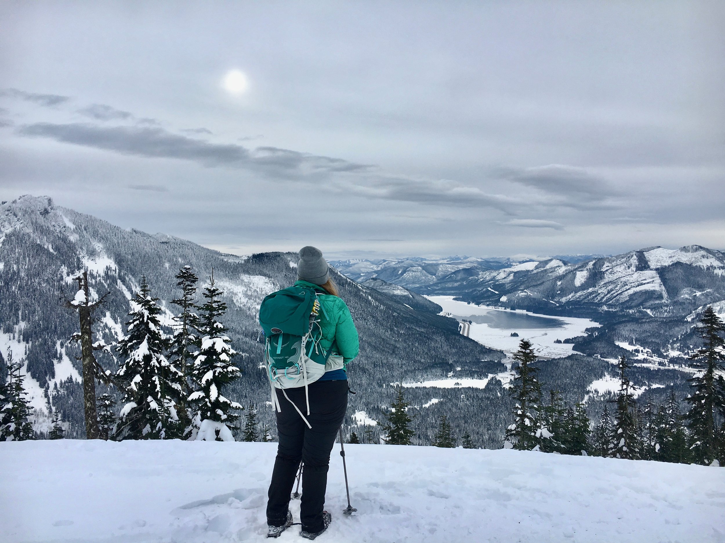
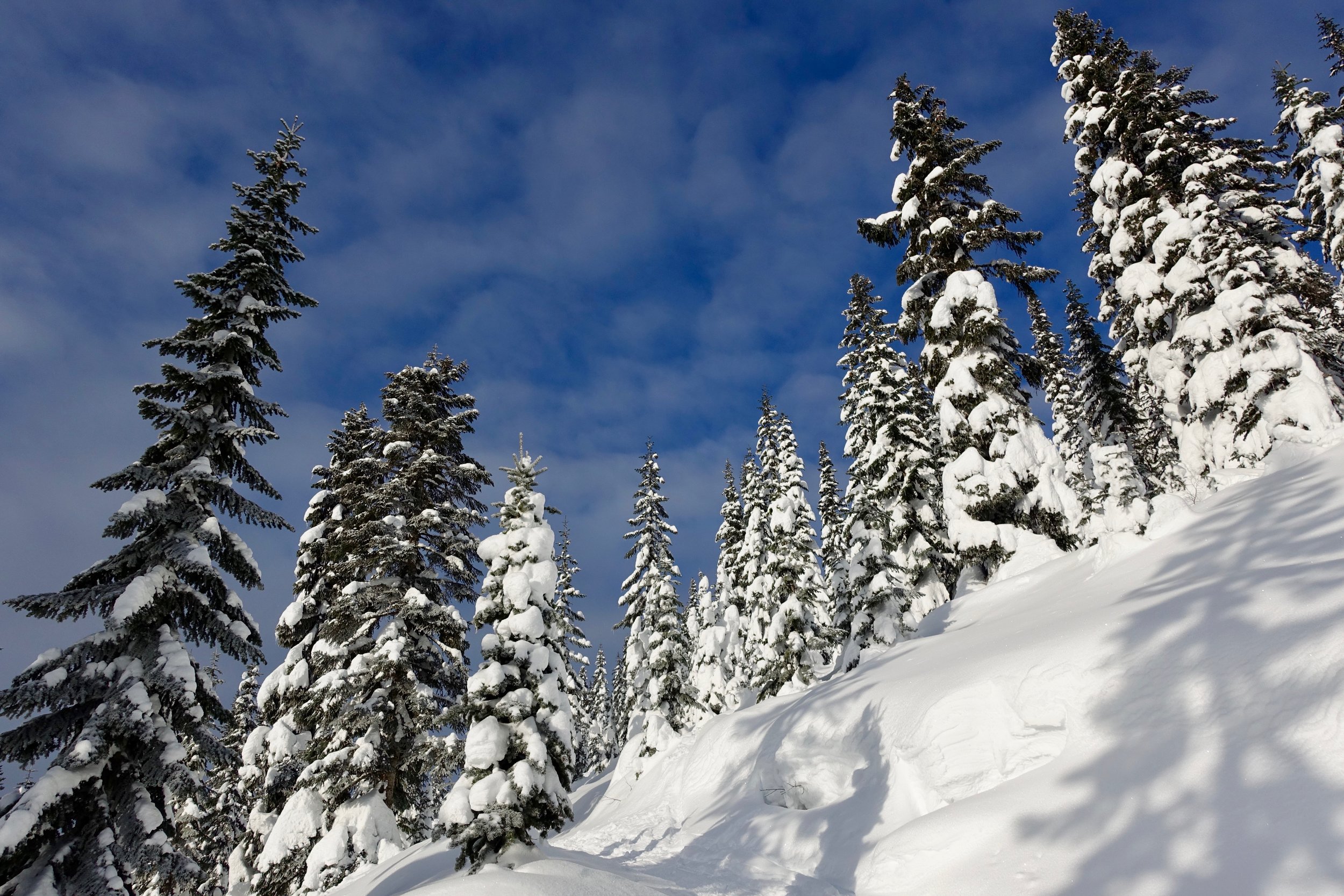
Site selection.. from what I learned this weekend is you want to be not under any trees (heavy snow can fall on your tent), away from any water sources, and of course out of avalanche terrain. We all picked our spots, and laid out all 25 tents! What a site to see. To make a spot for your tent you dig at least 2-3 feet down and make a flattened space. If it is windy, you want to build your walls higher. We had the most perfect weather you could ever have asked for with blue bird skies and no wind, so we didn't have to worry about that. This did take a good amount of time to make the platform for our tent. Stomping down with snowshoes helped a lot. We got up our tent, set up our beds, and ate lunch. It was actually really sunny and hot at this point and I was down to my last layers! I also put on sunscreen 3 times that day and still got a little pink. The sun is super harsh with reflecting from the snow so it's important to lather that sunscreen up a lot.
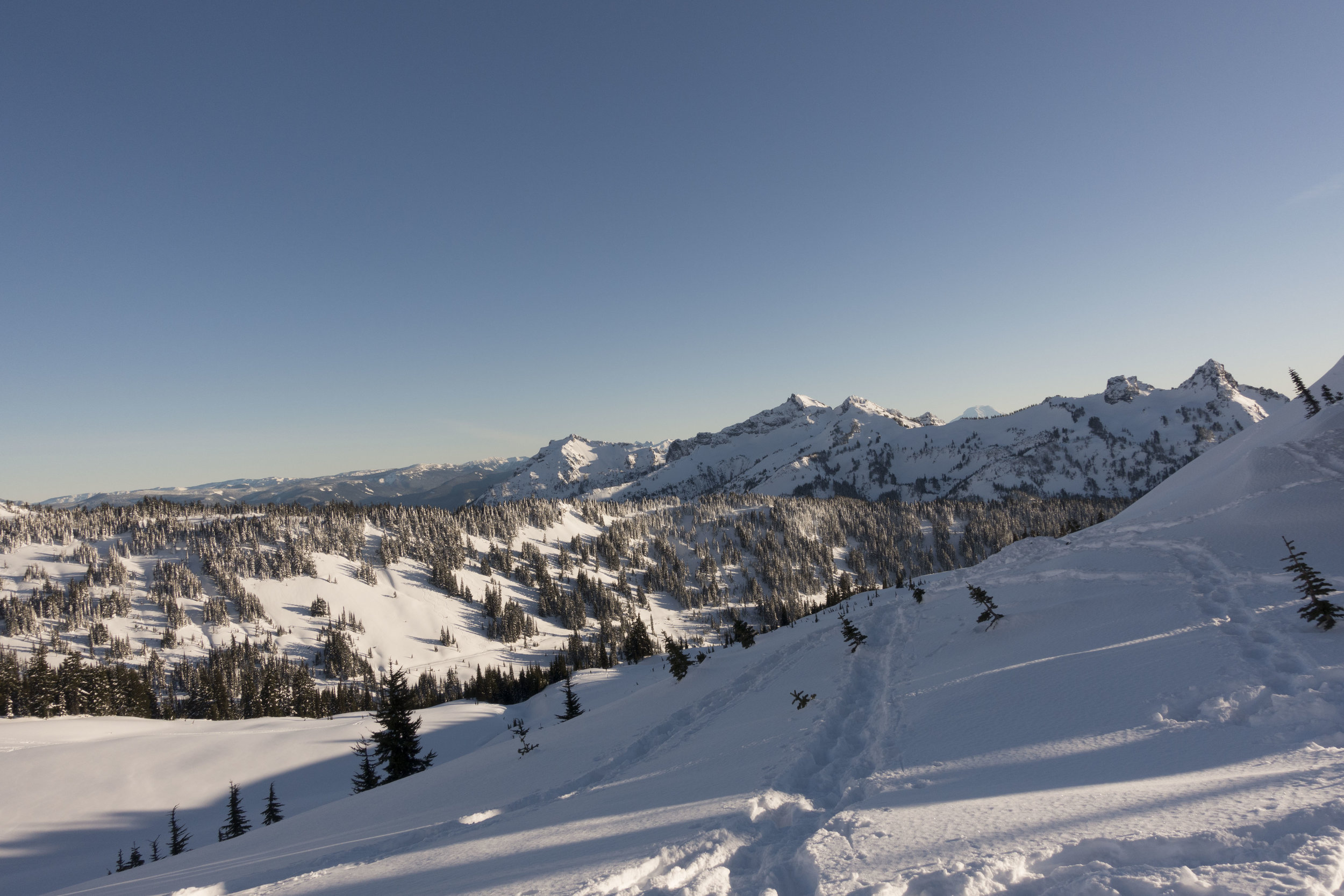
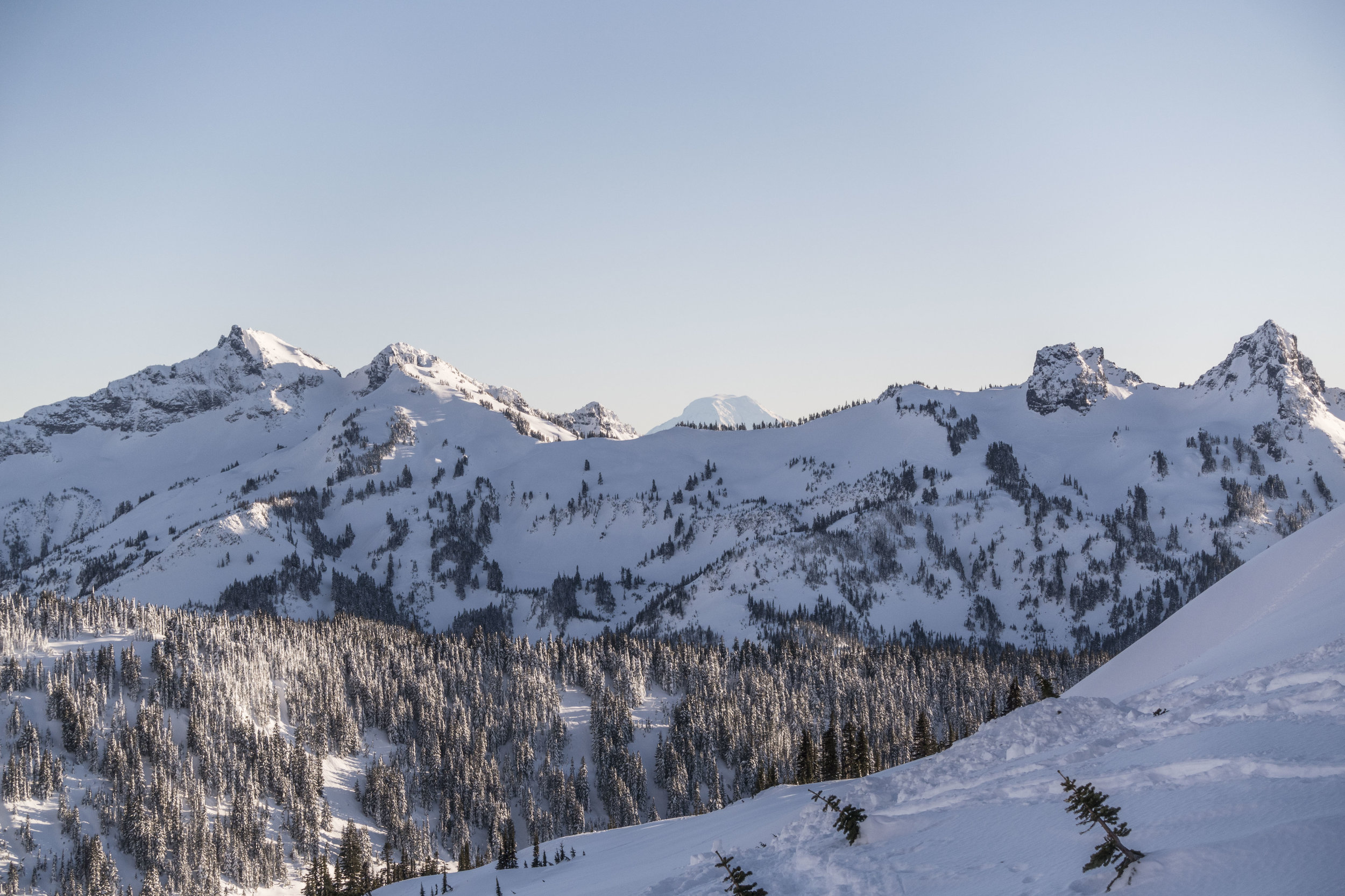
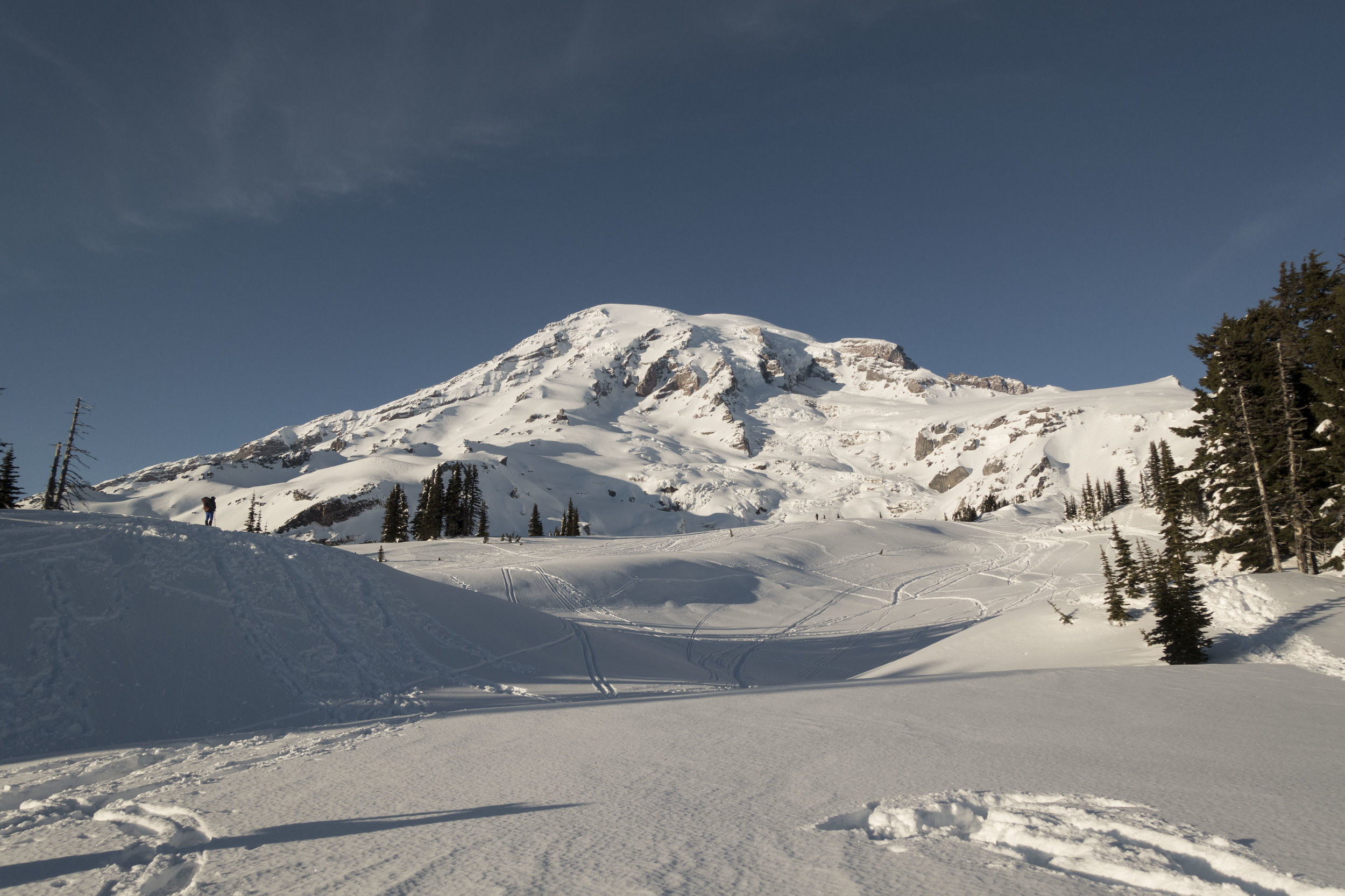
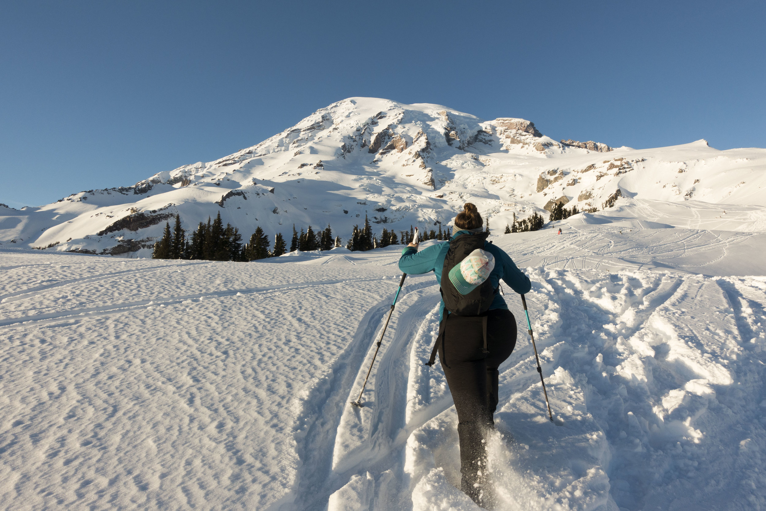
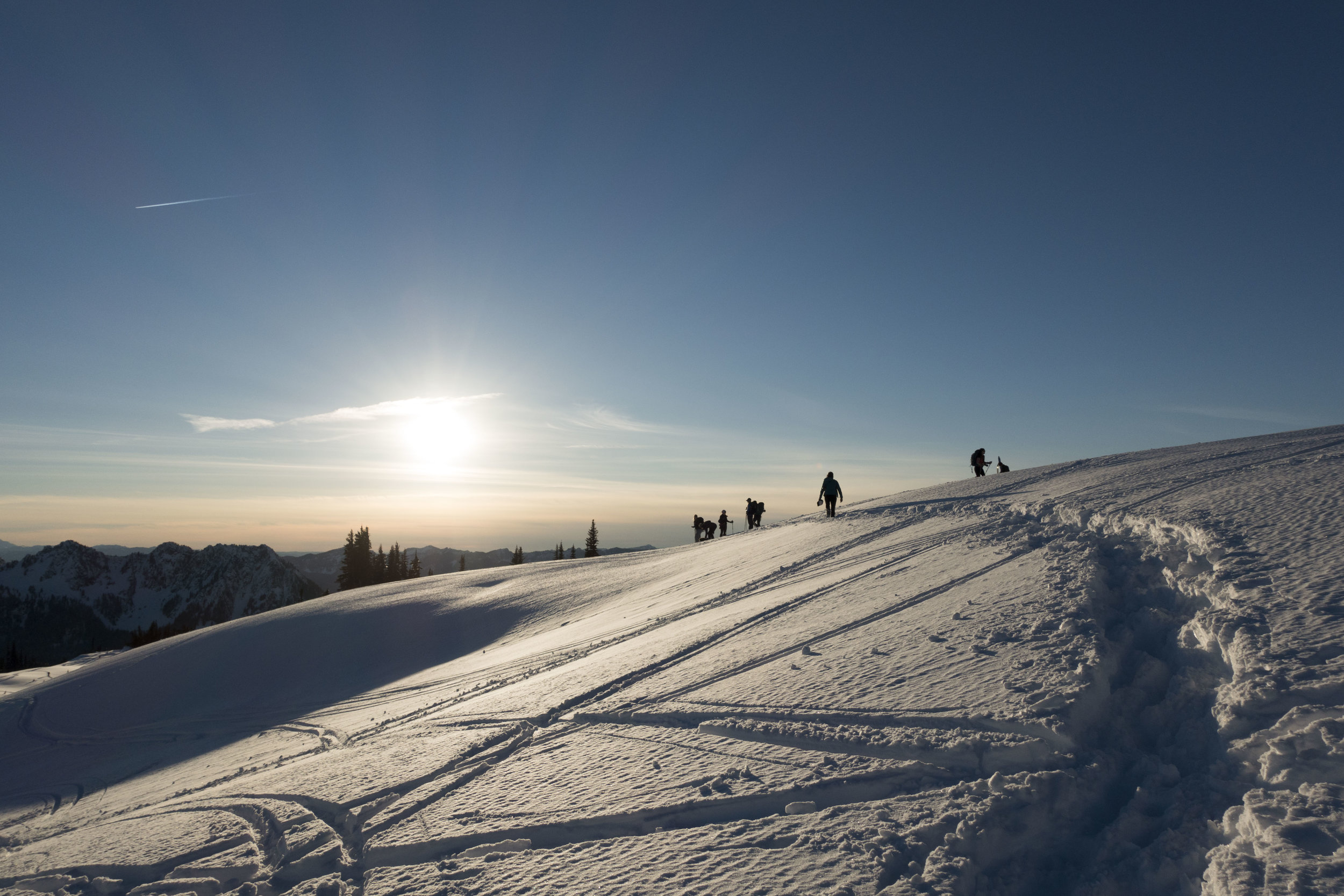
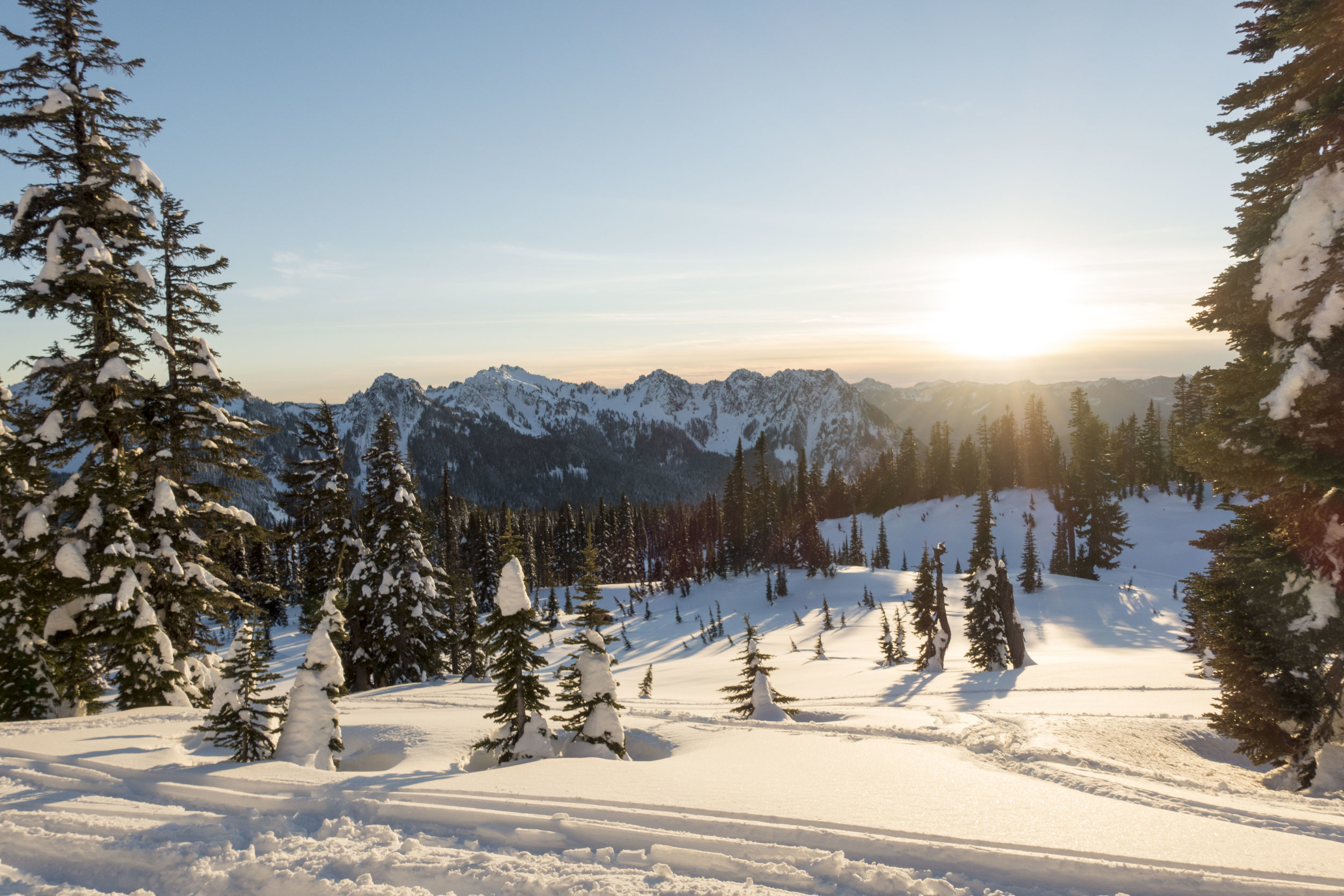
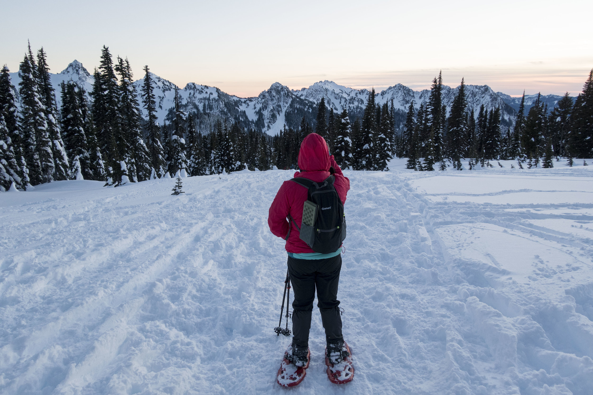
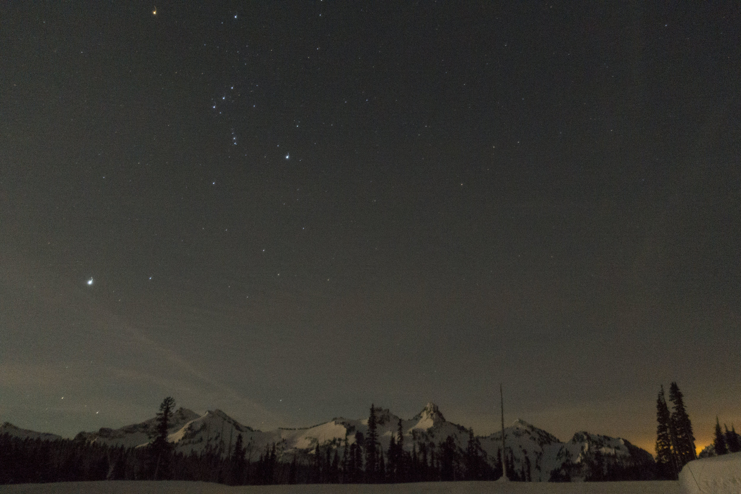
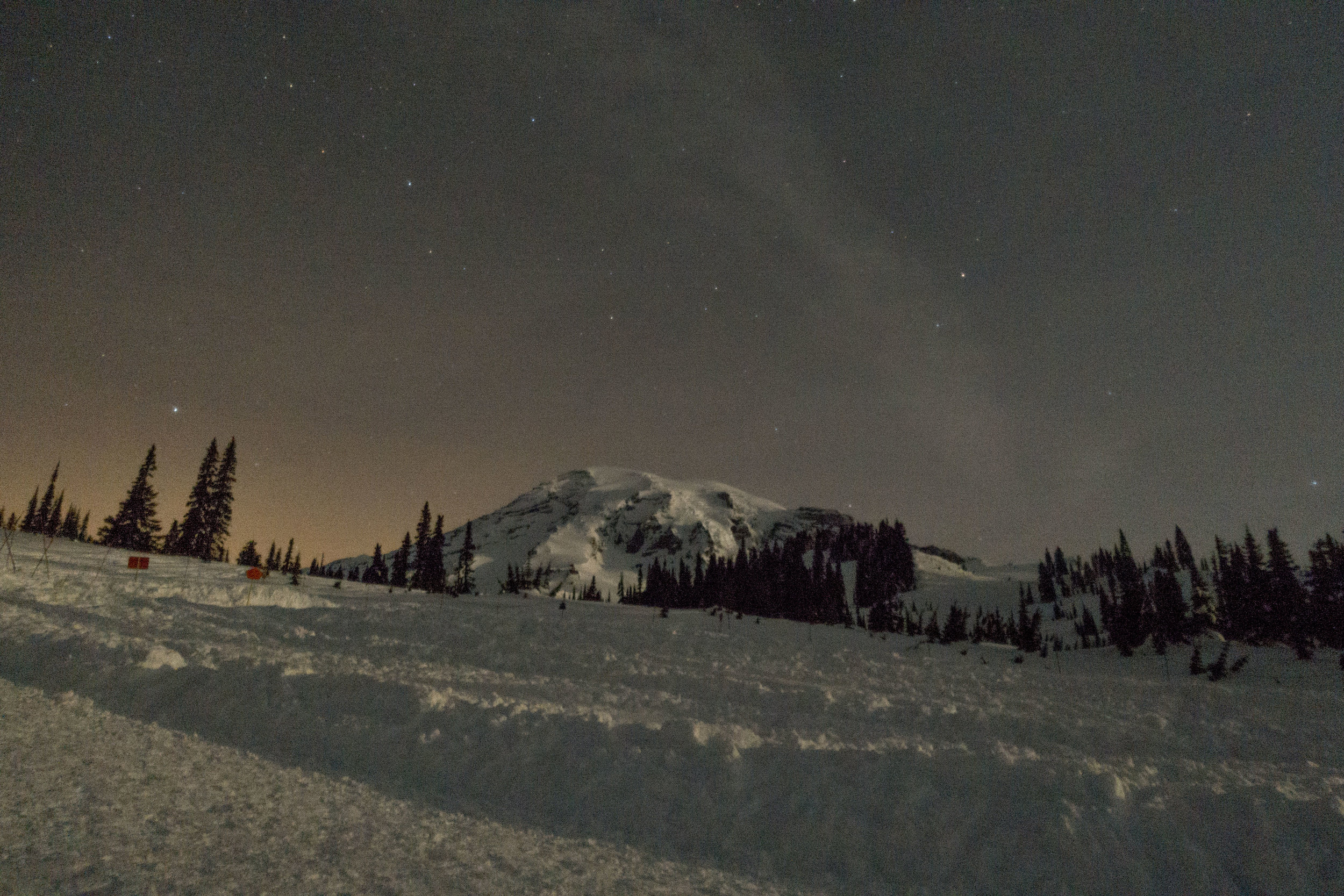
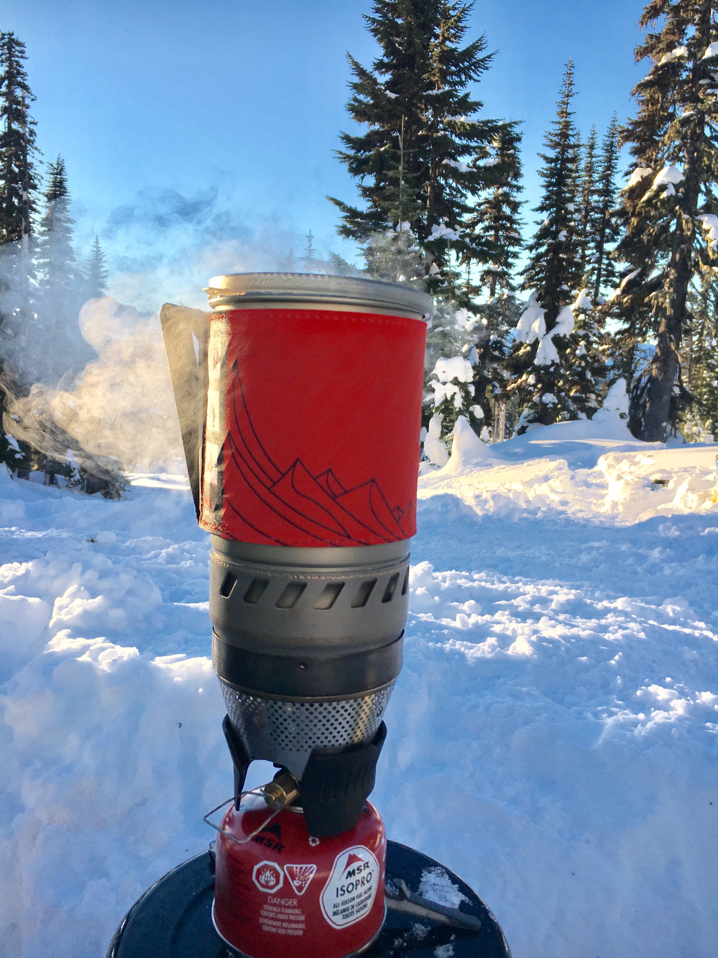
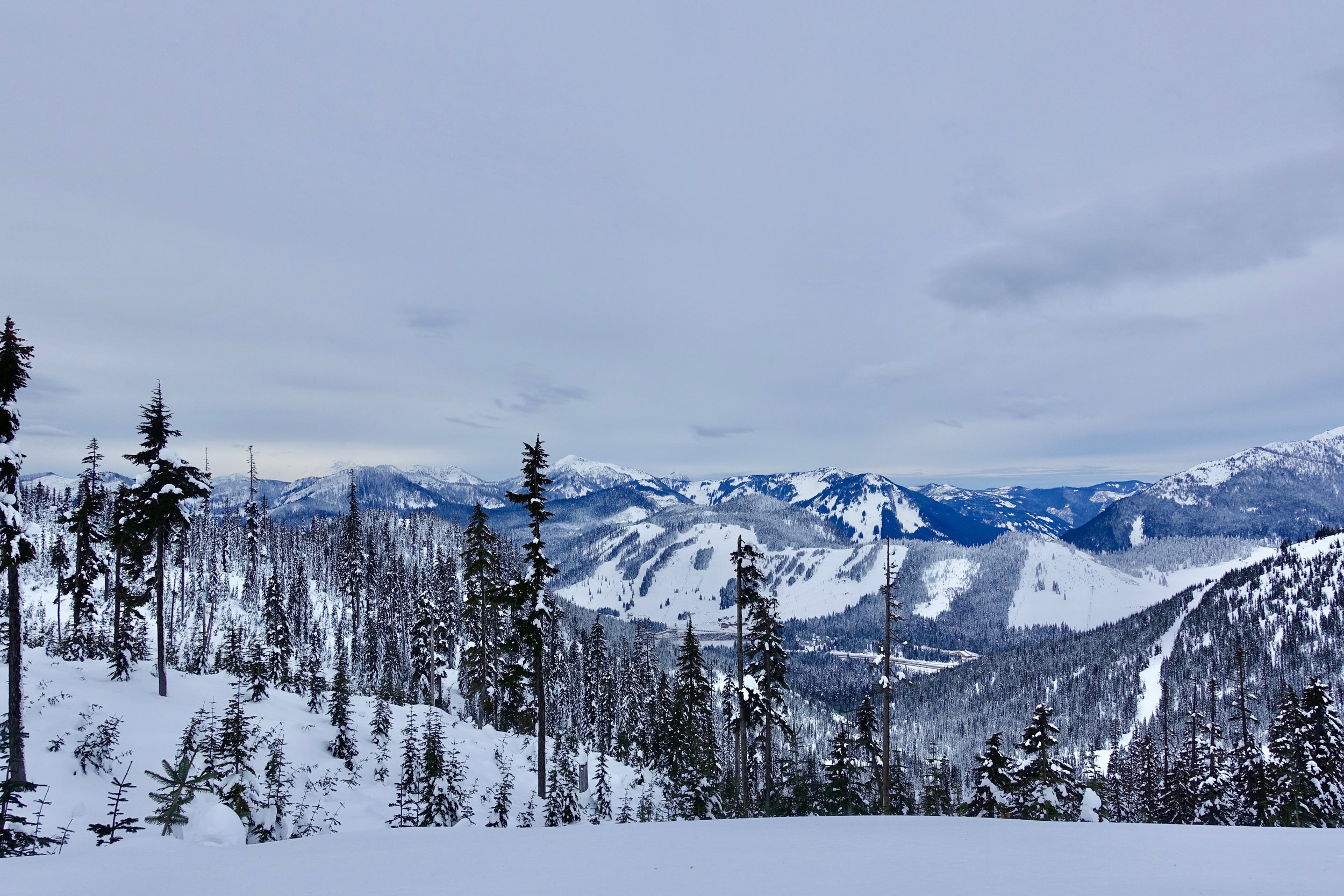
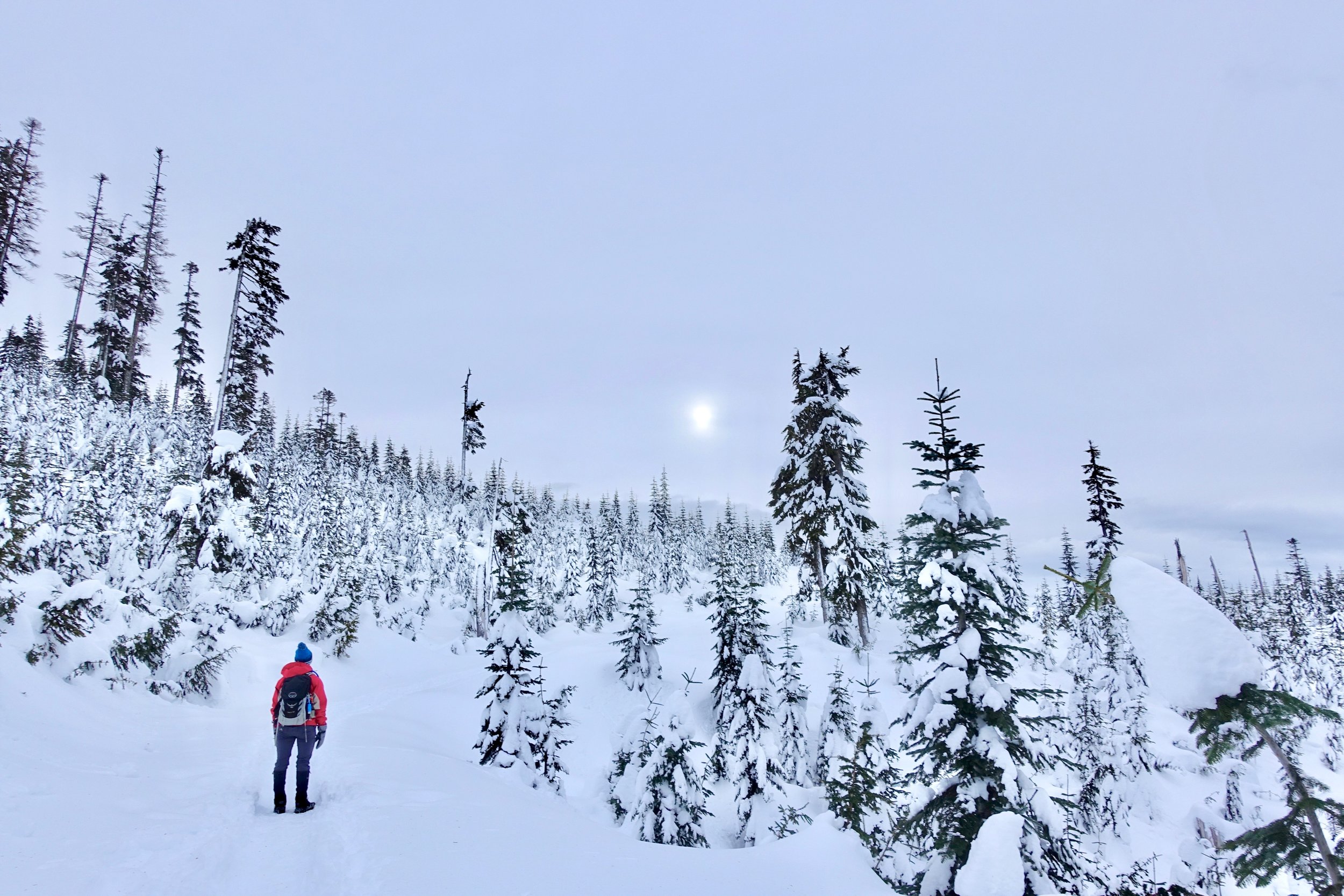
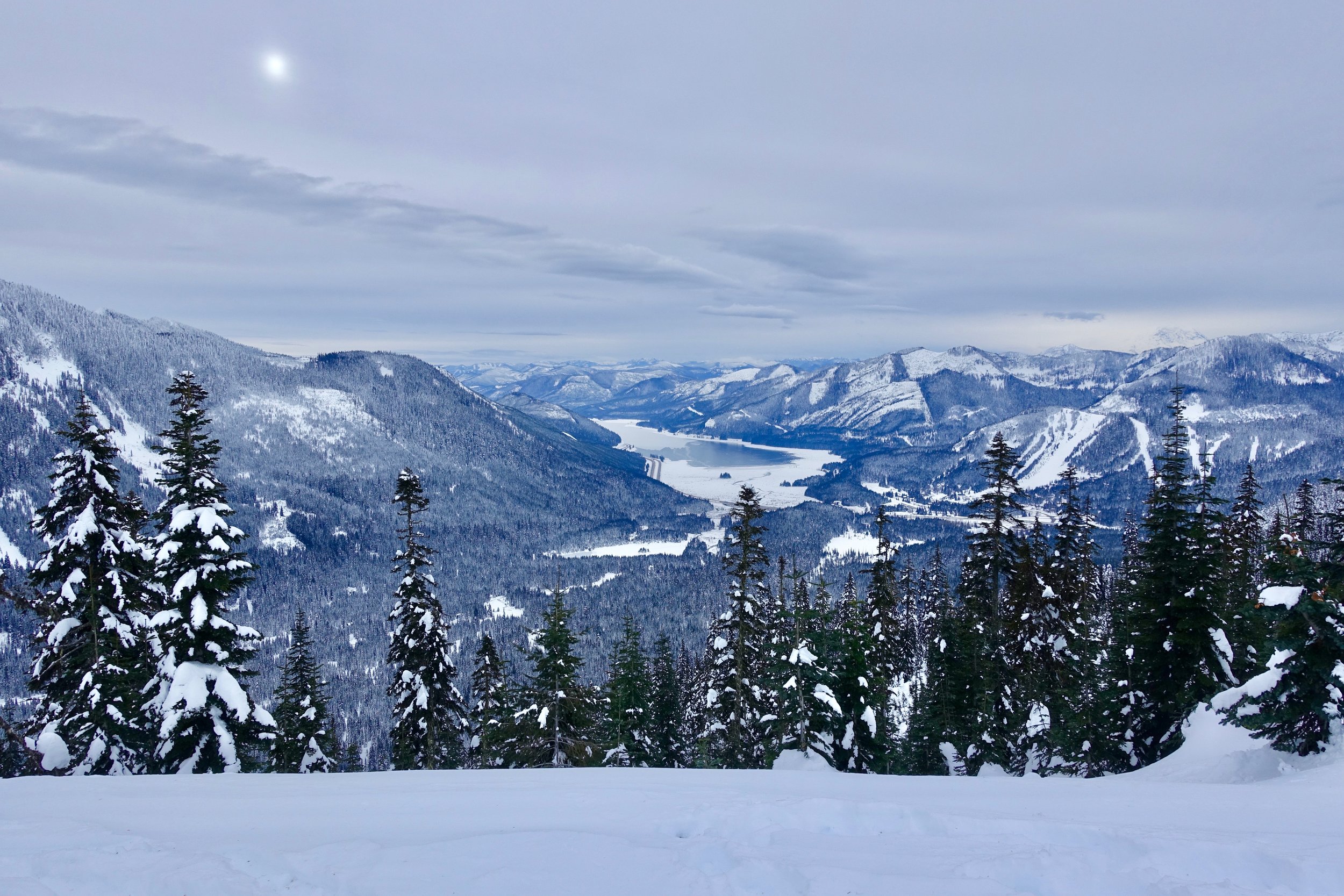
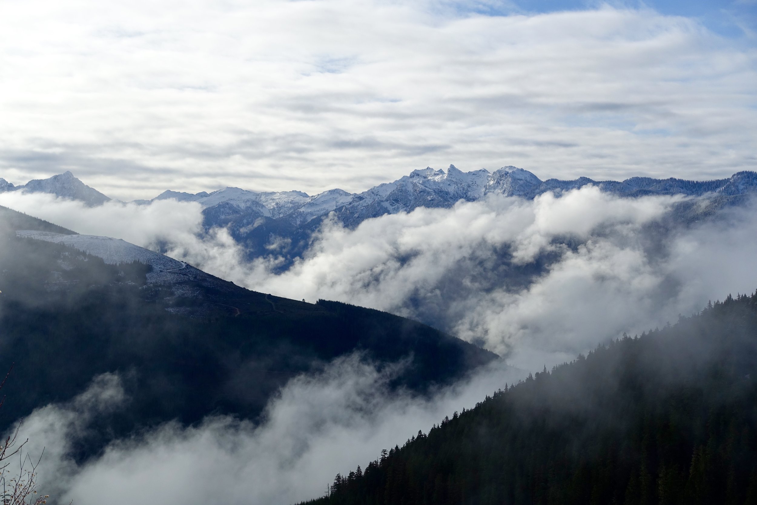
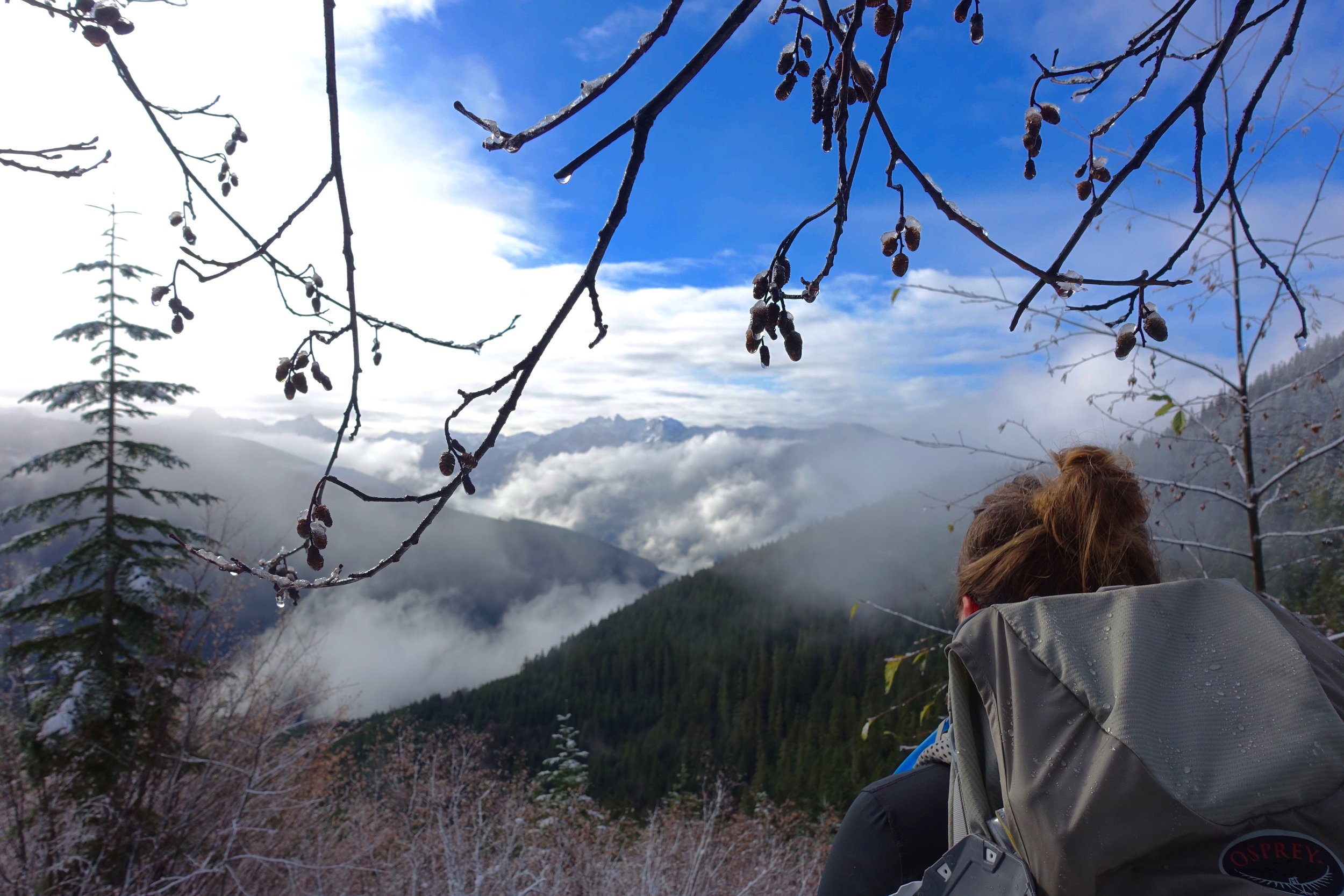
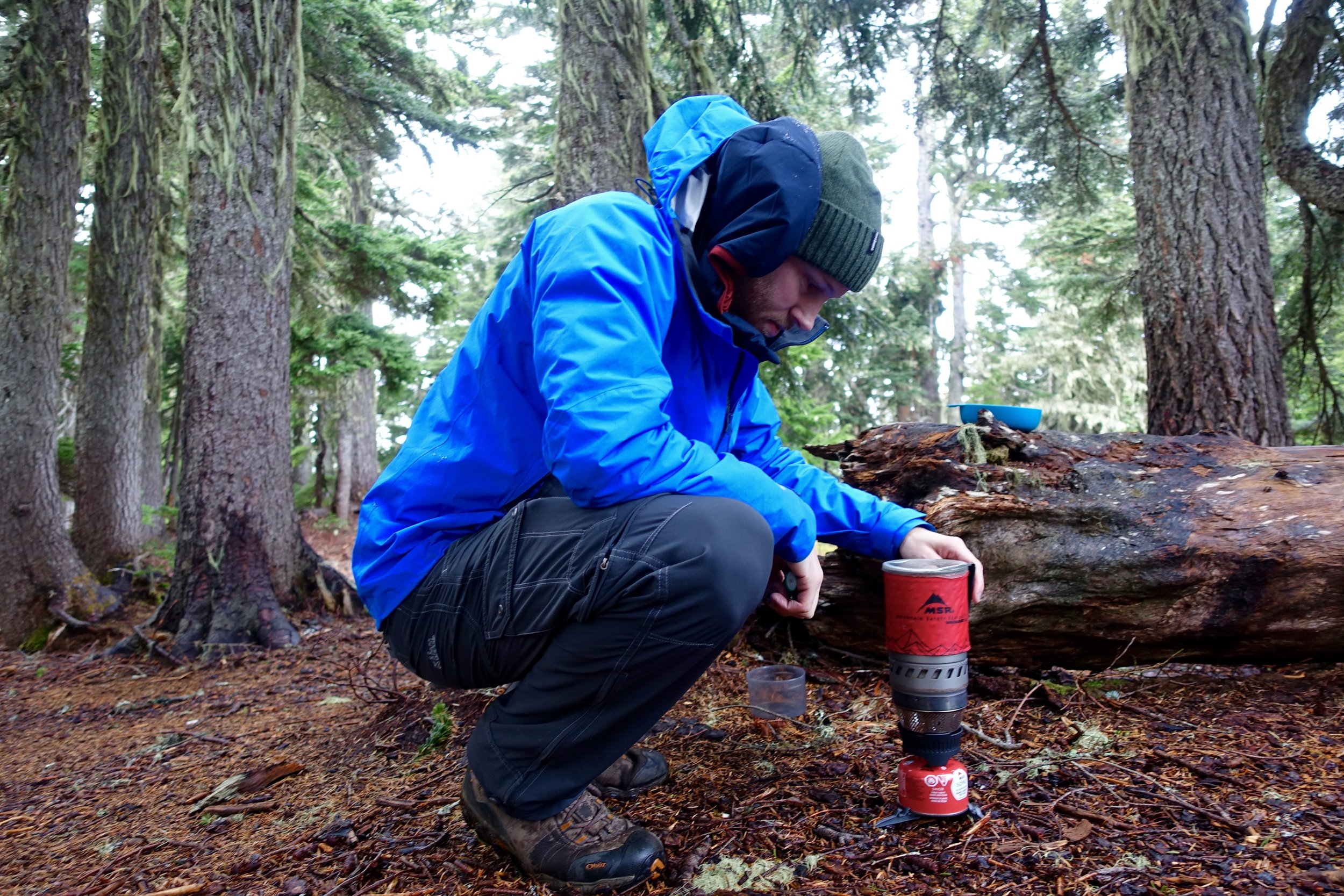
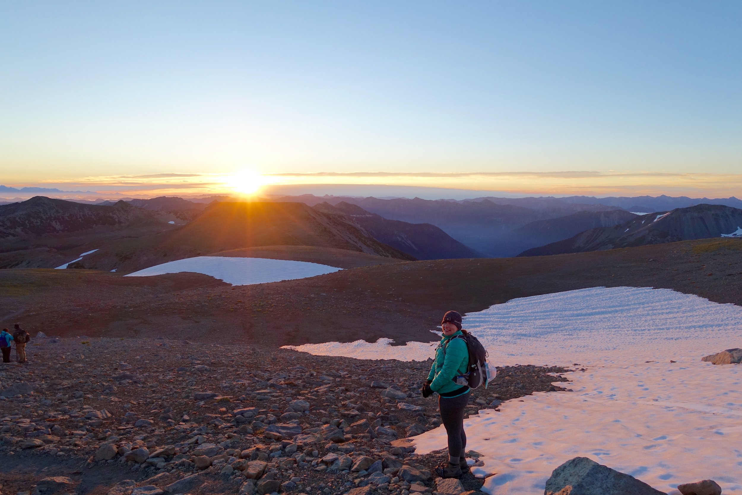
After everyone was set up we went to adventure up the mountain. Some chose microspikes and some wore snowshoes. I chose snowshoes as I don't enjoy post-holing too much. We hiked up just below panorama point and enjoyed the views of the mountain, the tatoosh range, and mt. adams and st. helens as well. The sun was beginning to dip down so most made their way back to camp while some of us stayed to soak in the sunset. We then made our way back to camp and made dinner in the "living room"- a carved out area of snow with benches to sit on! One thing about the cold and fuel for cooking- try to keep it elevated off the snow and always wrapped in something warm when not using. Ours froze fast when on the ground. Also, my MSR takes one minute to boil water, but boiling snow takes about 10 minutes so plan on using much more fuel. I would possibly buy a 4 season fuel canister for next time. I drank my hot cocoa with peppermint schnapps and then we decided to get ready for bed. It was before 9 but had already been dark for hours. I tried to do a few night photography shots, but waited too long and the moon had brightened up the sky a lot.
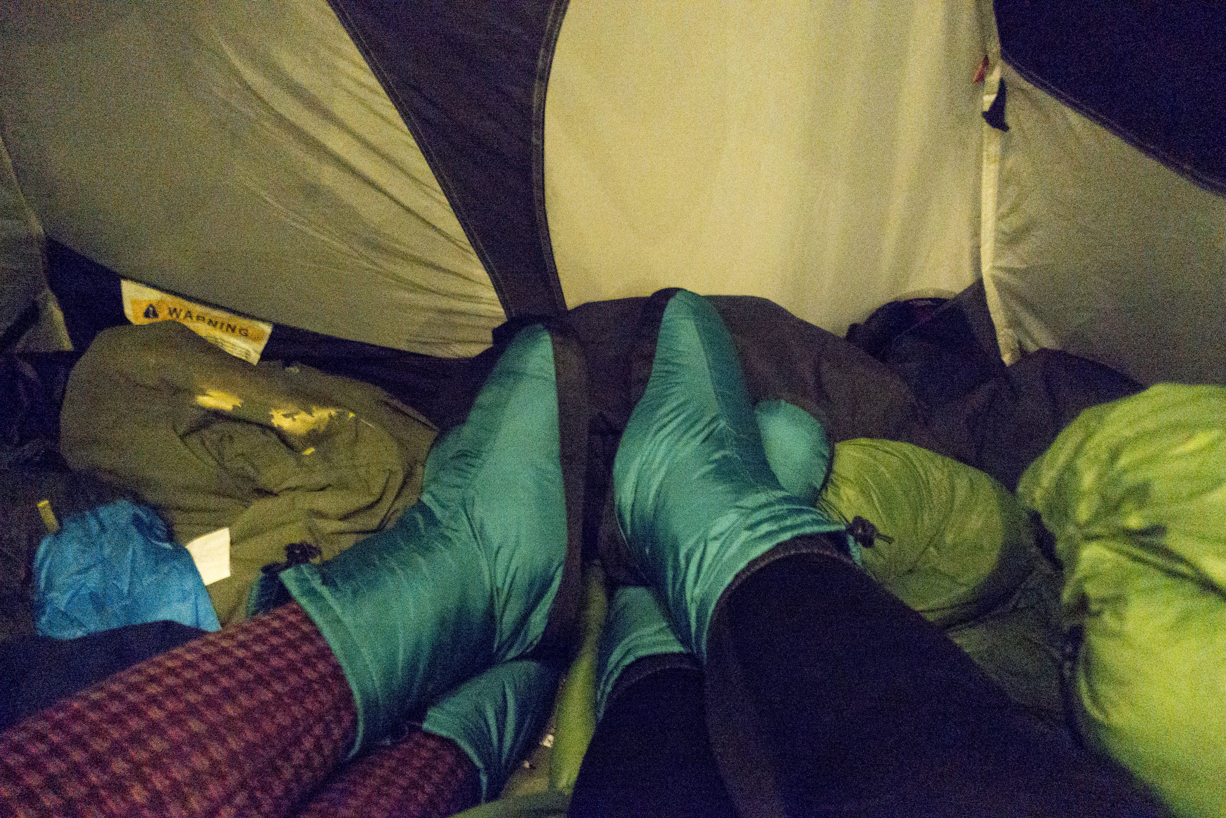
When sleeping- it is best to put anything that may freeze between you and another person or in your sleeping bag with you. I had my contacts in my pocket, cell phone, and camera, fuel, and water bottles between us. None of those things froze, so that worked out well.
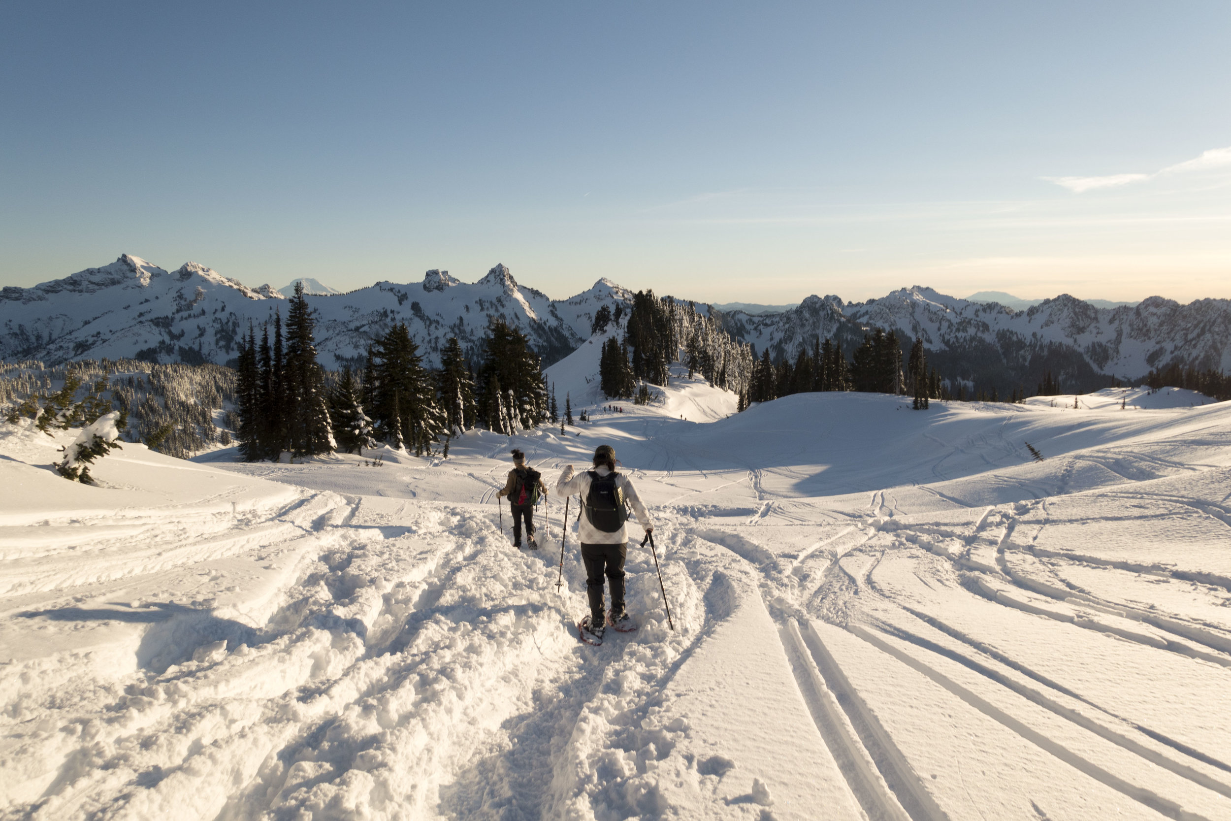
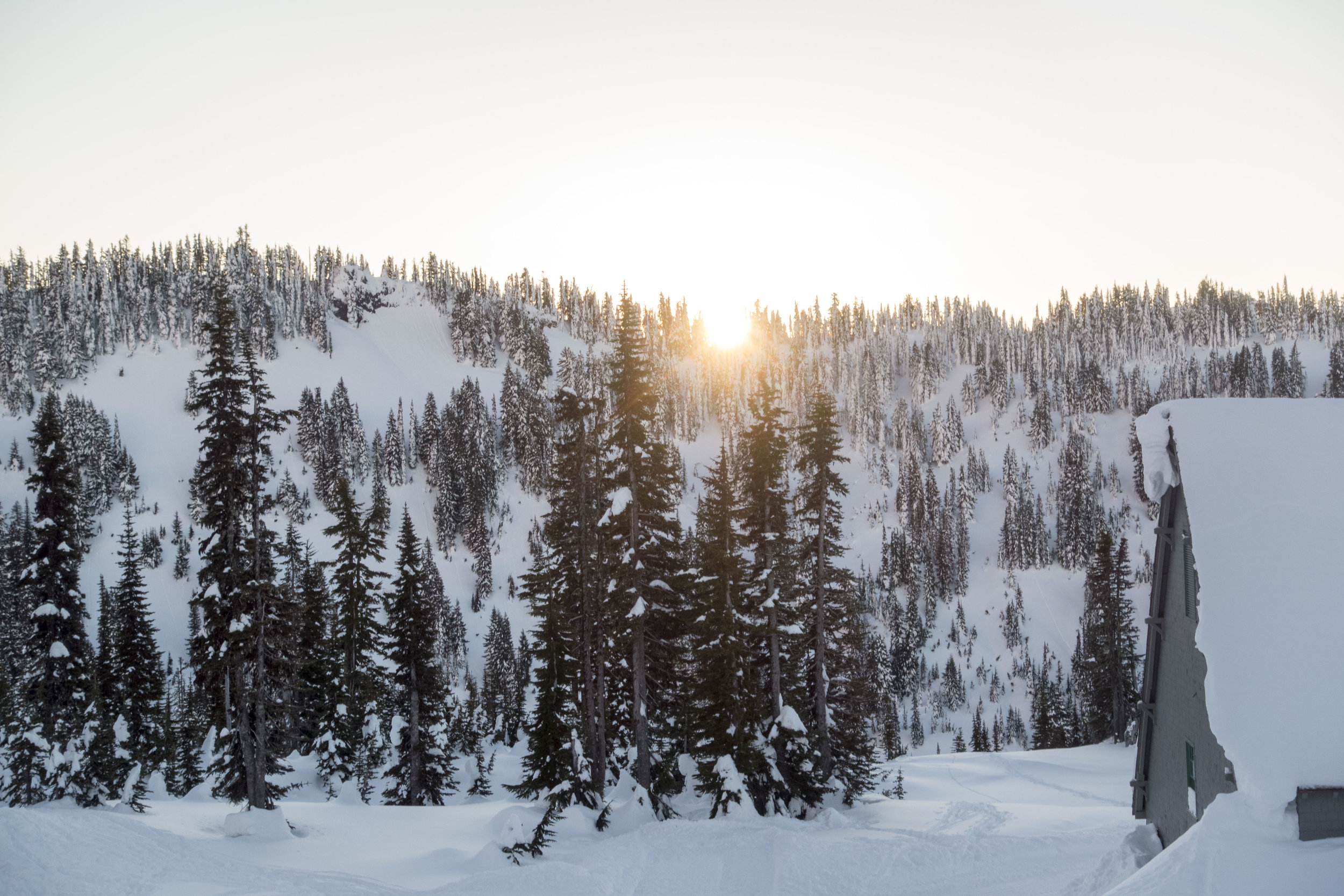
Up until this point I hadn't been too miserably cold at all during the day as we kept moving a lot. When we crawled into bed, we put on our booties and that kept our feet toasty all night. I slept with 2 pairs of pants on, and 3 layers on top. I didn't want to sleep with my huge ski parka and snow pants on as that was very uncomfortable. I got cold right away and kept trying to fall asleep, but had no luck. I couldn't warm up so I put my snow pants on at one point, but was still very cold through the night and didn't sleep well at all. Something that I think would've helped is a z-lite pad under my inflatable sleeping pad. My sleeping pad has a high R value (rated for warmth), but it was not enough. I could feel the cold snow below me all night, which was not fun. I also need to figure out the quilt sleeping system. This has no bottom and has 2 straps that go under the sleeping pad. I loved the spaciousness of it, but need to figure out how to stay warm in it. I got some sleep that night and then we were up by 7:30 to catch the sunrise (yay for late sunrises in the winter). My hiking boots had gotten wet from the snow the previous day and were now frozen when I woke up. I had even put them inside the tent to help prevent this and I still could barely get them on. That was not super fun as well. We got up and made our way to catch some of the sunrise and then went back to camp and made breakfast and had hot coffee and the community of the other women around.
It was a great time meeting so many new people that share the same passion with me. So inspiring to be around so many bad ass women who are doing things I can only dream. I enjoyed learning from them and all the experienced tips they had to give. I am such a beginner in the world of backcountry adventures, but am willing and excited to learn from all. I am so lucky to have found this community of women who strengthen and lift each other up.
With some tweaks to gear I have no doubt that snow camping would be something regularly on the agenda in the winter. I have always hated winter growing up in Minnesota, but have a new found appreciation for the season this year. I know for sure this won't be my last snow camping trip.
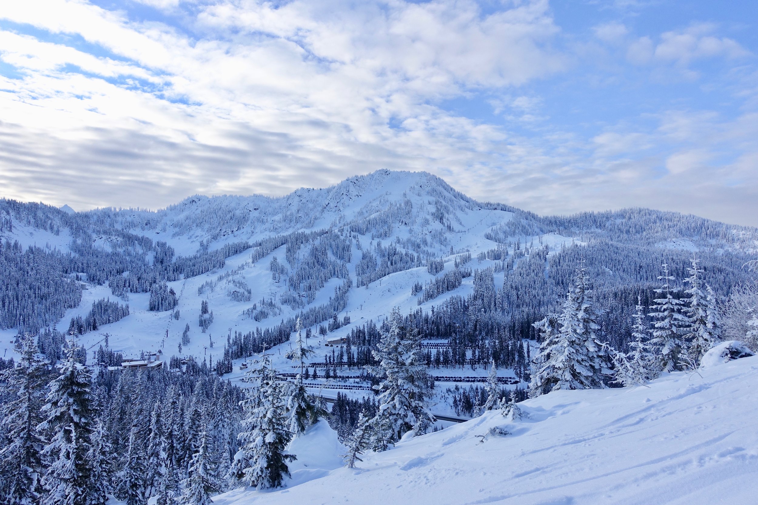
Kendall Peak Lakes Snow Hike
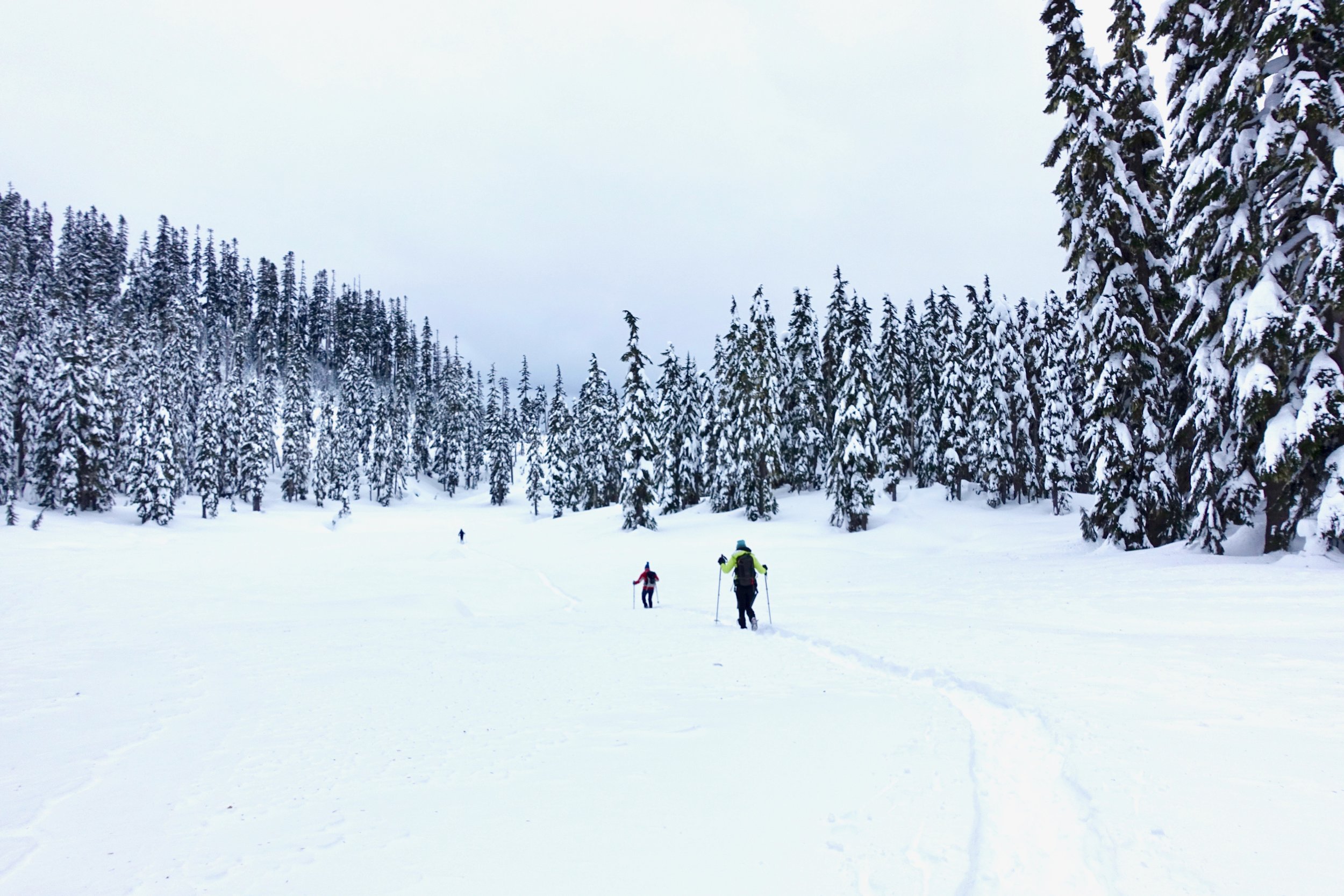
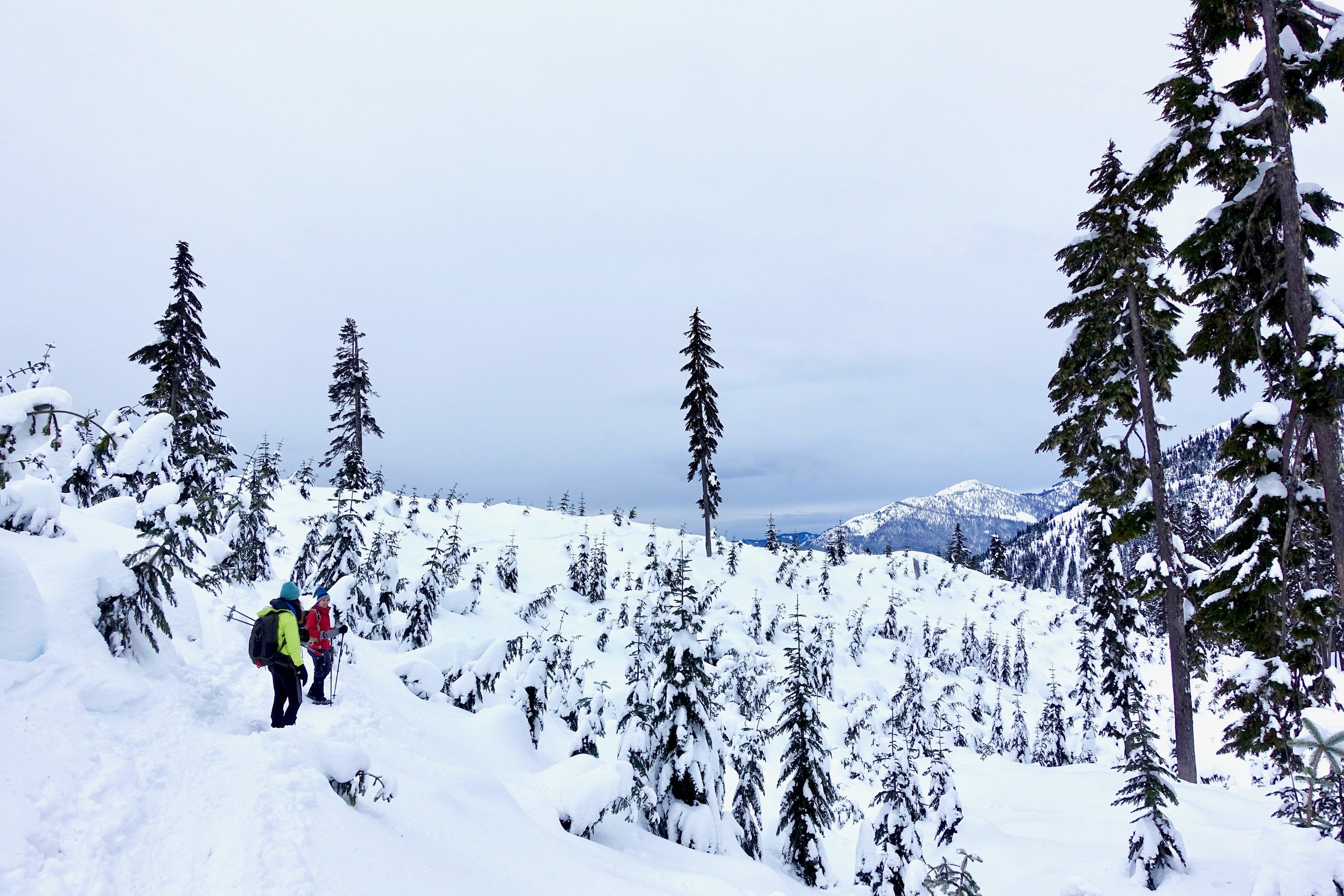
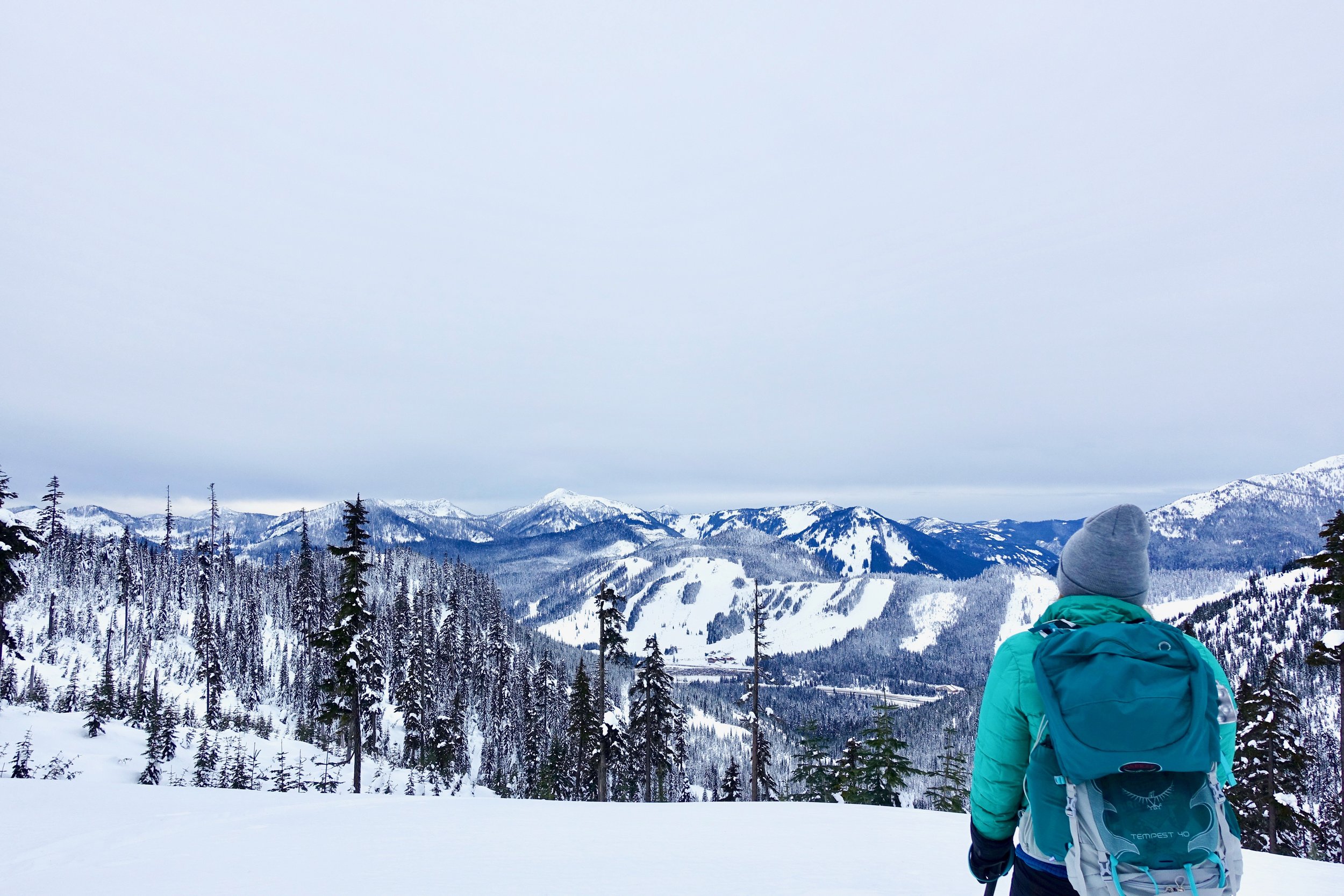
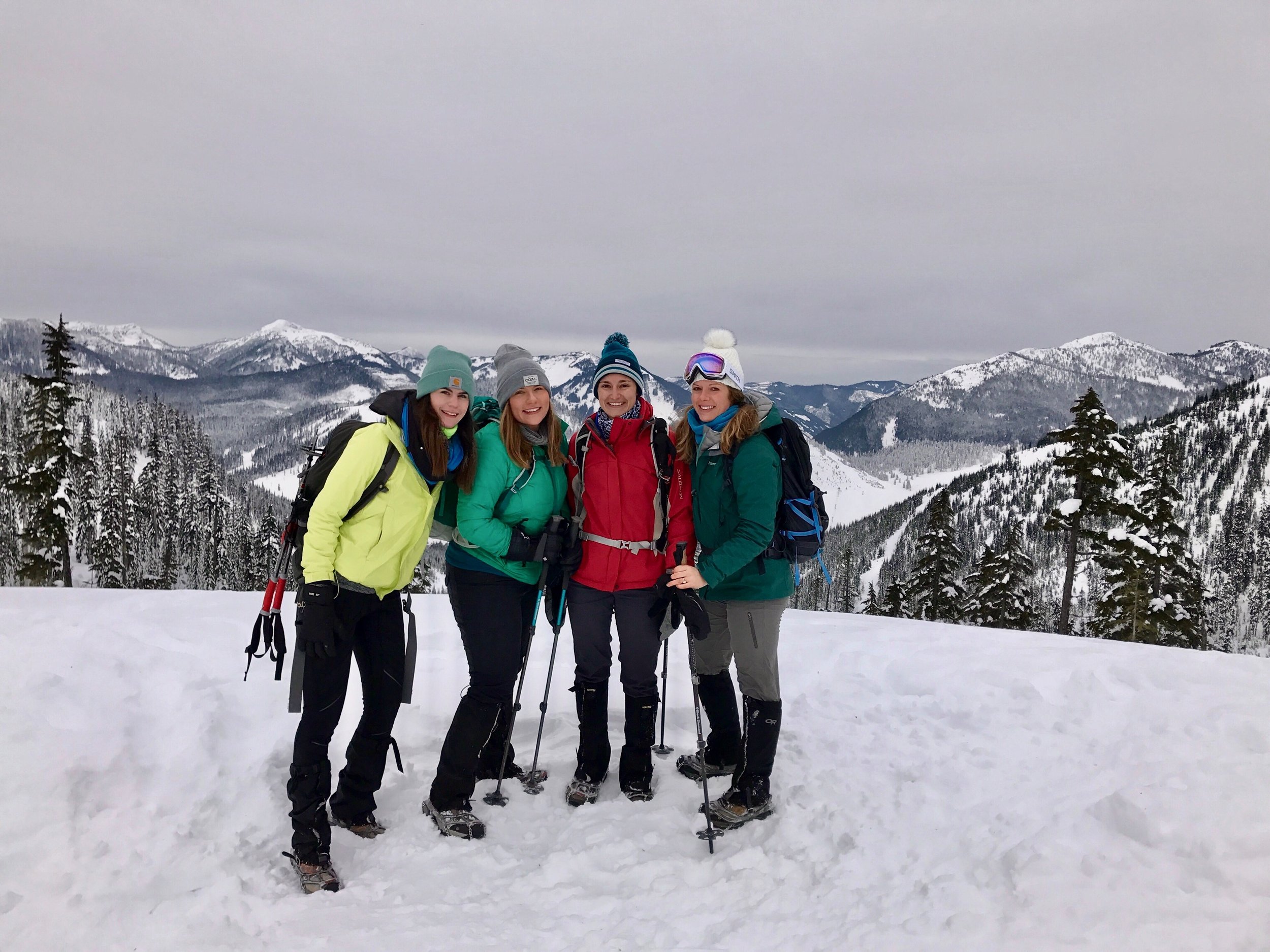
 Mileage: 9 EG: 2000
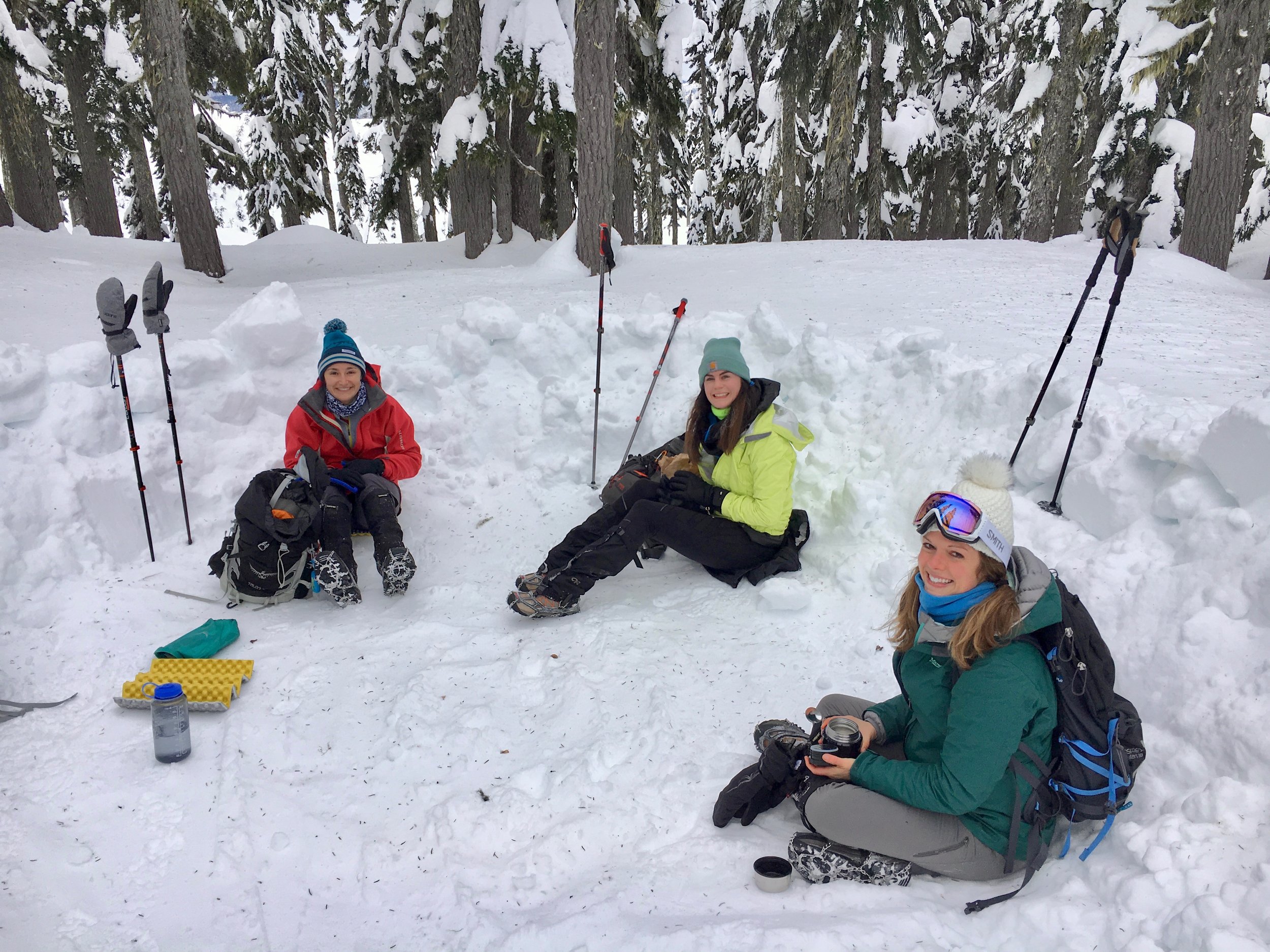
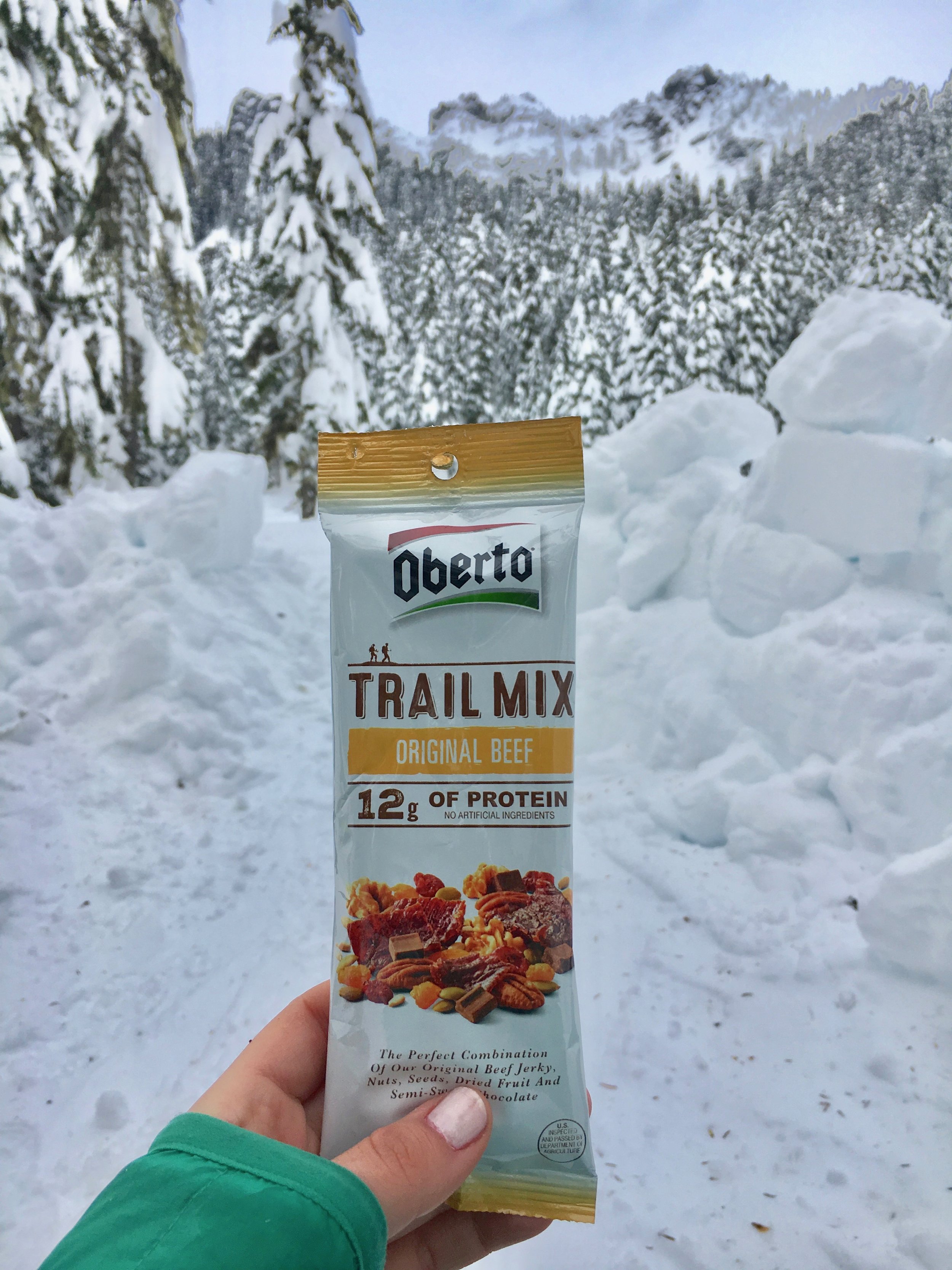
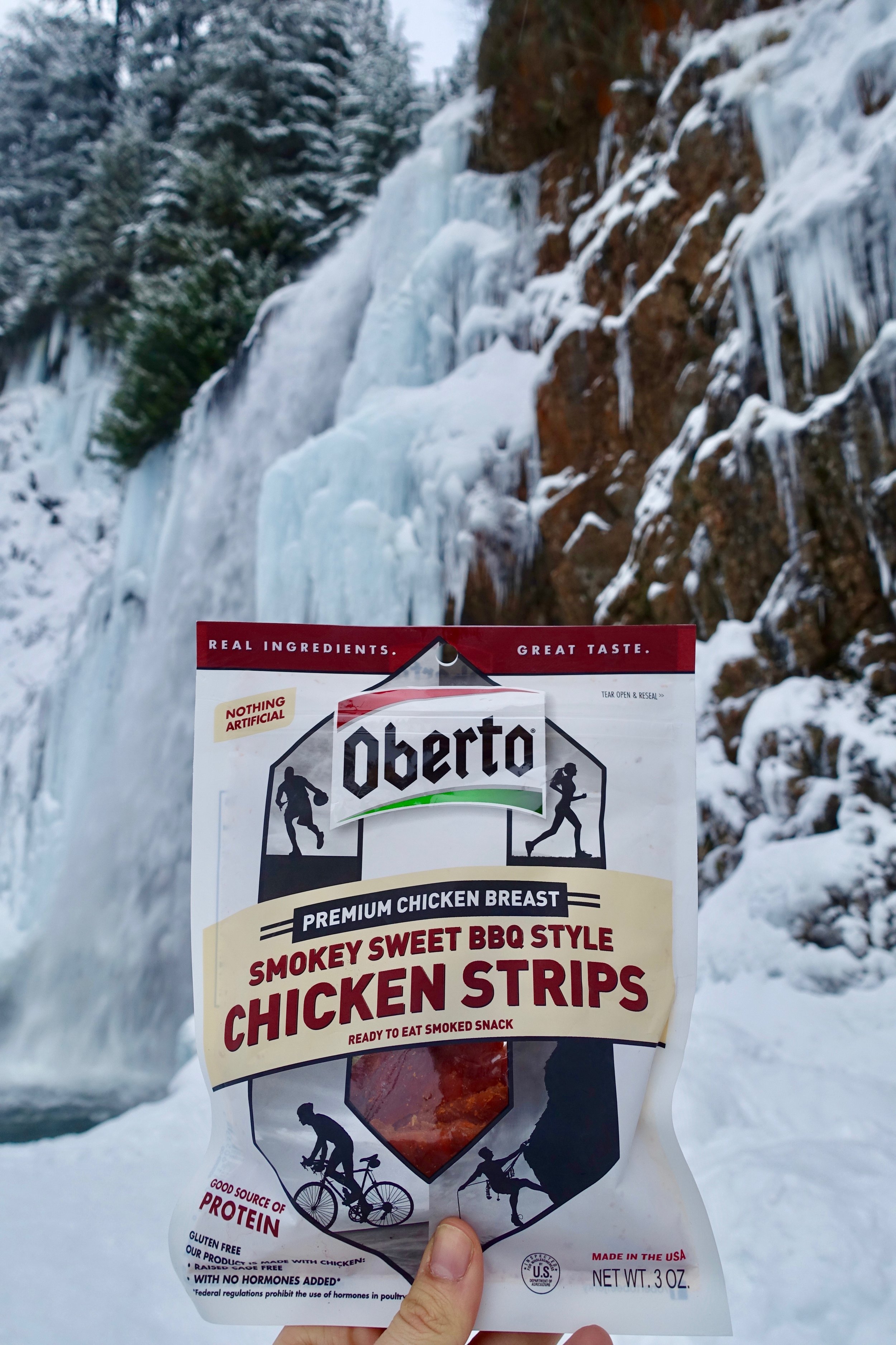
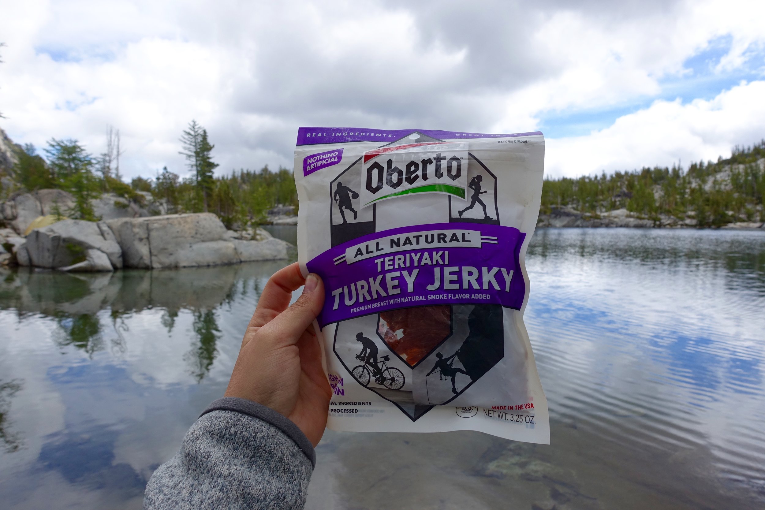
I had a free Saturday and rounded the girls up for a snow adventure. The 4 of us headed to the mountains early and donned our layers and layers. It was cooooold one. For Kendall Peak Lakes, you have to park at the Gold Creek Pond snopark. The snoparks take a different pass than the normal ones, so come prepared. We saw many cars ticketed! We brought our snowshoes with, but recent tail reports said the trail was compact so we left them in the car. You hike the long road walk up and up and up. It's a steady ascent with great views of The Summit ski hill across the highway. We got to the top and accidentally went right at the fork, but so glad we did. It went out to a great overlook of surrounding peaks and Kachess Lake. We headed back down the hill (off trail a bit) and post holed up to my hip! Whoops. Back on the main trail we then found the first lake apparently. It was all snow covered and not very large. Off the main trail Catherine found a half built snow structure that must've been used for snow camping. It was a perfect spot to stop and eat hot soup, and share this tasty Oberto trail mix. We tried to go to the second lake but at this point the snow was super loose and powder and was not fun without snowshoes. We were all also in a lot of pain from the cold and just wanted to get back. On the way up we didn't see many people at all, but on the way down we saw lots. Took us 4.5 hours to do the 9 miles, not bad at all if I do say so. Shout out to Catherine's family for taking us in for a glass of hot cocoa and great company after the hike. Perfect end to a cold adventure day.
Mt. Si Winter Hike
 Mileage: 8 EG: 3150
I previously did this hike last April on a perfect sunny day. This time around was a little different. My friend Caitlin and I wanted to hike on New Years Day (observed). I was not going to waste a day off! We chose the close Mt. Si. Less than an hour away from Seattle, this trail sees lots of traffic in the summer, but was still decently busy when we went. There was snow starting at the bottom, but most of the trail was an ice/snow combo. With the microspikes on we cruised right up. We made it to the top with semi-socked in views. I quickly ate my corn chowder and we made our way back down. This one is a great conditioner and go to if all else fails.
Franklin Falls Winter Hike
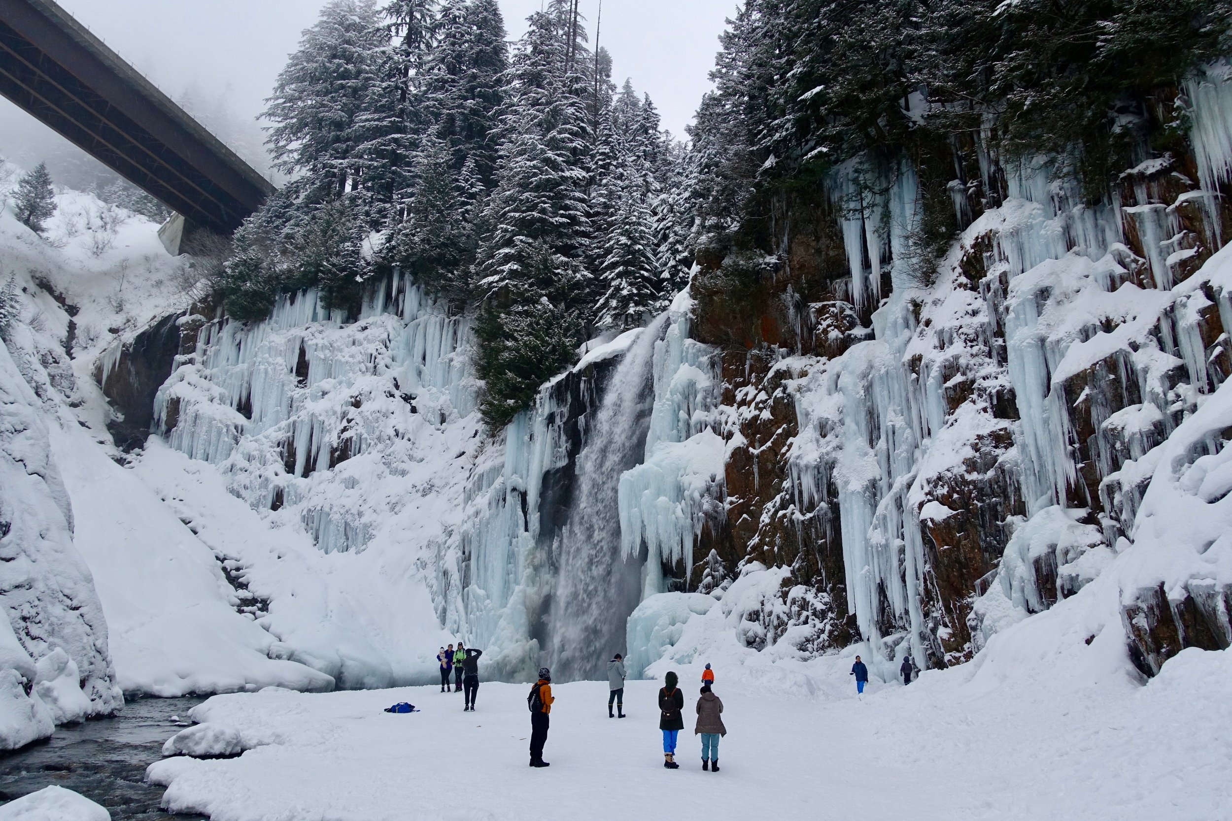
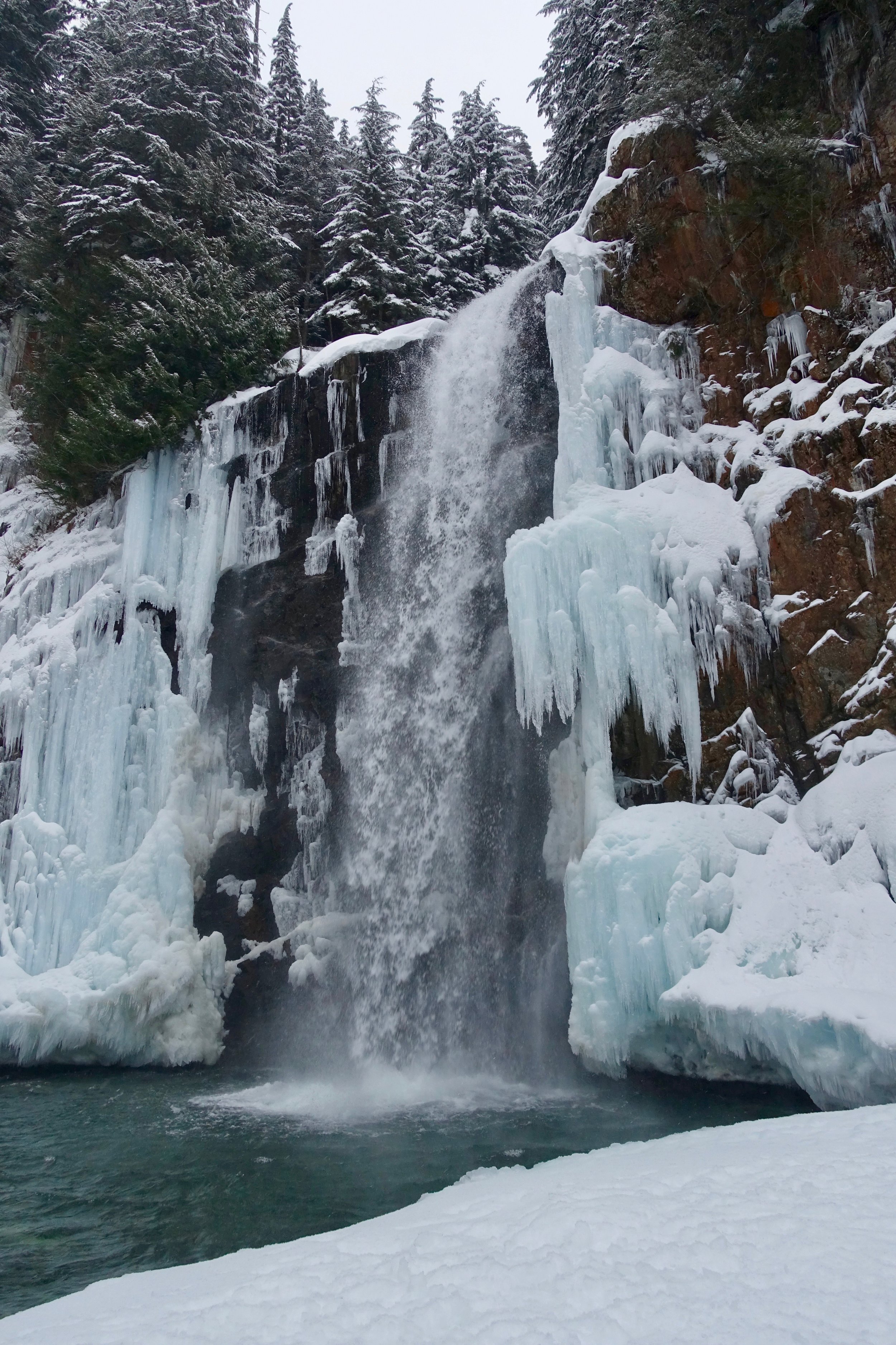
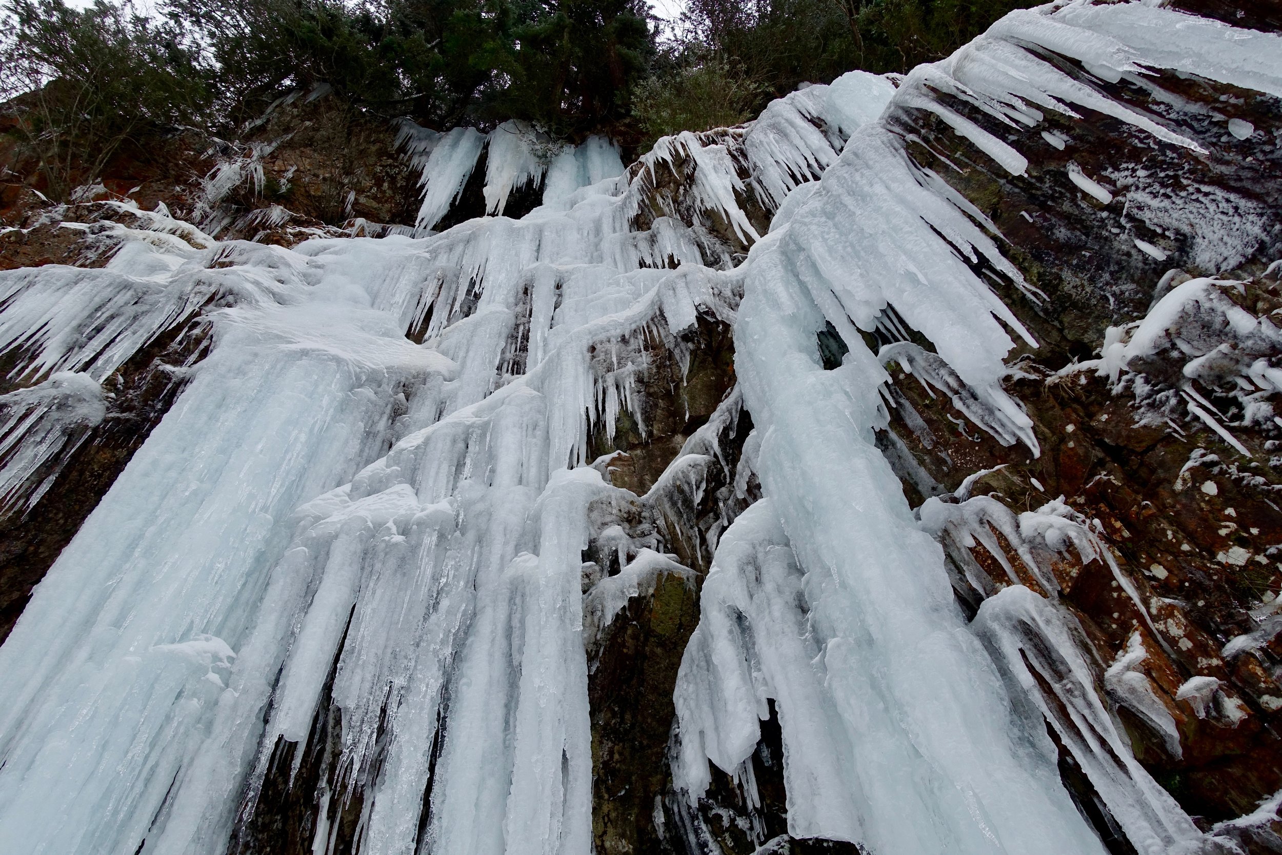
 Miles: 2 EG: 400
It was Christmas Eve and my husband had gotten out of a 30 hour shift midday. We still wanted to get outside so we opted for Franklin Falls. This was my second time doing it this year, but it was more frozen this time around. This hike has blown up in popularity resulting in insane crowds. The parking was a mess, but we got to enjoy a quick afternoon outside.
Skyline Lake Snowshoe
 Location: Skyline Lake at Steven's Pass
Mileage: 3.5 1,00 EG
This one we knew we had to arrive bright and early as it shares the same parking lot as Steven's Pass Ski Resort. We arrived sometime after 8:30 donned our many, many layers of clothes and headed out. This hike is a short (steep) 1.5 miles to the lake and then we continued on to the ridge line about another quarter mile up. We stopped at the top to take in the views, snack, and then it was quick to get going again as stoping movement froze us. I'm really loving winter here so far and show shoeing. I do miss the ease and warmth of summer. There is something to be said with experiencing the 4 seasons in the mountains and all the extremes. You can't appreciate one without the other.
Big Four Ice Caves Snowshoe

 First snowshoeing adventure- ever! Finally got to try out our new MSR Revo Explore in some fresh powder on the mountain loop highway. The road was full of snow/ slush/ ice and was pretty dangerous. The parking lot had not been closed off yet, but was full of deep snow. The 5 of us + 2 dogs donned the snowshoes and headed out on the trail. The snowshoes were not 100% necessary as the trail had been stomped down a lot. The trail is 2.4 miles roundtrip and little elevation gain. As we approached the turnaround we heard a loud noise and it was an avalanche at the end of the trail. Some people got caught in the dust of it, so we decided not to venture too close to the mountains. After some lunch we headed back and made it back to the car, but not before Cooper decided to jump in a half frozen pond. That dog. On the way out we saw a car deep in a ditch and stopped to pull over to help and lend our tow rope. Be careful on those roads out there!
Beckler Peak
Mileage: 7.4/ EG 2,263 The day donned to opt outside.. by REI that is. I didn't need an excuse to go outside, but took advantage of the time nonetheless. My friend Caitlin and I had wanted to go to Colchuck lake to see the snow covered beauty, but a trail report a few days prior showed the road going up to it closed already. After that we thought about going to Artist Point to snowshow, but didn't want to drive so far. The first avalanche reports of the season came out the night before and the entire state was orange: which meant considerable. This meant that many hikes would be considered somewhat not safe with the conditions. Mt. Dickerman, which we were thinking of doing, was one of these. We opted for Beckler Peak as the conditions looked more safe. This was all decided at 10PM the night before. Gotta love winter hiking.
A side note about avalanches.. I knew absolutely nothing before going to an avalanche awareness class, which I recommend to anyone getting into winter hiking/ snowshoeing. The conditions can change fast day-to-day so it is important to check the reports to see where is safe to hike. Avalanches take many lives each year here in the PNW, so it is something to take very seriously. I would love to get my AIARE certification sometime.
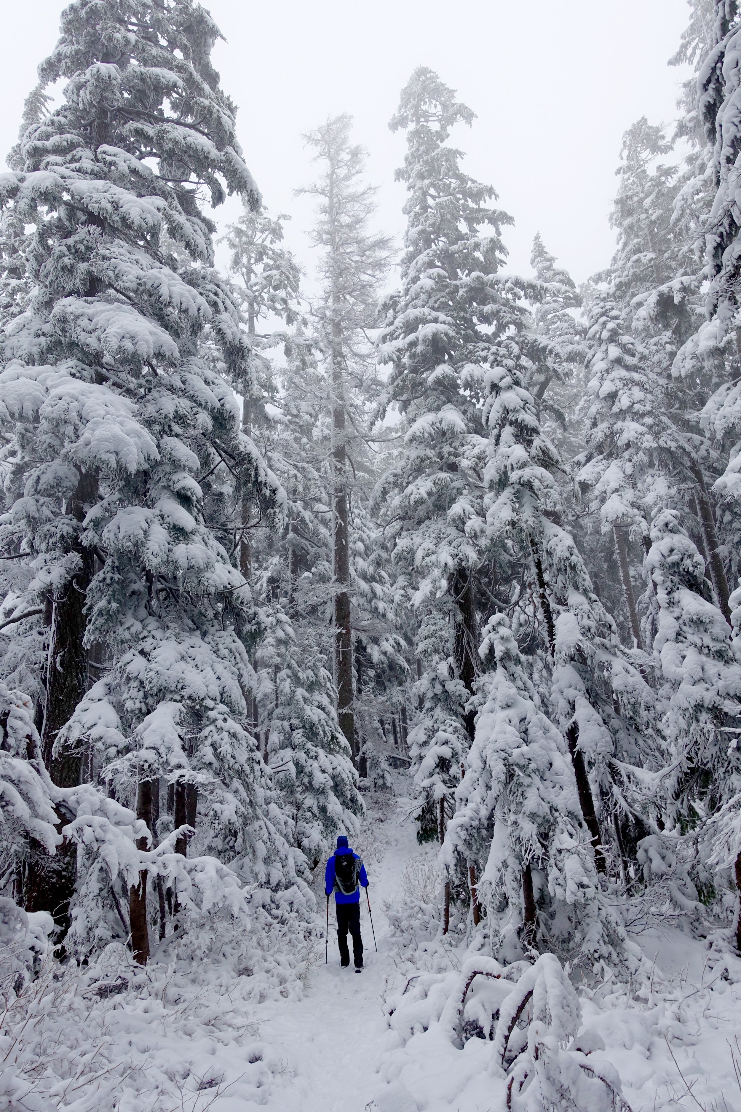
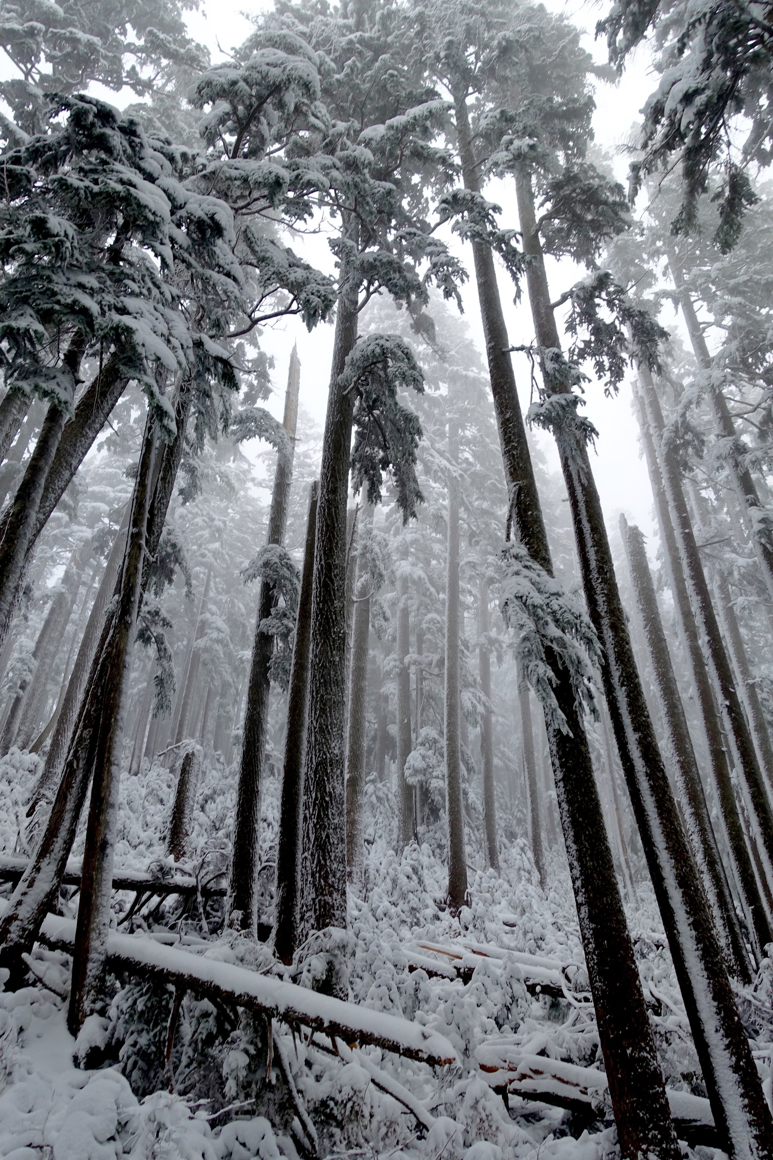
The road leading up to the trailhead was in really good shape, for a change. We started hiking at 10 and saw a group already coming down, thanks for breaking trail for us! We brought our snowshoes with not sure if we would need them, but the boot path was compact enough to not need them. The hike was a good, consistent climb the whole time. Blue skies even peeked out above the white snow which was a beautiful contrast. The end was a hard climb to the very top. There was lots of snow at the top (probably 3 feet or so). The top gave views of snow topped peaks for as far as the eye could see. I have never felt snow was so beautiful as I have here in Washington. We sat up there for a long time with our ramen and hot cocoa. The trek down was fast and we were back to the car in no time.
Lake Valhalla
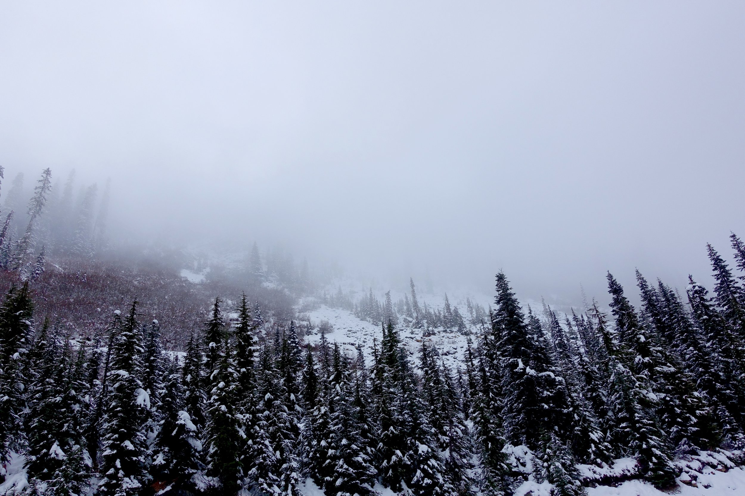
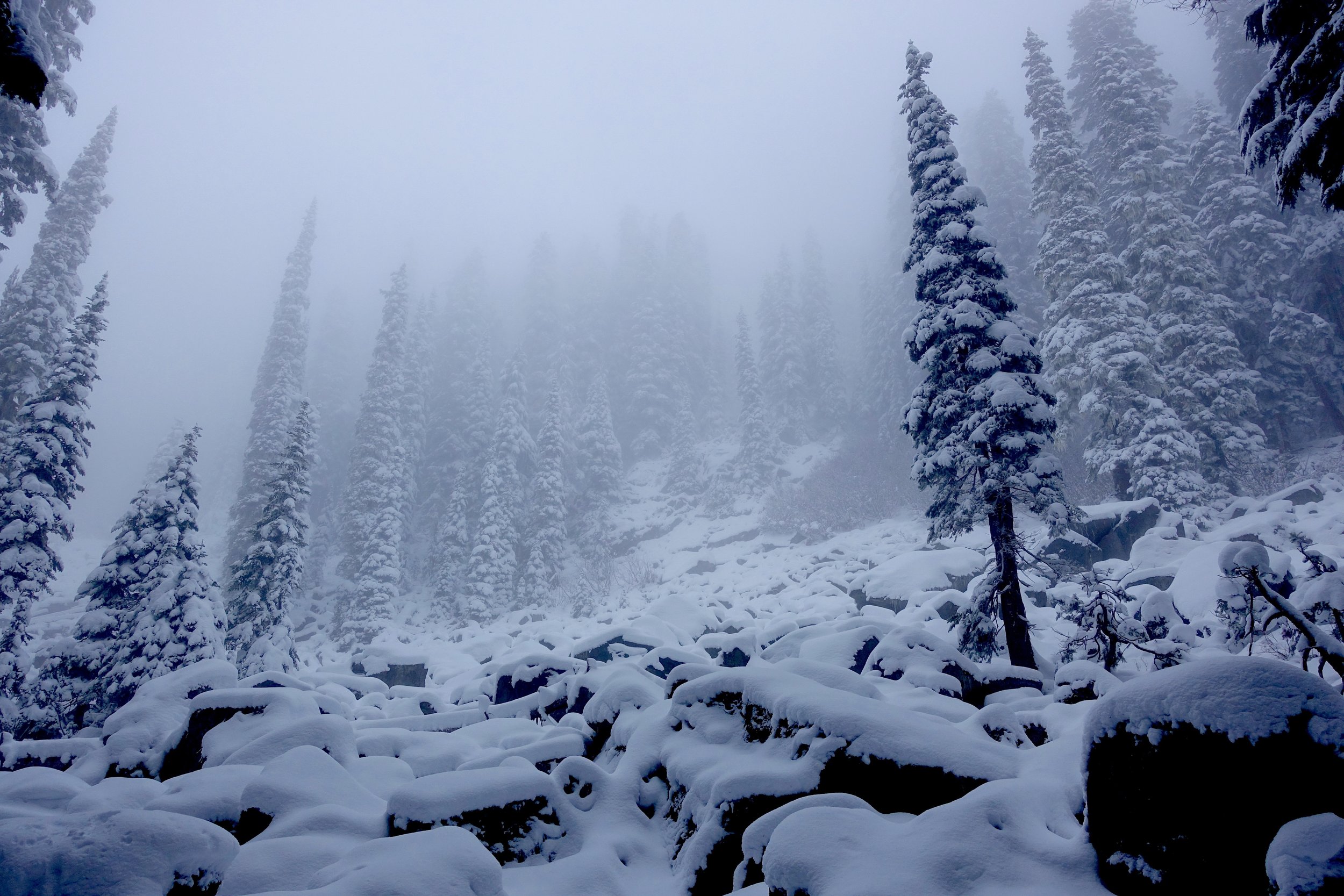
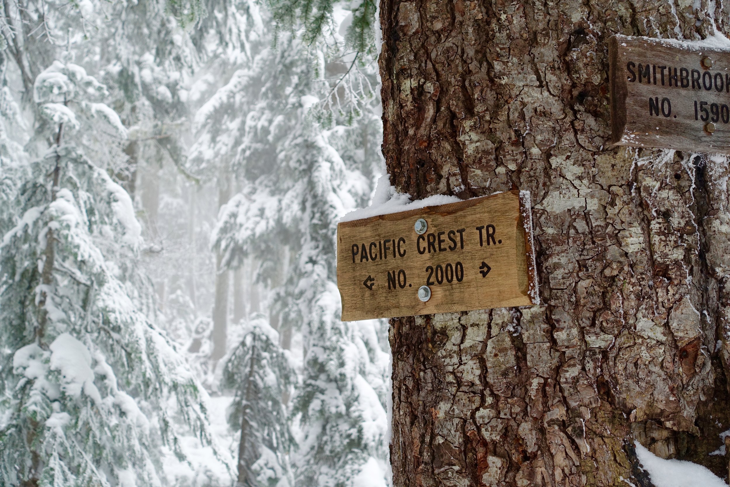
Mileage: 7/ EG 1500 Loved the snow so much that I had to come back for more the same weekend. 3 other girlfriends and myself headed to Lake Valhalla near Steven's Pass to enjoy some more of the fresh snow. The entire road leading up to the trail was covered in snow but still passable. The regular winter attire, as I'm learning, is a puffy down coat, hard shell rain coat, hat, good gloves, warm pants, rain pants, gaiters, poles, waterproof boots and microspikes. Much more than the average summer day hike.
The incline was gradual and never too difficult. This trail meets up with the PCT and then you make your way to the lake. We got to the lake and it was socked in. We had a few times where the fog would pass and we could see a beautiful mountain peak peek out. We sat on our insulated seats, ate hot ramen and then quickly turned around to make it back before dark, which we were successful at.
Mt. Catherine
It was right after the first big snow fall of the year and we were itching to play in it! We chose a short, random hike off of I90. Mileage: 3/ 1330 EG
The road heading up was pretty rough and washed out in some areas. The top half was covered in snow. The entire trail was covered in snow so we donned out gaiters and microspikes. We took too much time taking pictures of the snow and soaking it in. We made it to the top with socked in views, but we didn't care. We made it to back to the car and heading back down was super slippery. We skidded a bit and had to inch our way back down. A beautiful day in a winter wonderland.
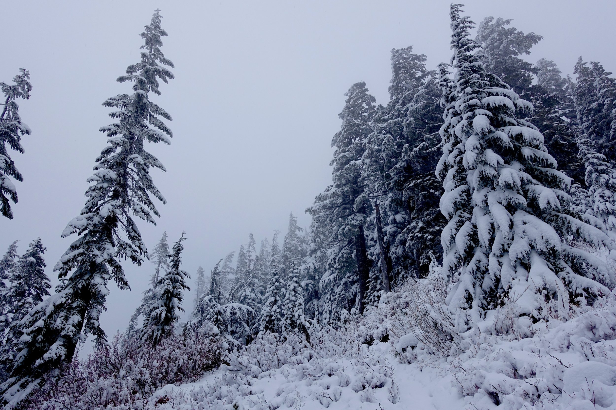
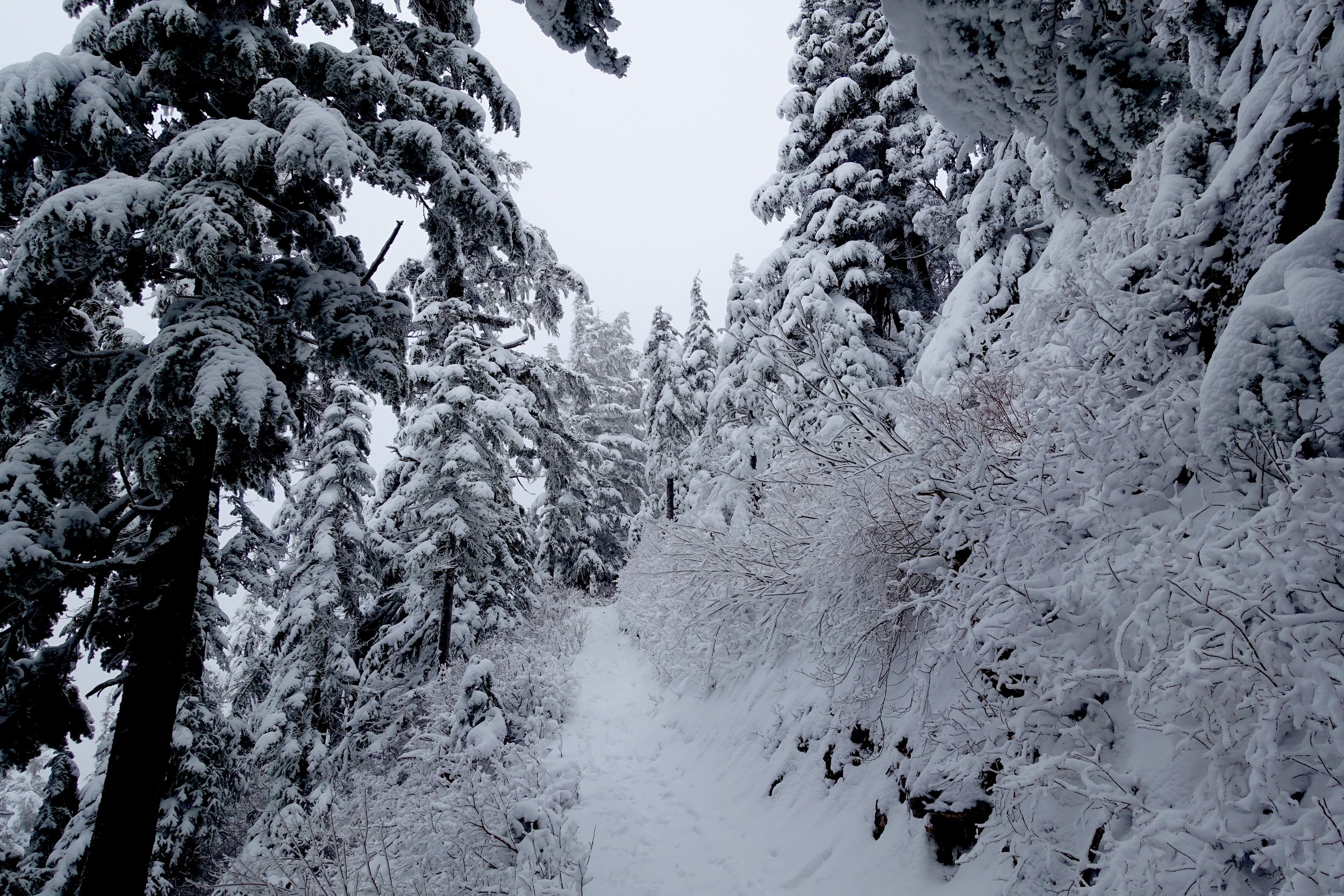
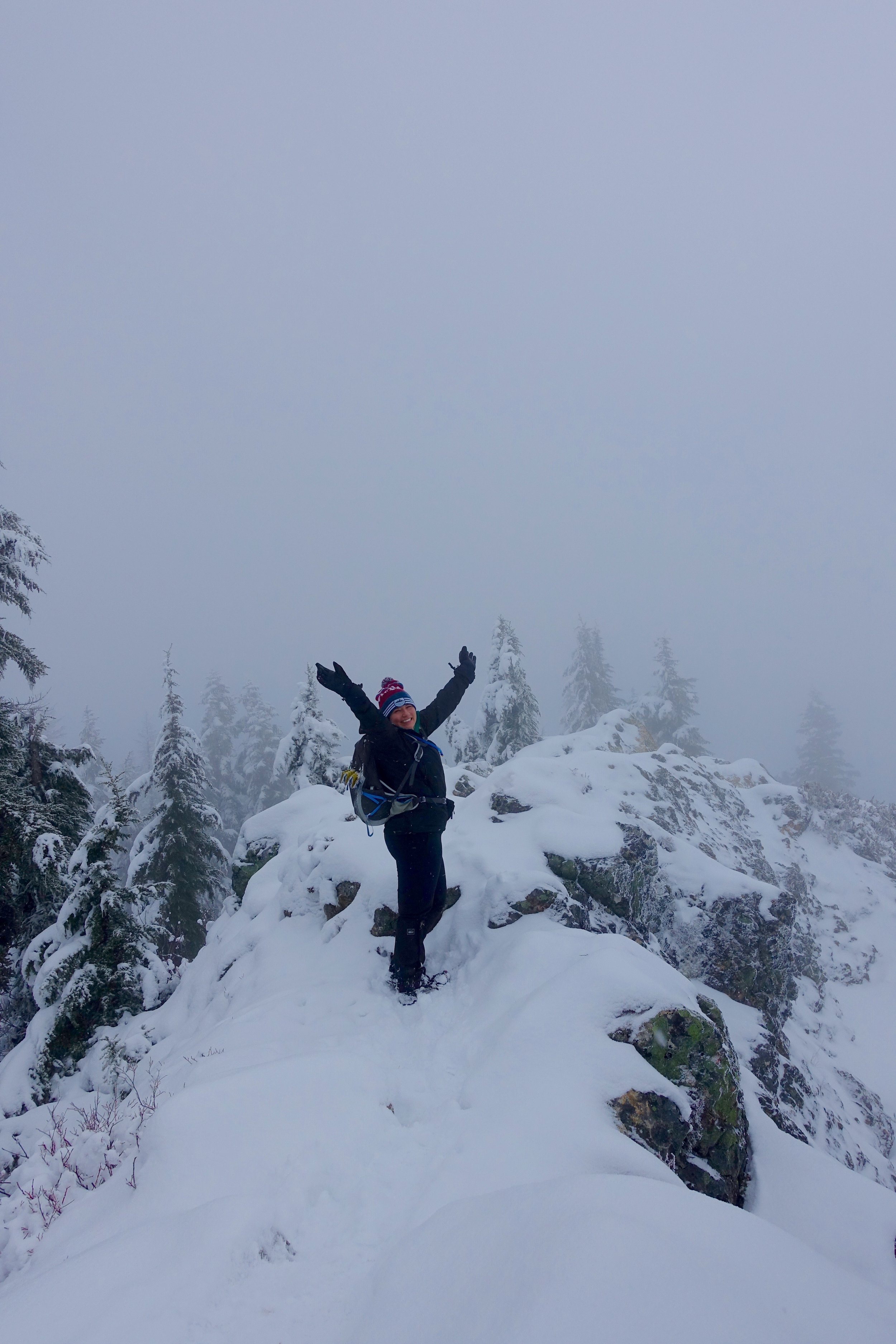
Summit Lake
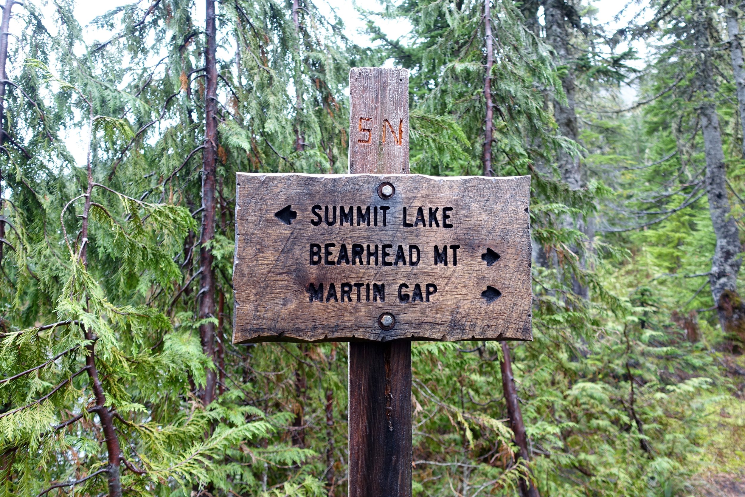
 Day Hike to Summit Lake near Mt. Rainier.
Miles: 6
Elevation Gain: 1300
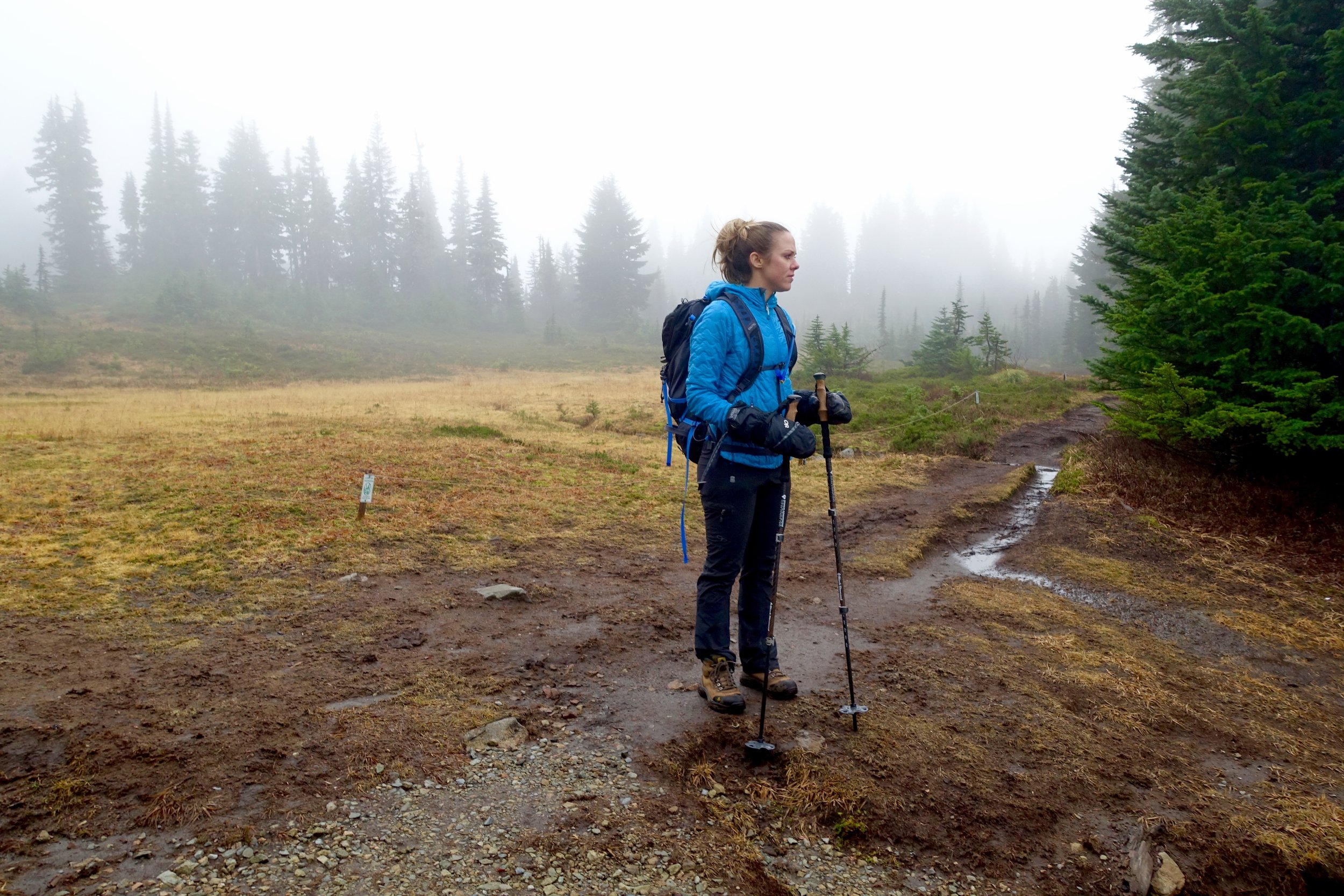
Forecast called for 66% chance of rain, but we took our chances. It payed off as it drizzled for only 5 minutes the whole time. Easy/short climb up. We did not get views of Mt. Rainier as it was too clouded. Only another reason to come back. Would make a lovely spot for an overnighter.
Annette Lake Hike
Where: Snoqualmie Mileage/EG: 7.5/ 1400EG
Granite Mountain Fall Hike
Where: Snoqualmie Distance/ EG: 8.6/ 3800
Close hike to Seattle that's a but kicker and has beautiful fall foliage. One to for sure add to the fall hiking list.

dsc01664

dsc01683

dsc01699

dsc01701

dsc01728

dsc01776

dsc01792

dsc01825

dsc01835

dsc01853

dsc01889

dsc01899

fullsizerender
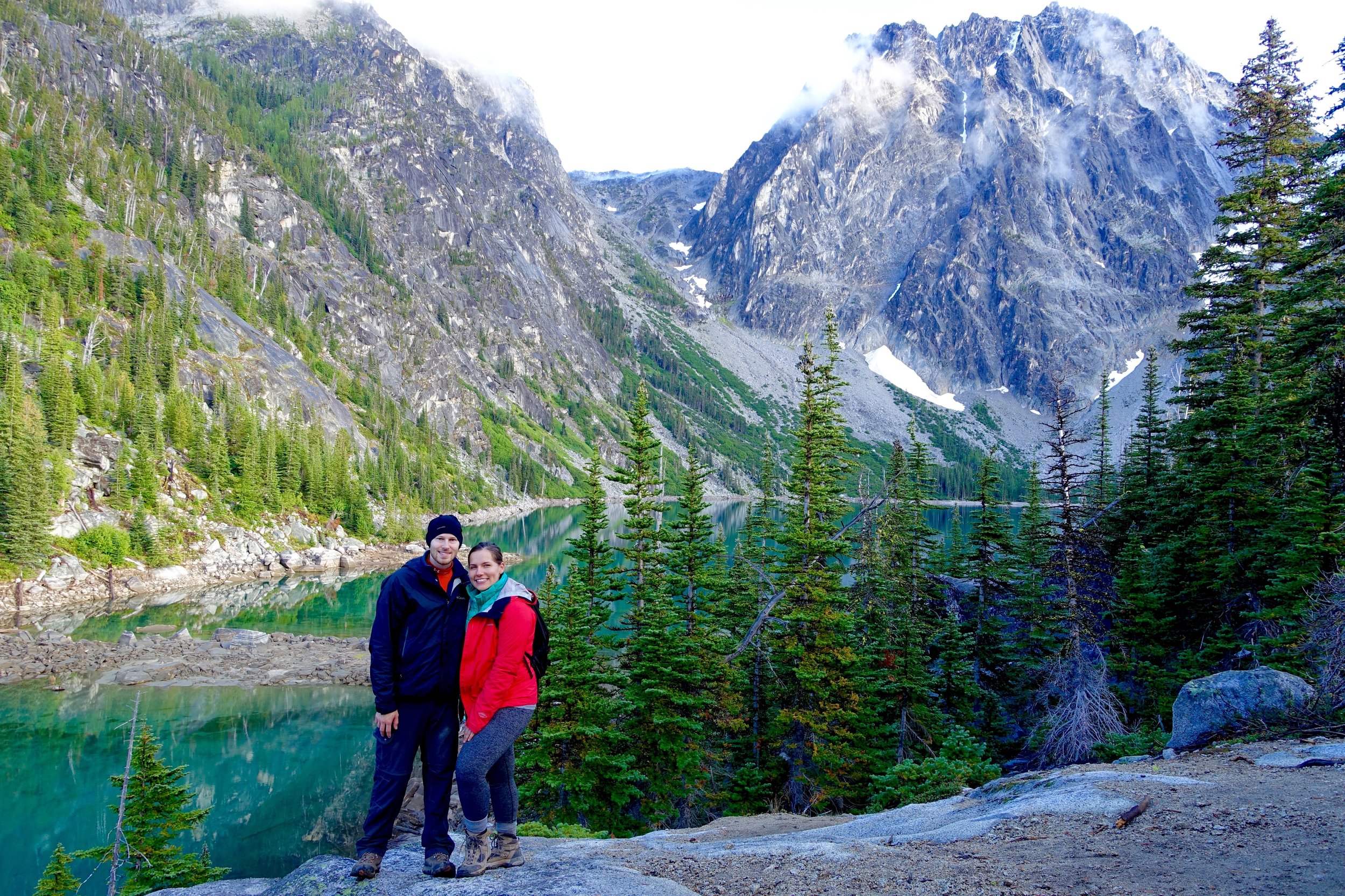
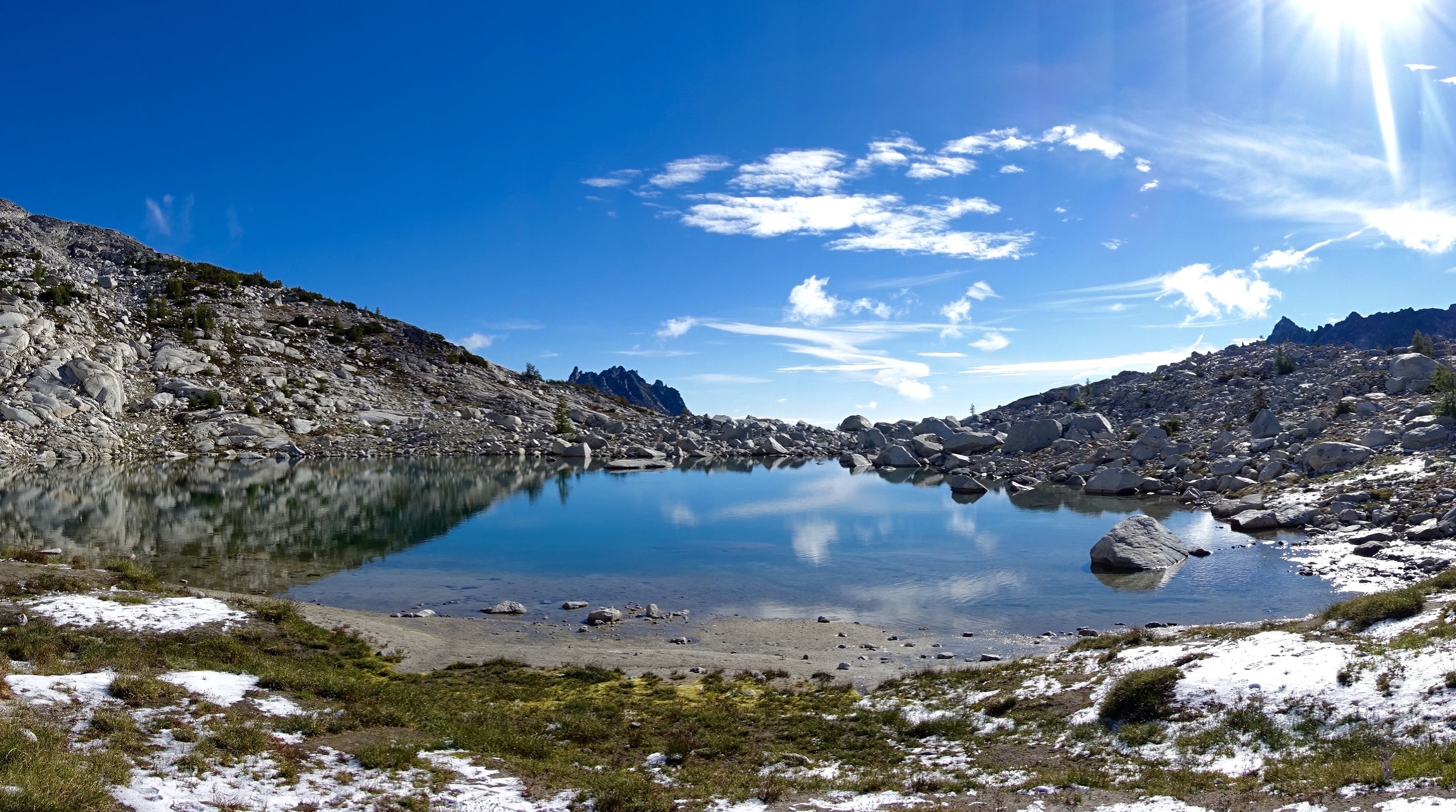
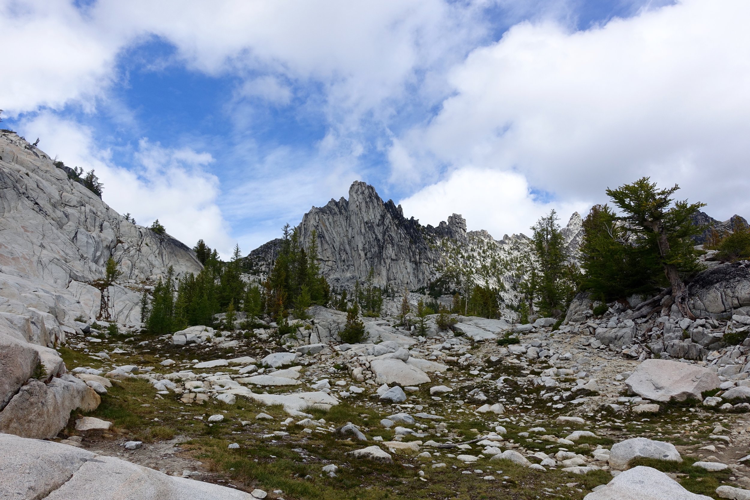
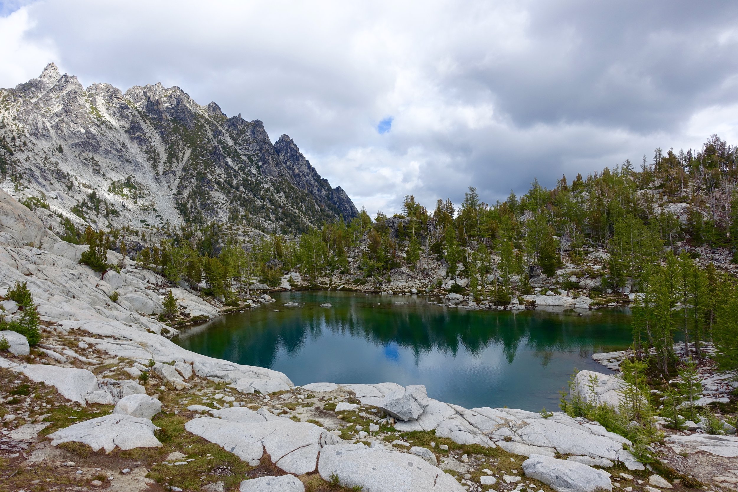
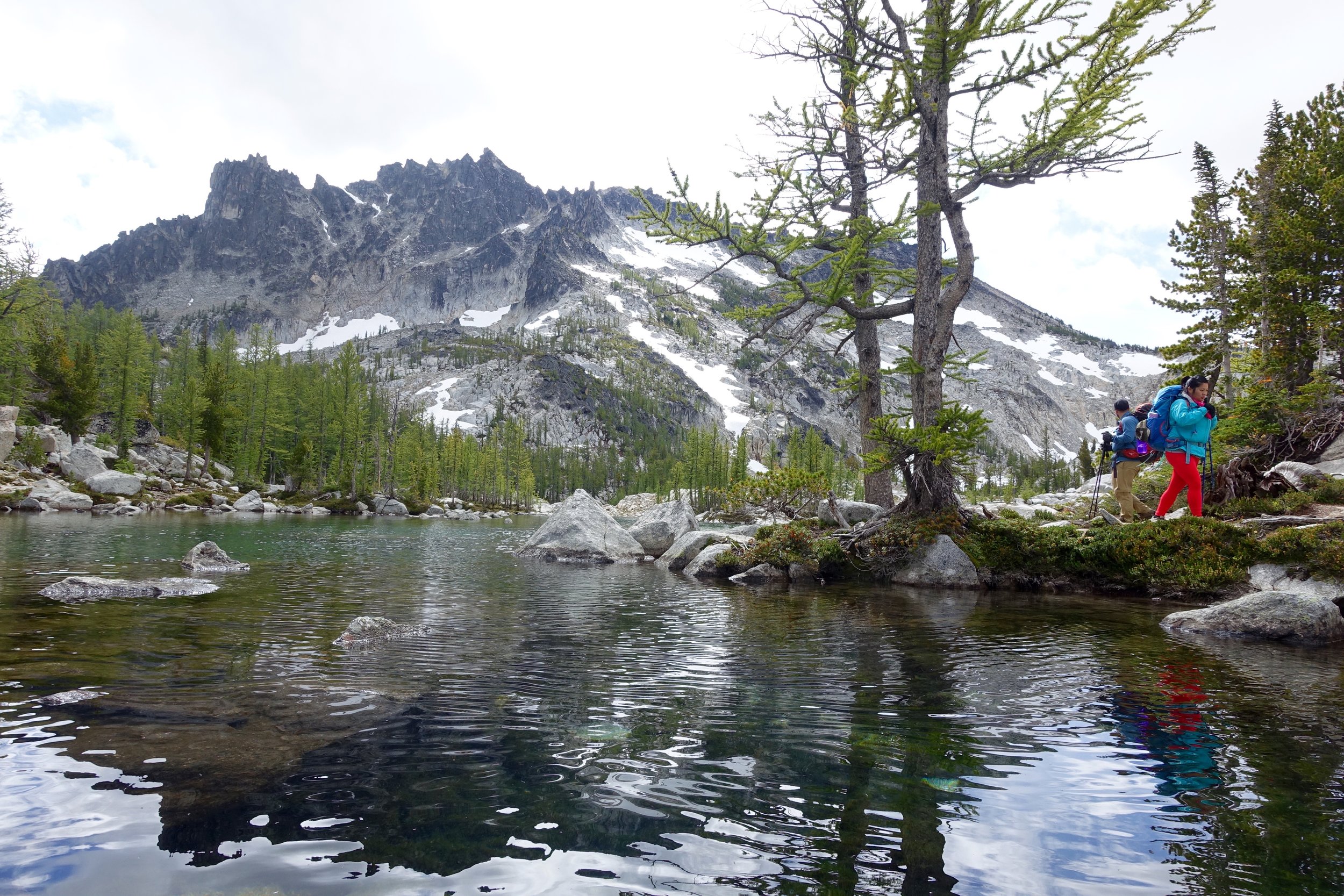
Enchantments Backpacking Trip
Dates: September 2nd- 5th 2016 Location: Leavenworth, Washington
Mileage: 20ish, 4600 Elevation gain/ 6000 elevation loss
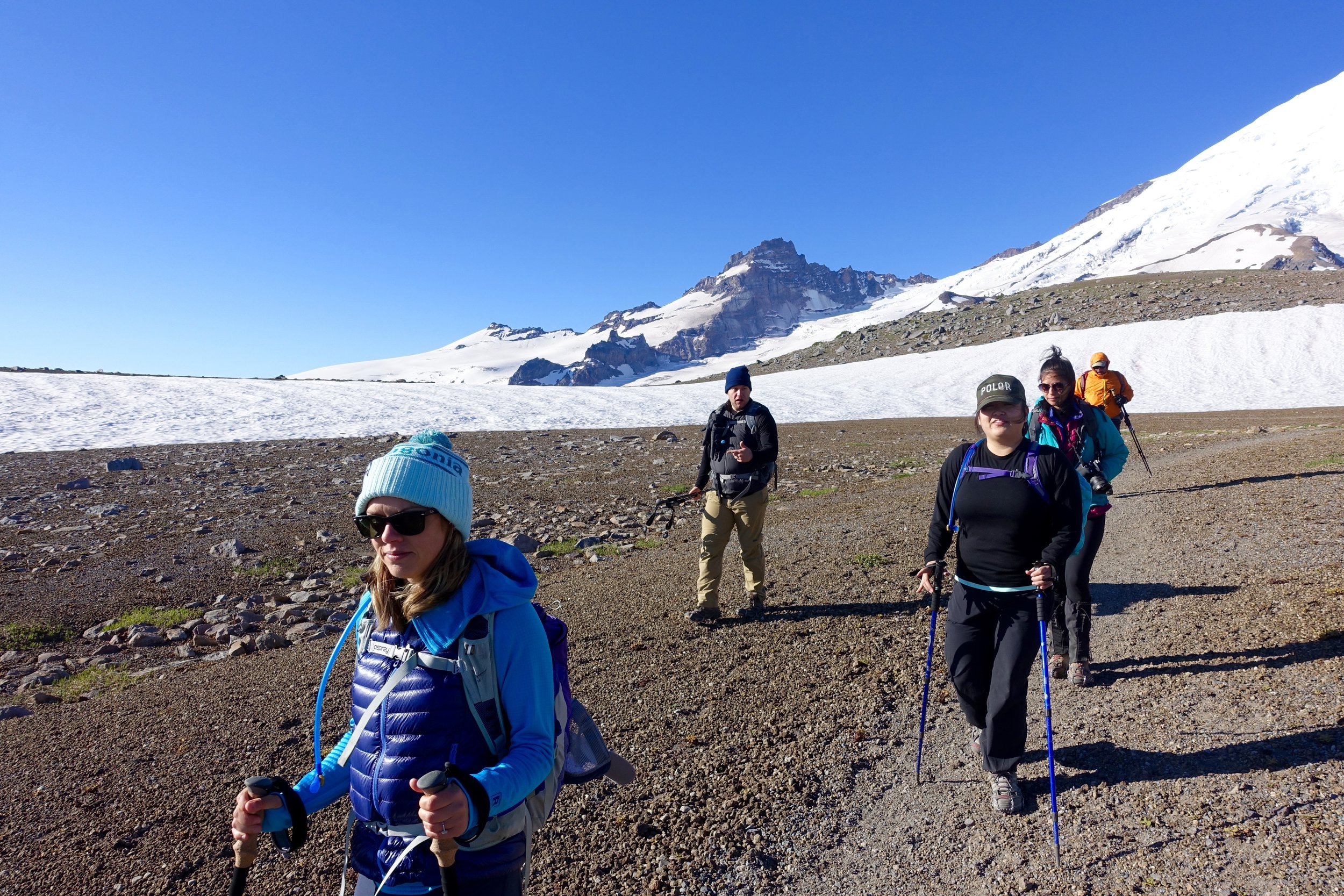
Pre- Enchantments: A lot went into this 4 day/3 night backpacking trip. In February I put in the permit application for the enchantments as I heard everyone talking about it. We had just started getting into hiking at this point and I figured that we would have to try for many years to get a permit. A month later on a Sunday evening the lottery was drawn and we hit the jackpot somehow. We scored CORE zone permits (the best) starting on a Saturday during Labor day weekend. How we got that I still don't know. I later read that they only give 6 core permits out a day. You are allowed to have a group of 8 for each permit so I worked on getting a group together. My husband Ryan would go (impending work approved, and it did), invited my friend Doris and talked to a few out of town friends that were interested in going. Months later the final group would be a college friend of mine (Chrissy + fiance Scott), Doris and her boyfriend Cody and a newer friend, Hillary.
At the time we won the permits we had no backpacking gear. We ended up using our tax refund to basically get most of it and started on our first trip a month later (Ancient Lakes). Over the summer we would go on more trips to get in shape for the enchantments and learn the ways of backpacking and all that it entailed. So happy I had Doris to help me along the way with this as a total newb.
Gear list for the enchantments along with new gear bought:
- pack- Osprey 65L, still loving this pack!
- pack rain cover (ended up using this a couple times)
- hiking poles
- tent (love, love, love our Big Agnes Copper Spur UL 3)
- sleeping bag ( I have a mummy Marmot down sleeping bag and hate the mummy style so much. Maybe before next season will get a quilt style one instead)
- sleeping pad (really happy with our insulated Klymit sleeping pads keeping us warm)
- stove/fuel (the MSR Windburner has been one of my favorite things. Super reliable and so fast to boil water)
- sunscreen
- bug spray (didn't end up having bad bugs on this trip)
- sunglasses
- 2 athletic pants
- 2 sports bras
- 1 Patagonia mid layer
- 1 set long underwear ( just bought my first pair before the trip- REI's new midlayer long underwear. Overall very happy with it!)
- down puffer
- rain coat
- 3 underwear
- 2 pairs socks
- camp sandals
- baseball hat
- warm hat
- gloves
- headlamp/ extra batteries
- water filter (We are using the sawyer mini now. Chrissy and Scott had the Steripen UV water filter which is just a pen thing you swirl in the water for a little bit and it is purified. So crazy. Definitely getting this before next season.)
- camelback
- platypus 2 liter bag
- toilet paper
- hand sanitizer
- toothbrush
- deodorant
- contacts
- contacts solution
- glasses/case
- wet wipes
- day pack
- mini towels
- multi purpose soap
- first aid kit
- multi tool
- ursack bag (We just bought the critter proof one after much debate if we should get critter or bear proof. In most cases if we have to worry about bears we will be hanging the bag so that a bear can't get it and then it will still be critter proof then. We are happy with it! We ended up bringing my friend's ursack bag as well so we had 2 bags of food.. so. much. food.)
- opsak bag (blocks food odor in ursack bag)
- rope
- 2 flasks
- compression bag ( I just bought my first compression bag as they were on sale at REI. I got it for my clothes and that worked really well for the trip. I don't use one on my sleeping bag right now as it is pretty compact.)
- camera + case + 3 batteries + mini tripod
- go pro
- External battery charger for phone
- ziplocks for trash
- ear plugs
Food (for 2 people):
- 6 dinners (freeze dried meals- had mountain house chicken teriyaki- very good, parmesan noodle one- very good, mac & cheese- not good).
- 8 breakfast (2 oats + almond butter/ 2 eggs + tortillas + hot sauce, first time we had made eggs backpacking. Got the egg crystals instead of freeze dried eggs. These turned out super good. We need to get a pan for our stove.)
- Lunch: 5 ramen, 7 tuna packets, turkey jurkey, crackers, dried fruit, trail mix, peanut butter + tortillas
- 8 instant coffee
- candy (always a top priority)
- electrolyte tabs (nuun)
- eating utensil
- mug
- whiskey (always bring more than you think you will need)
- collapsable bowl
- apple cider packets
Group:
- bear spray (thanks Hillary!)
- paper map (wasn't going to bring one with our hiking app we have but Chrissy and Scott wanted to and it ended up being super useful)
- compass
- milk jug bucket (Friend Caitlin gave us this idea, cut off the top of a gallon milk jug and use it to carry water. We used this so much!)
It was definitely a process getting down this list and I used more experienced friends to cross check it and tell me what I need/ didn't need. I cut out things like a swim suit, extra clothes, hammock and things that just weren't necessary. I weighed my pack before we left and I had all the food (which was something like 20 pounds I swear..) + 2L of water and it came out to be about 43 pounds. The heaviest yet. After the 2nd day Ryan and I split up the food but my pack was still probably 38 pounds or so for the rest of the trip.
It was the day before the trip and we were crazy excited. Chrissy and Scott flew in that Friday mid-day and I picked them up from the airport, did a last minute gear check, dropped the dog off at boarding and prepared all finishing touches for our adventure. Doris and Cody took half days and made their way out to Leavenworth a bit earlier in hopes of snagging a walk up camp site (which is mostly all they have near the enchantments). It was around 6 and I still hadn't heard from them and was getting a bit nervous that they didn't find anything. I get a call around then with Doris saying "do you want to good news or the bad news first?" They ended up getting a spot...but it was the very last campground with the very last spot...and it was at a horse campground. Basically if someone with a horse were to show up we could get kicked out but that was unlikely. We had a spot to stay for the night and that was all that mattered. The 4 of us left Seattle around 6:30 and made the 3 hour drive to our camp spot. We had to go up some rough roads to get there but finally arrived. Ryan and I decided to sleep in the back of the outback for the first time to avoid having to set up and take down the tent. Got awful sleep that night (as I usually do outside).
Day 1:
We woke up early to pack up camp and head out. Our goal was to be at the Stuart Lake trailhead at 7:30, but ended up being there at about 7:50. Once the 6 of us got there we dropped off Chrissy and Scott to hold down a parking spot (there was about 2 left in the parking lot at this time) and then brought 2 cars over to the Snow Lakes trailhead to leave one there for when we would exit on that side. We then drove back to the other trailhead and got everything ready to go. It is about a 20 minute drive between each trailhead. We made coffee and oatmeal at the trailhead now and then secured the cars, took pre hiking photos and made our way out. 
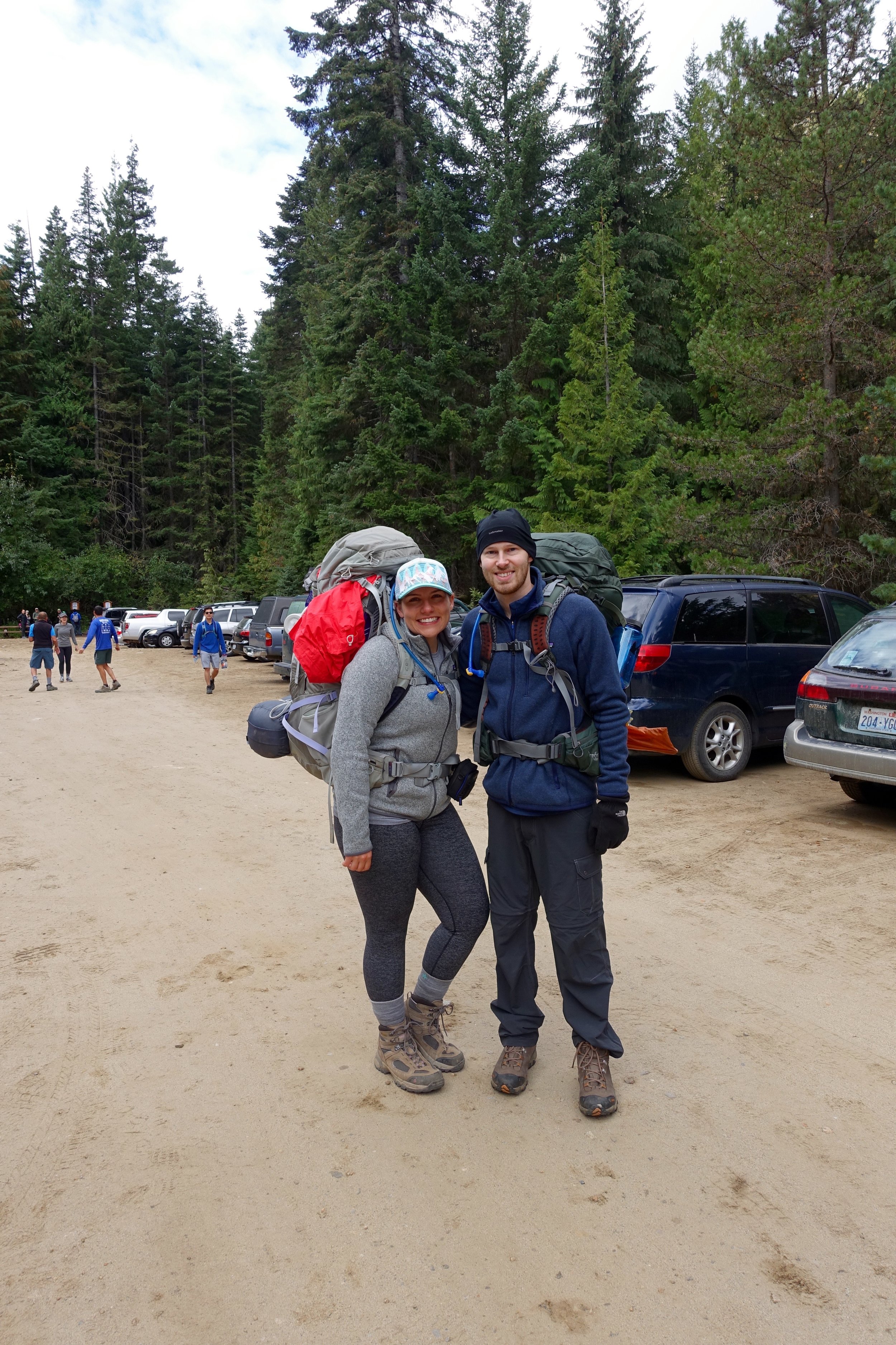
We started on the trail about 9:40 or so and it took us about 3 hours, if I can recall. The climb to Colchuck is not an easy 4 miles up with 2,280 elevation gain + 40 pound packs. We took it slow up that climb. Towards the end it started raining a bit and we had to don our rain coats and rain covers for our packs.
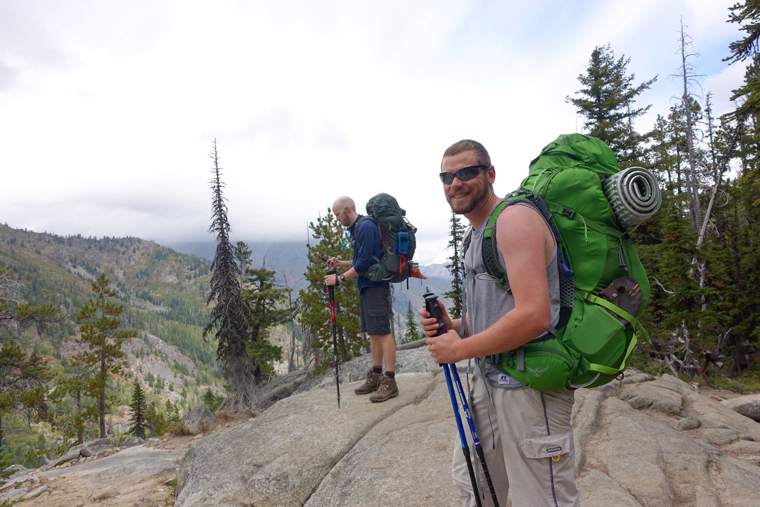
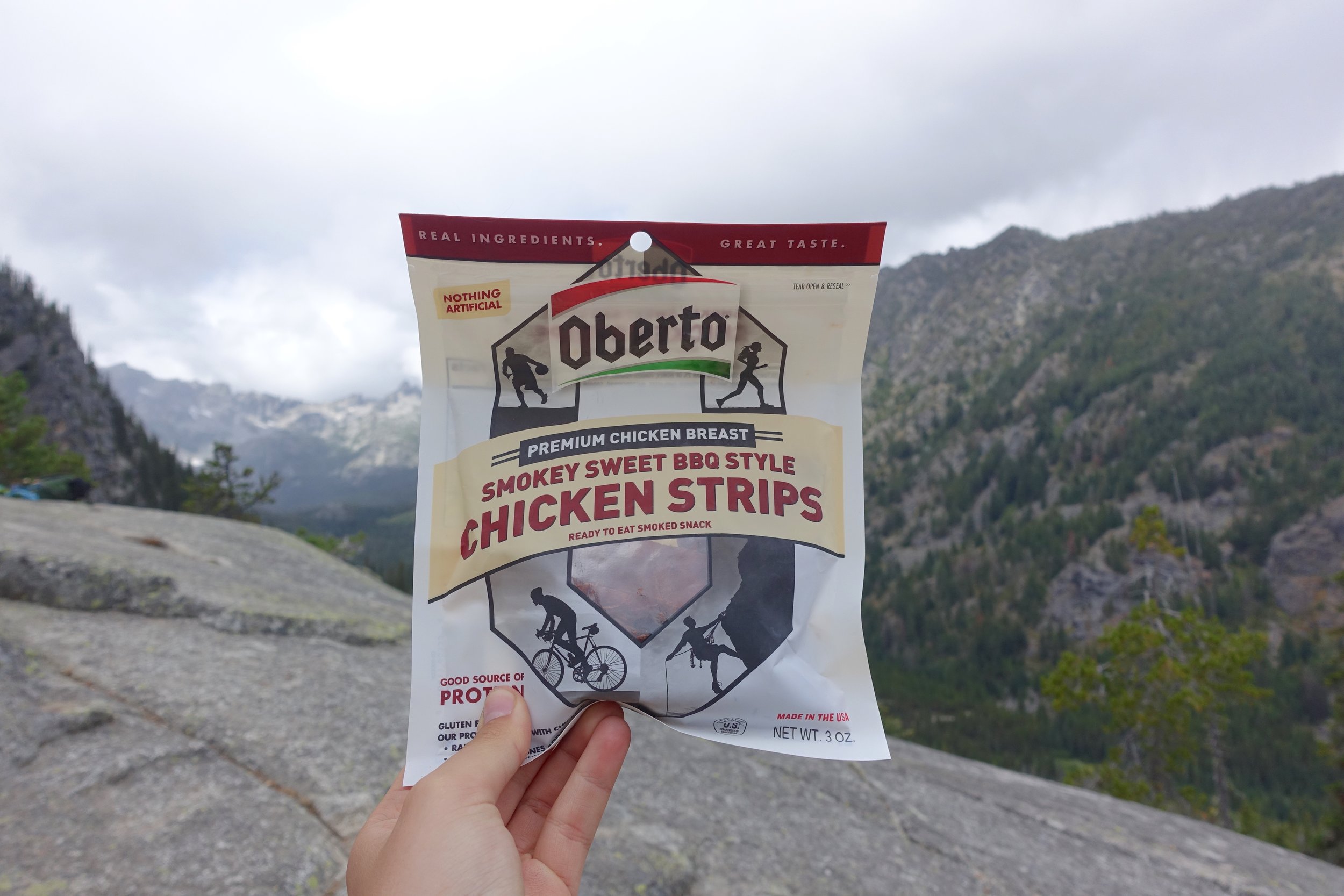
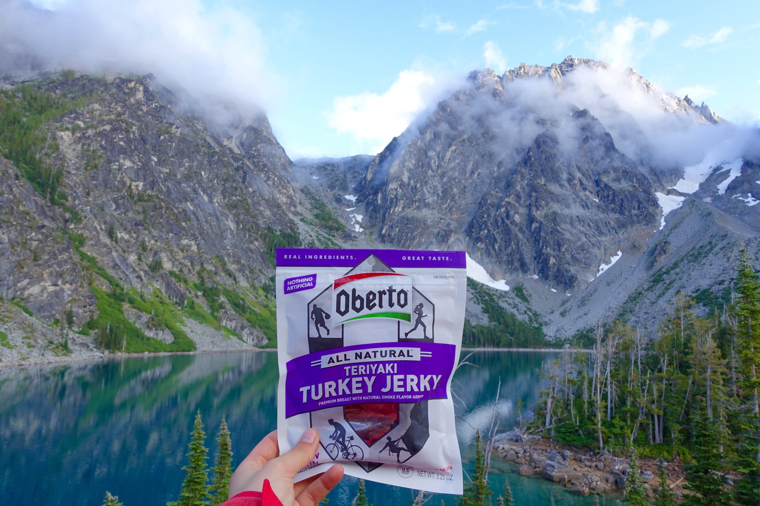
Also, Oberto asked me to be a brand ambassador for them and I basically said "hell yes, I love jerky." Promoting a local company with good ingredients is A+ in my book.
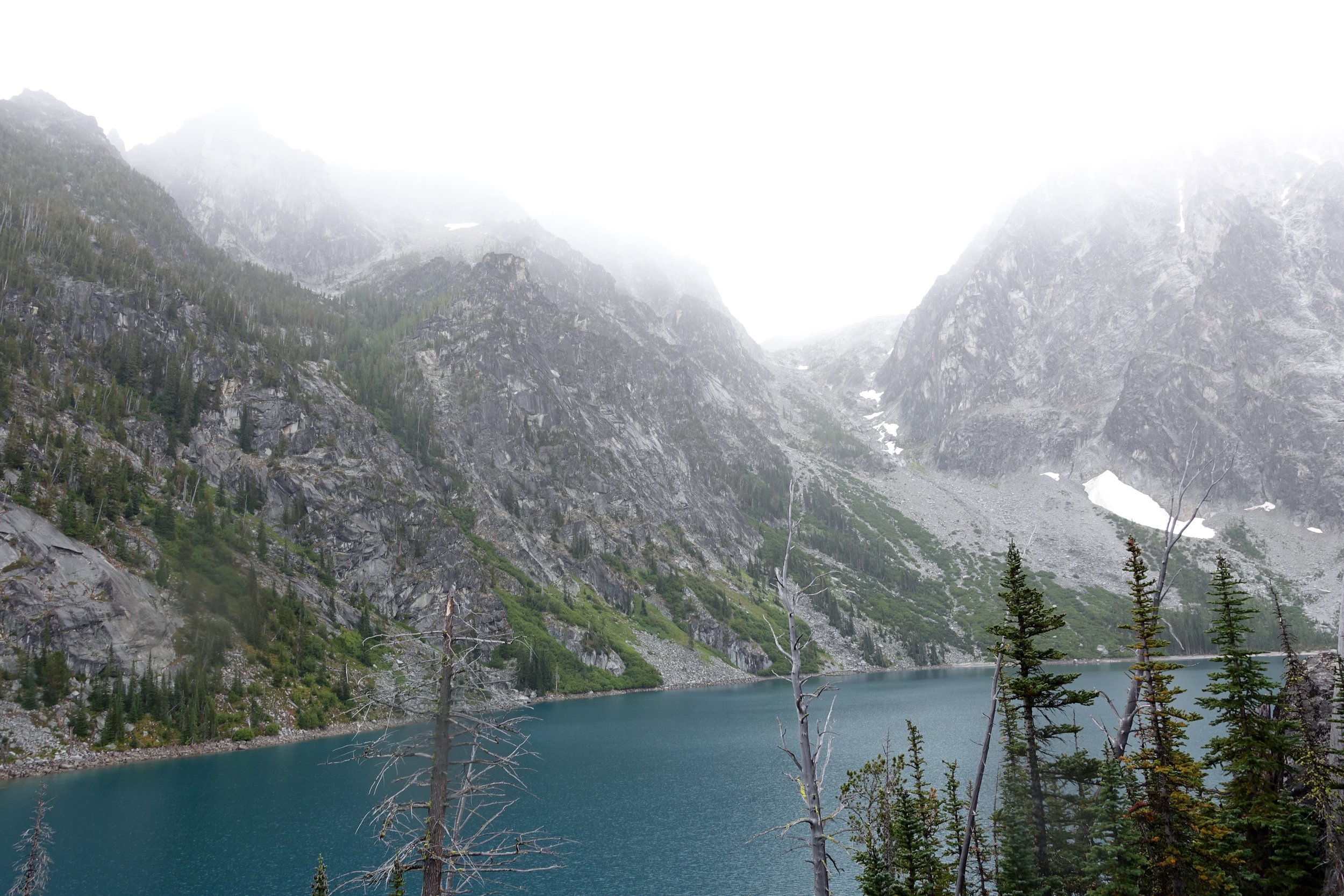
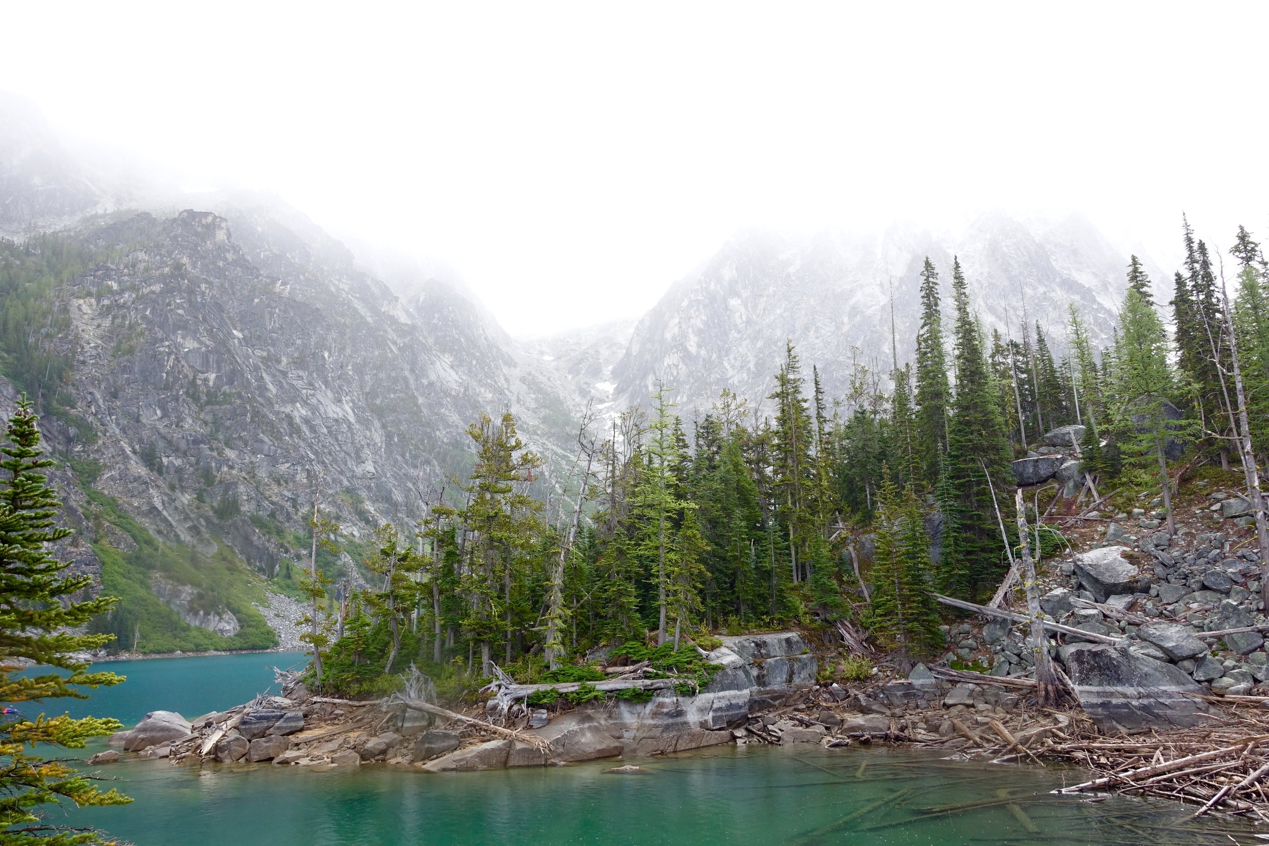
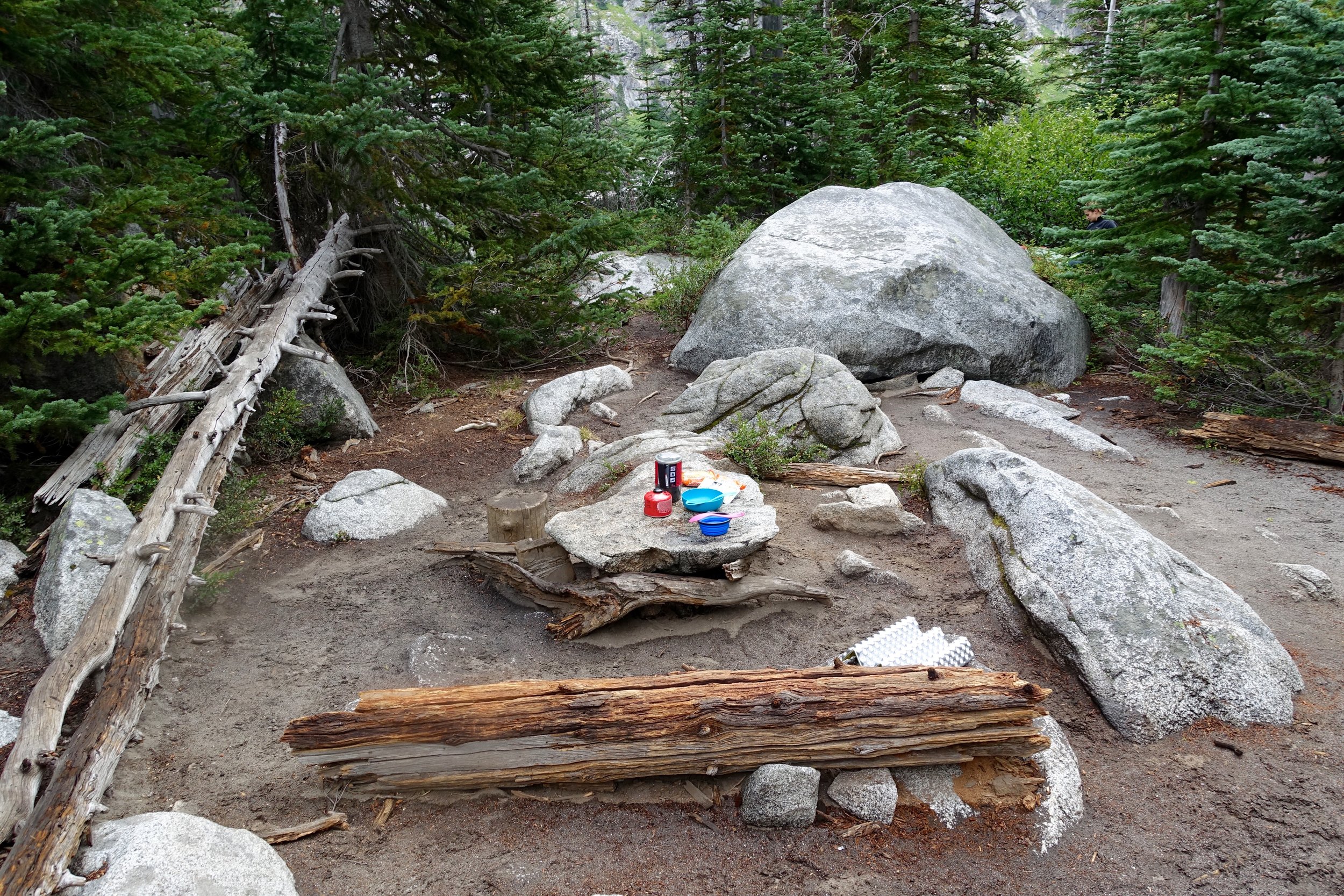
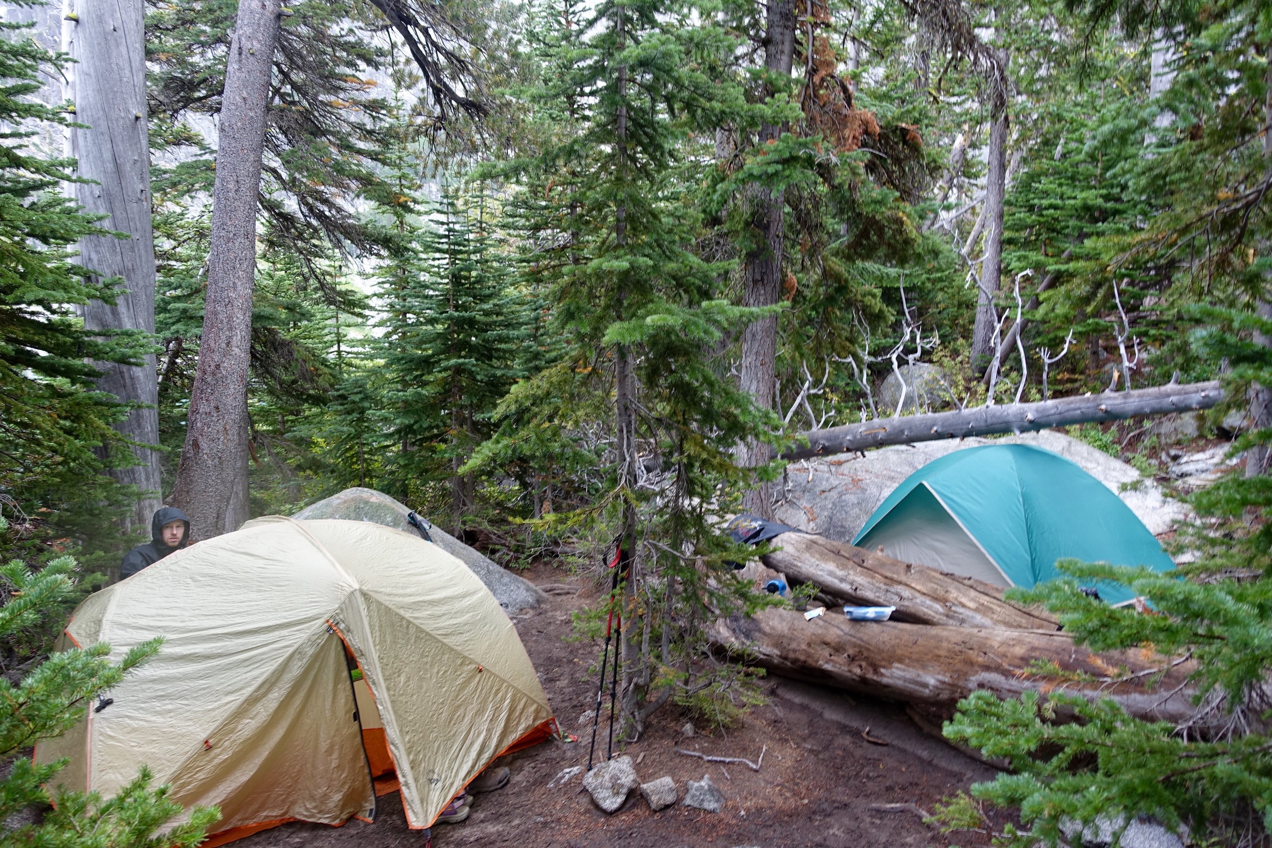
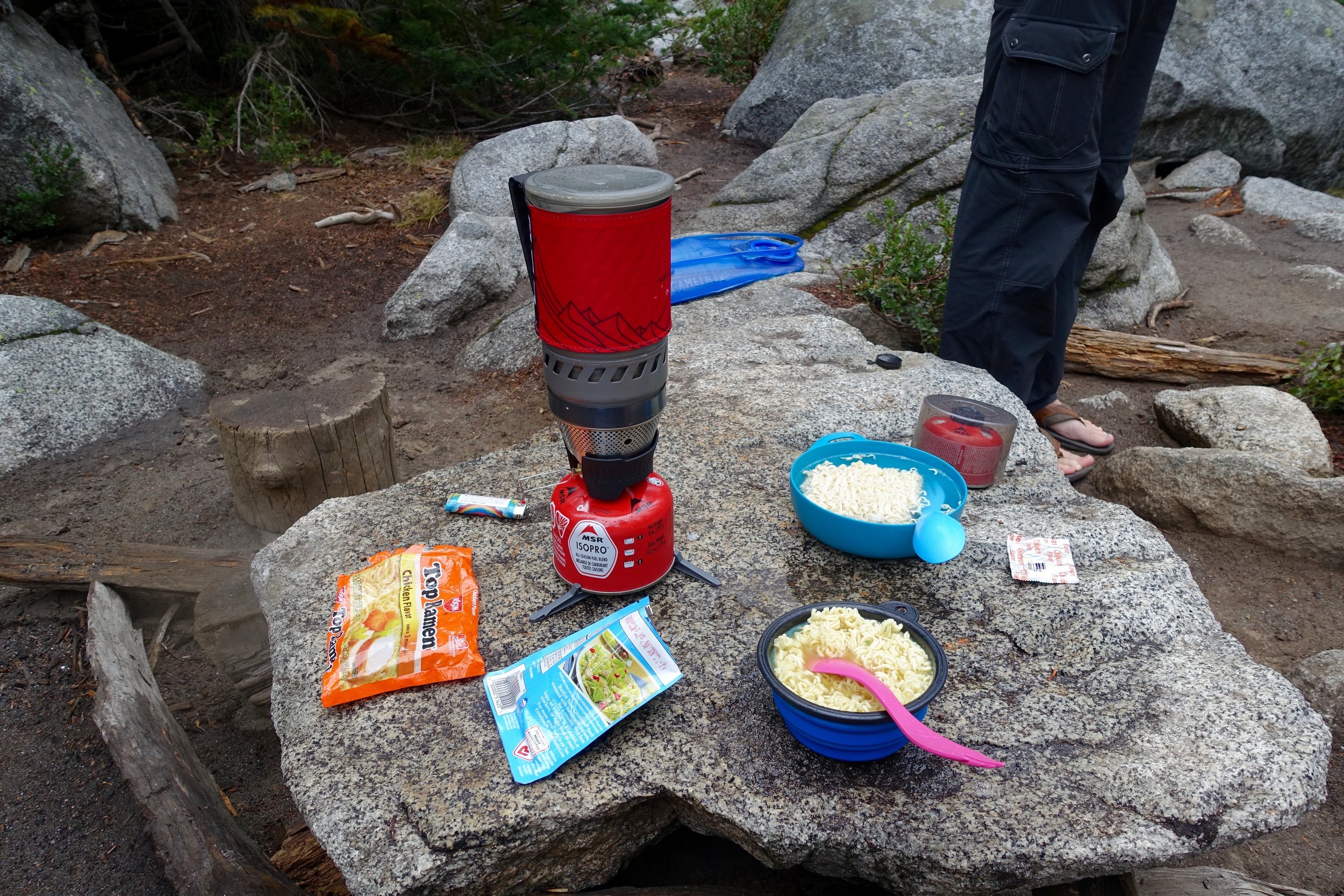
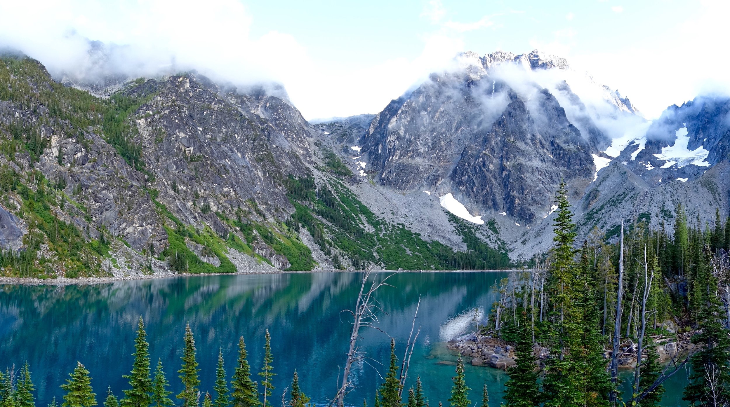
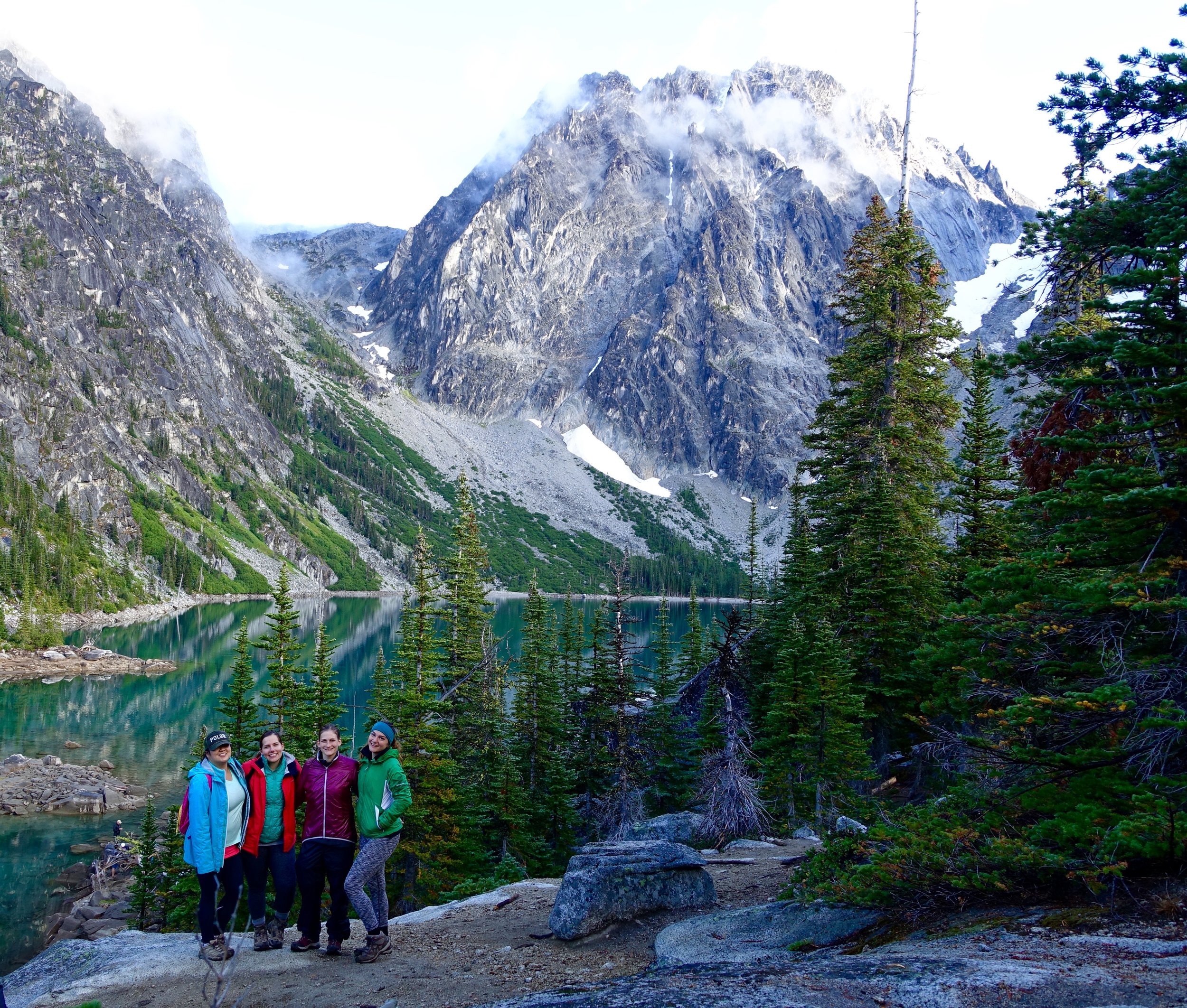
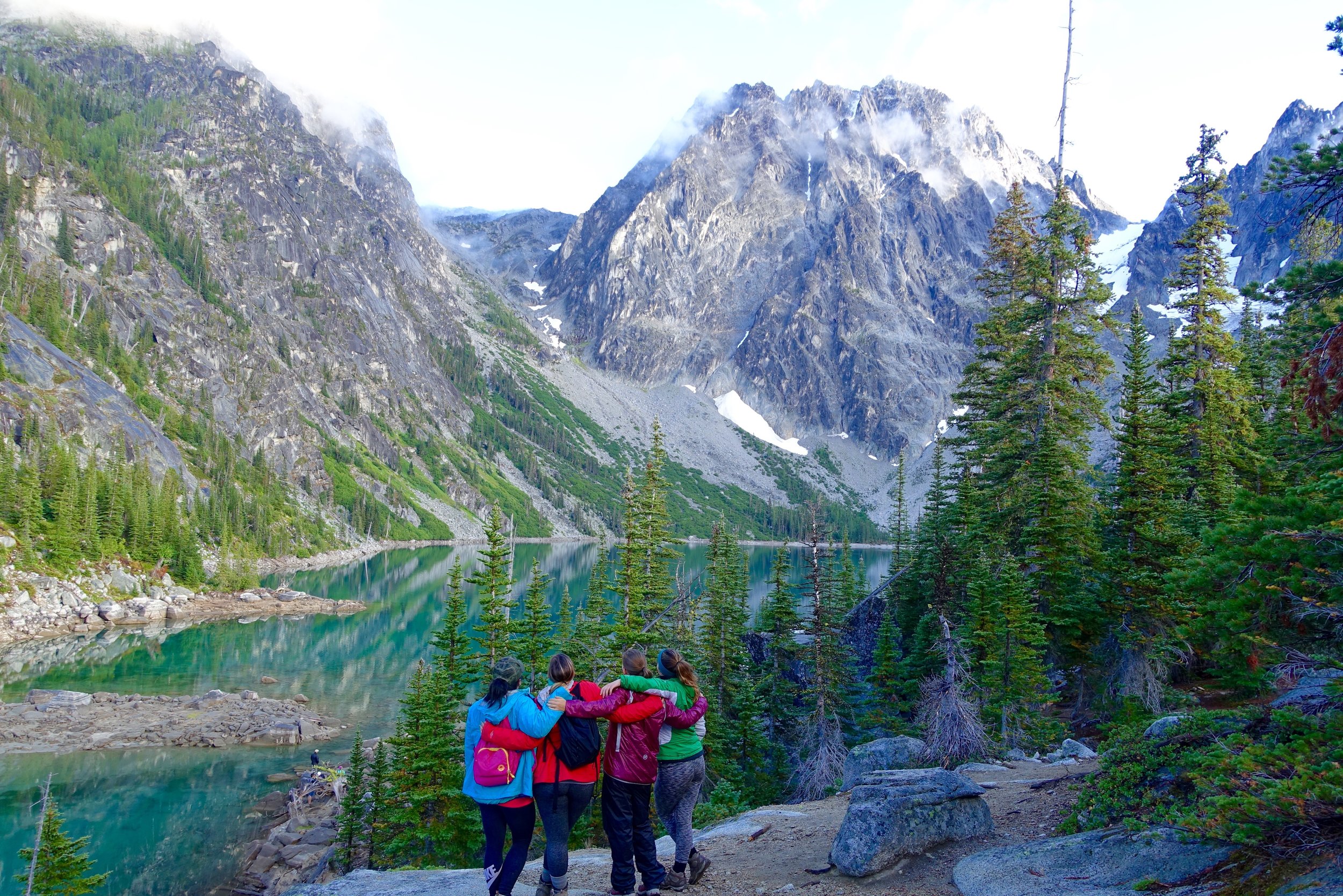
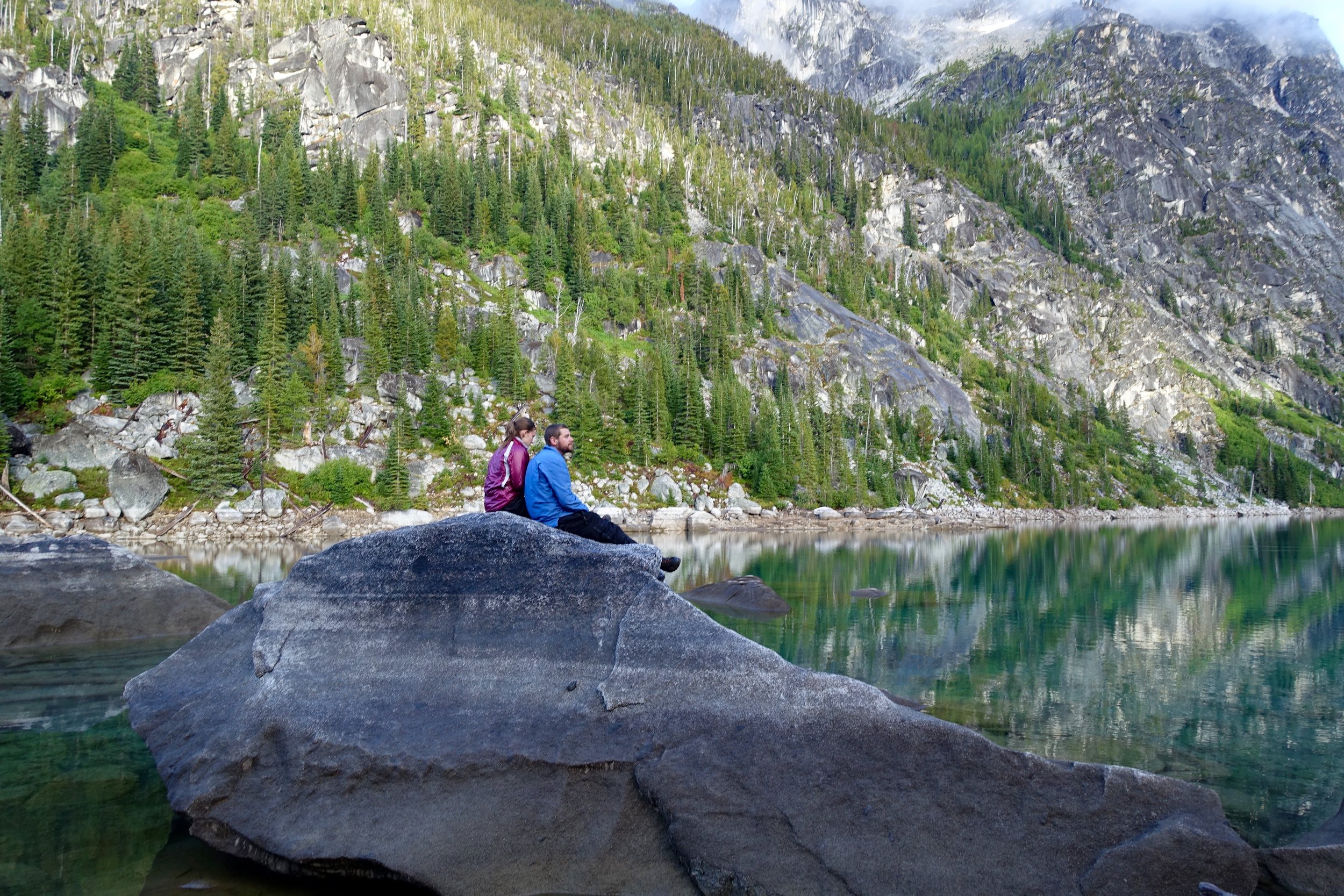
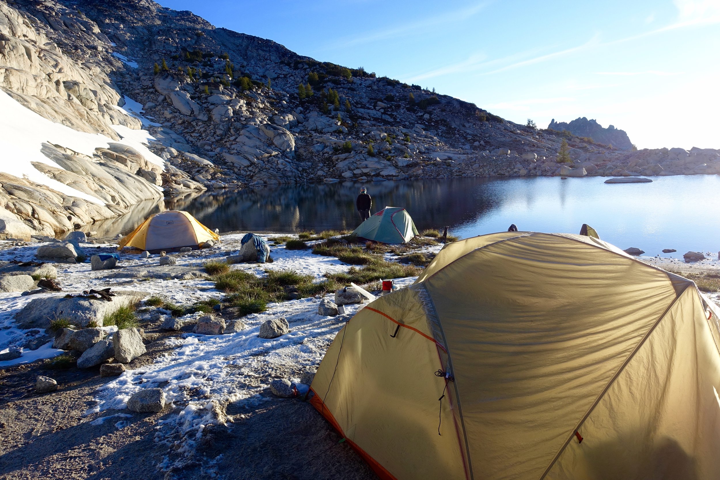
After seemingly endless climbing we made it to the lake! It was very foggy when we arrived but our number one goal was to find camp for the night. Looking at the map we could tell where different camp spots were as we walked around the lake. We went half way down the lake and found an area off of the trail that would've fit all 4 tents but wanted to check out the next one as well and I'm so glad we did. This one was very close to the lake, had an awesome granite table already set up and had enough space for all of us. Sold. We set up our tents right away, made some lunch (ramen) and the family table and then napped in the tents while it was raining.
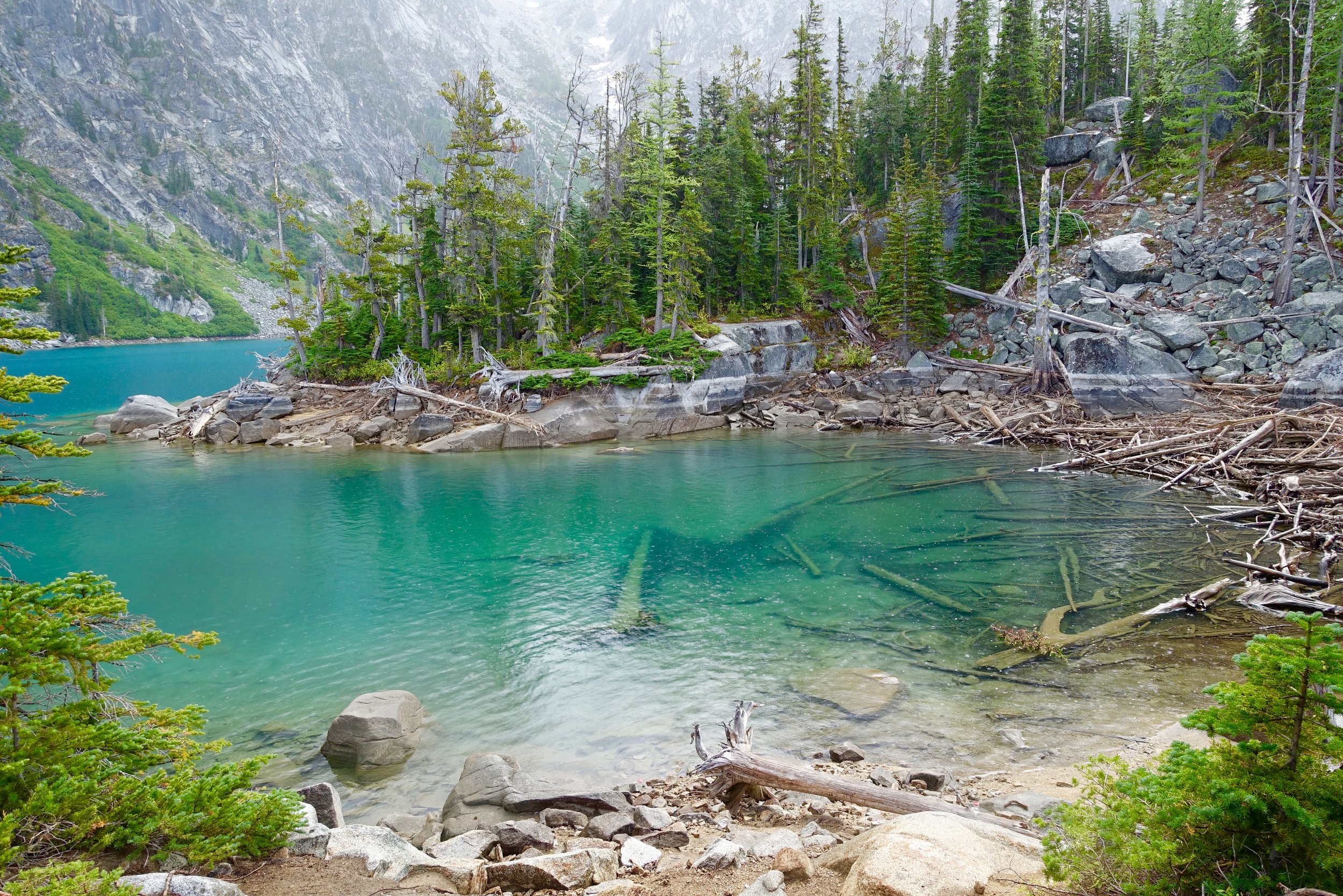
After our nap we slowly woke up and got the crew together to adventure around the lake as it was nice out now and the clouds had cleared up. I got my daypack out and we hiked back up to the other end of the lake and explored around the beach areas.
After that we made our dinners and went to bed early to gear up for the big climb the next day: Aasgards pass- climbing 2000 feet in just under 3/4 of a mile.
Day 2:
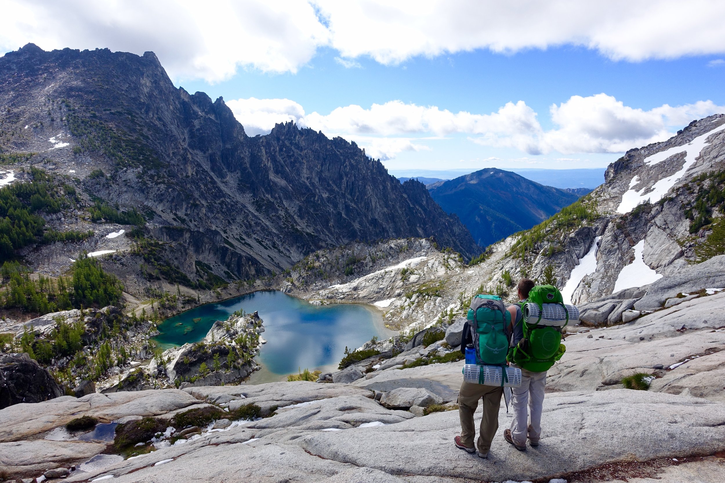
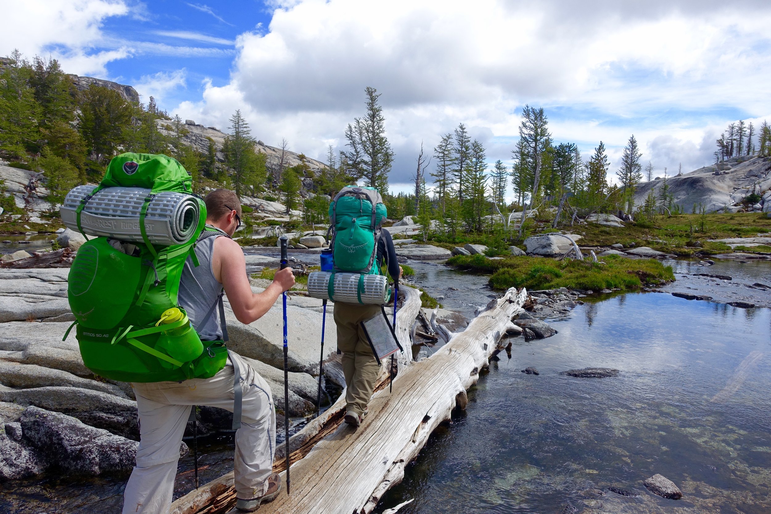
We woke up early, made egg burritos (top notch) and drank coffee while staring at the calm lake. We packed up camp and made our way to the other end of the lake. To get over you you have to climb over many large, boulder rocks that are quite difficult with big packs. At the bottom of Aasgards is a really nice beach that would've been the best to camp at. Next time.
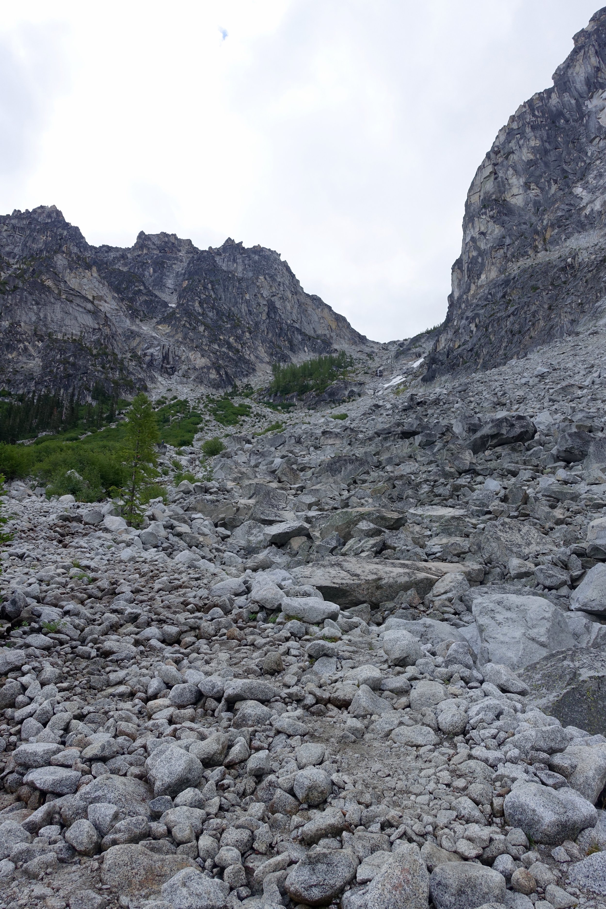
We then started the climb up Aasgards. Right from the beginning we took it really slow and steady taking many breaks along the way. Many day hikers passed us as we made it up with our big packs. Half way up we really stopped and took off the packs and fueled up.
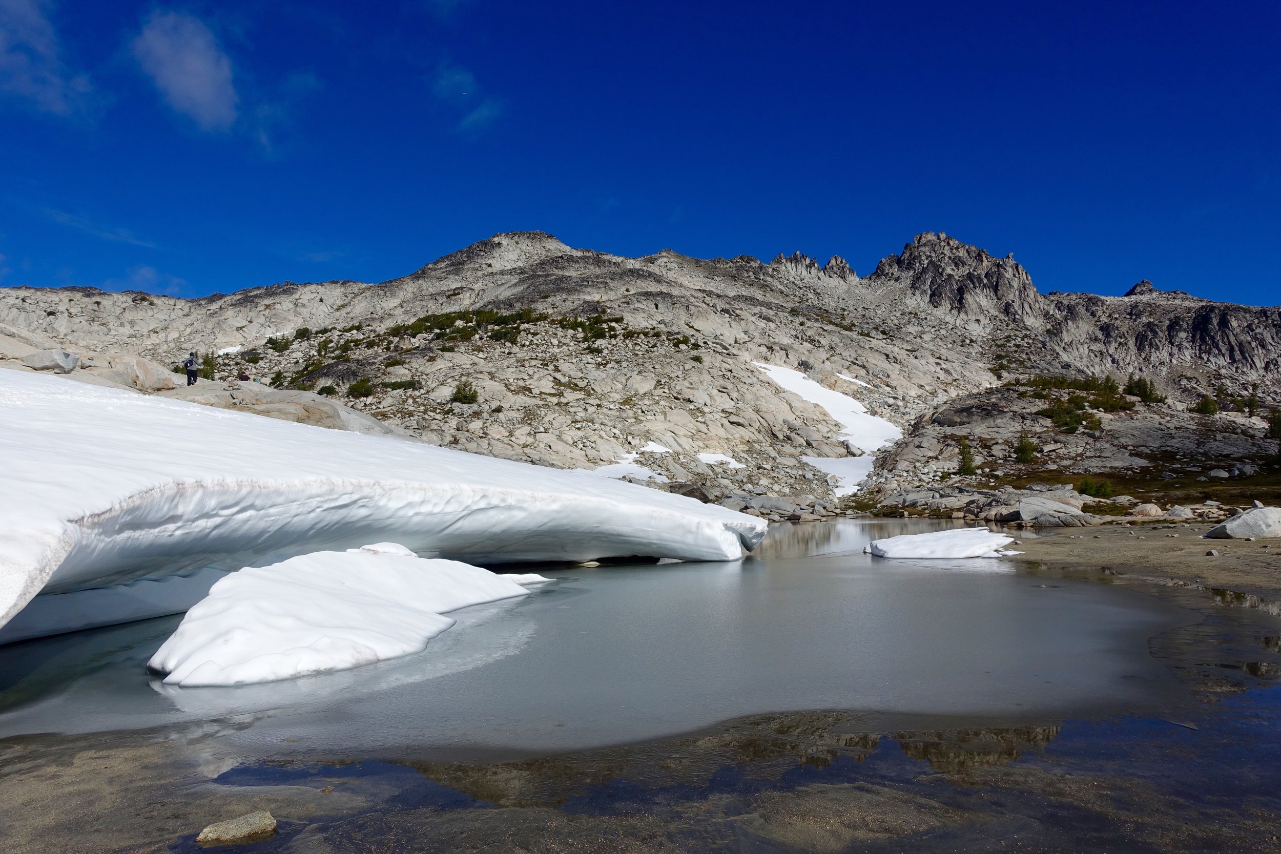
Just within 20 minutes after this last photo was taken the weather turned dramatically and dark clouds rolled in and with it came hail and snow...We were about 3/4 up when this happened. We had no other choice but to keep going.
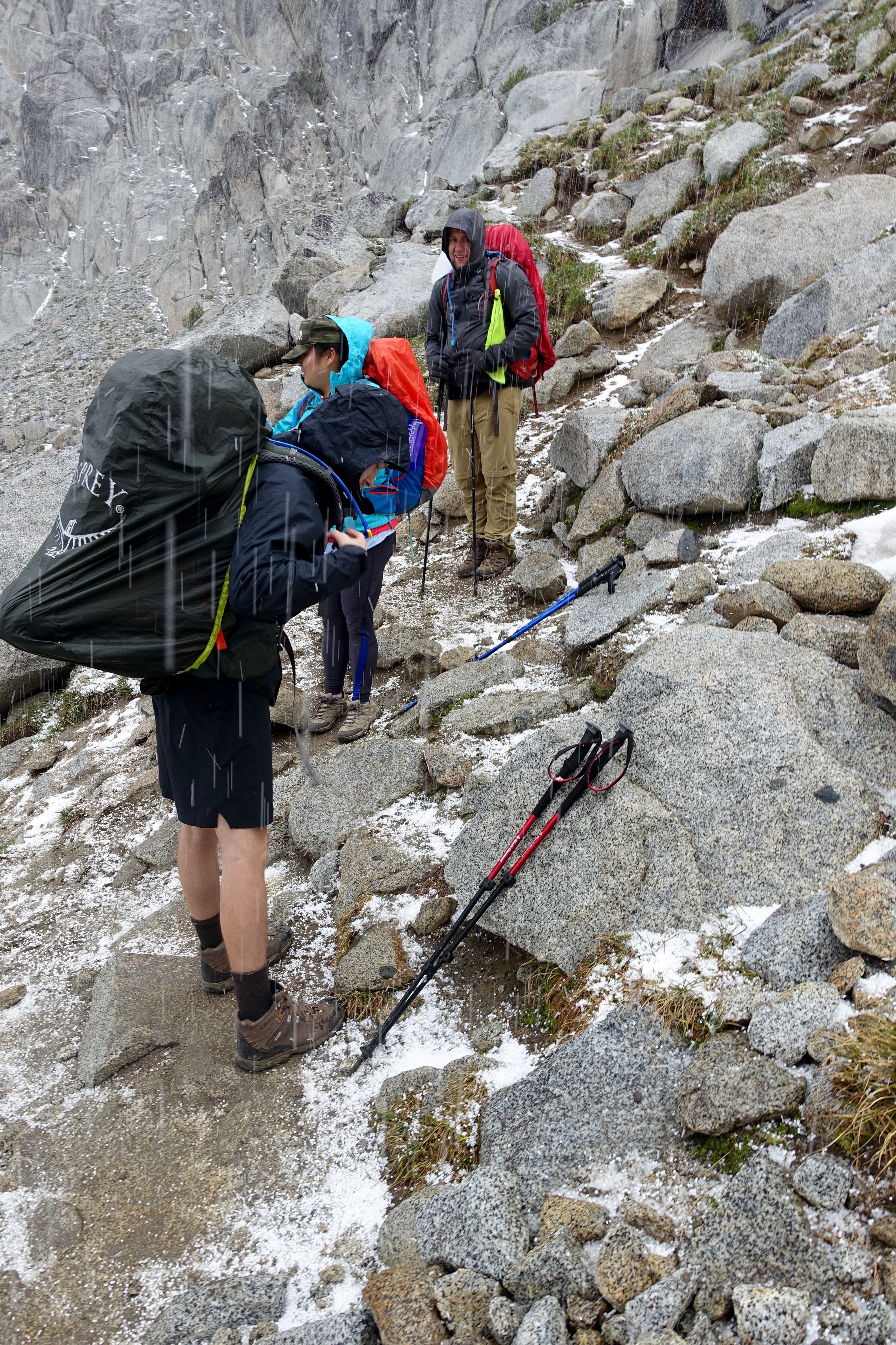
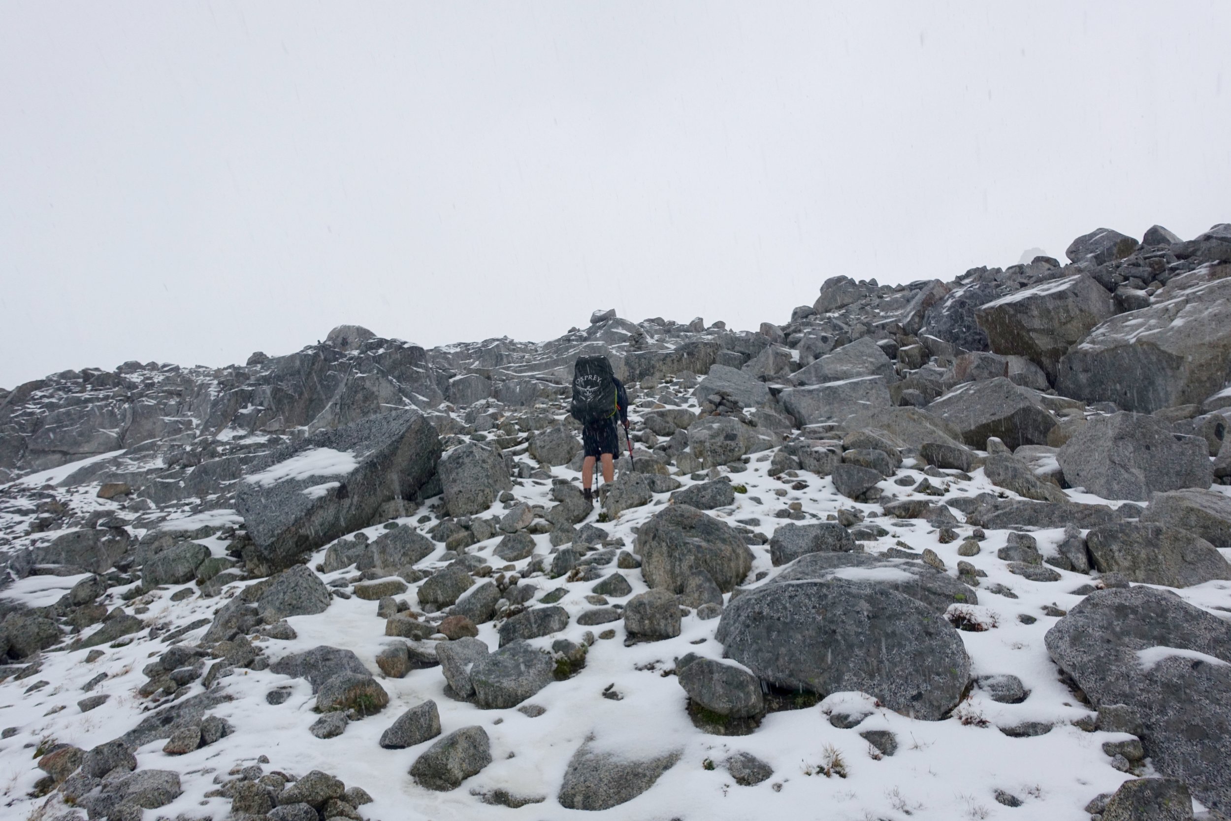
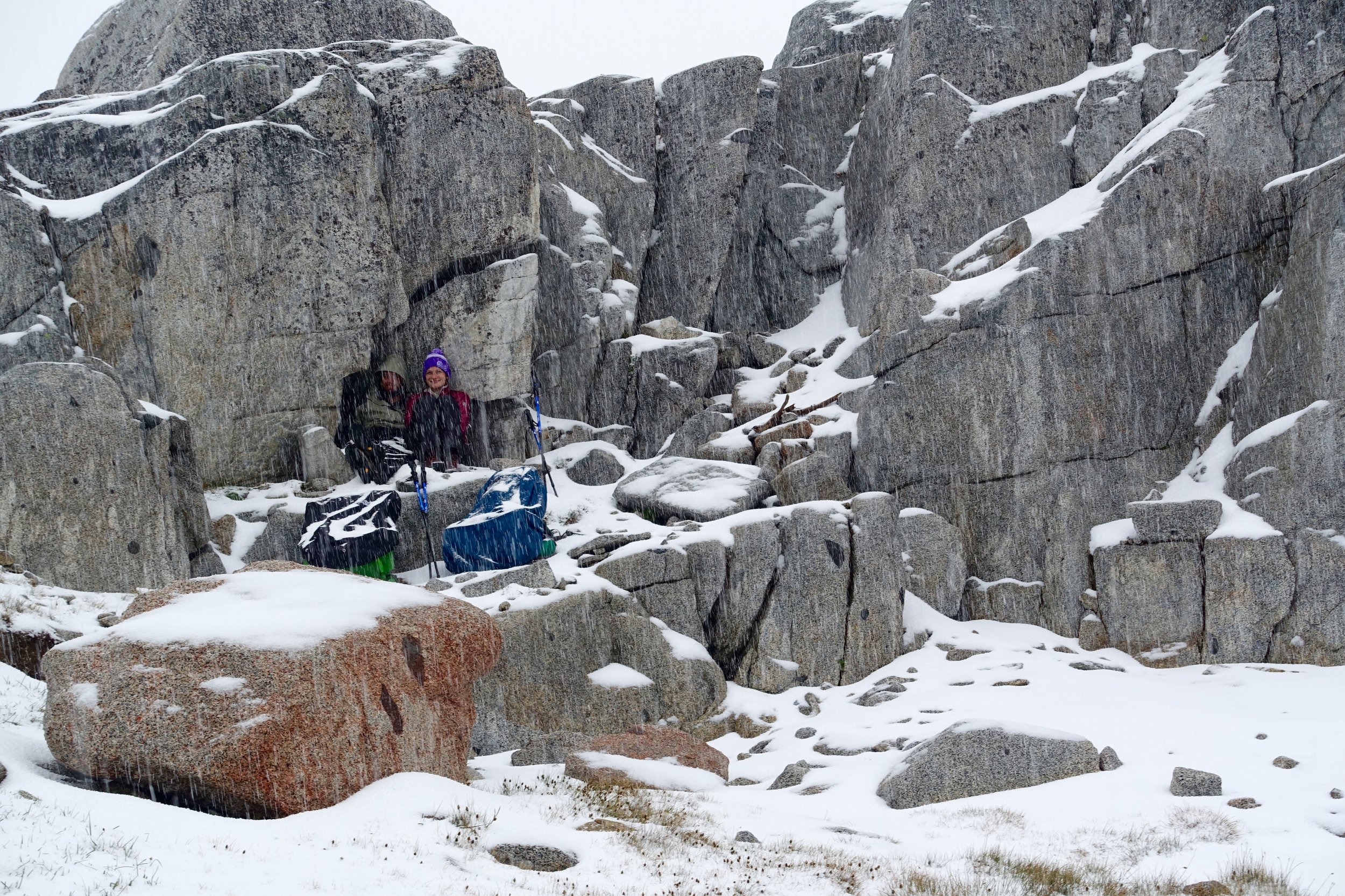
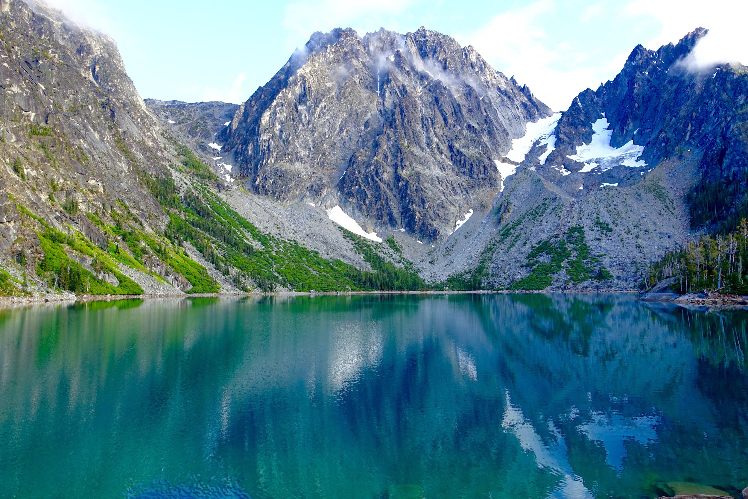
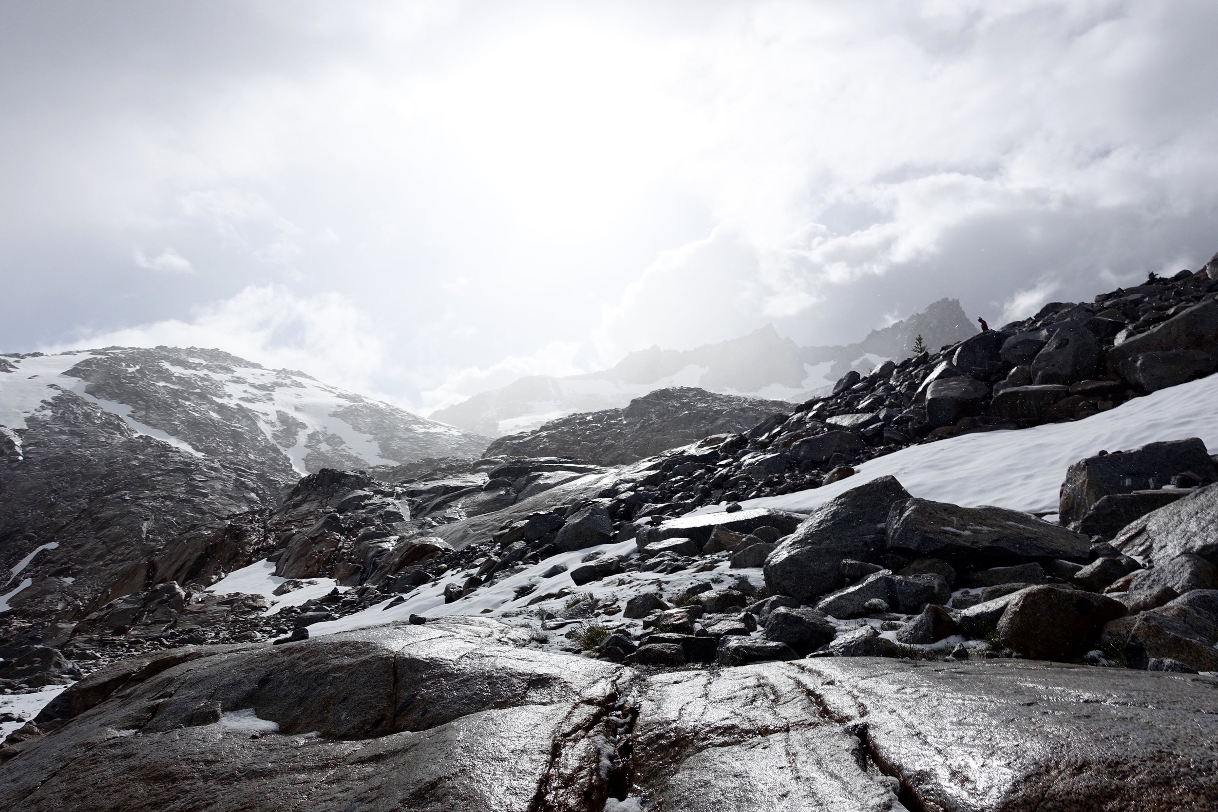
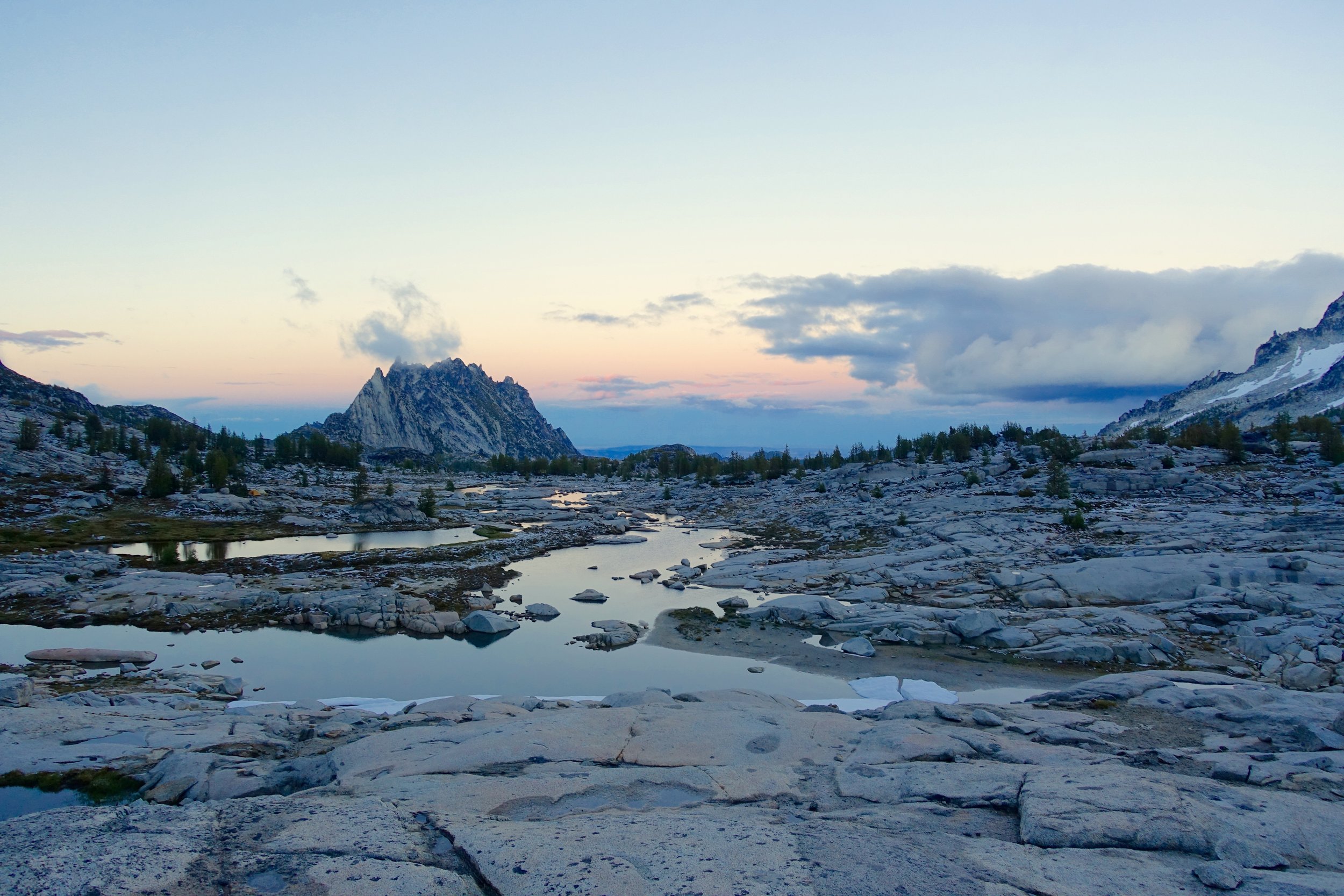
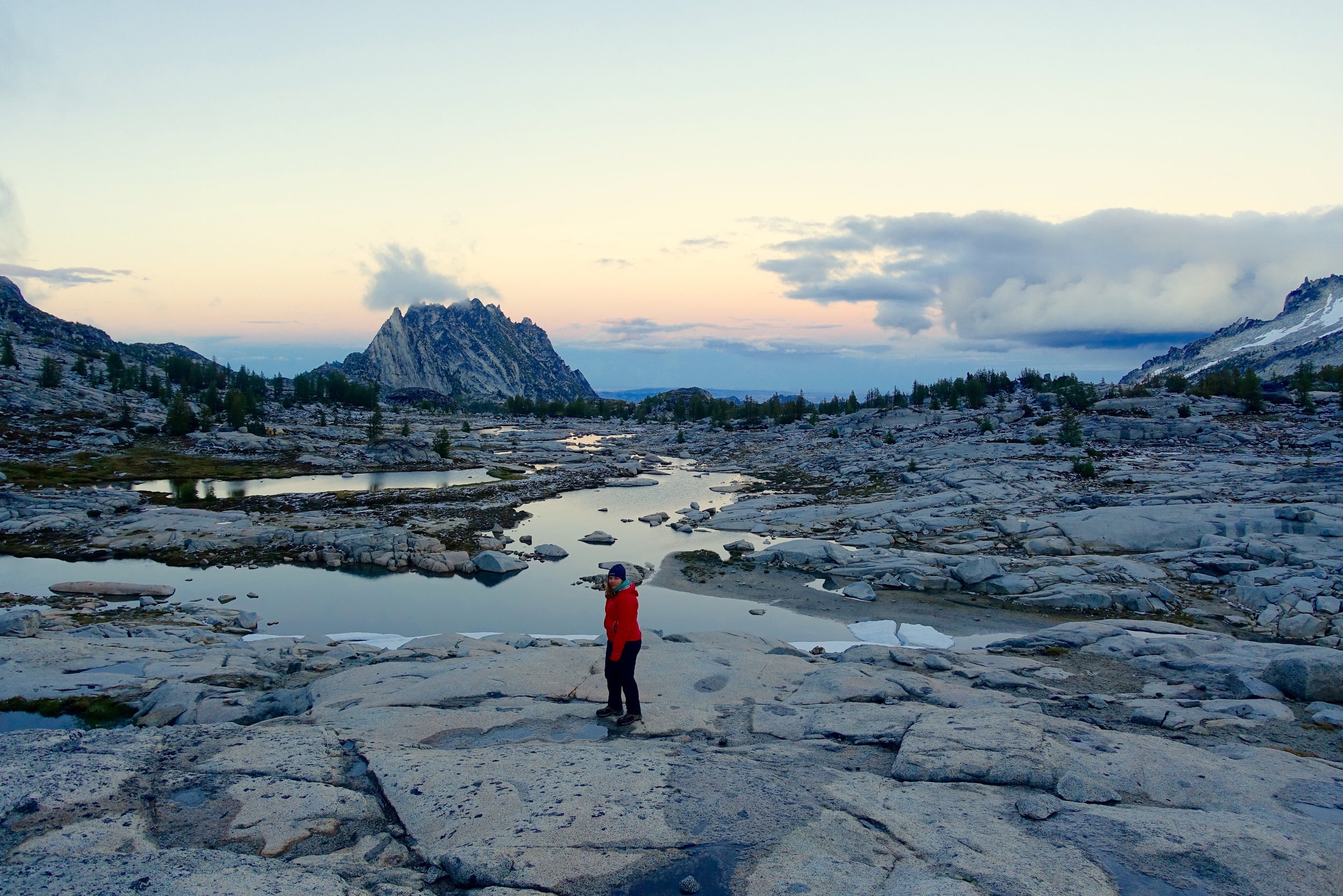
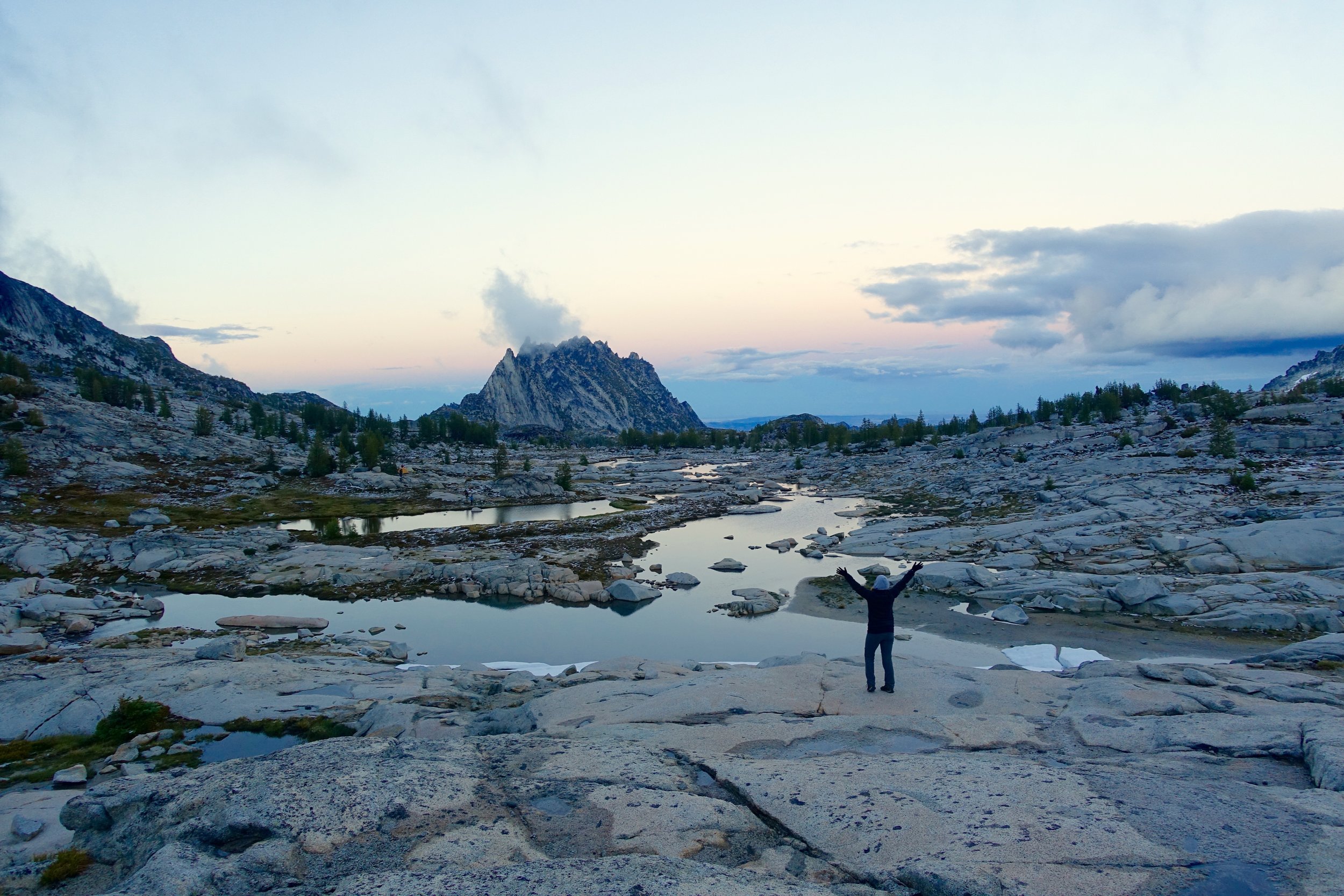
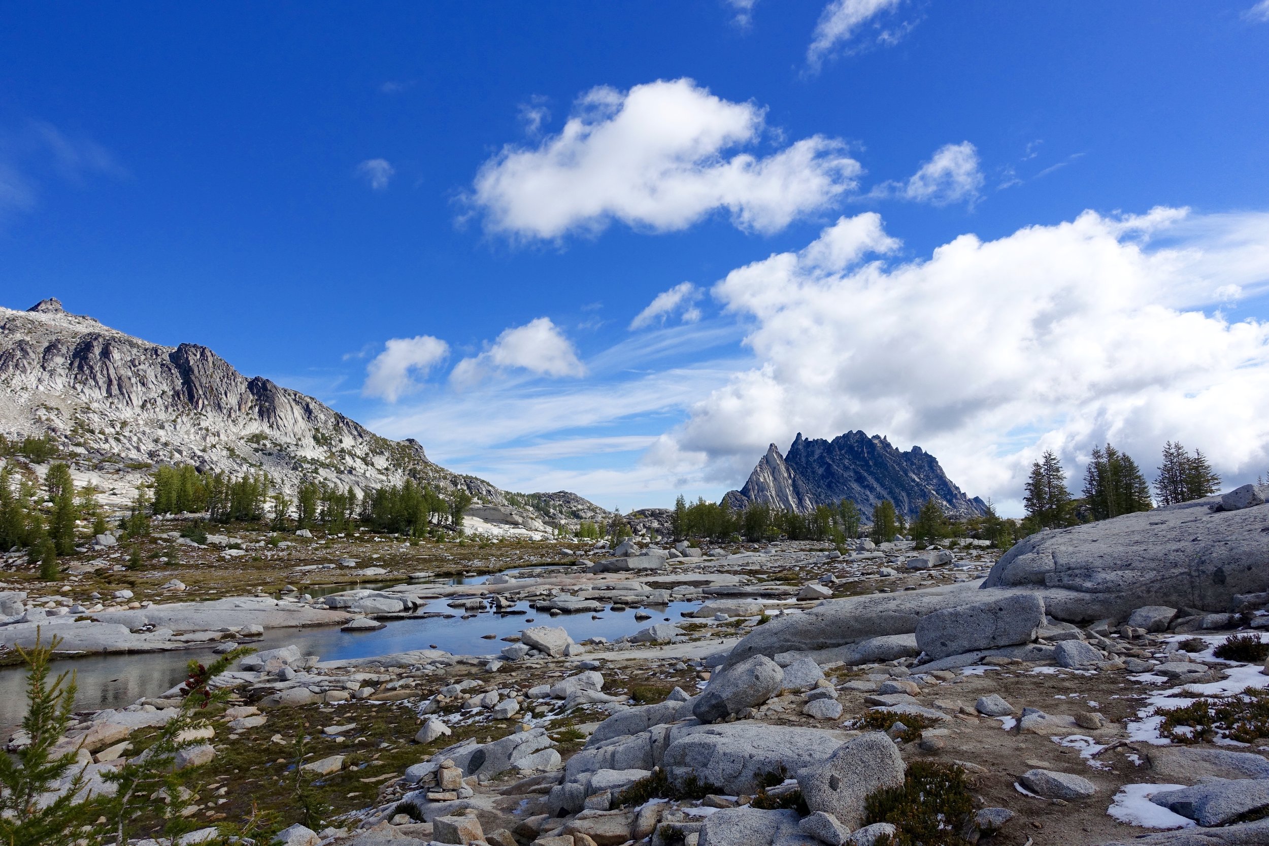
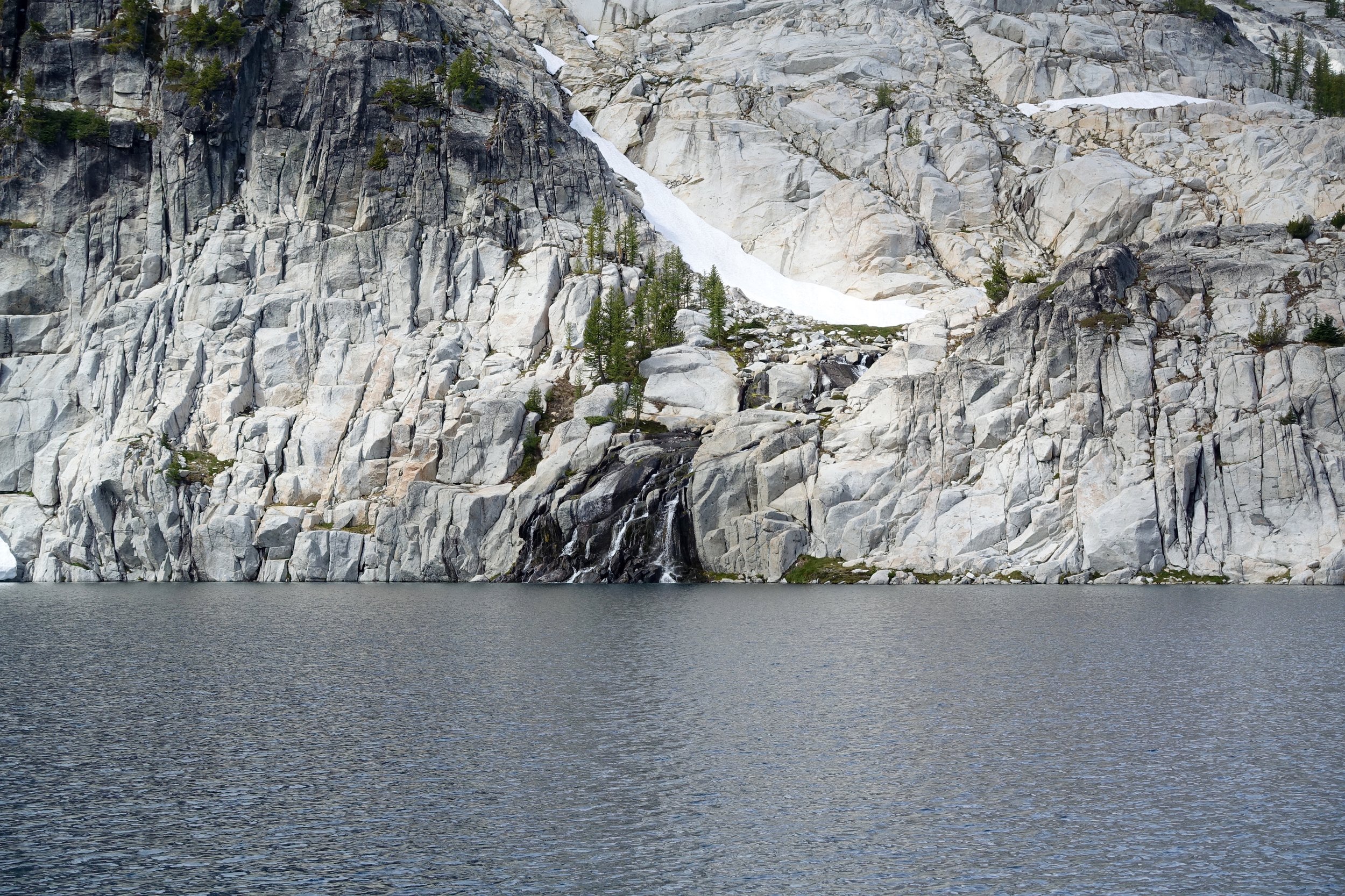
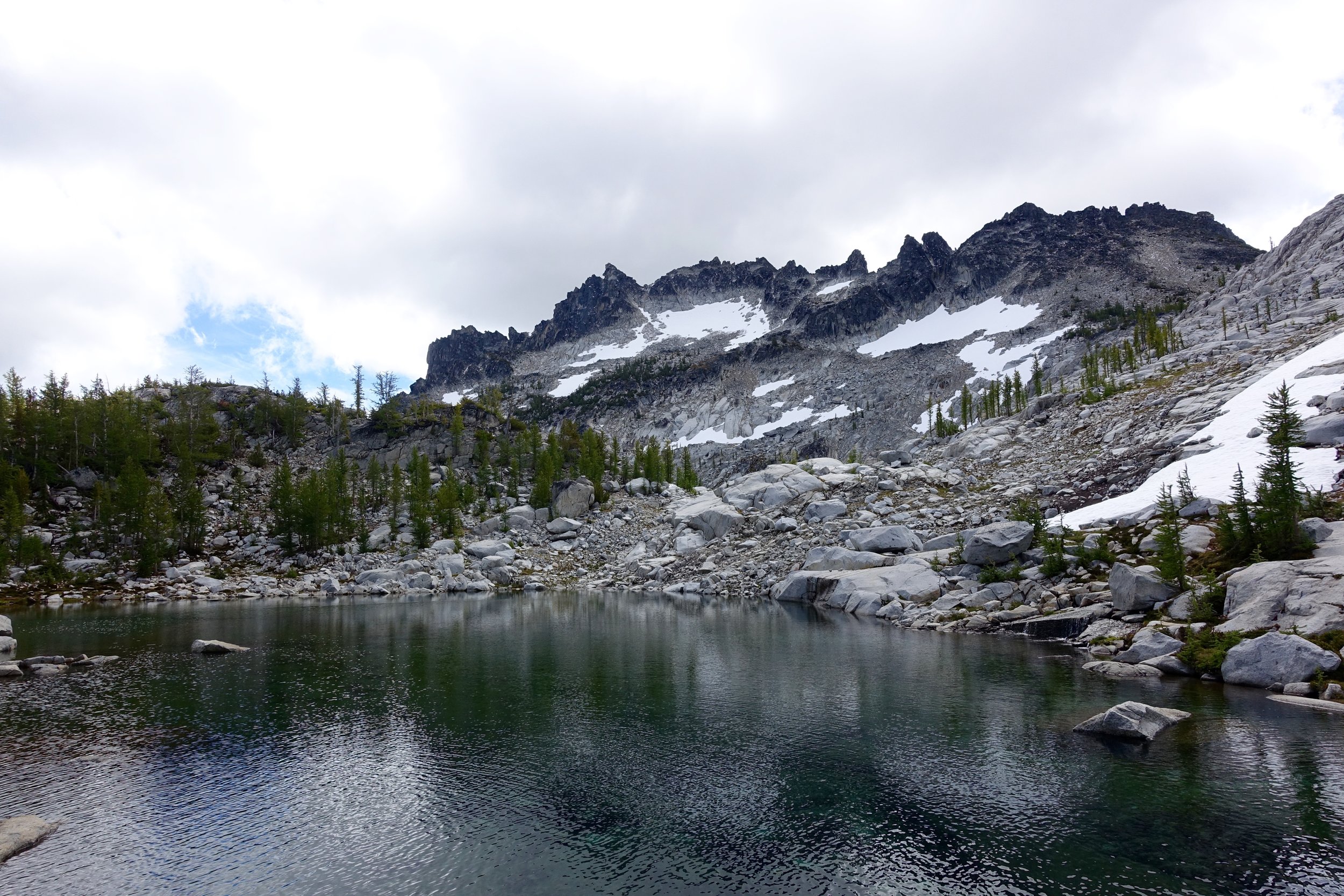
We got to the top and were in white out conditions. It took us about 3.5 hours to climb that 3/4 of a mile. The climb was hard but not as brutal as I thought it would be. It became a lot worse with the slippery snow at the end. When we got to the top our priority was finding and setting up camp to have safe shelter incase the weather got worse. The last the forecast said was 0% chance of any precipitation. The mountains do what they want though. We looked at the map and tried to find camp about .5 a mile in. We found an area that had enough space for us and was on a small lake. We would've loved to camp further in the core but this was the safest route of action with the weather.
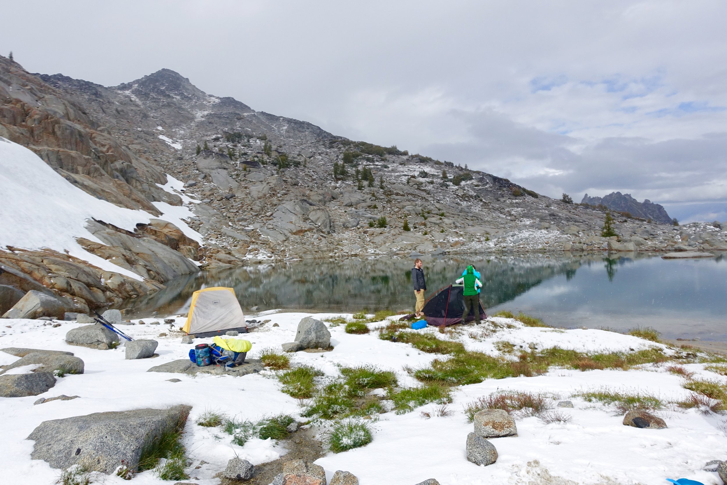
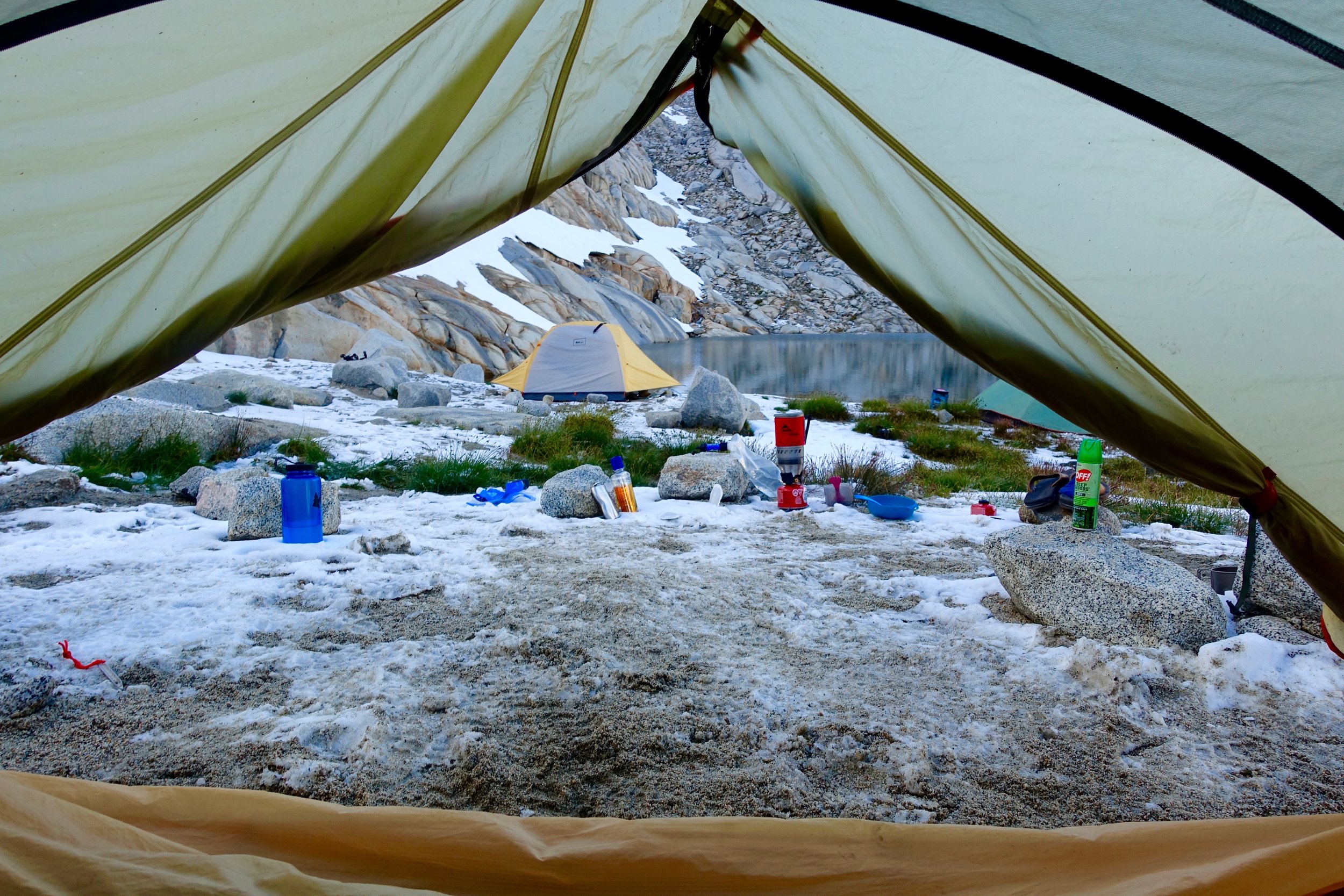
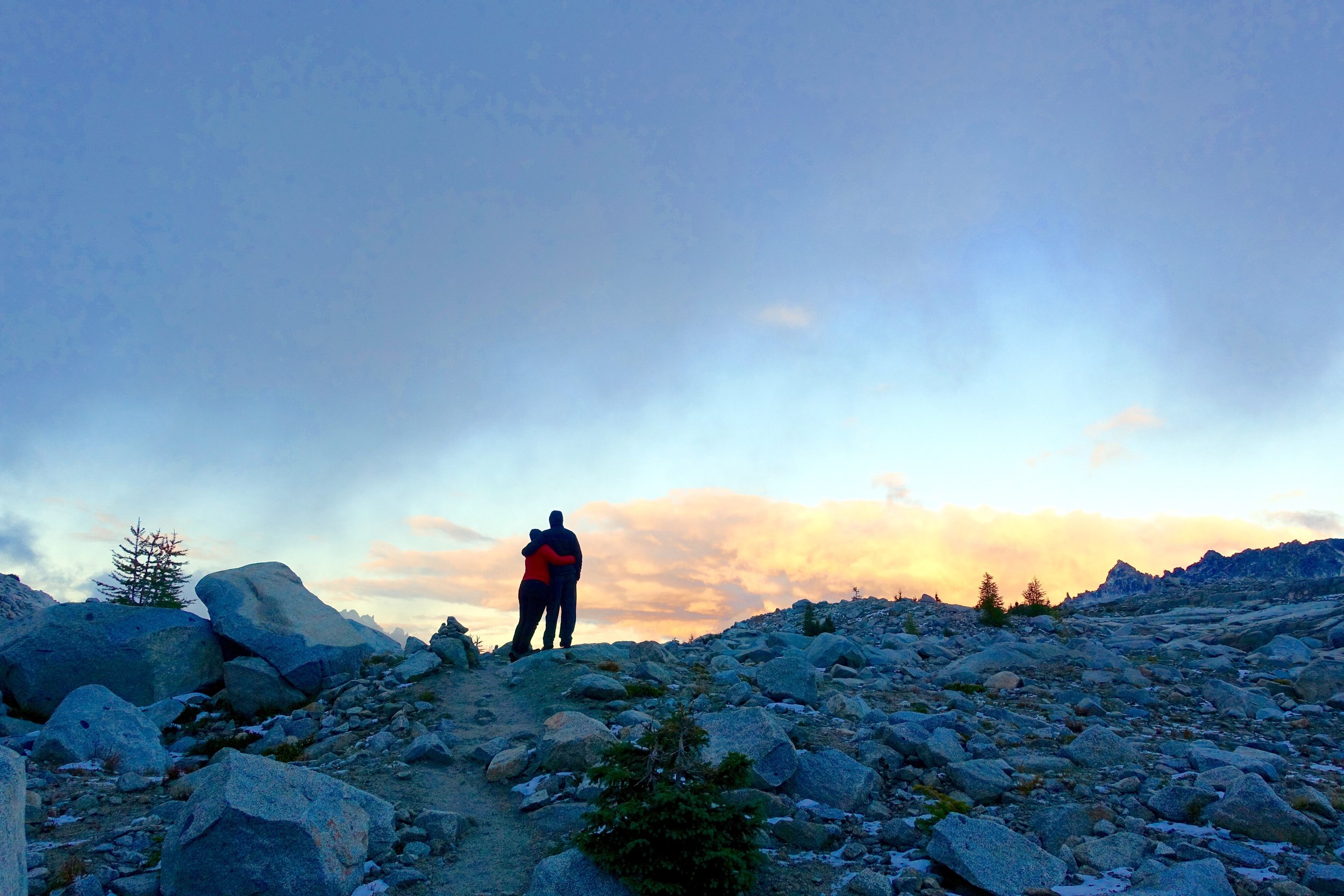
We all napped or rested in the tents for awhile after getting them up and to hide from the cold. We walked out later to catch the sunset over many little lakes. This was one of my favorite moments with how the lighting hit the water and the drama of the landscape around.
After that we walked back to camp, ate dinner quick and then we were all so cold we went in our tents by 8:30. By the way, hot toddies were a saving grace on this trip for staying warm at night with not being able to have fires. This night I donned 4 tops, 3 pants, and 2 socks. We also tried the water bottle trick that is boiling water and putting it in a Nalgene and sleeping with that. It did help warm us up a lot! The temperature had to be in the 20's that night. I woke up a few times shivering painfully.
Day 3:
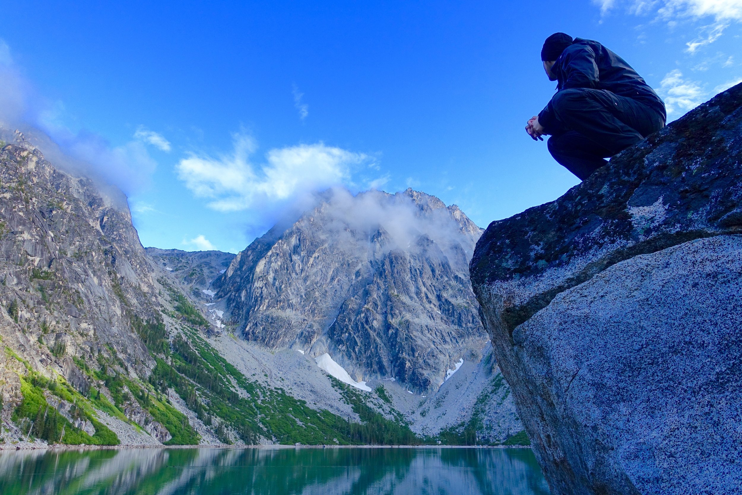
We awoke to beautiful sunshine this morning that warmed us up quickly. We made more egg burritos, coffee and slowly packed up and made our way down through the core.
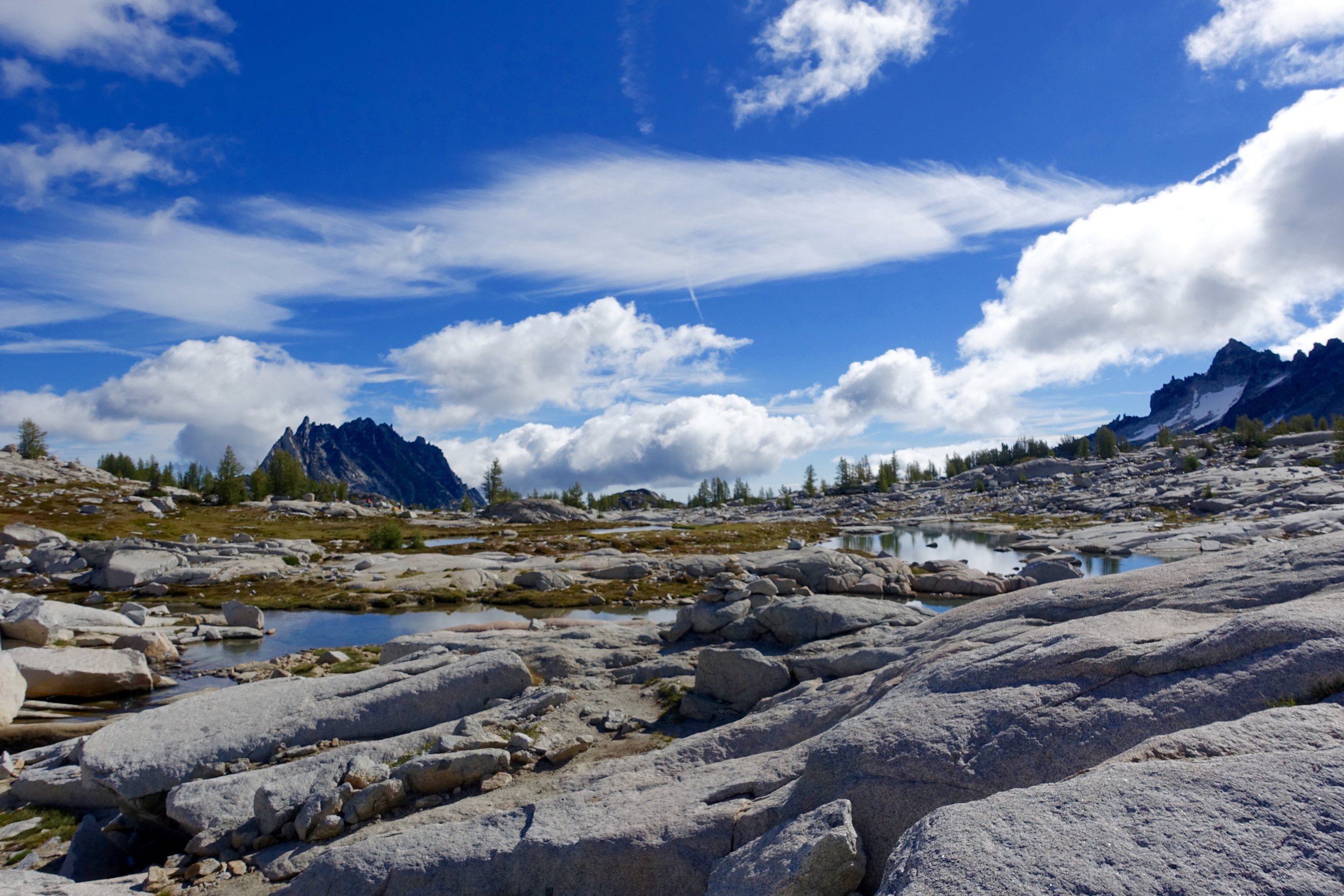
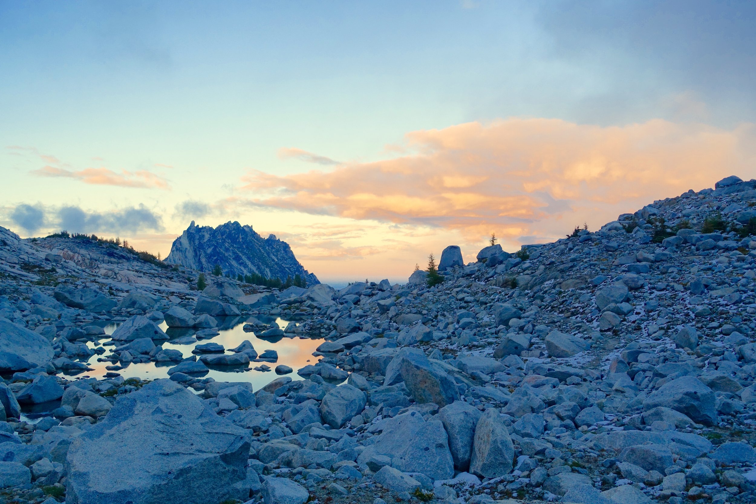
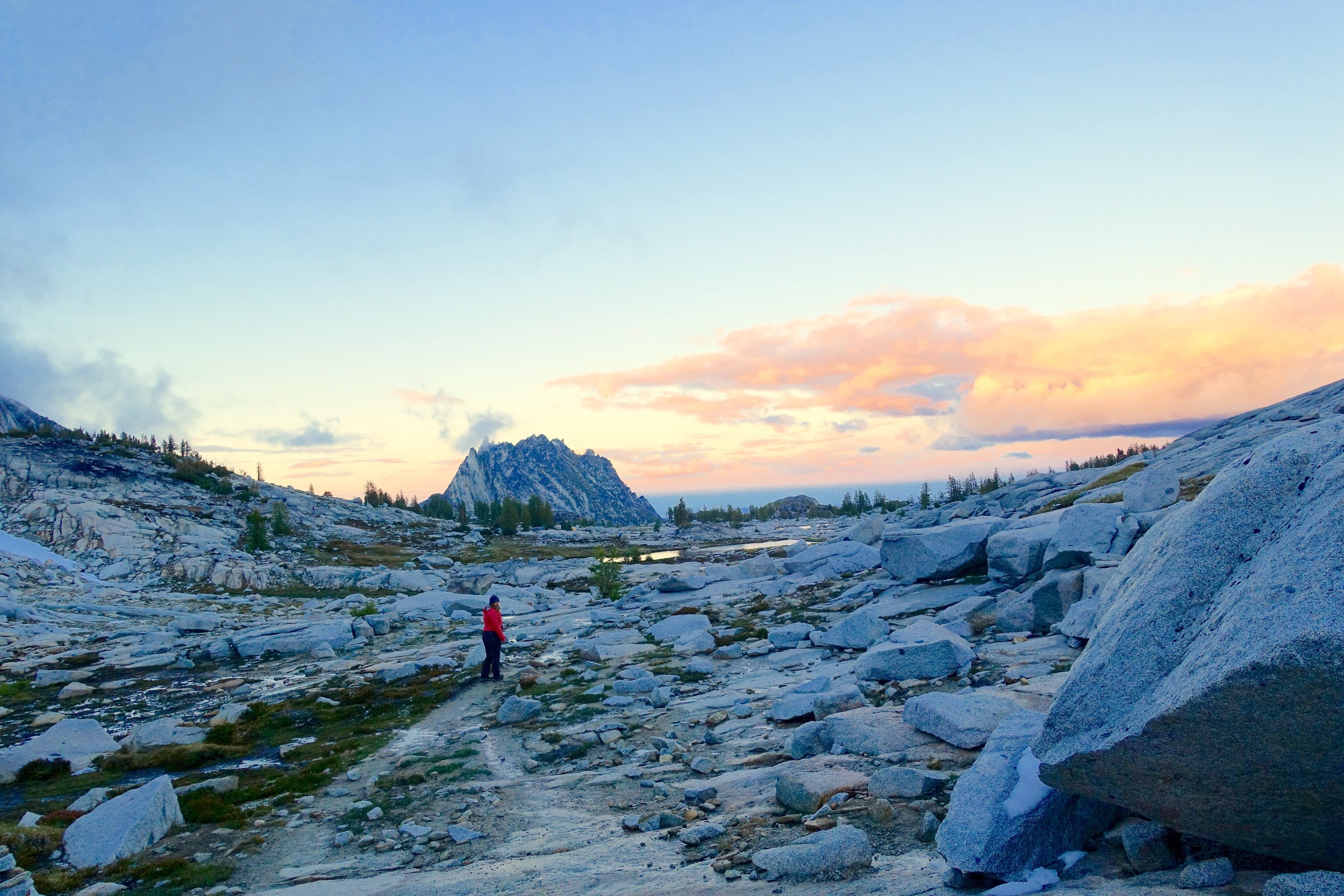
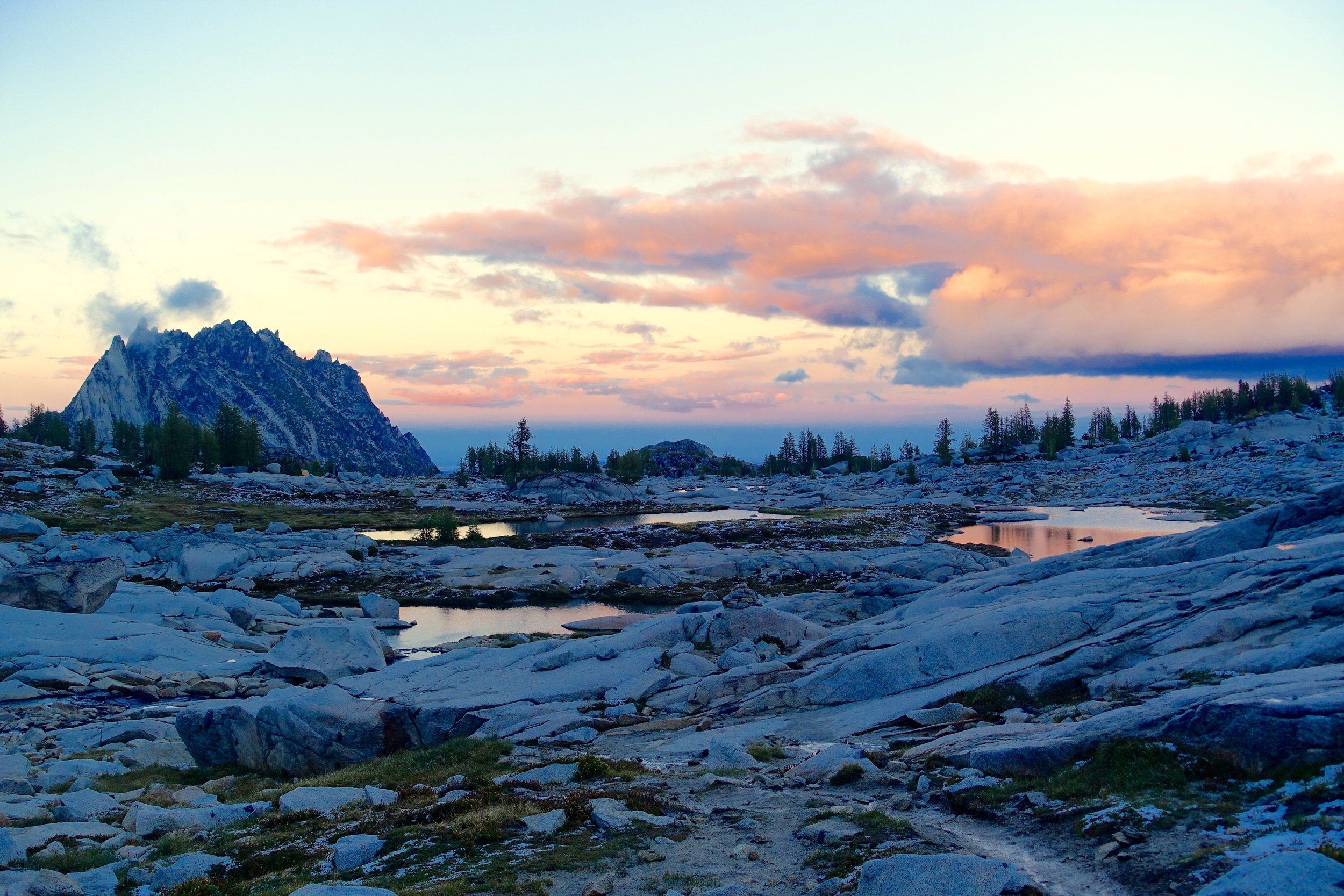
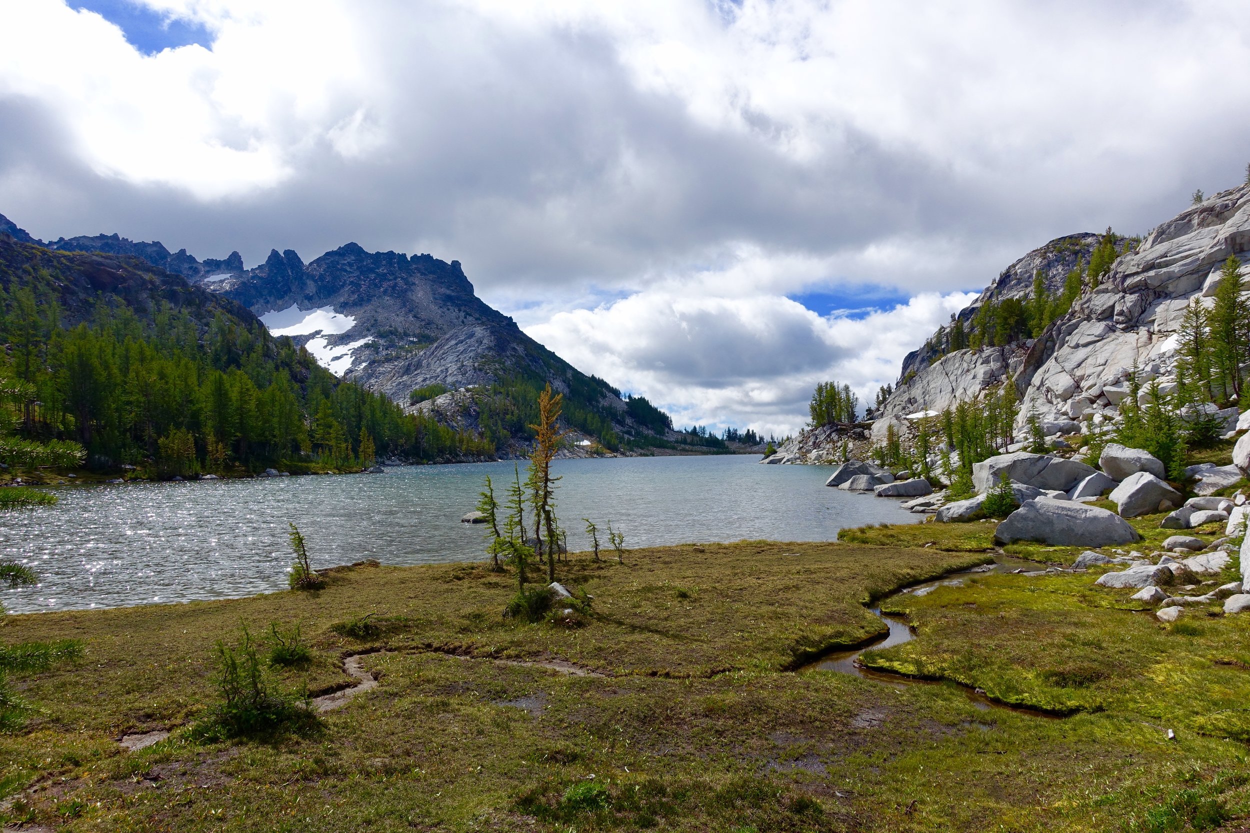
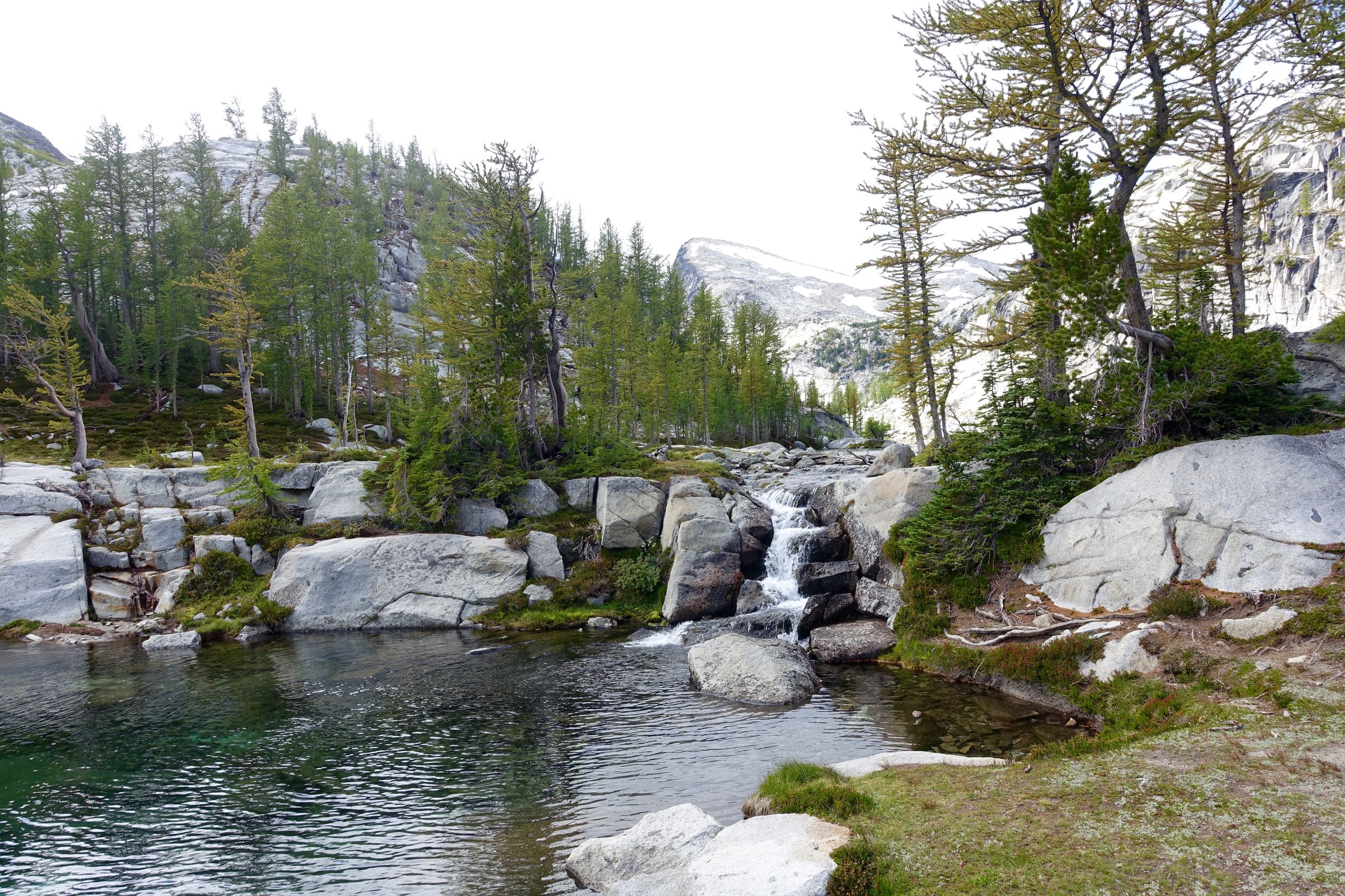
The good thing about going up Aasgards is that the whole rest of the trip is a decline. We came across our first big lake of the day, Crystal Lake.
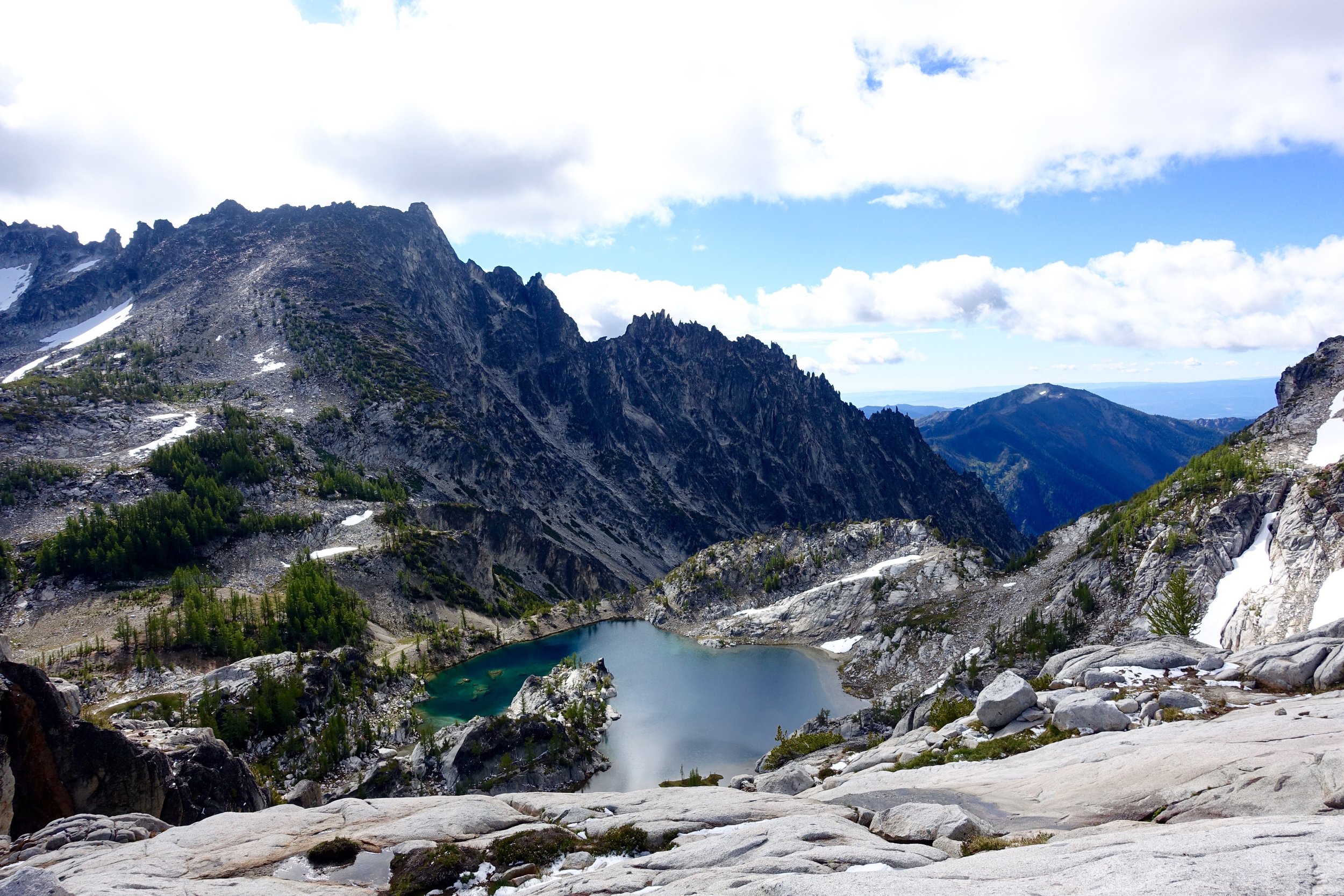
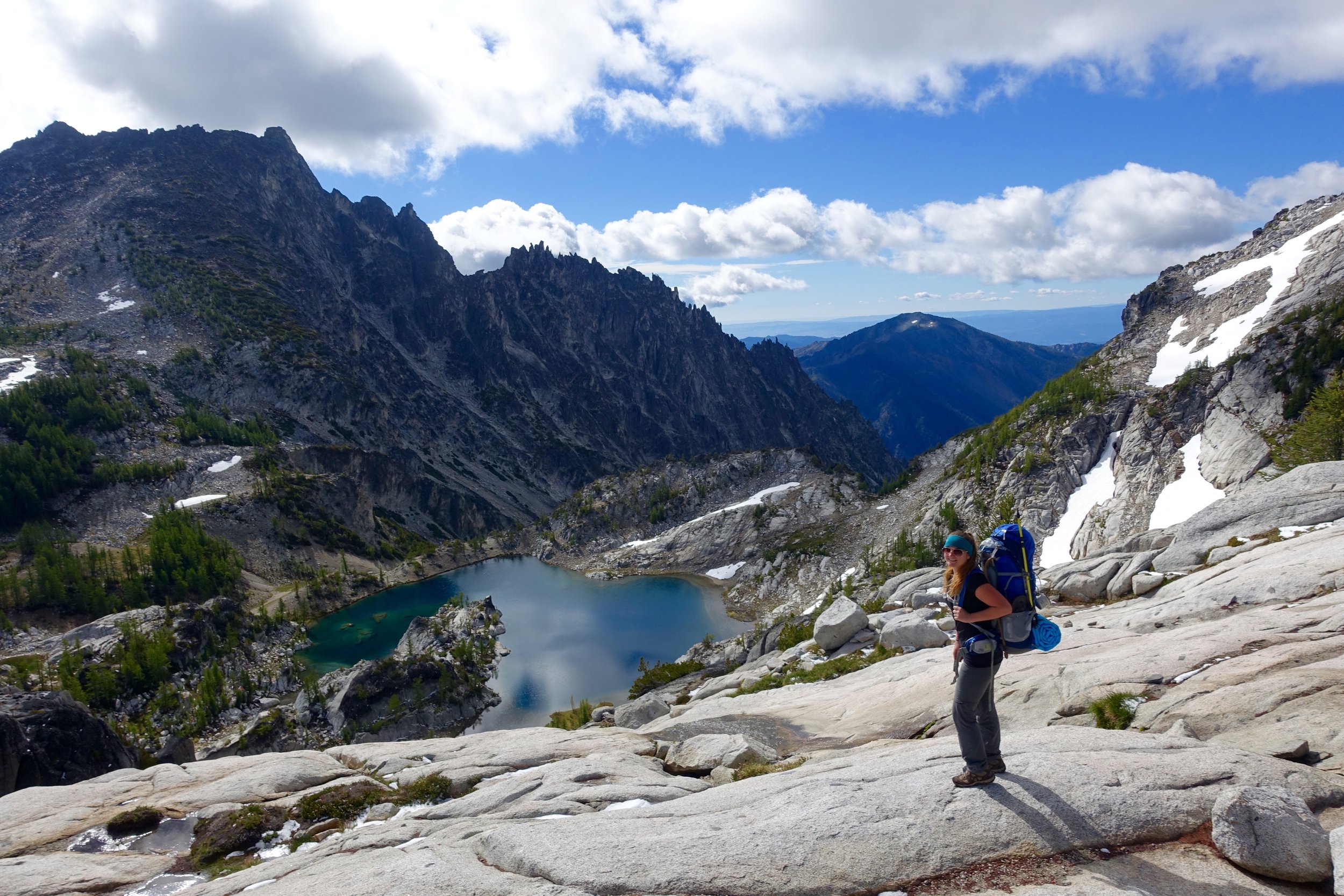
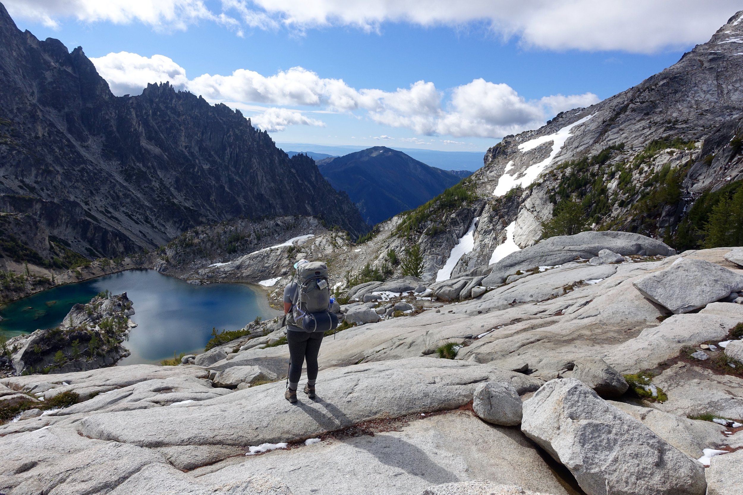
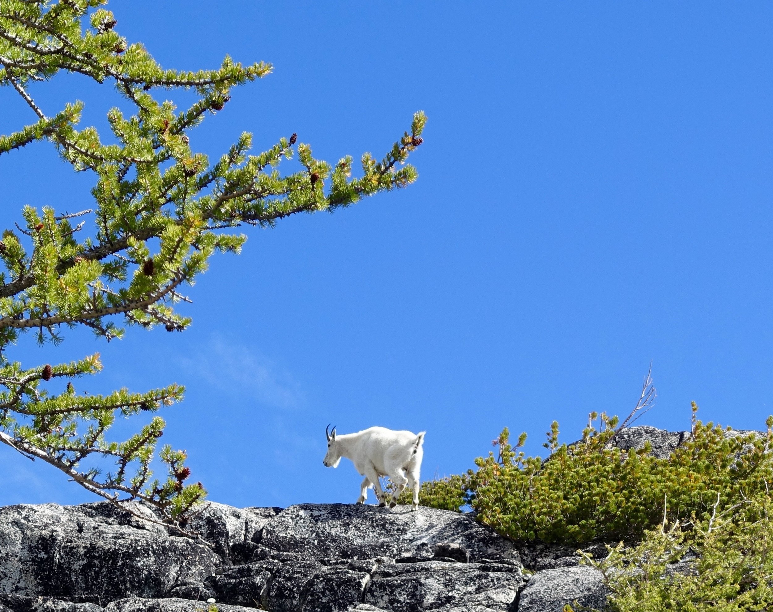
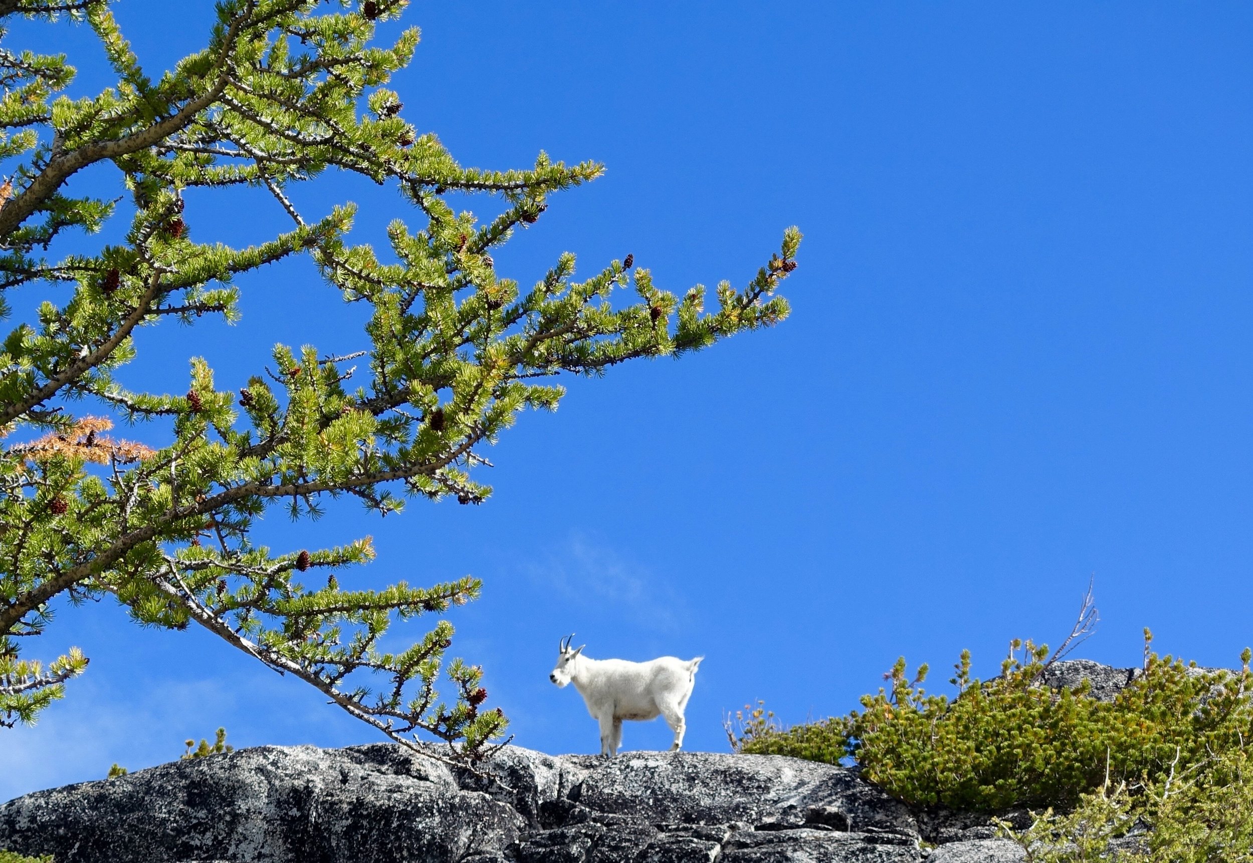
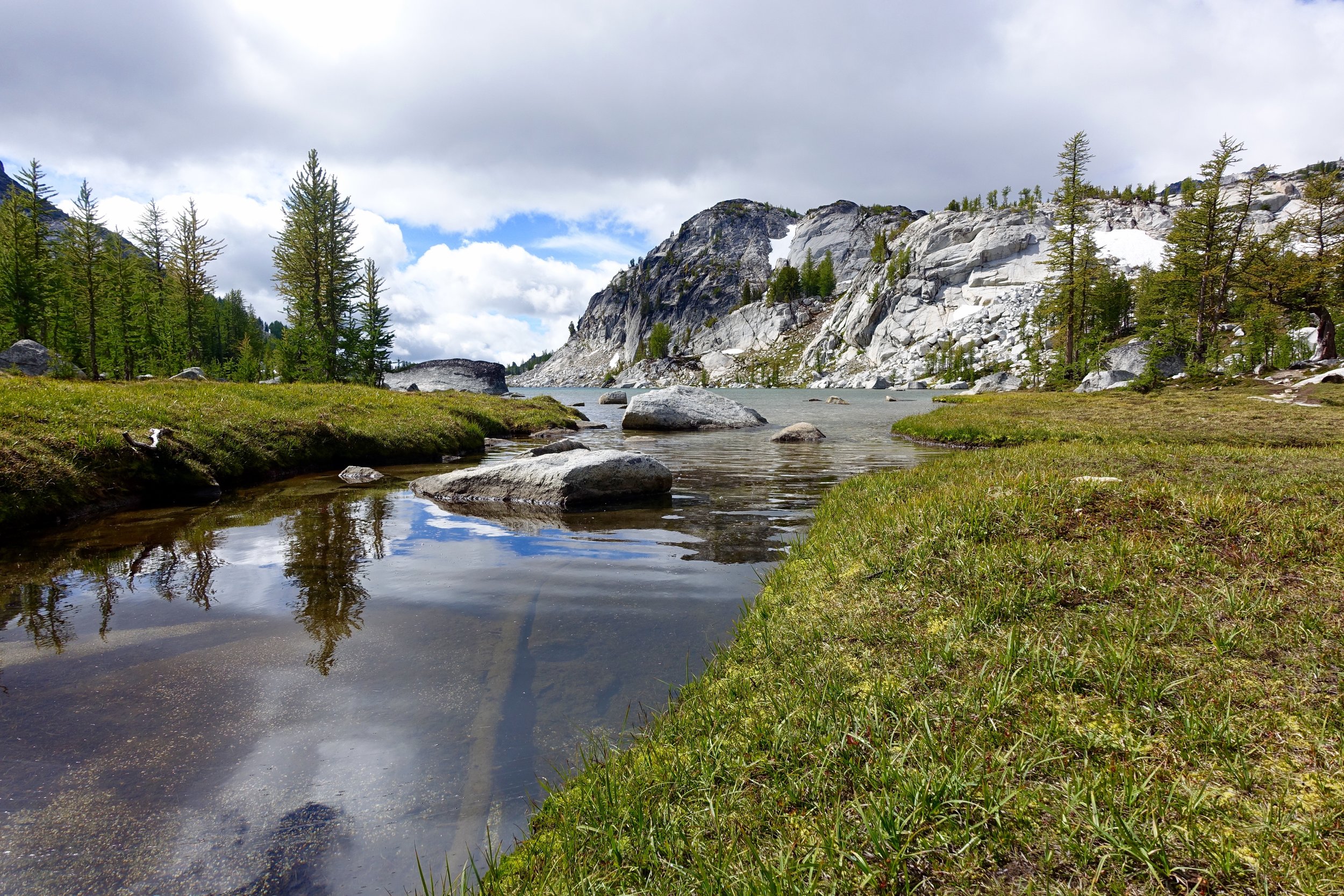
Next was Inspiration Lake, just around the corner from this lake is where we saw our first goat sighting!
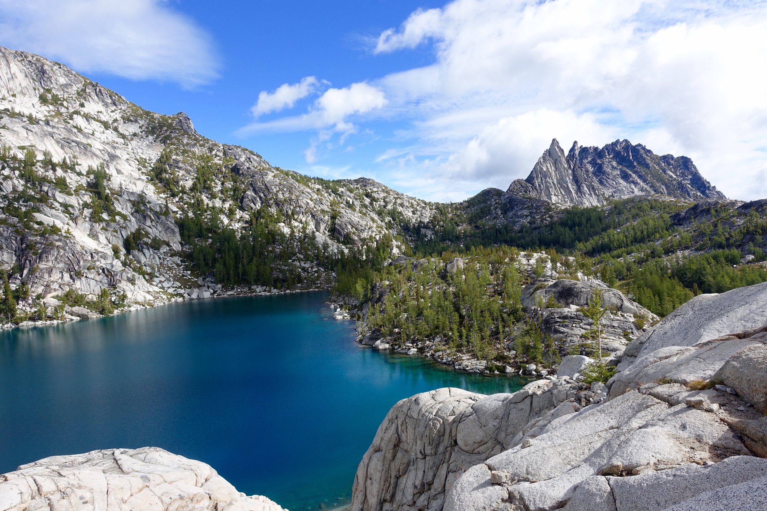
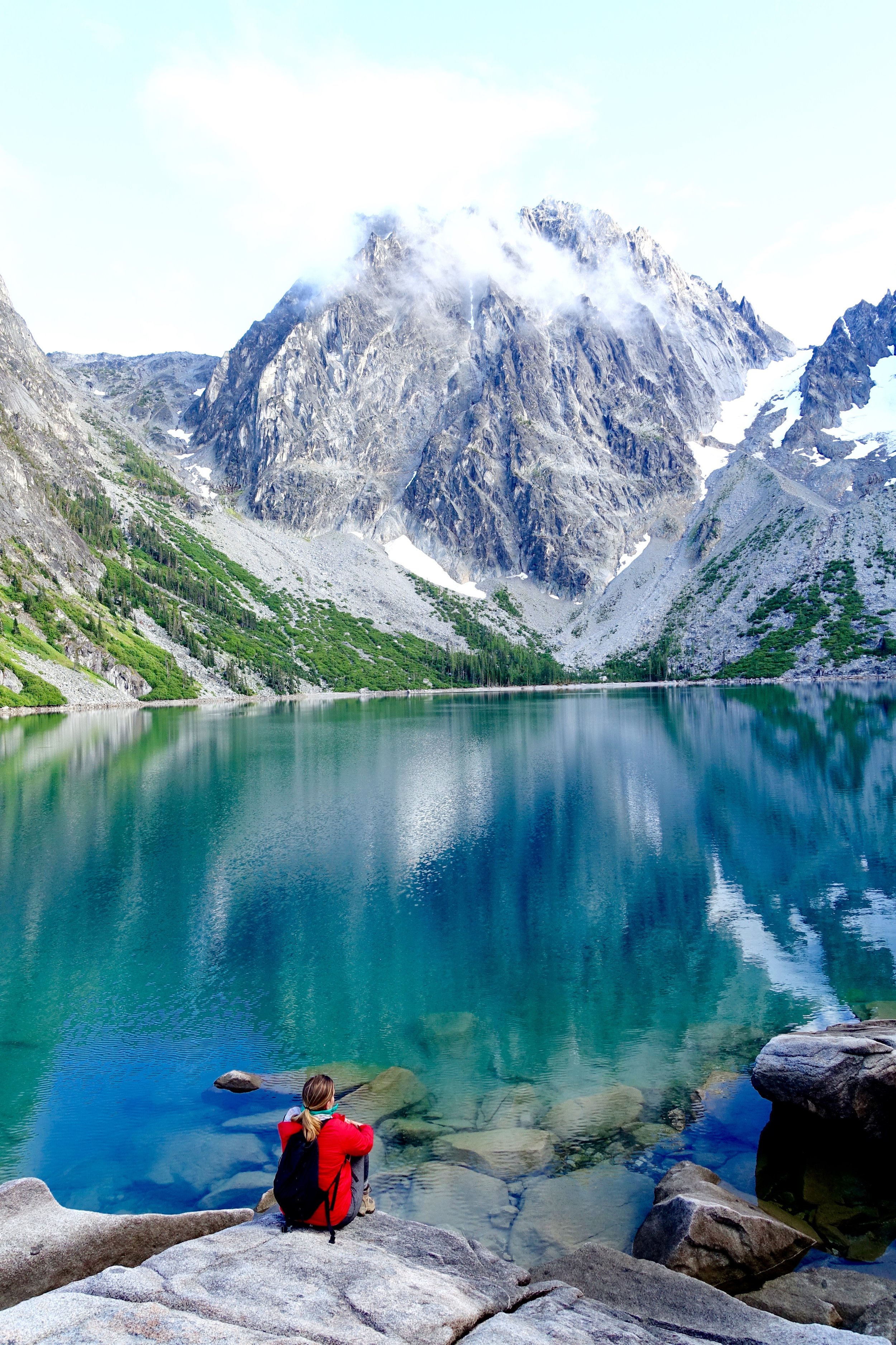
Next lake up was Perfection lake probably one of my favorites. I would love to come back and camp here, given the chance.
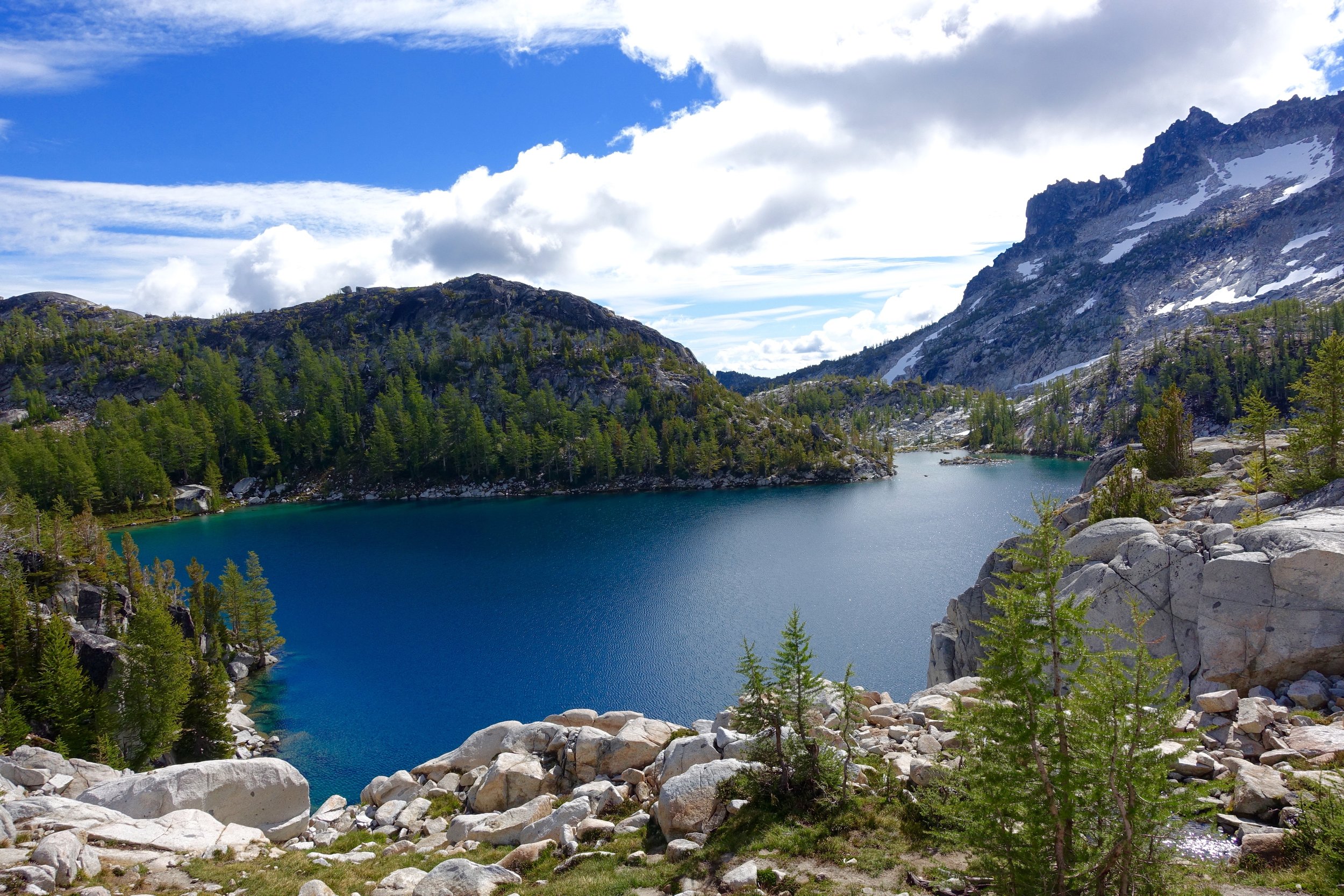
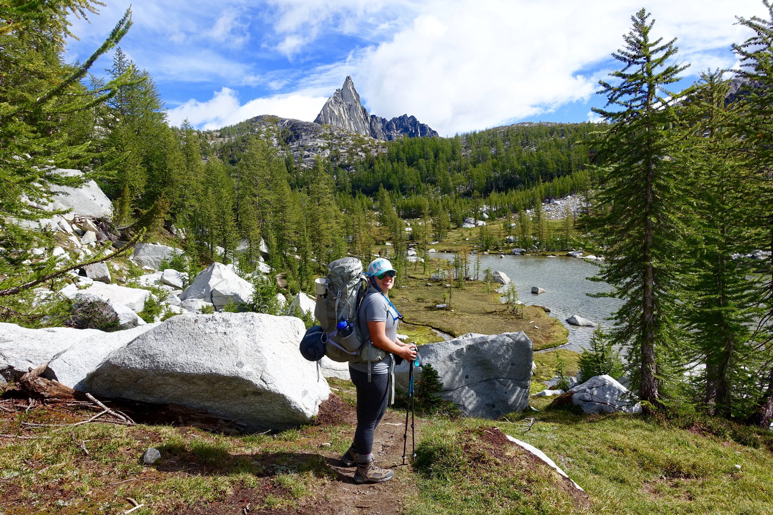
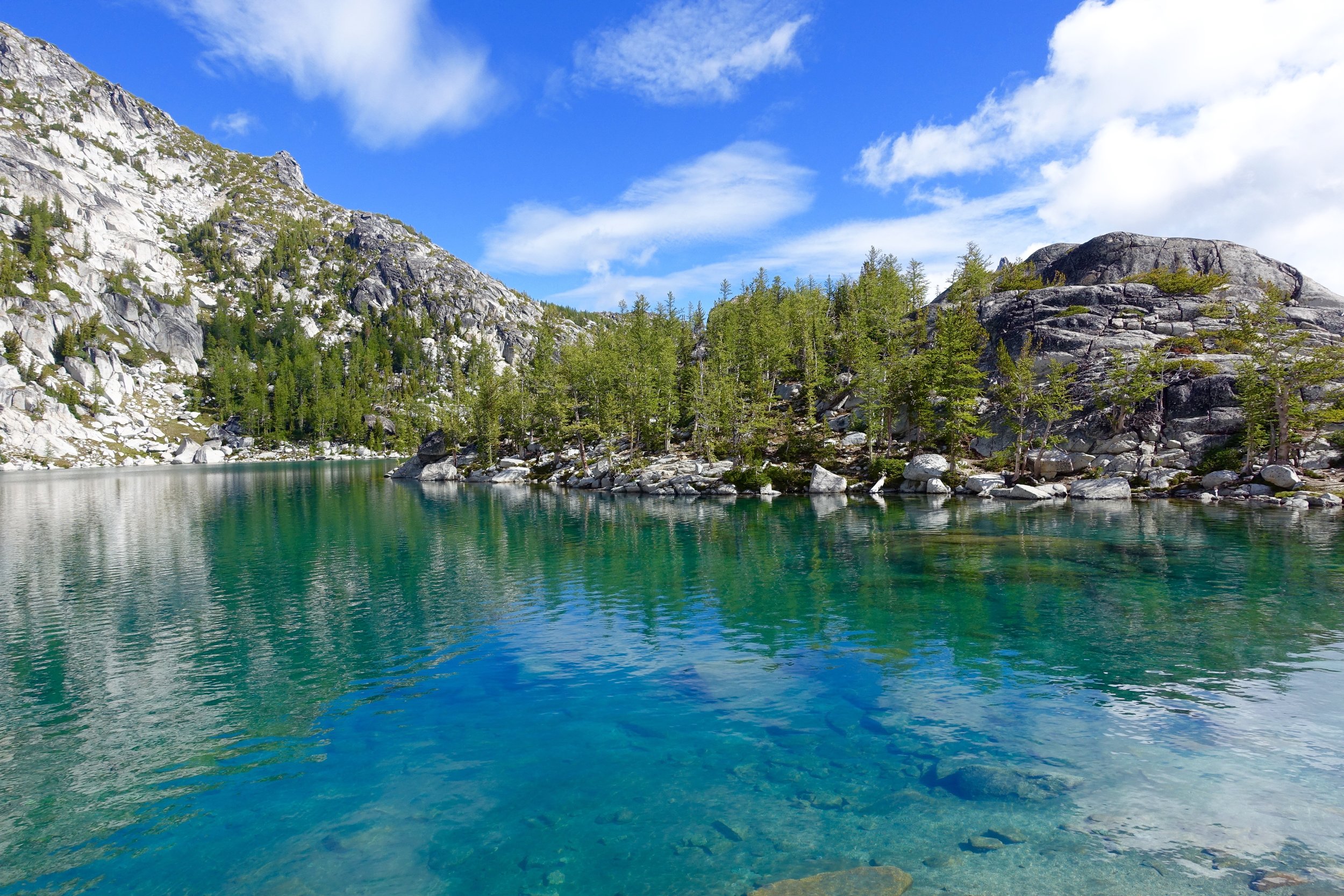
Next up, Sprite Lake. Refreshing? Maybe.
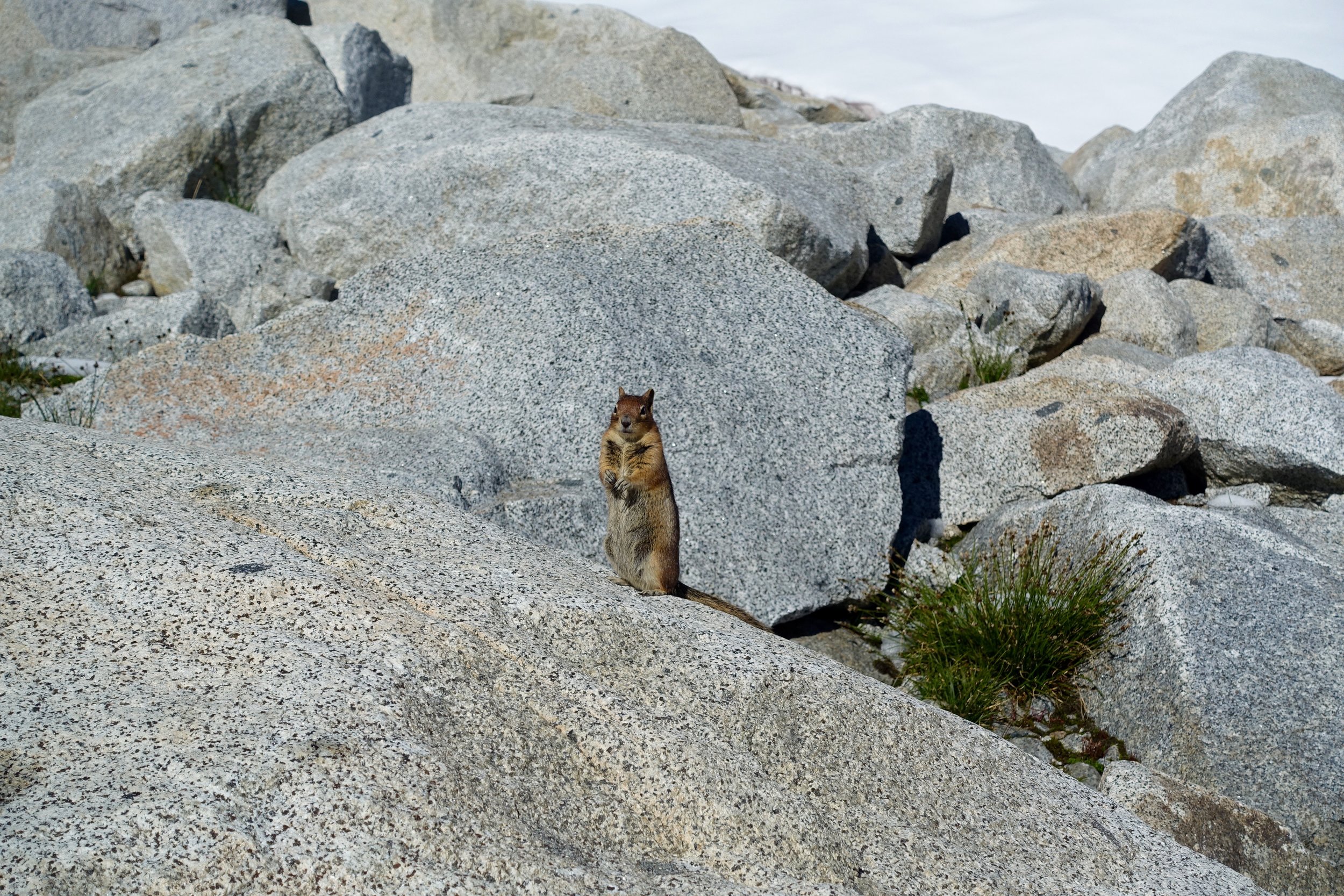
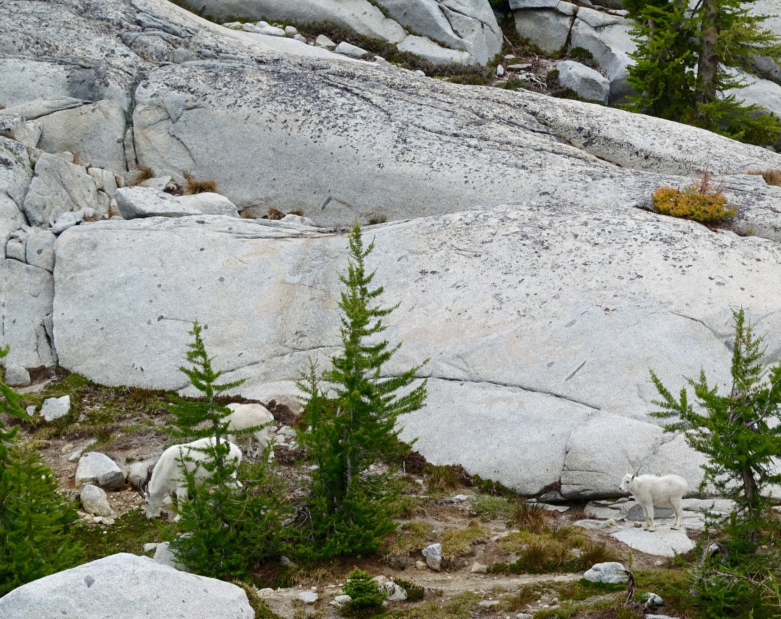
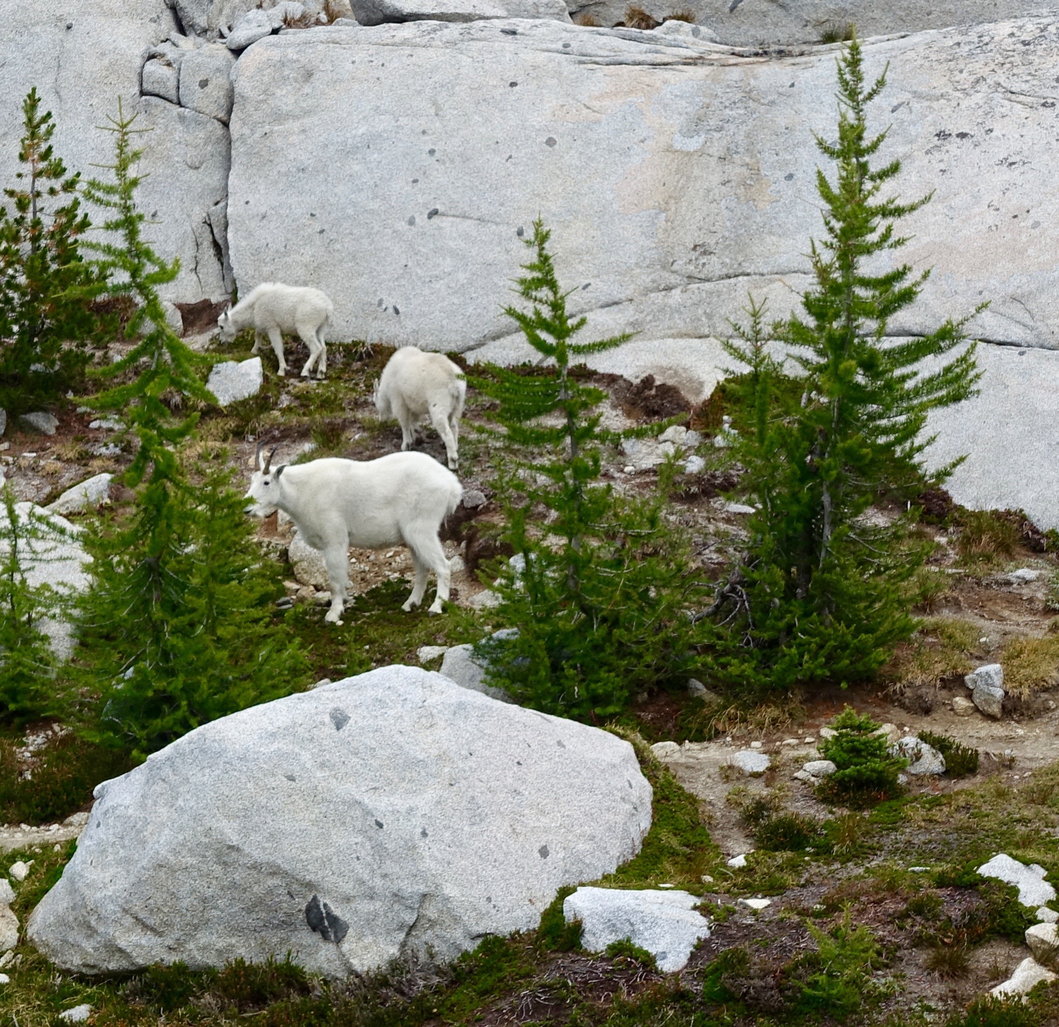
Our game plan was to check out the camping options around Leprechaun Lake and see if we wanted to stay there for the night. We really really wanted to stay in the core for another night, but Snow Lake, a lake out of the core but with campsites, would still be 9 miles out for the last day. So we looked around a bit and the group decided it was best to camp at Snow Lakes for the night to not have a crazy long last day. We did stop at Leprechaun Lake for lunch and to relax a bit. While eating lunch we spotted a mama goat and 2 kids across the island thing we were on. Cody and I went a little closer to get some pictures but were still a good distance away. We were shooting away and the mom eventually noticed us and must've gotten annoyed and ran towards us very fast. We ran back to the rest of the group quickly but the goat was now on our side of the island and creeping closer with the kids. We were terrified for a brief moment being cornered in by this mama goat, that could get aggressive. We yelled at it to stay away with bear spray in hand (just in case). It stayed on our side of the island for a long time just eating and watching us. When we were ready to go another mama goat and a kid came to our island so now we had 5 goats blocking us in on this island. We yelled for them to move and they eventually did and we booked it out of there. Goats can be really cute but they are still a wild animal that needs space. Any animal with babies I am way more precocious of as well.
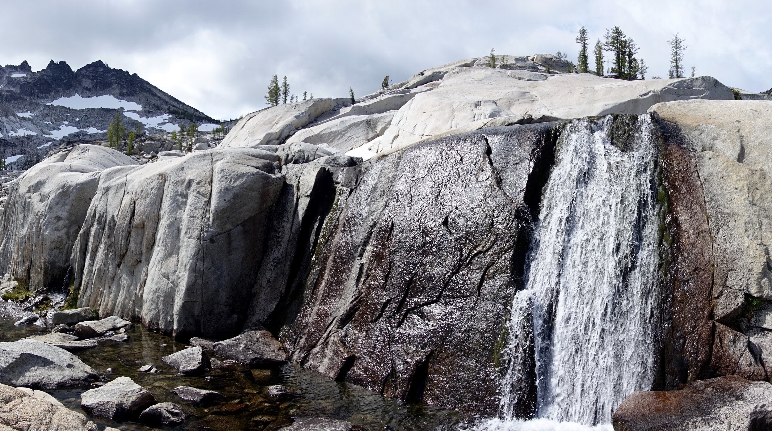
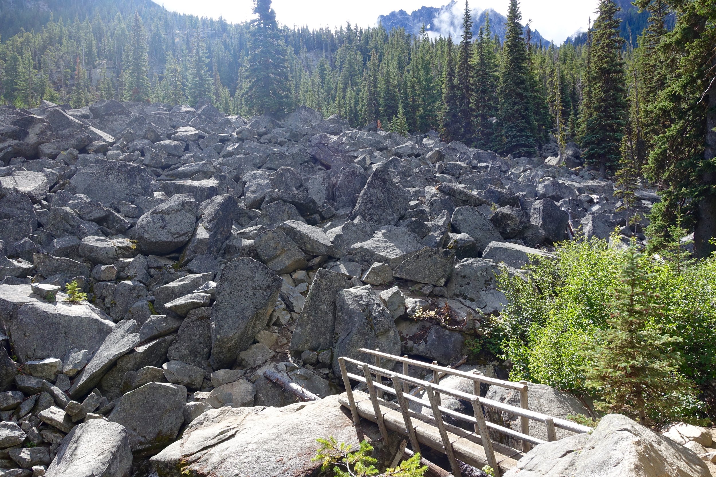
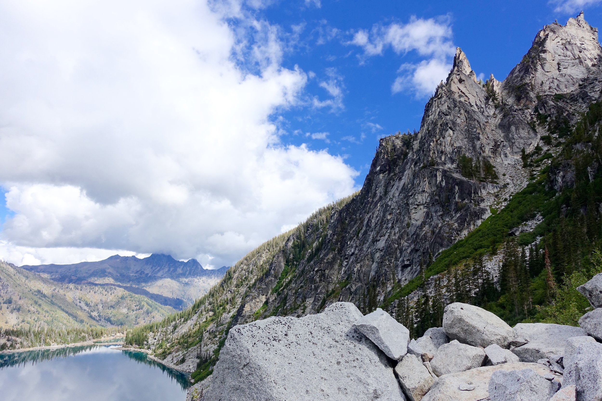
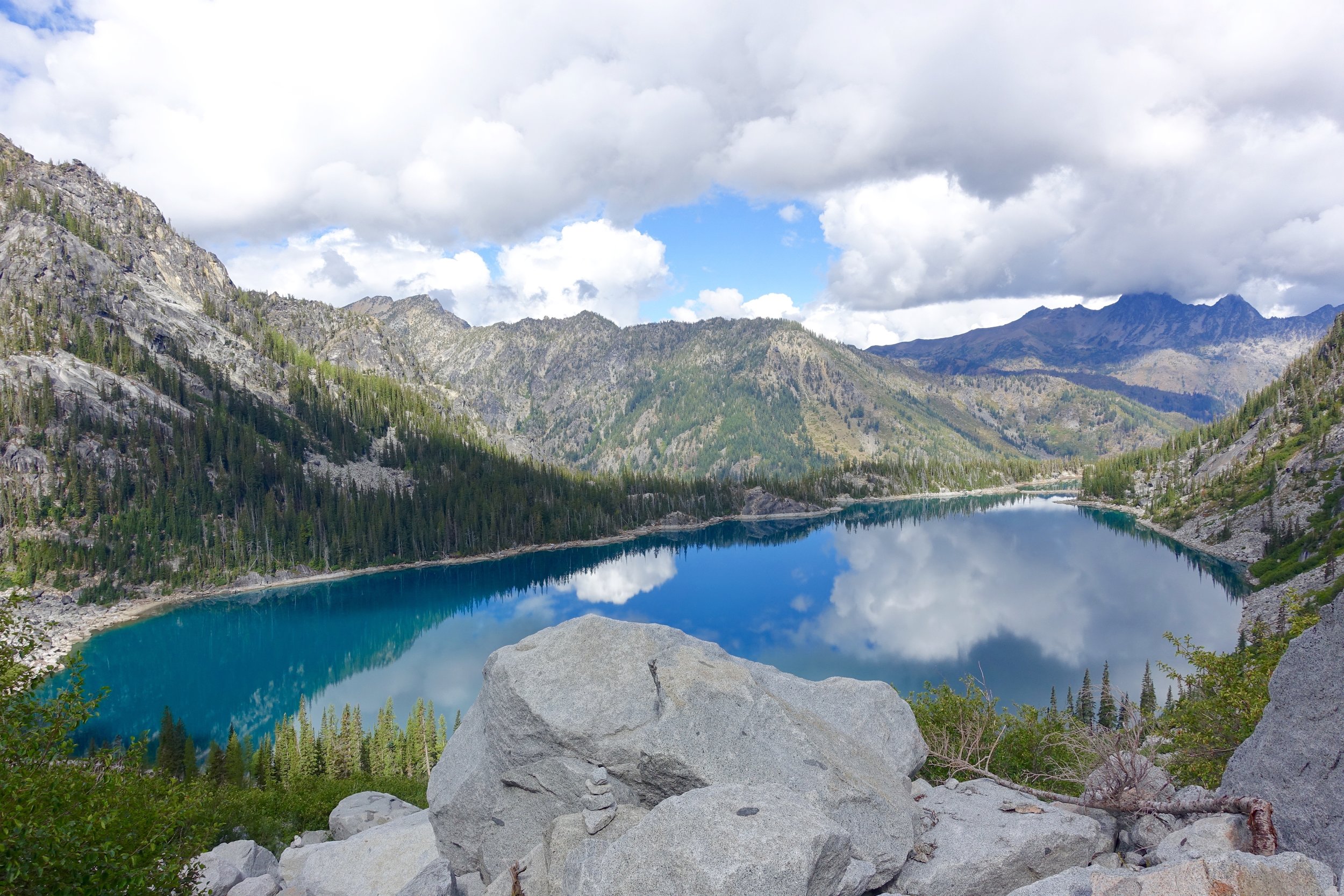
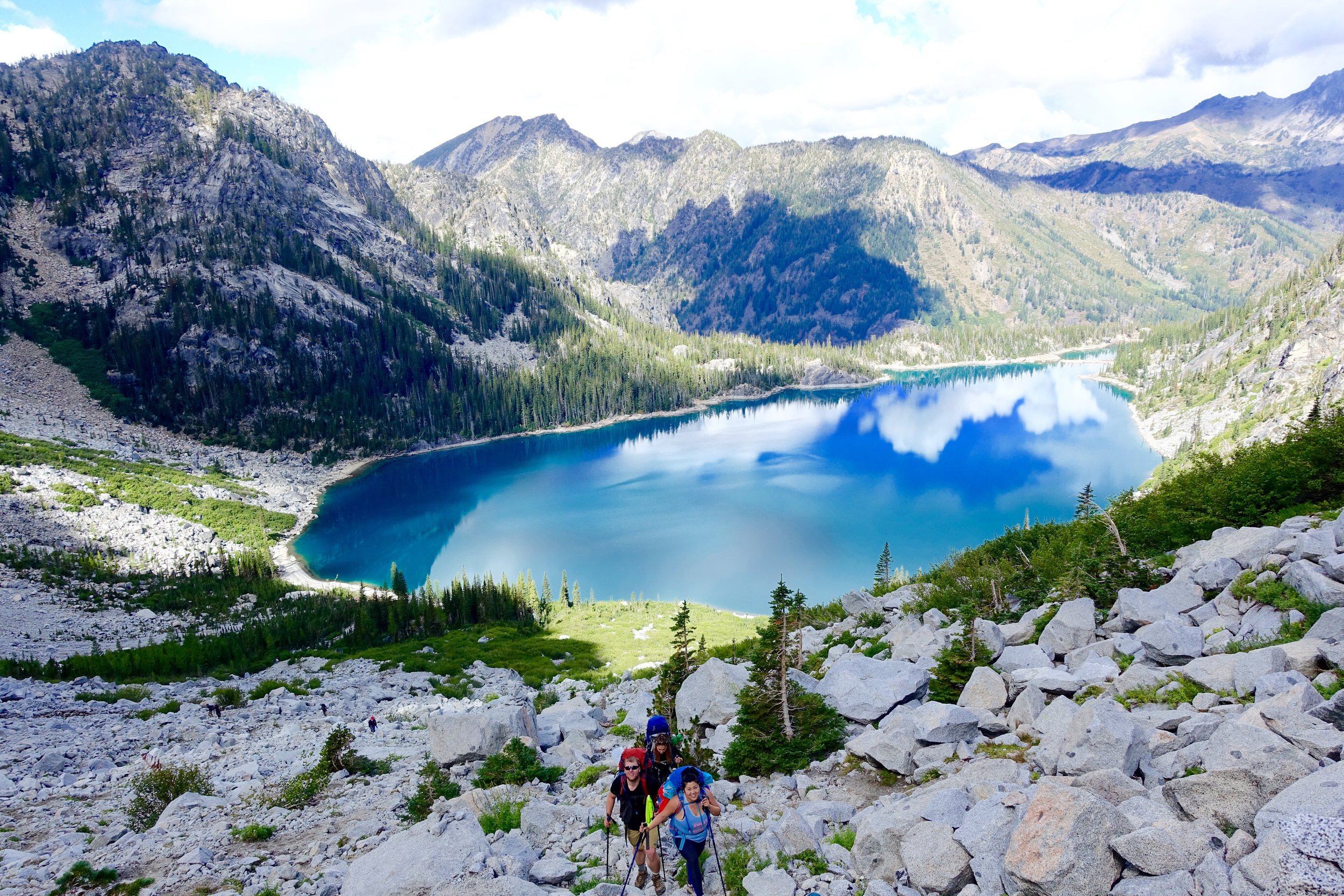
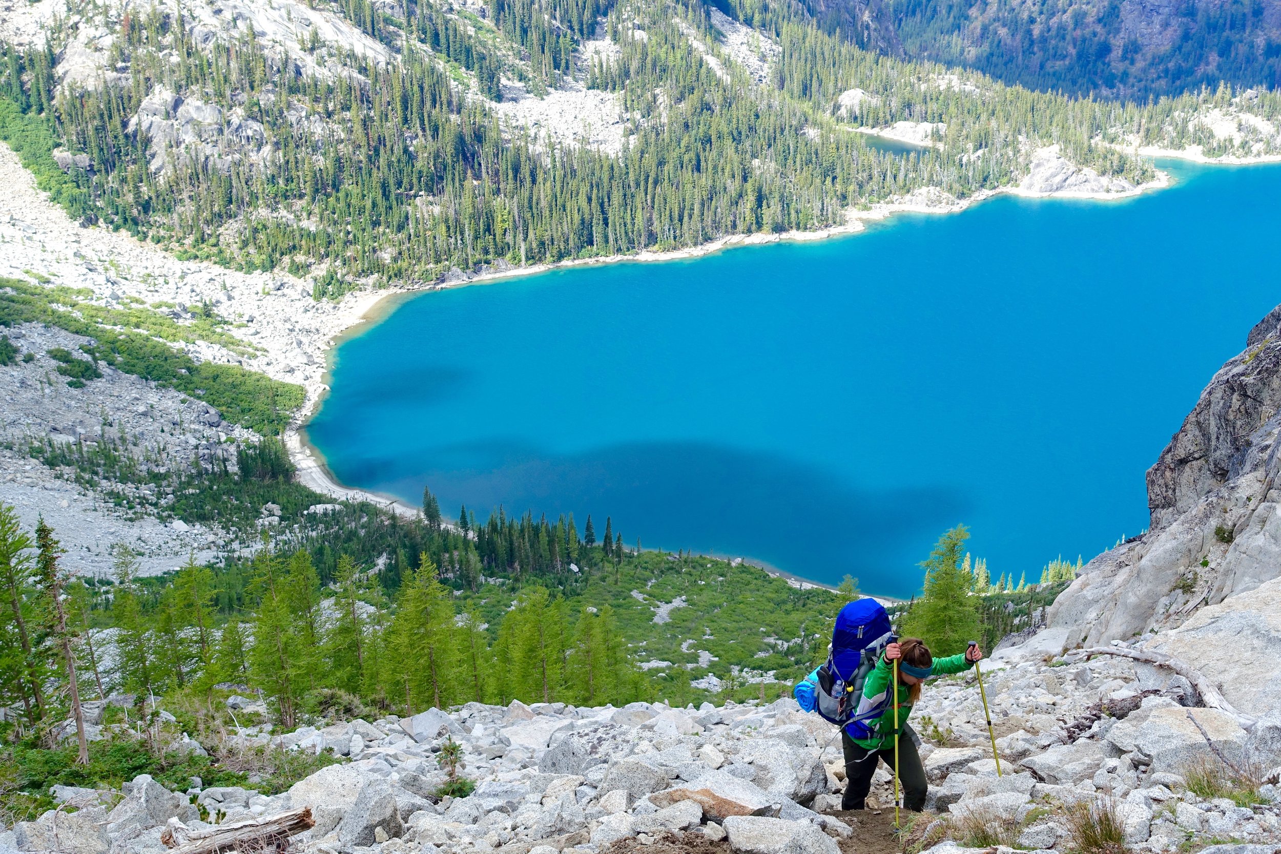
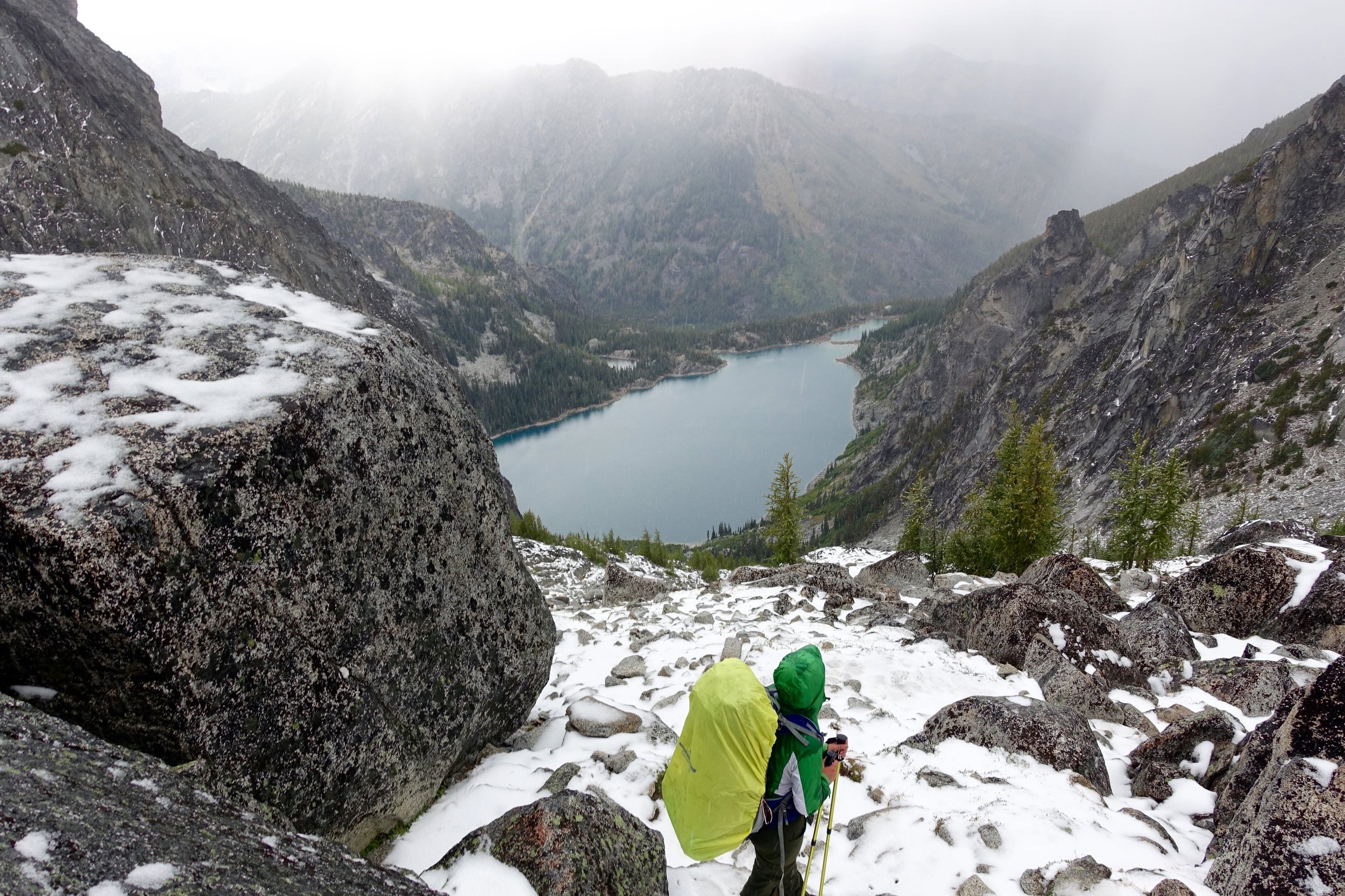
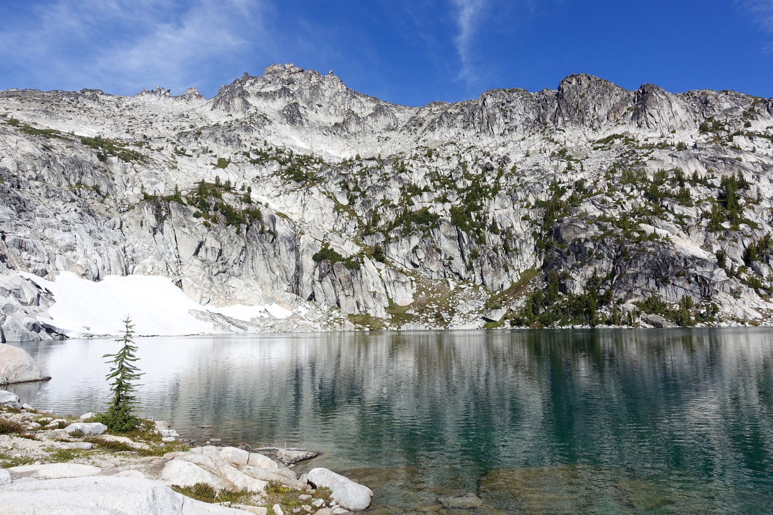
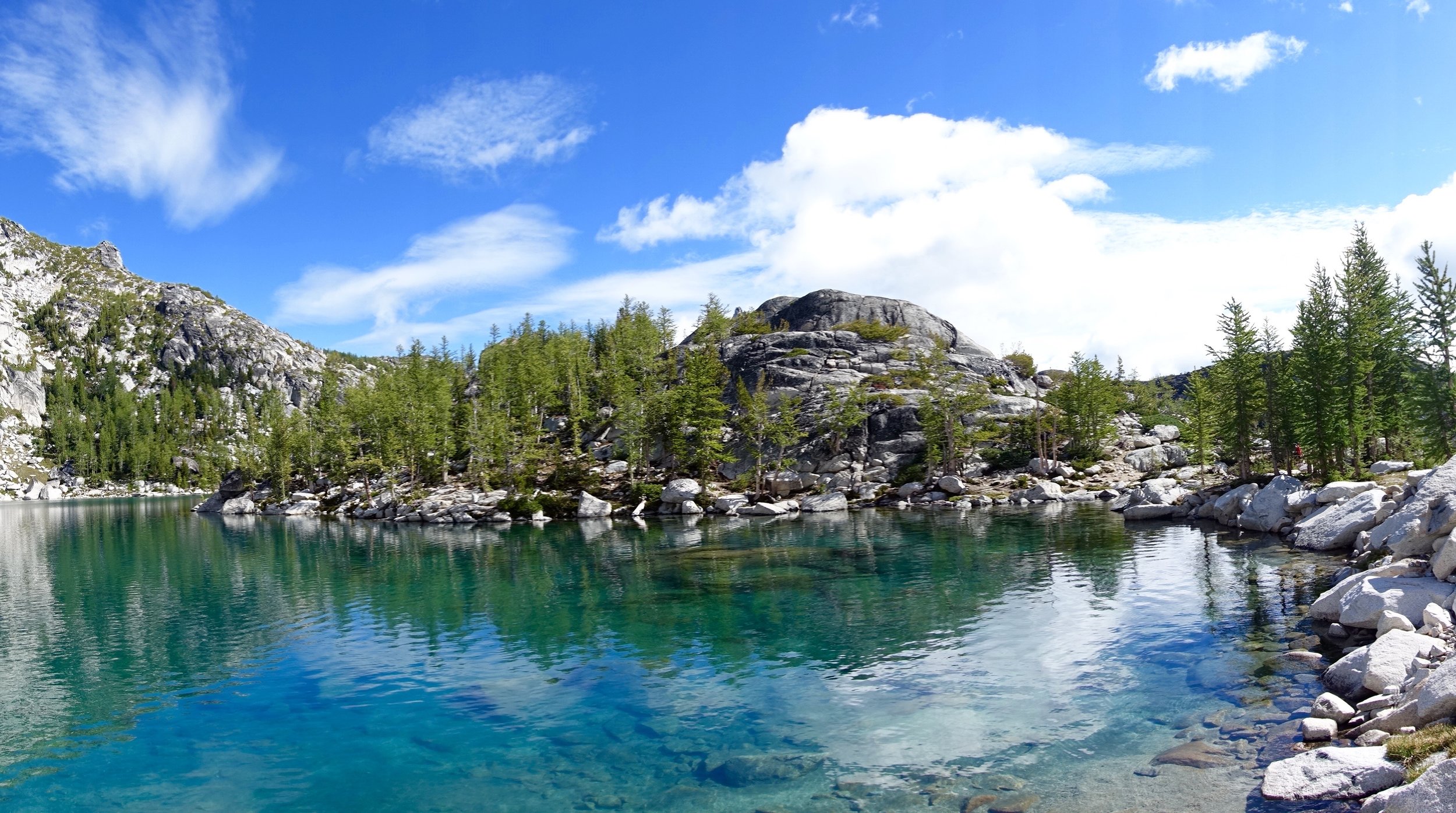
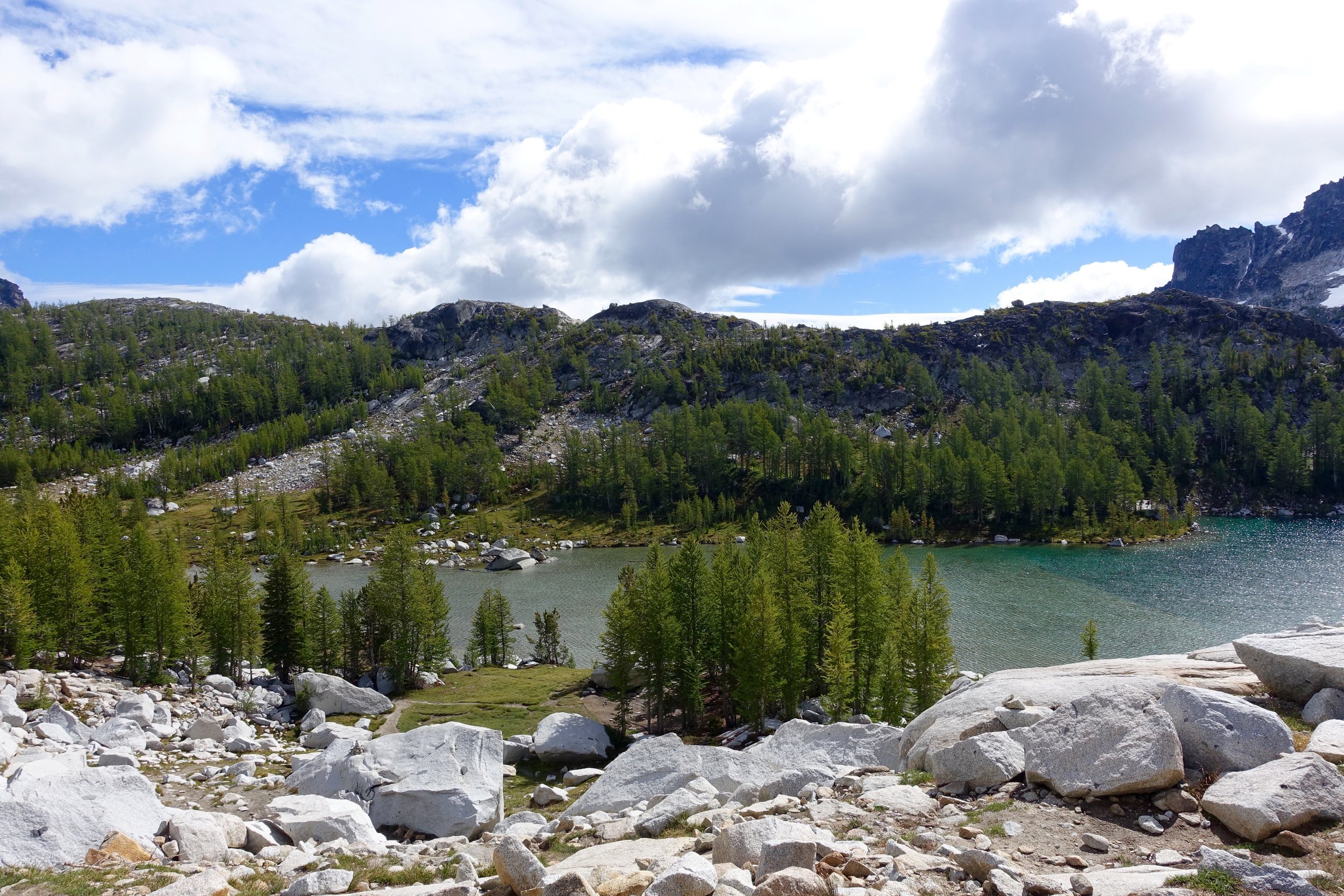
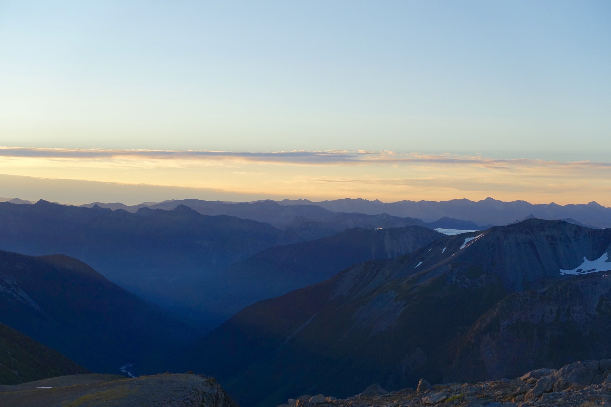
The last lake in the core would be Lake Viviane. So sad to leave the core. I want to be up there playing forever. We got an overlook shot of Snow Lakes down below before we made the decent to it. Getting down from the core is almost as getting up to it. So many times we were scaling boulders larger than cars with sketchy footing, using our hands and buts to safely get down. It was a brutal pounding on our knees until we hit the lake. 


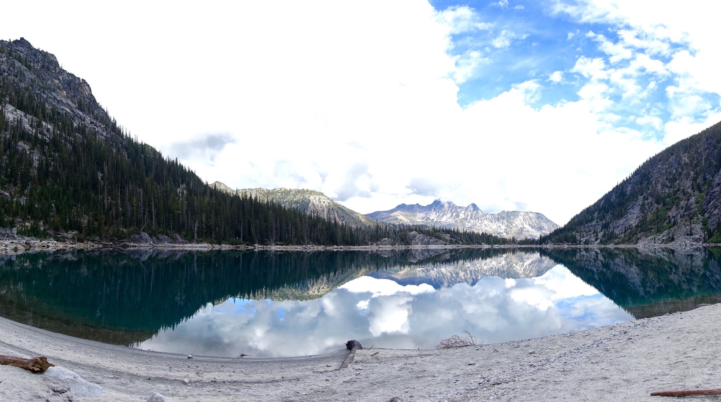
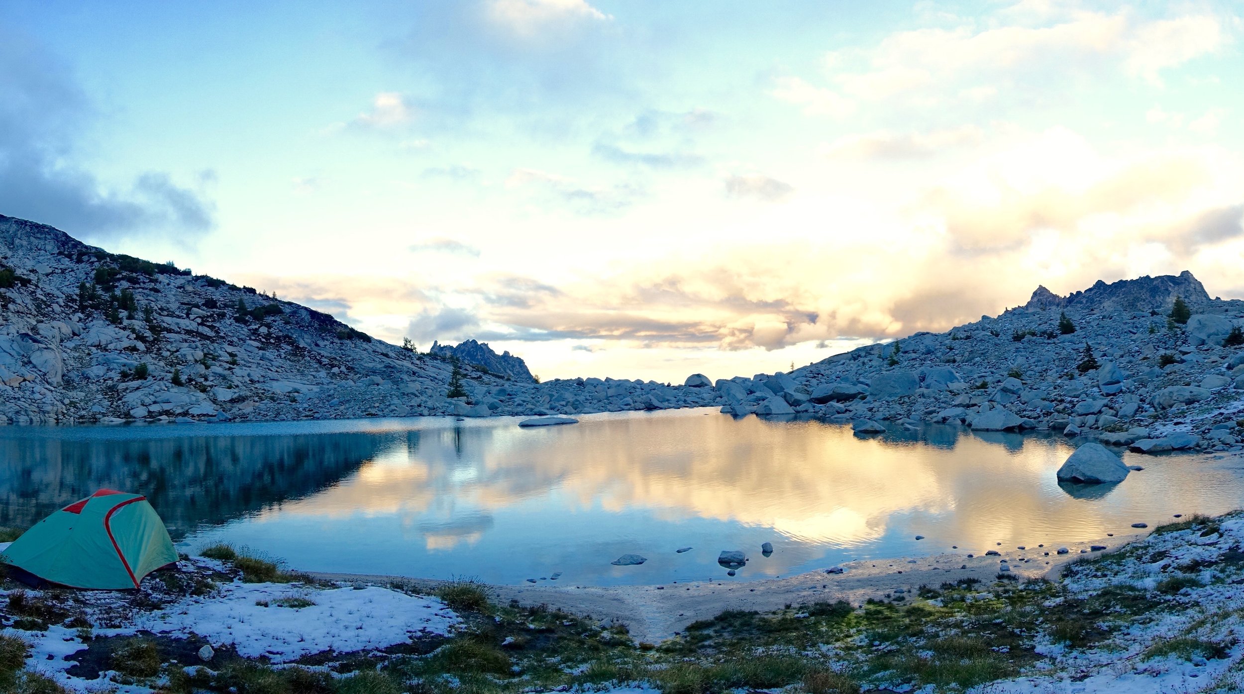
We finally made it to Snow Lakes and hit the first camp site we found. There was part of it in the woods and then we went out to a beach area beyond it and decided we definitely needed to camp on the beach.


We made dinner, actually got to hang out this night since it wasn't so cold, played Uno, drank more hot toddies and just enjoyed our last night of camping.
Day 4:
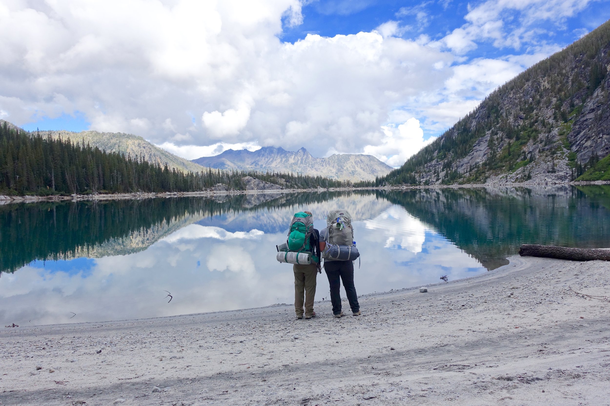
We wanted to get a very early start since we had 9 miles to hike out this day with 4000 feet of elevation loss.. Before I got into hiking I would think this means you can just basically run down the mountain. What this actually looks like is a very rocky terrain that slows you down a lot since you don't want to trip and take a tumble down the mountain. The whole terrain of the enchantments was very rocky and brutal to hike on. So we woke at 5:30 to the pitter patter of rain on the tent. Lovely. Ryan and I packed all of our stuff in the tent up first and then the rain actually stopped. We made oats and coffee and tried to quickly get everything together. We were out before 8 AM and hit the trail. We picked up a quick pace right away as it was relatively easy terrain through the woods around Snow Lakes. We got to the bottom of upper snow lakes and then saw lower snow lakes and crossed a dam. A little while later we got to Nadda lake. This was the greenest lake we had seen the whole trip and was very pretty. We were back to the very rocky terrain that was hard to hike on again as well.


Nadda lake had many camp sites that were gorgeous. I think I've decided as long as I live in Washington I should apply for permits. No what what zone I get it will all be gorgeous. The hike out after Nadda lake was about 5 miles and this was probably the longest, most boring section of the entire trip. Just all mostly in woods and it felt like it was taking forever. In one part we stopped to have snacks and rest a bit and another group stopped there after us. This group caught up with us again a little bit later and they said that right after we left a mama bear and 2 cubs crossed the trail! The bear must've been watching us the whole time until we left to cross. Gives ya the heeby-jeebies knowing you were that close to a bear. It took us about 5 hours to hike those 9 miles out. Not too bad. When we got to the trailhead we cheered in victory that we made it. What an accomplishment it was. It was super hot and sunny and we were ready to go into town and get our victory beers. We first had to go pick up the other 2 cars at the other trail head. We then made our way to Leavenworth and went to Munchen Haus for brats and beers and pretzels. It was the best thing ever. We walked around town some, got ice cream and then said our goodbyes and made our way back to Seattle.


This trip is one that I will remember forever. The people were outstanding. Everyone came from such different paths of life but we made it through the mountains together in one piece. I would choose this group over and over again. We all uplifted each other in times we wanted to give up or throw in the towel. We laughed until we cried. We became better together.
The enchantments are such a special place for the variety of things you get to see in 20 miles, but you sure have to work for it. This trip will be very hard to top but has left me with the feeling of needing more. Needing more time in the mountains. Needing more miles under my boots. One of my profound thoughts from the trip was that I am happiest when I am outdoors in nature and I will continue to choose what makes me happiest.
"Be fearless in the pursuit of what sets your soul on fire."

DSC01009
Snow Lake Day Hike

DSC01020

DSC01022

DSC01033
DSC01041

DSC01061

DSC01070

DSC01076

DSC01082

DSC01091

DSC01093
Where: Snoqualmie Pass
Mileage/ Elevation gain: 7.2/1800
We were going to do another overnighter this weekend but opted for a day hike instead (less stress/time). This one had been on my list, was only 45 minutes from Seattle and was relatively easy for a good payoff. We made it to the lake in about an hour and a half, hiked a good ways around the lake until we got to a shore area with sunshine. It had been my goal this summer to pack in a floatie and go floating on an alpine lake, so we made it happen! It wasn't particularly very hot, but the sun was out so we went for it. That water was really fricken cold, but it was worth it. Stayed in for about 20 minutes and the clouds started to roll in so we rolled out. It was like 2 totally different days there with the sun coming in and clouds going out. This is a lovely area and I would like to come back to do an overnighter and make it to Gem lake as well.
Vesper Peak Day Hike
 Location: North Cascades/ Mountain Loop Highway
Mileage/ Elevation gain: Est. 10-11/ 4,200 FT
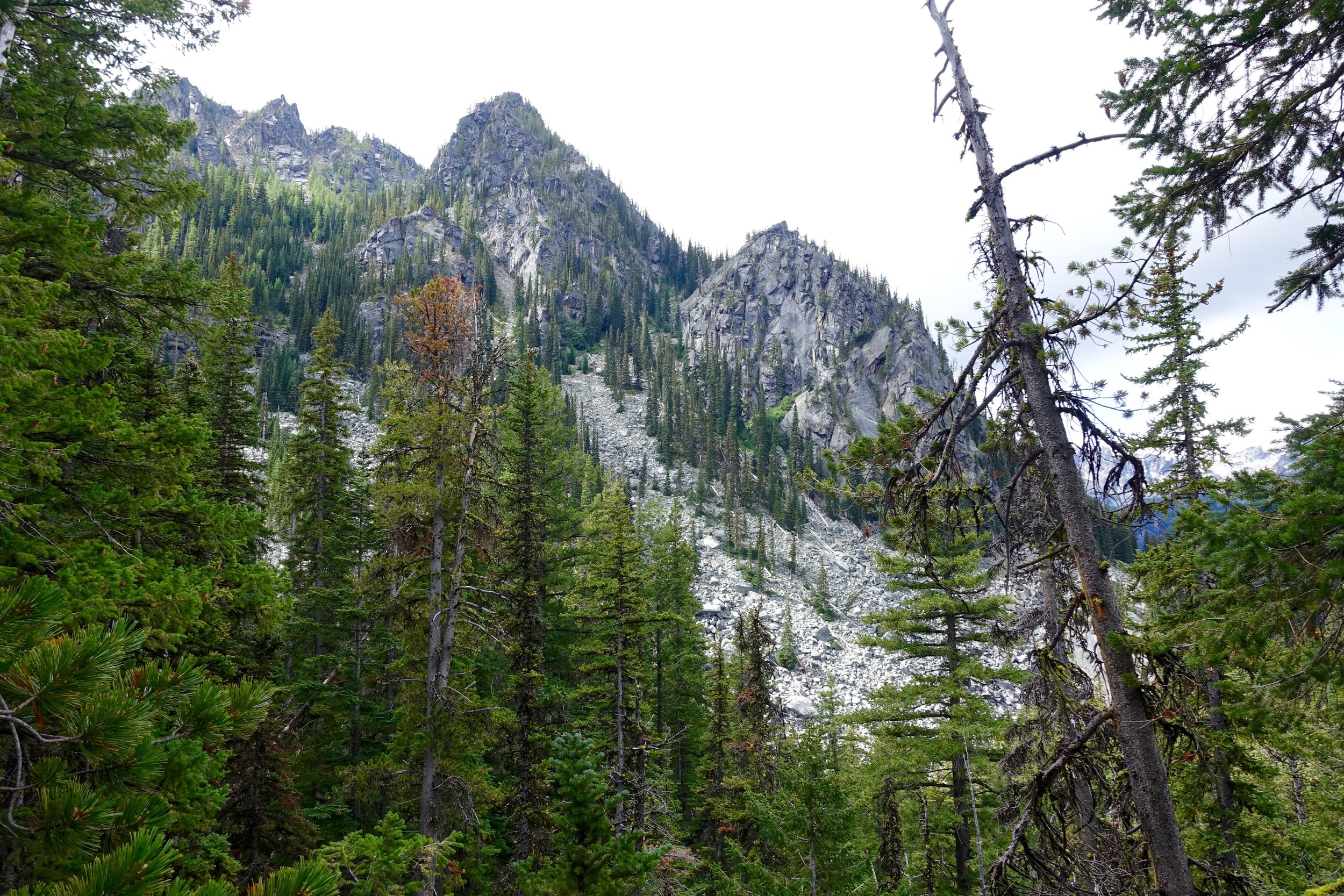
I had 2 Minnesota friends move into town and it was the perfect weekend to show them the beauty of my beloved Washington state. Vesper Peak had been on my list for a long time and everyone was on board. WTA website said the hike was 8 miles, but it definitely ended up being a lot more. We'll get to that.
5 of us left Seattle just a little after 6 AM. We arrived to the turn off on Mountain Loop Road and the sign said"road closed." I had read online that there were 2 big washouts on the road, but even small cars were making it, so the outback should handle it fine and it did. At one part about half the road was gone, so definitely a little bit sketchy but we zoomed on past it. We arrived to the trailhead just before 8 and were on the trail by 8. The parking lot probably had 7-8 cars in it at this time even with the "road closed" sign.
The first part of the hike was all woods and crossing low streams. We crossed a bigger stream and soon after started our climb. The climb from the woods to Headlee Pass was some of the toughest 2 miles I've ever done. Steep steep climbing on loose rock and it was already heating up at this point. We took many breaks along the way to make it through this portion. After a couple hours we finally made is to the pass. I was feeling really ill at this point and didn't know what was going on. I said I wanted to at least make it to Lost Lake and then we would all assess how we were feeling. On the way to Lost Lake a man said Vesper was about 1.5 more and wasn't too bad at all to get to and was way worth the views. Half of that was about right. I'll let you take a guess which on which one. Shortly after we made it to a stream crossing and to Lost Lake. This is a gorgeous alpine lake surrounded by large granite giving it a nice dark color. There are many campsites in this area with amazing views all around. It was exactly at this point that I realized that I ran out of water, all 2 OZ I brought. This is usually more than enough for a day hike, but it was really hot and I must've started the hike dehydrated. I had a headache, was dizzy and had no appetite. I was panicking as I did not bring my water filter and we weren't even half way done with this hike. Caitlin offered to share her 3L, so I took her up on it. I wasn't feeling like moving up the mountain anymore, but the top was so close. We all pressed on up more crazy steep sections finally getting to the last granite field. This was really steep sections of large boulders that took some navigating and scrambling to climb. Along the way up was a stream that seemed to be coming right from snow so this was the chance to get the most unpolluted water, hopefully. I did learn my lesson to always bring my water filter. We all drank the ice cold glacier water and it tasted soooo good. Near the top we got our first glimpse of Copper lake and I had forgot I had seen pictures of it. The color blue was something just amazing. I read something online about this lake-more people have summited Everest then have been to the shores of this lake. Apparently it's quite difficult to get to. 10-15 minutes of more climbing and we were at the top. Another summit in the bag! I was so proud of us. Proud of me for pushing on even though I wanted to quit so many times and proud of my Minnesota friends who had no hiking experience here, quite the ordeal for their first hike! We ate PB & J at the top and enjoyed views of Mt. Baker, Glacier Peak and Mt. Rainier. After that started the long descent back down. It is pretty grueling to mentally have to think through that you have to take every step back down that you took to get there (duh). We all cruised the way down with sore knees and ankles to boot. My limbs wanted to stop working and I probably fell more times on this hike than ever before. Oh and with the mileage deal, WTA said 8, other sources said 10-11, so we are gonna believe the later with how long it took us. When we finally made it back to the car it was 4:30. So a 8.5 hour day. Longest day hike for me yet. I can look back and enjoy the day now, but at the time it was one of the most miserable things being so dehydrated and feeling so ill. I think I drank 5L of water during that hike.
This was one of the first times getting up close and personal with the North Cascades and I can say I am a big fan. The rough, jagged peaks are something so enthralling. They are called the "American Alps" for a good reason. I would love to come back to Vesper for an overnighter and break up that mileage/elevation over 2 days.
3rd Burroughs Mountain Sunrise Hike
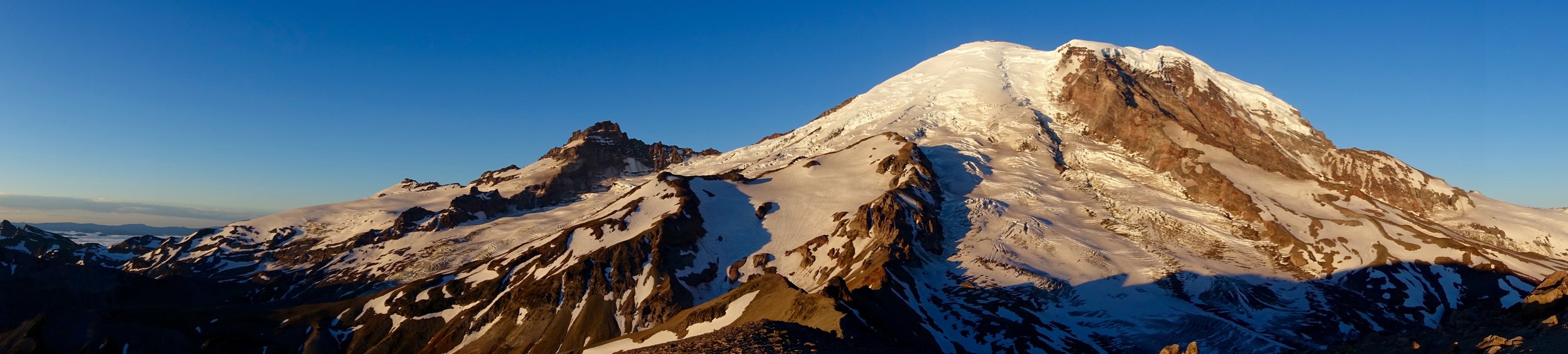
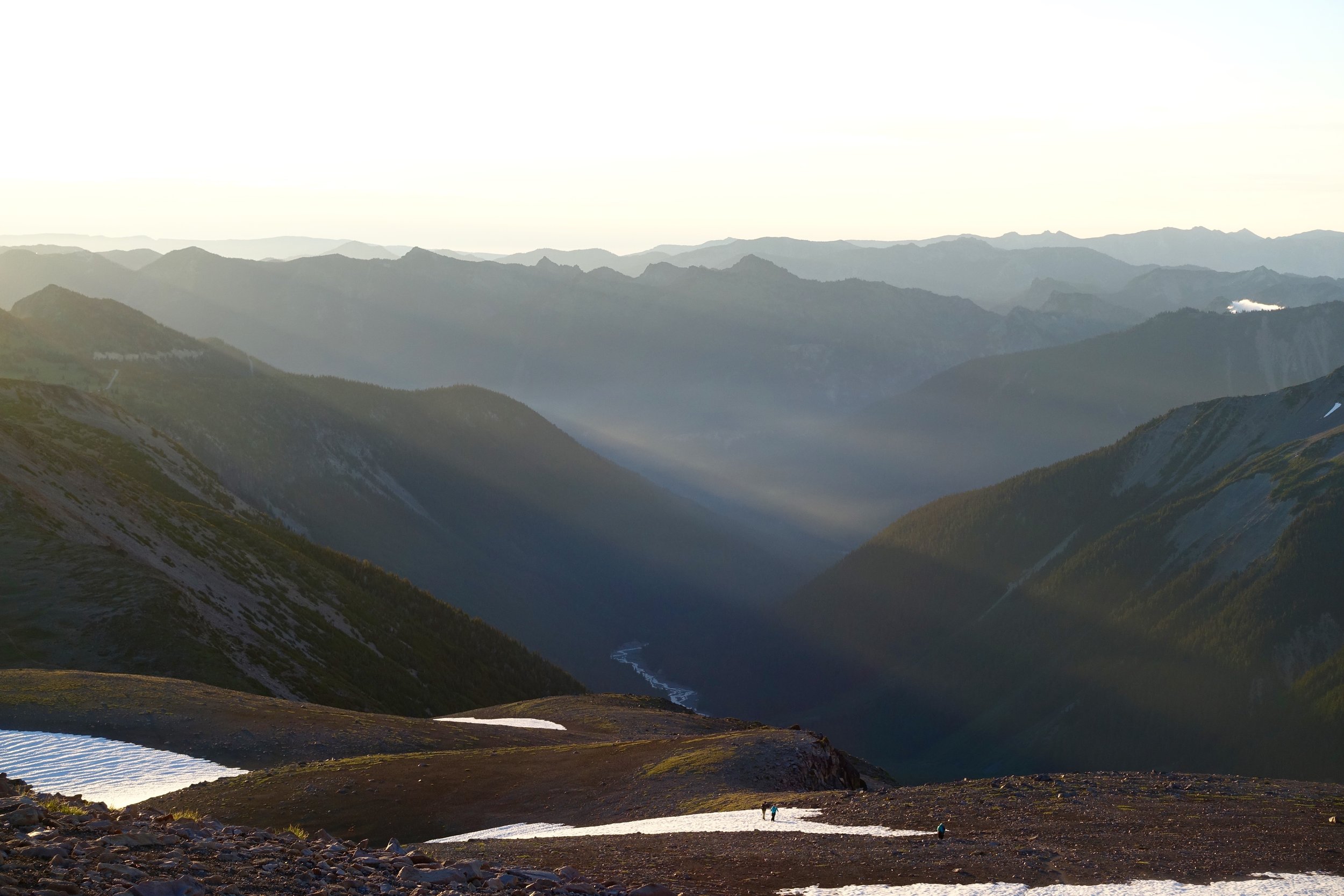
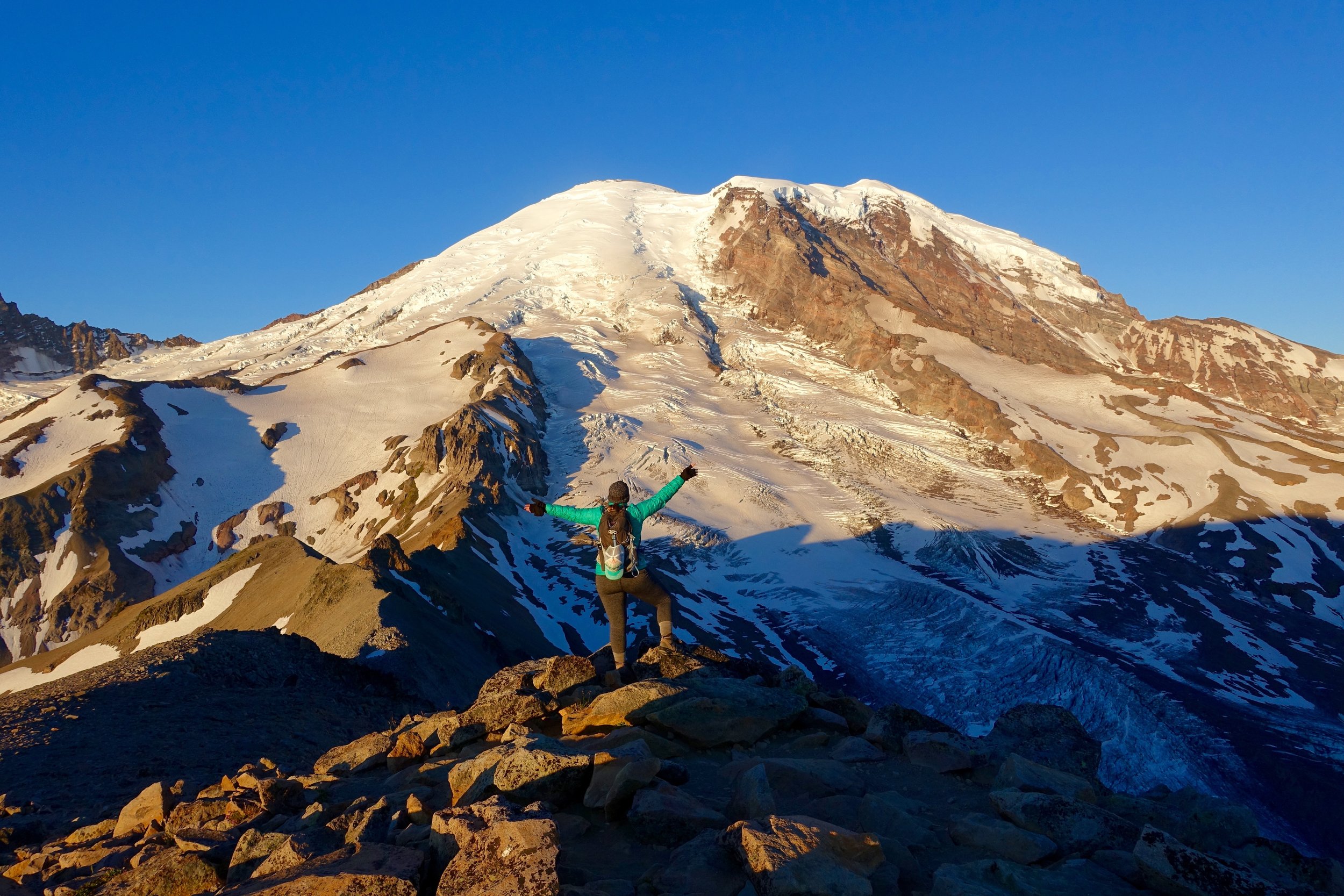
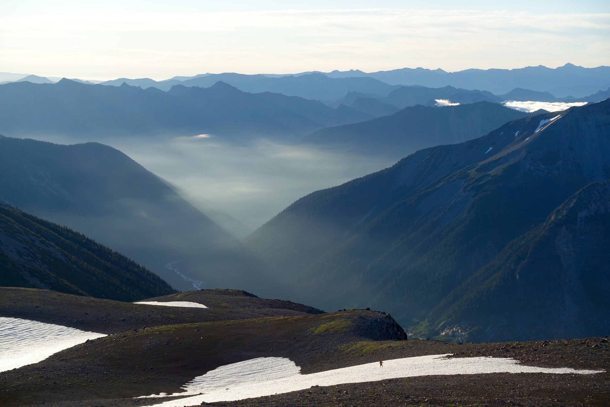
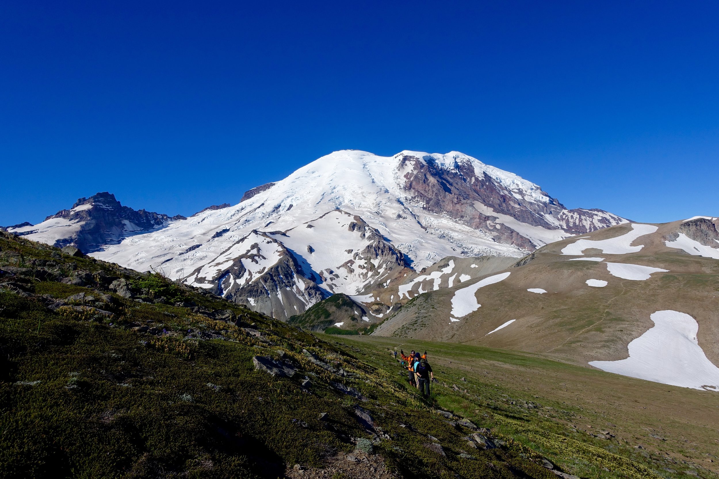
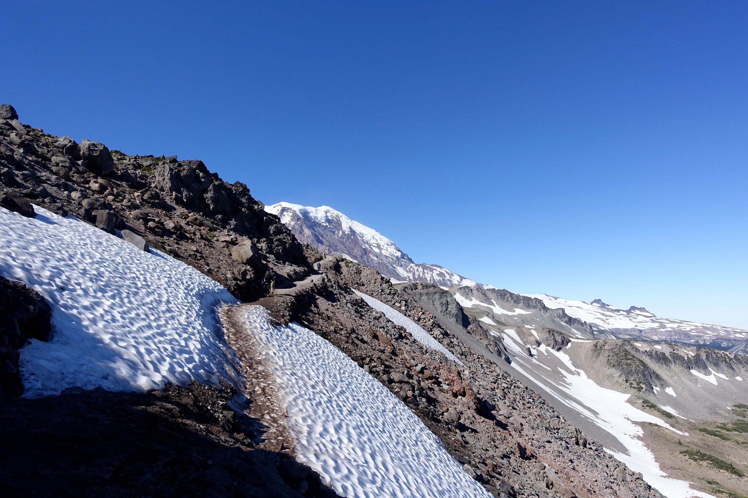
 Location: Mt. Rainier
Miles: 9/ 2600 elevation gain
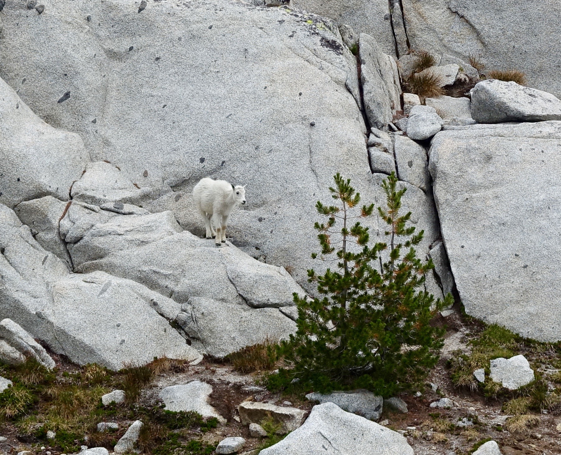
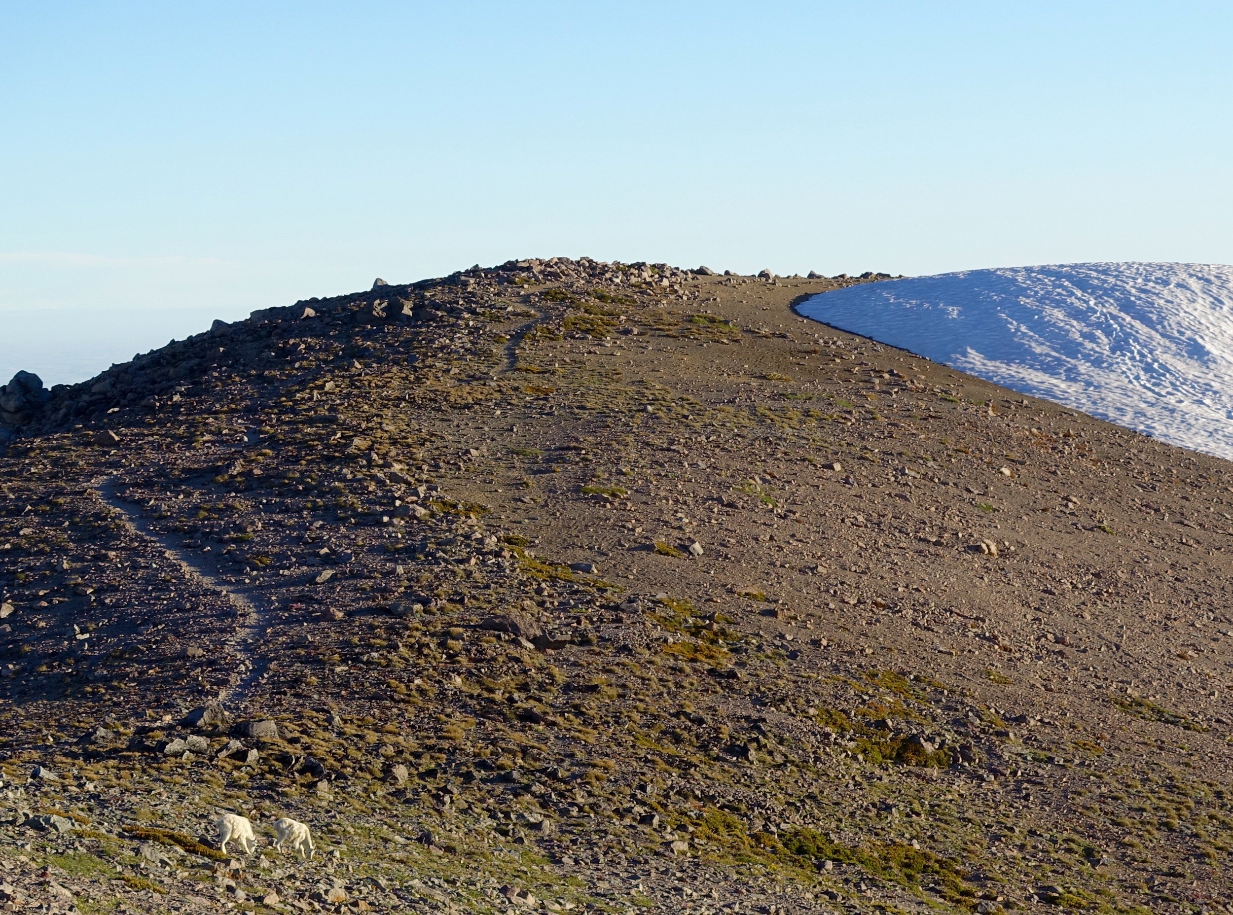
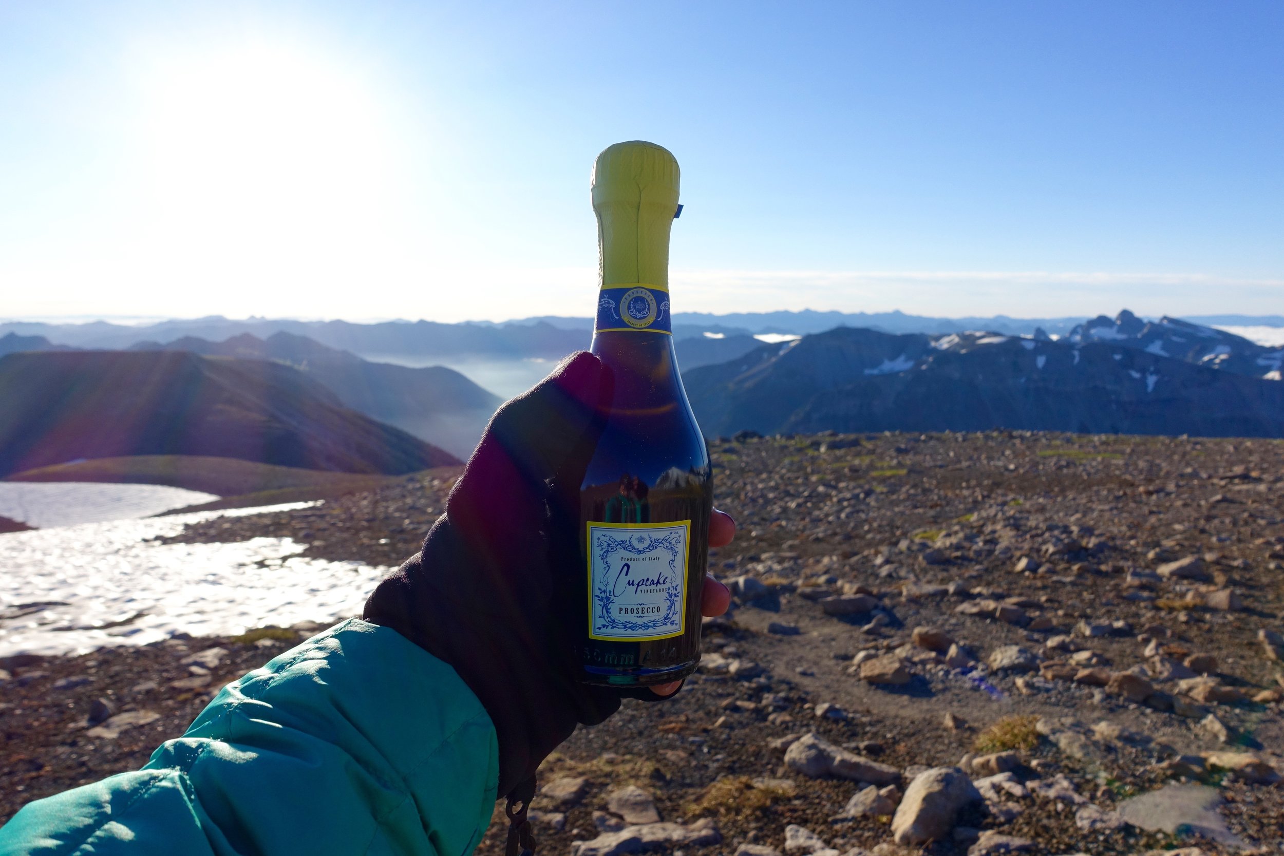
7 of us left Seattle at midnight to make it to the trailhead at 2 AM. As we arrived at the trailhead, the stars were nothing like I'd ever seen. They were so bright and numerous. I could stare at them all night. We had a destination to make though. It was in the 30's when we started the hike, so we all bundled up, but were not prepared for it to be this cold. I had a down puffer and hat and gloves on and was still miserably cold the entire time (until the sun came out). We took our time hiking up as we all thought we'd be waiting at the top in darkness for the sun to come up. This was not the case though as it slowly crept up even before 5 AM. As the light began to trickle over the mountains, it was like unwrapping a present as we had no idea what was around us during this hike. We saw our first group of mountain goats on the way up, the first I have seen in Washington! We donned our spikes and made it through a few snow fields, but they weren't bad at all. Caitlin and I pushed to the very top quickly, while the rest were just below the summit. At the top we saw more mountain goats on the trail and not very far away this time. Such a crazy thing to see. We joined with the rest of the group and rejoiced over prosecco. We were kind of deliriously tired at this point as most of us were working on relatively no sleep. We sat at the top a long time taking in the views and also procrastinating the journey back. The way back though was great because again we didn't see any of it on the way in really. We made it back to the trail head at 10:30 and then made our way to brunch. Another day of new friends, epic adventures, and memories with my favorite mountain.
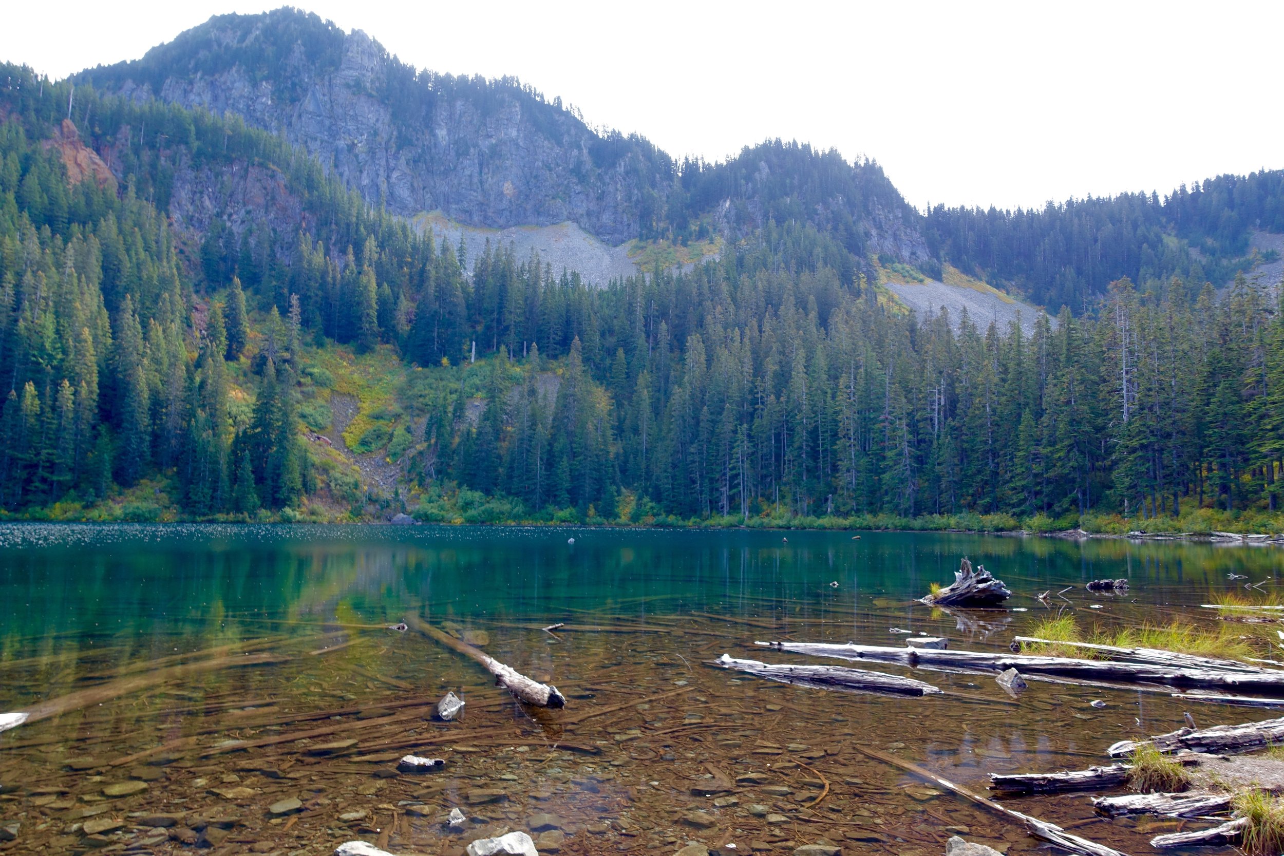
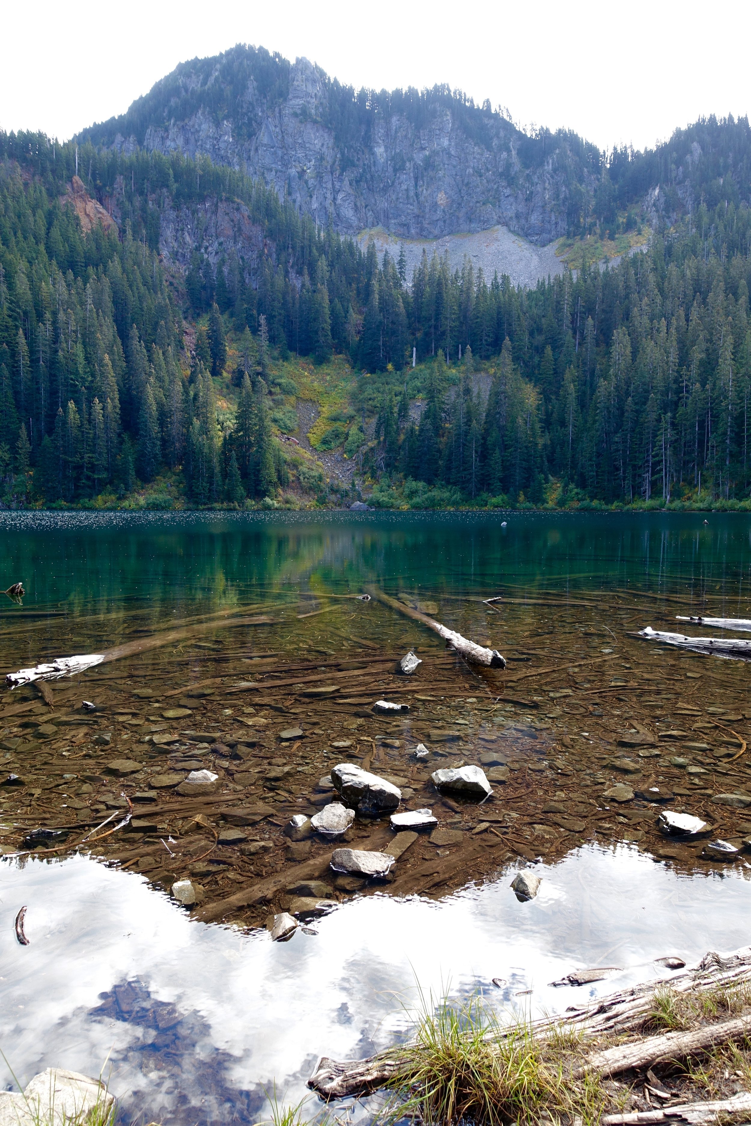
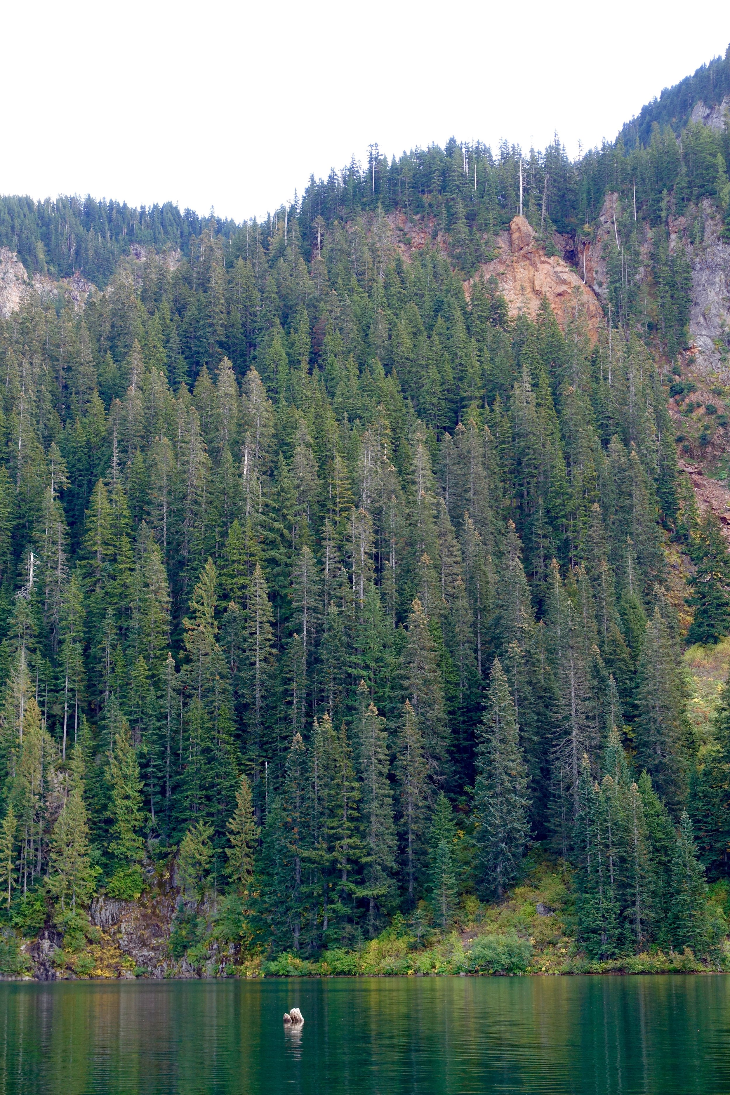
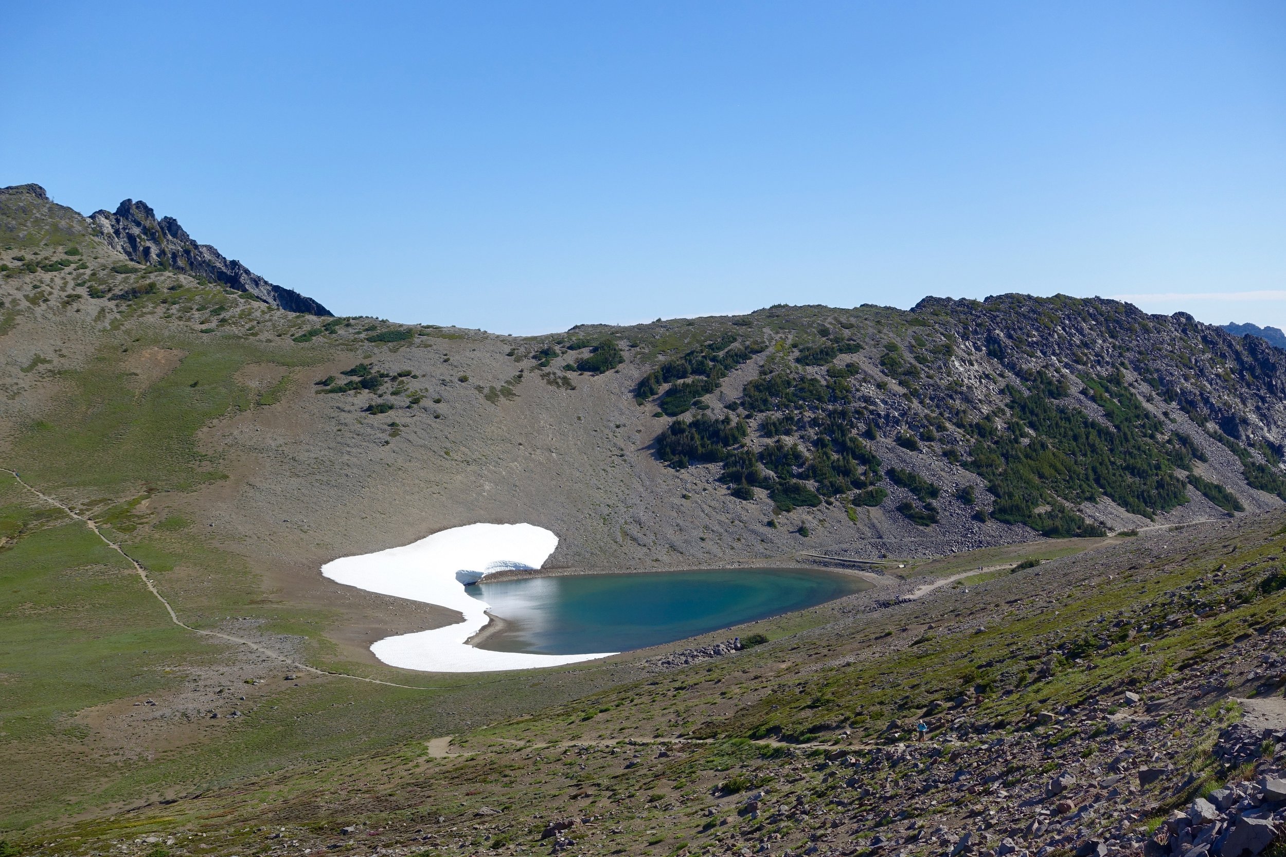
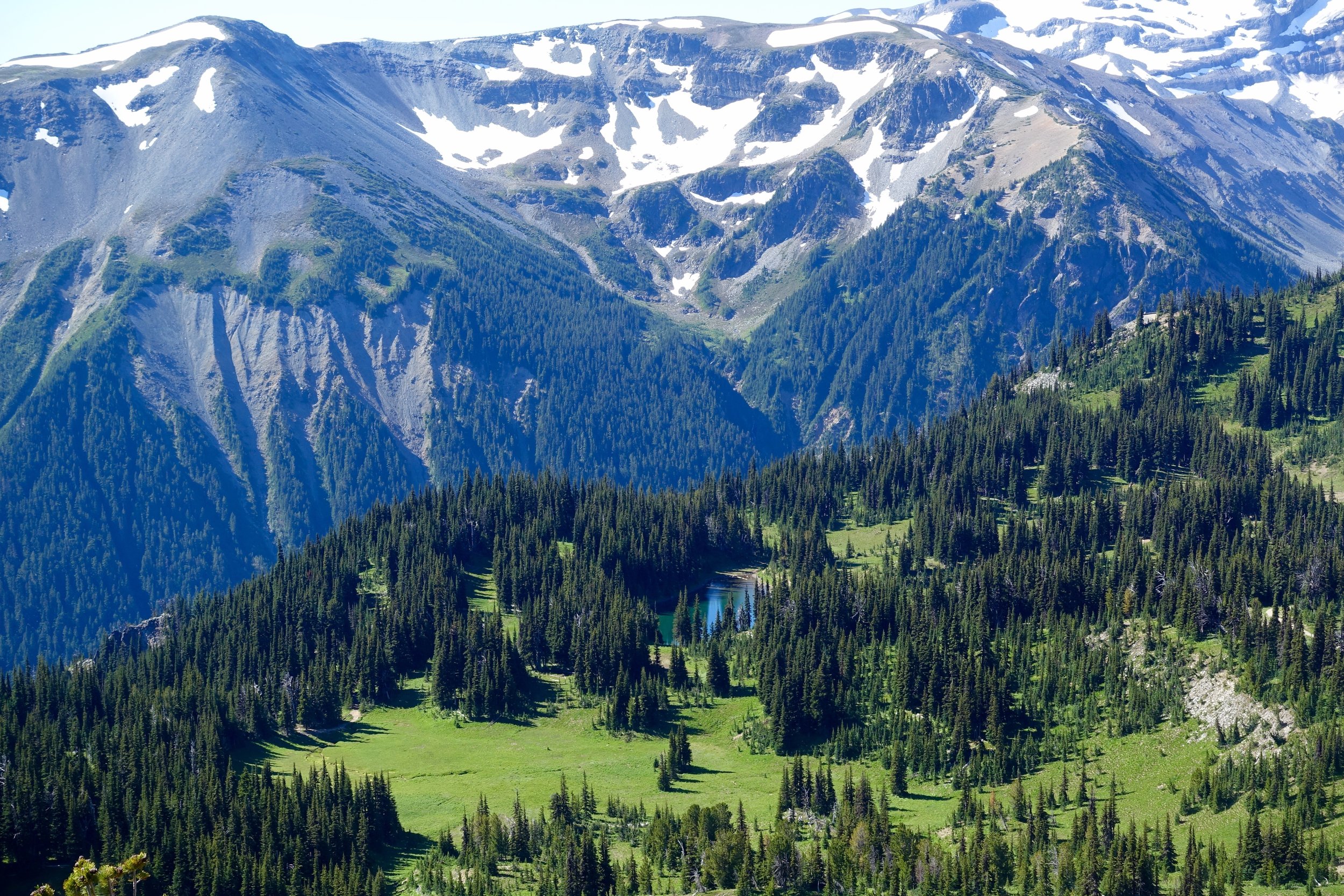
Goat Lake Backpacking
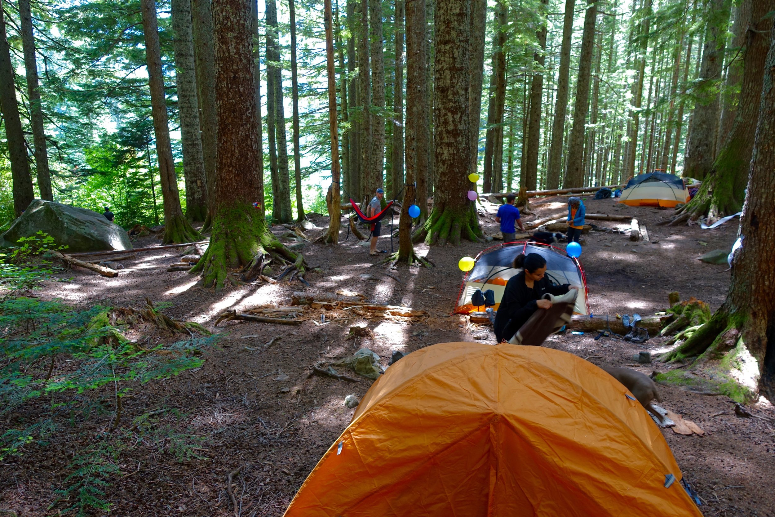
Where: Goat Lake, North Cascades (2 hours from Seattle)
Distance: 12miles/1400 elevation gain - 10.4 total roundtrip to lake (we added on 1.5 with hiking up the lake too)
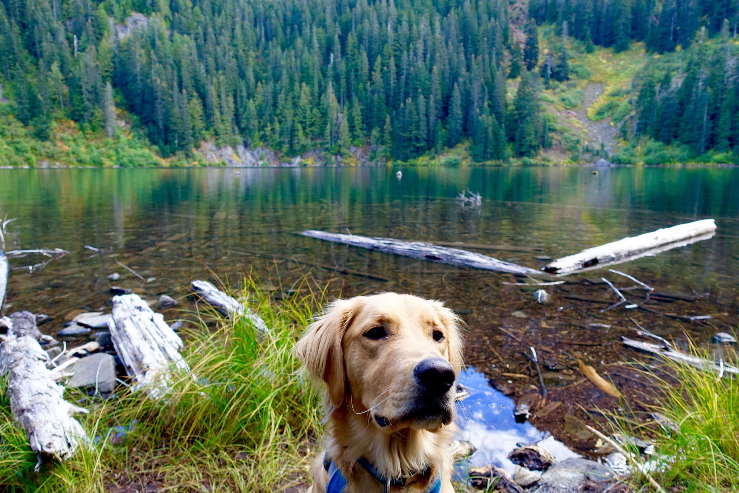
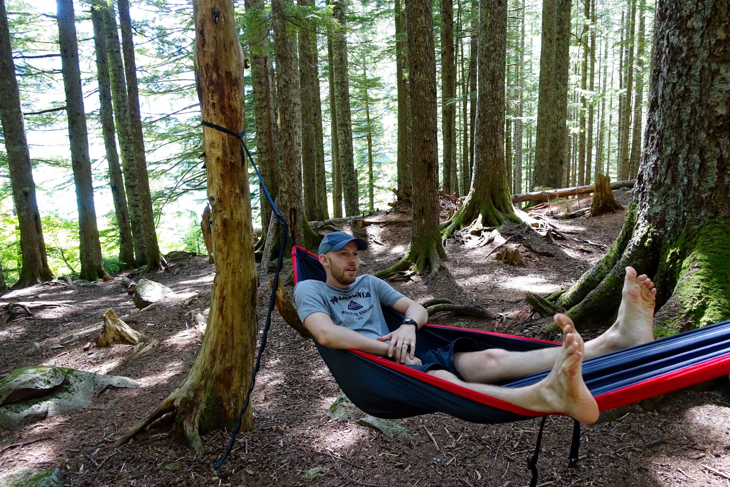
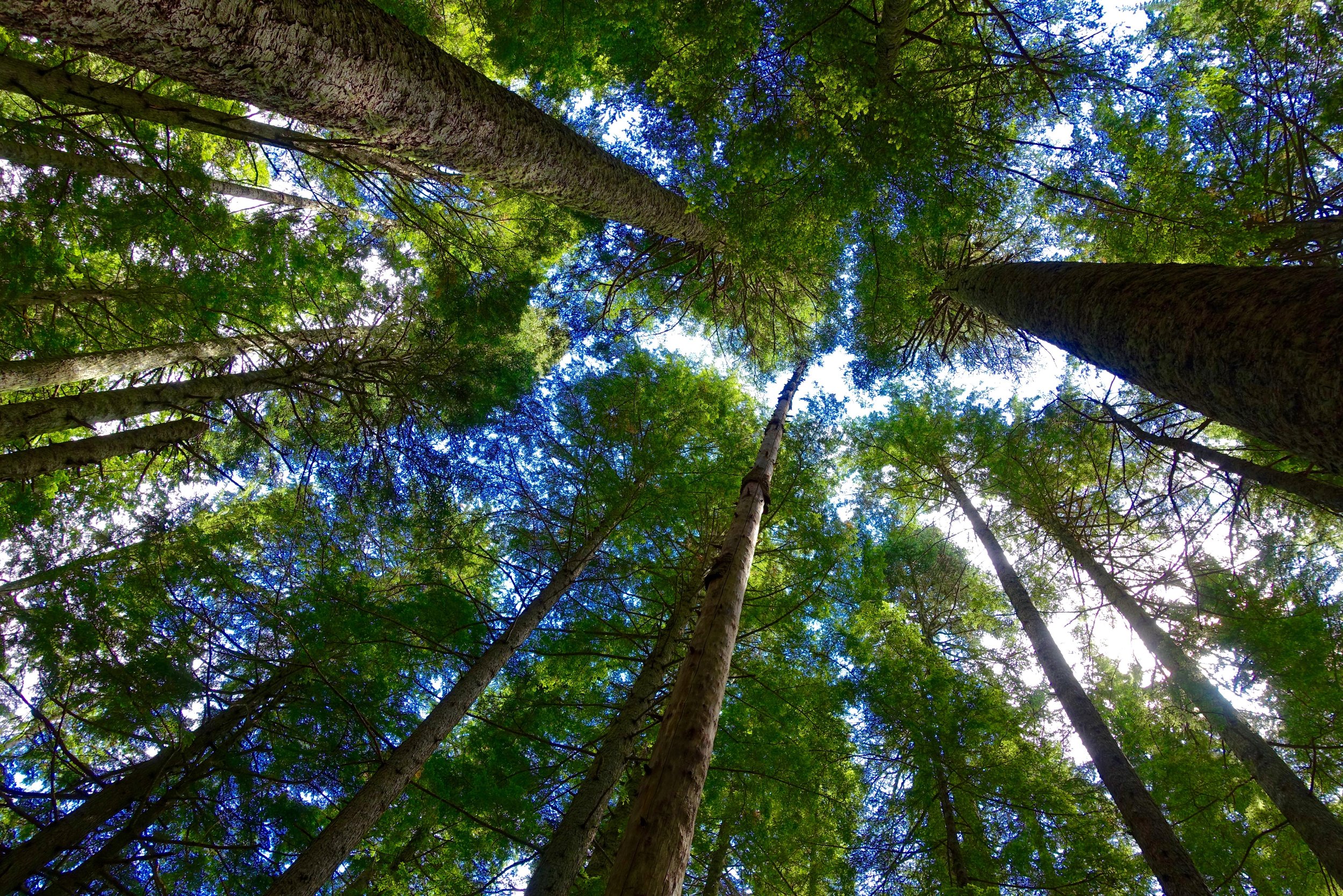
My husband, myself and two other couples (from Ryan's residency program) + 3 dogs headed out to Goat Lake for a one nighter. This weekend was also a celebration of Ryan turning 27! We left Seattle a little after 6 AM to arrive to the trailhead by 8:30. The small parking lot was already full with cars starting to park on the sides of the road. This is why we always leave very early for hikes. We donned our packs and headed up the Upper Elliot trail. There are 2 trails that you can take for this and both will reconnect before the lake. The 5 miles in was a very gradual incline until the last 15-20 minutes where it got more steep. The trail was also very gentle and wide most of the time. Right before the lake you will see a waterfall to the right that cascades down into a waterfall that follows the lower trail down.
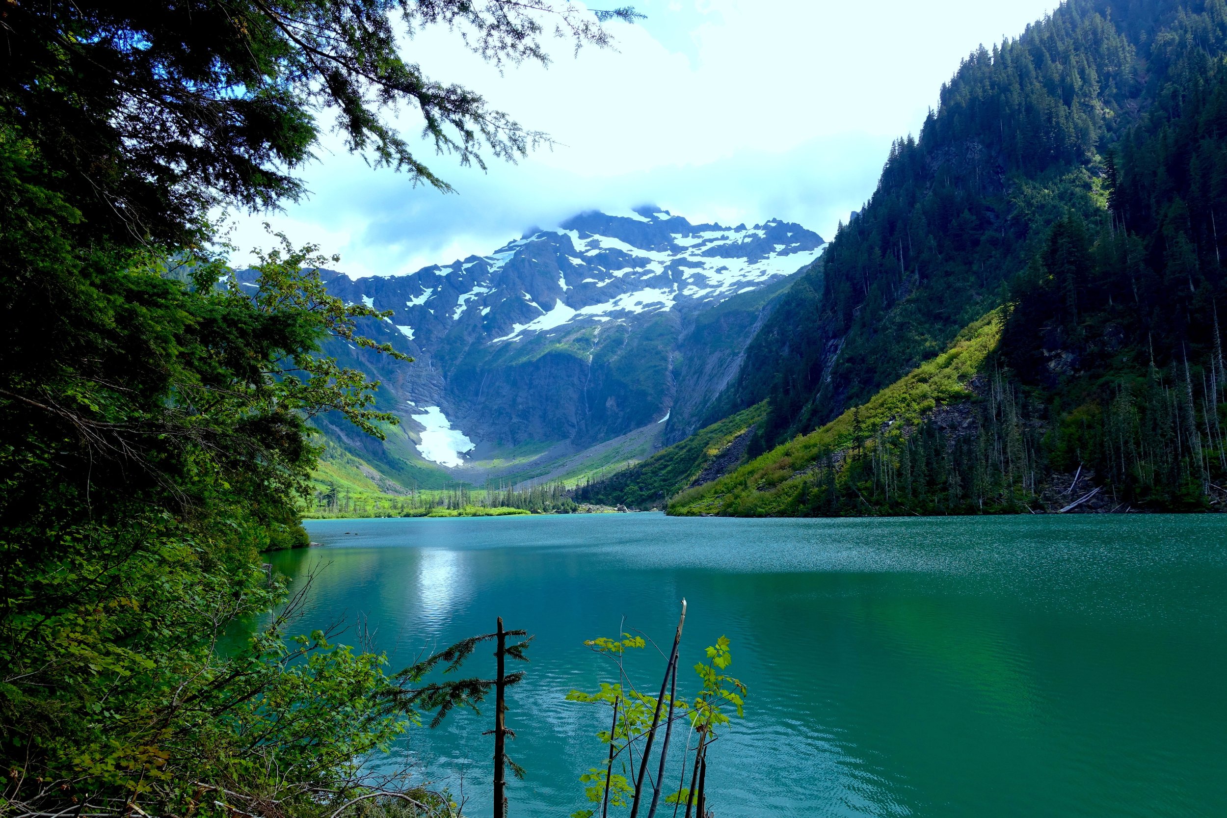
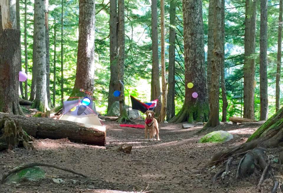
We reached the top in about 2.5 hours. The first view of the water was breathtaking. I had never seen a lake so green before! First things first was to find a campsite. I read that there are designated spots a bit away from the lake and this is true. When we got there, there where many people already set up but there were also many spots still available. We found one that would be big enough for our 3 tents and set up camp and then ate lunch.
My friend Dorris helped me devise a plan to set up a big celebration at camp for Ryan's birthday. We had the guys go ahead and go down to the lake (2 minute walk from camp) and the girls blew up the balloons and set up "happy birthday" banners and streamers! We met up with the guys and the dogs were having a blast swimming in the alpine lake. We came back to camp and surprised Ryan with the decorations. We then took a siesta as it was only 1 in the afternoon and the lack of sleep was starting to hit us.
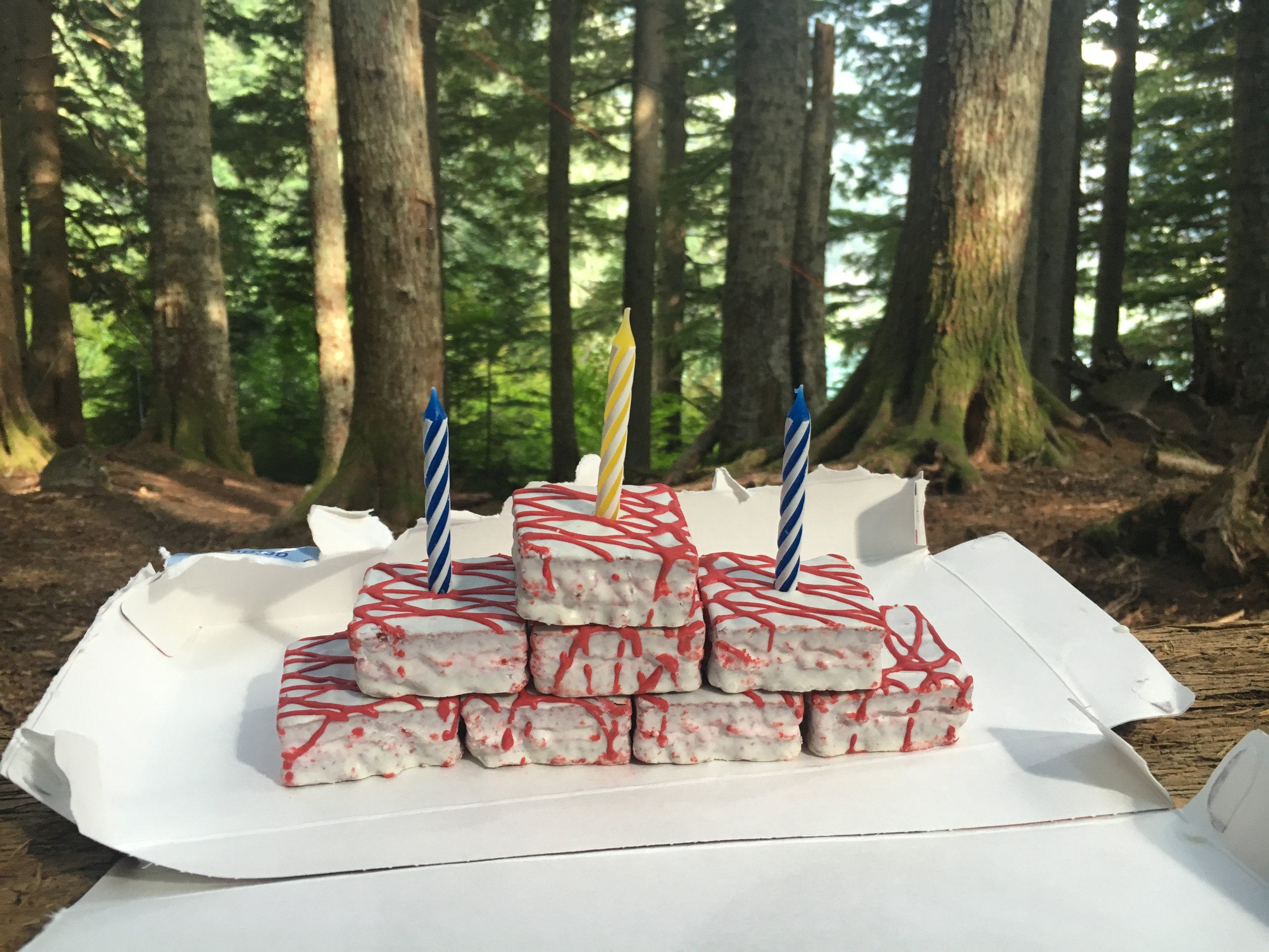
After awaking we explored the trail as far as it would go up the lake (1.5 round trip). We all could just not get over how gorgeous the lake was and the perfect backdrop of the mountain behind it. We then made dinner (freeze dried chicken teriyaki for me- very good!) and chili mac for Ryan. I had one more surprise up my sleeve for Ryan- I brought the most processed cake type things I could find and built him a little cake out of it which was surprisingly good (anything is good on the trail). We then drank boxed wine, made a hot toddy type of drink (apple cider packet + whiskey + boiled water new favorite trail drink!) Thanks Caitlin! And enjoyed each others company as we rolled into the evening.
I did not sleep well that night as well, I think it had to do with the previous weekends events (bear run). I sat awake seemingly all night listening to every noise that came by becoming more and more paranoid by the hour. Even our pup Cooper slept good not moving the whole night. My brain would just not shut off. Sleeping in the wilderness exposed to any creature is something I have to get over and accept. Bear run in's are quite rare, or so they say. We did all the right things by hanging all of our food as well. Next time will bring ear plugs and drink a little more whisky perhaps..
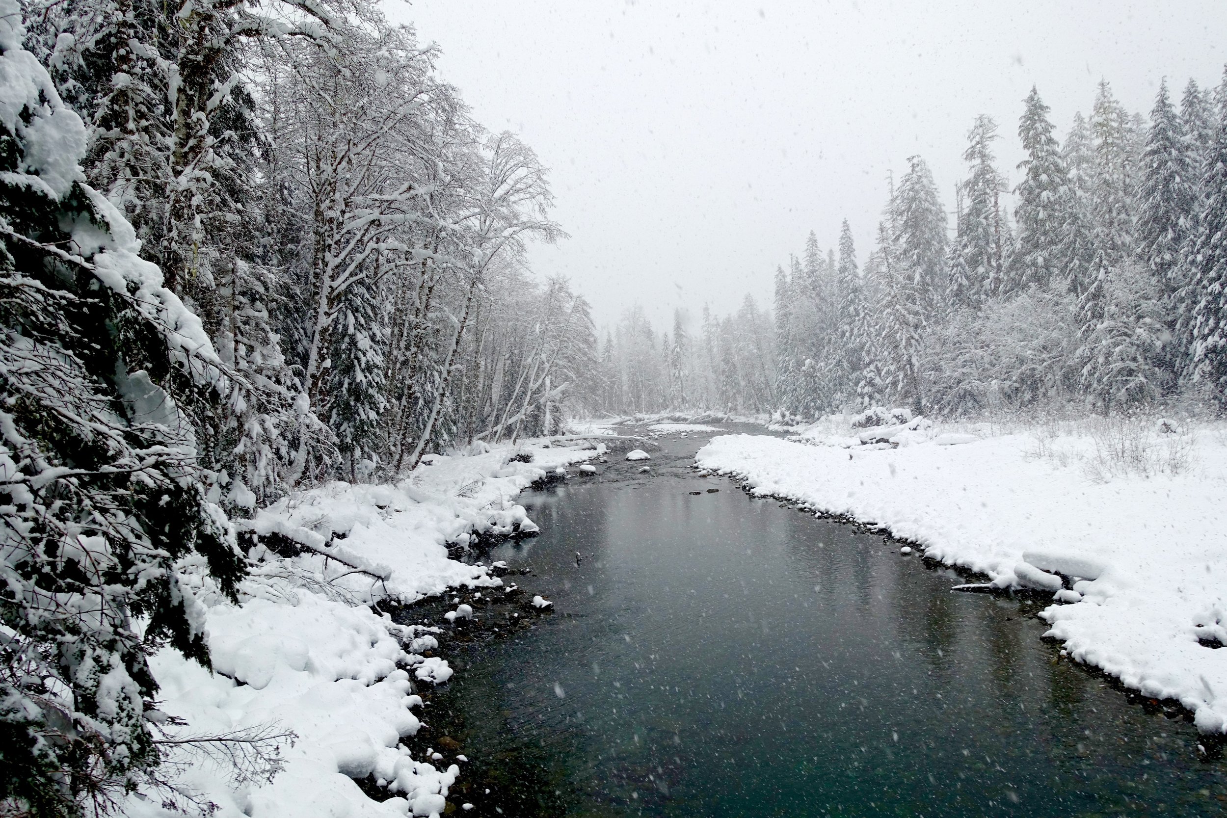
We woke up by 8ish in the morning and slowly ate breakfast, breathed in the foggy PNW air, and drank hot coffee. We packed up camp and headed back down on the lower elliot trail. This one eventually follows the river down, which is a nice change of pace.
Overall this hike is not very strenuous (good for the pups) with a high pay off of a gorgeous alpine lake. Definitely won't be our last time here!