Camp Muir- Base Camp of Mt. Rainier

FullSizeRender 20FullSizeRender 12FullSizeRender 19IMG_4758IMG_4780FullSizeRender 2FullSizeRender 5FullSizeRender 6FullSizeRender 7FullSizeRender 8FullSizeRender 16FullSizeRender 13FullSizeRenderIMG_4890IMG_5001IMG_4997FullSizeRender 22FullSizeRender 10FullSizeRender 11IMG_4946FullSizeRender 17IMG_2677FullSizeRender 14FullSizeRender 18IMG_4992 Hike: Camp Muir

Location: Paradise, Mt. Rainier

Mileage/ Elevation: 8 miles/ 4,640

Last summer Ryan and I did the skyline loop trail on Mt. Rainier as the most amateur of amateur hikers. This hike is 5.5 miles and at the top you see the section where it splits off to go up to Camp Muir. At the time, this seemed like a mythical far off land where professional climbers went. As we have gotten into hiking this year Camp Muir had been on our list to accomplish, at some point. Ryan had 2 weekends left of the summer basically before having to work 4 weekends straight so I asked him what his priority was to do on those weekends and Camp Muir was one of them. Skeptically we prepared to go within a couple weeks time. I say skeptically because the weather needed to be absolutely perfect to go and we weren't even sure if we were (physically) ready. Well the weekend approached and the weather was looking good so we decided to do it. Camp Muir should never be attempted in non-favorable conditions as there is no clear trail and white outs can be deadly as people drift onto nearby glaciers. This hike is actually listed as one of the top 10 most deadly hikes.

First things to figure out where the accommodations regarding staying at Mt. Rainier at least the night before. This is no easy task in the summer and the options are quite limited. The park has 3 campgrounds and all the reservable sites go far in advanced and we would never make it to the walk up sites. I booked at Alder Lake Campground like I did the previous year for Friday night. It is an hour and a half from Seattle and an hour from Paradise. We didn't arrive at our campsite until 10:30 or so Friday (thank you surgery residency) and set up camp in the dark and went straight to bed. Well not me.. I was kept awake by the noisy campers partying. I would not recommend this campground unless it was last resort like it was for us. I wanted our wake up call to be 5 to be at the trailhead at 7 but Ryan assured me we did not need an hour to pack up camp in the morning so 5:30 it was. I was right and we would've been better off with that extra 30 minutes as we started on the trail at 8. At this time the parking lot was already quite full. Get here early to snag a spot.

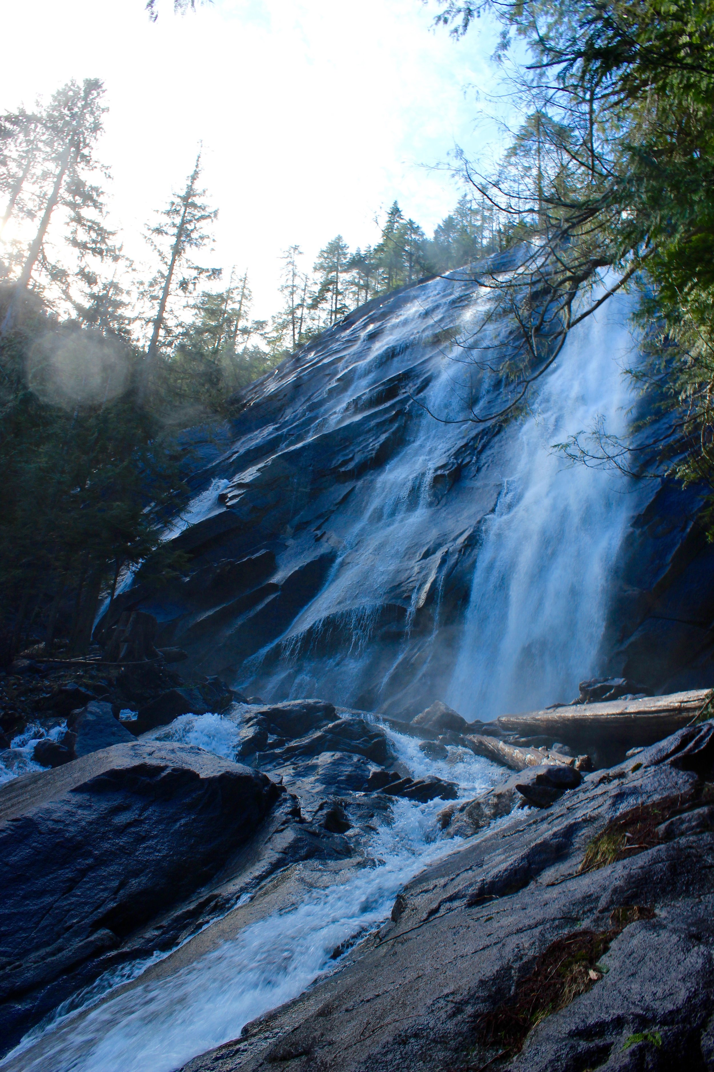
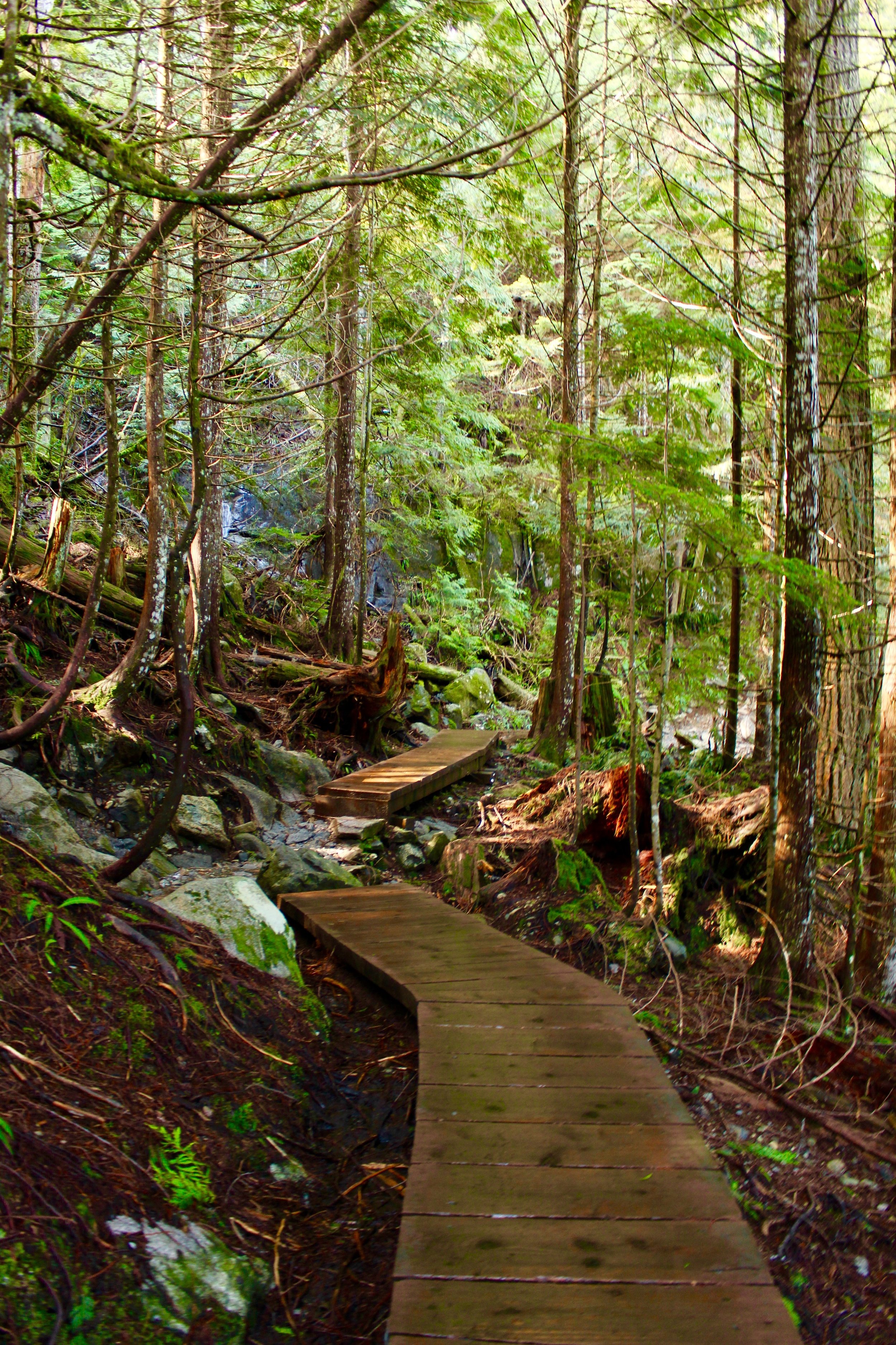
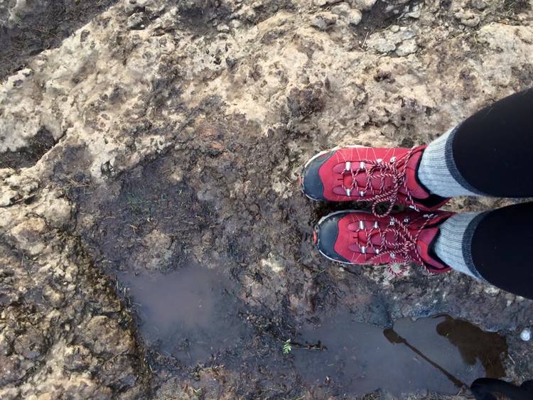
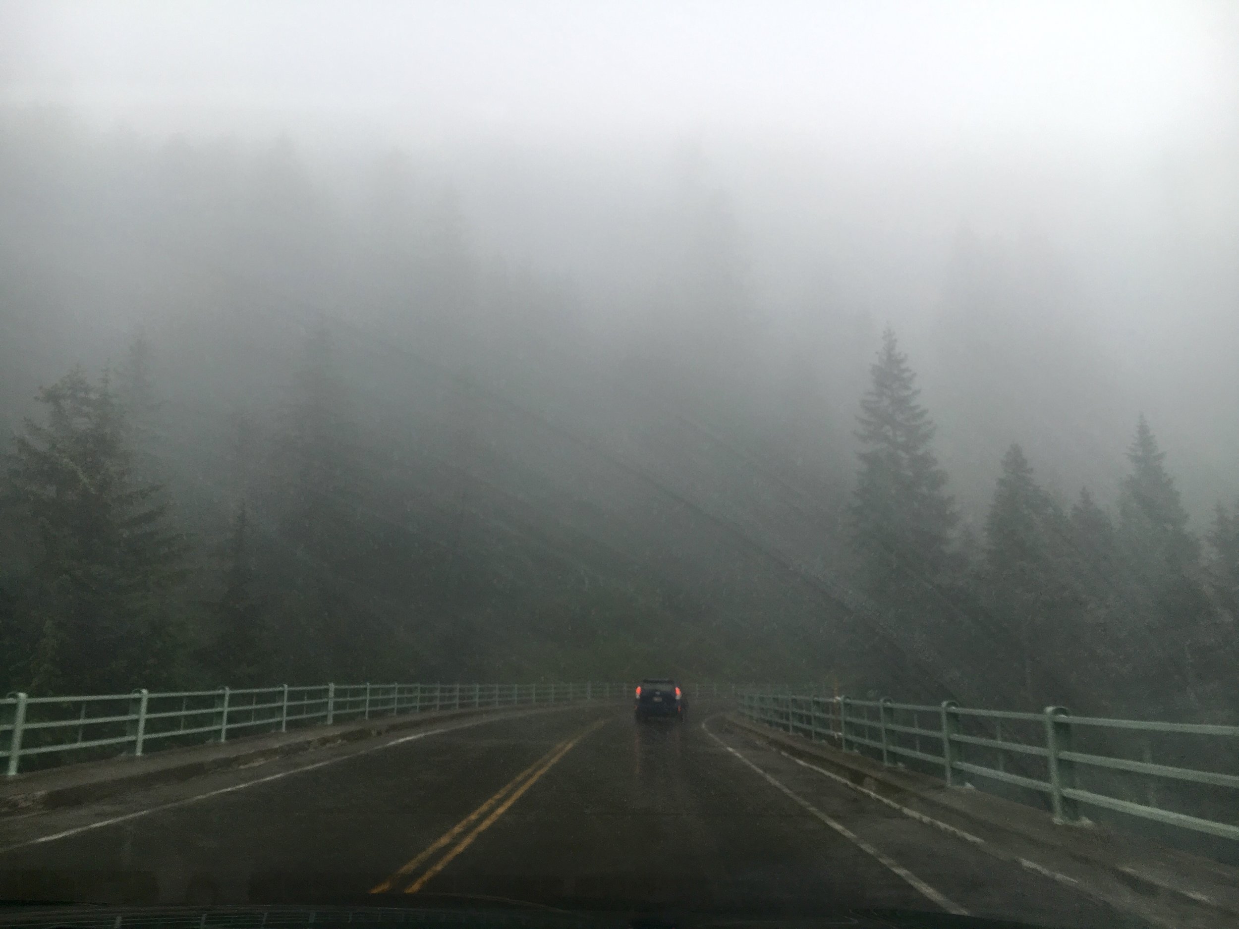
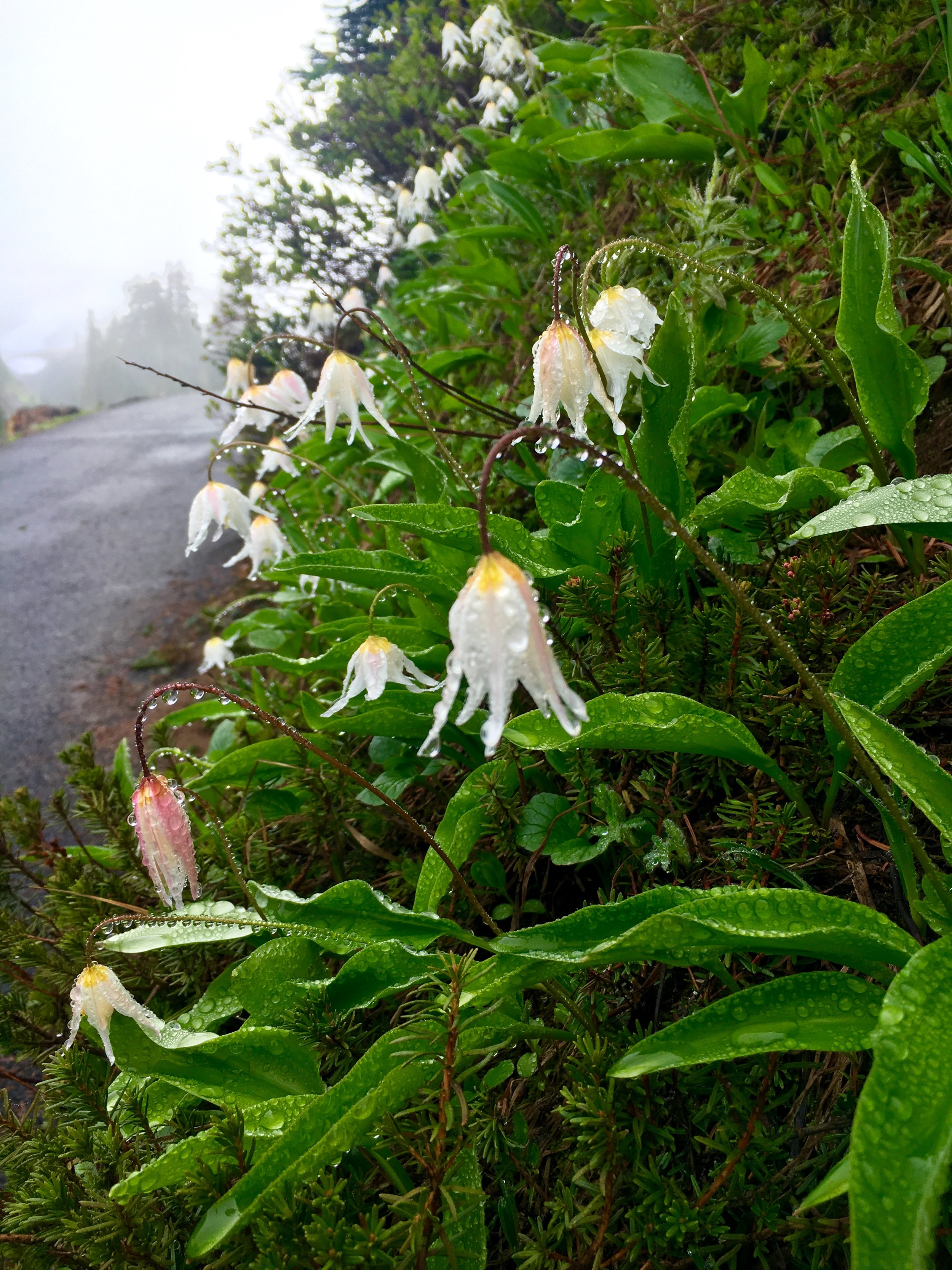
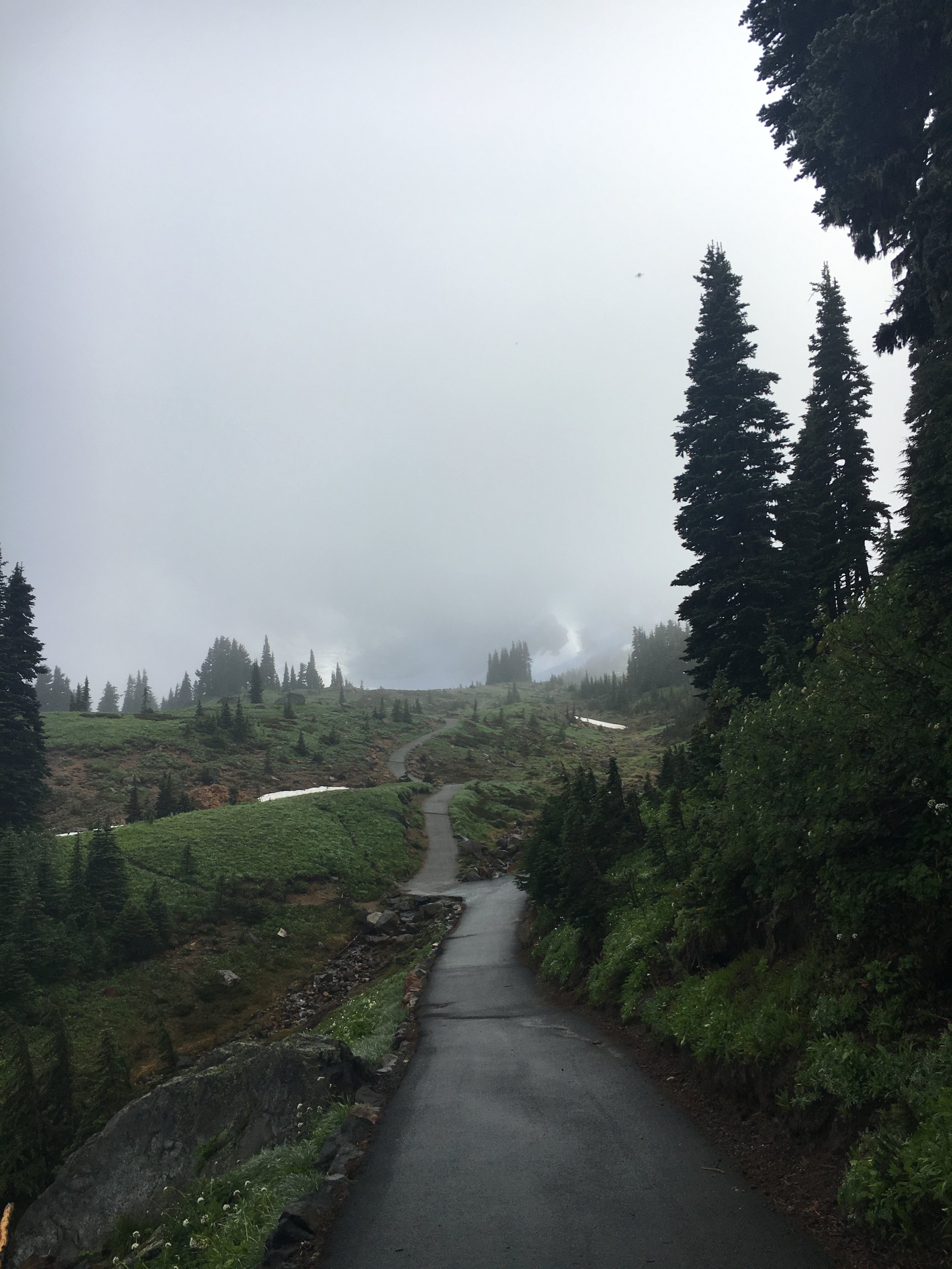
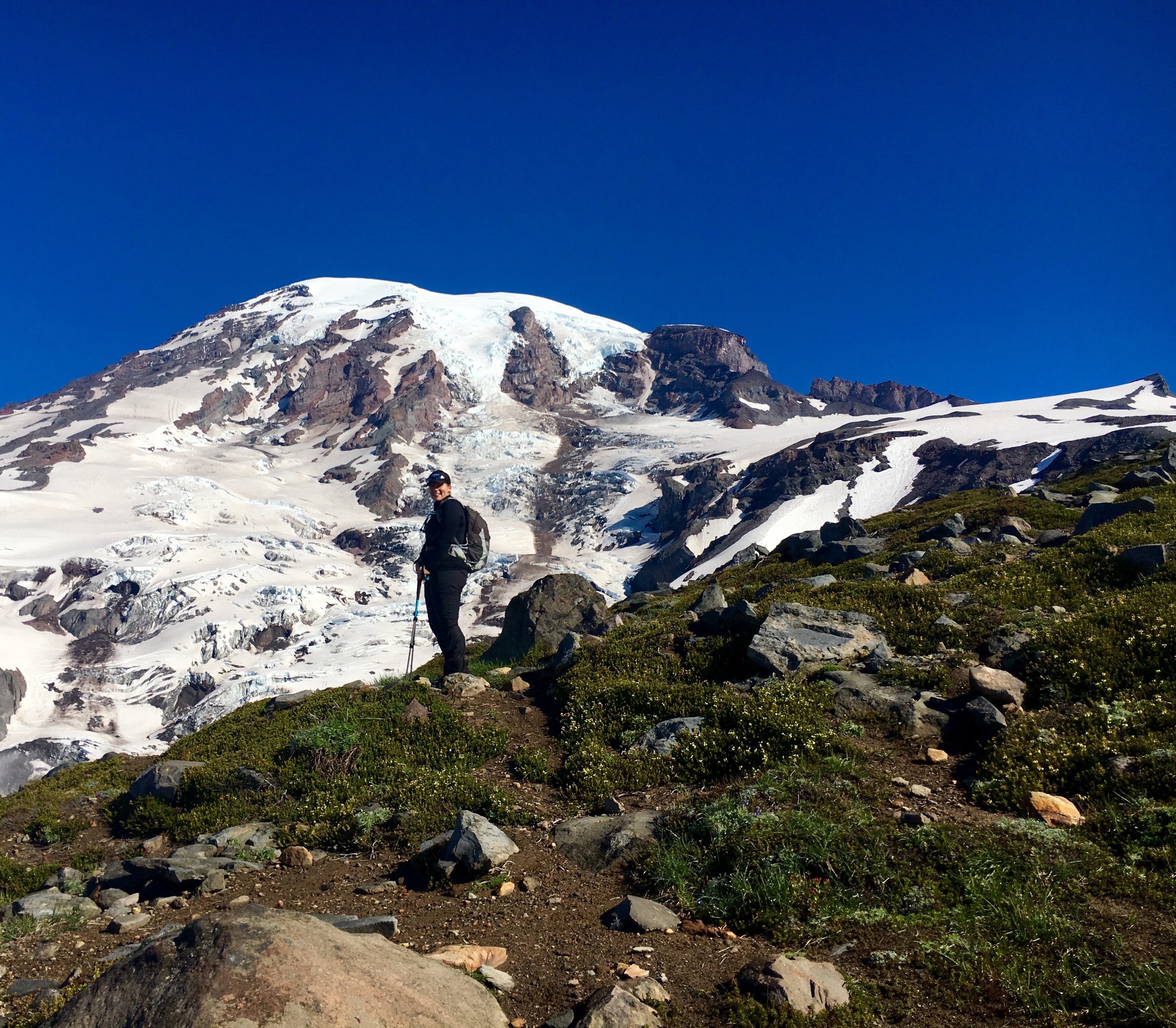
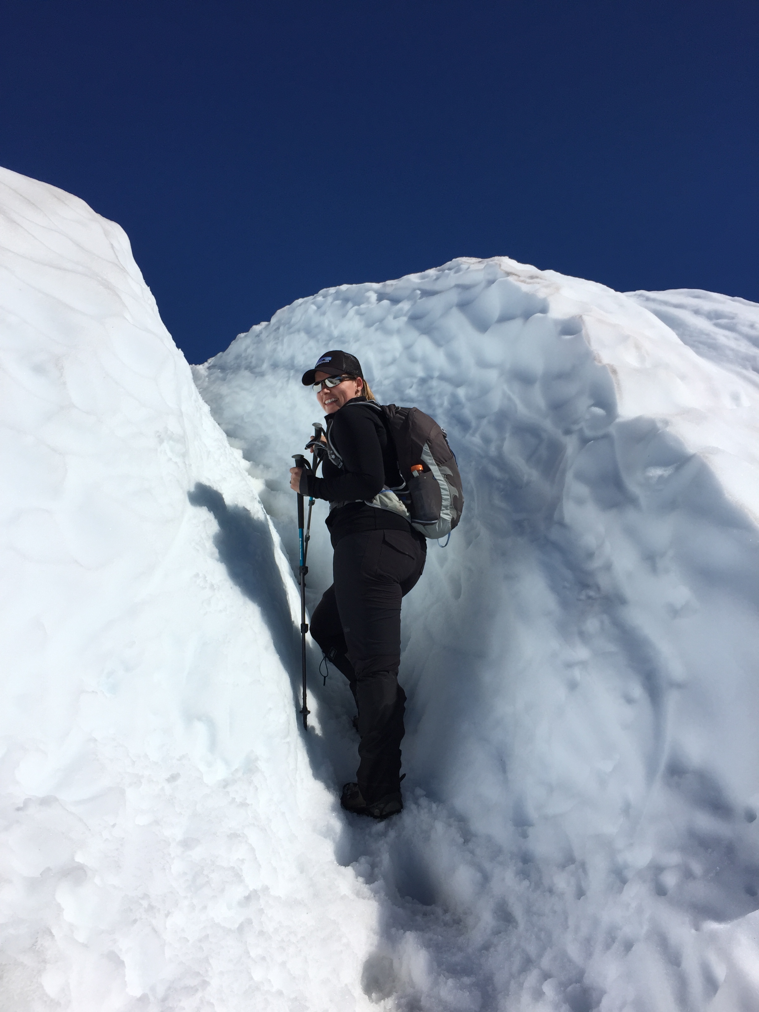
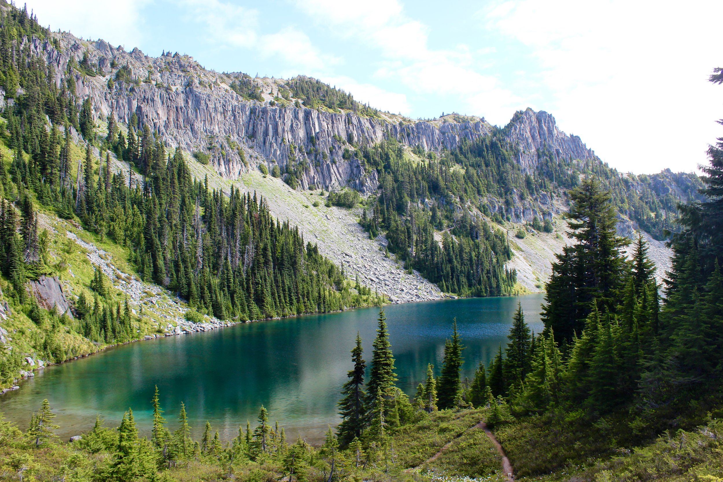
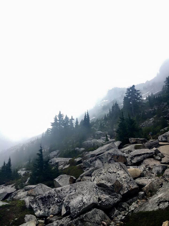
The forecast had called for mostly sunny so we were a bit discouraged by the thick fog that devoured the mountain. We donned our gear and hit the trail. The beginning of the trail is paved and quite steep. Eventually it turns into dirt but we were surprised at about a mile in there was already snow and lots of it. There were stretches of snow on and off for awhile. At a bit before 2 miles you will see that cut off to Camp Muir that continues up while the Skyline Loop trail continues straight. It was now or never and this was really happening. We went up and crossed Pebble Creek (the last source of fresh water beyond melting snow). After this the snow was constant so we put on our micro-spikes (traction) and were happy to have gaiters to not get our pants wet or snow in our boots.

600_370402492

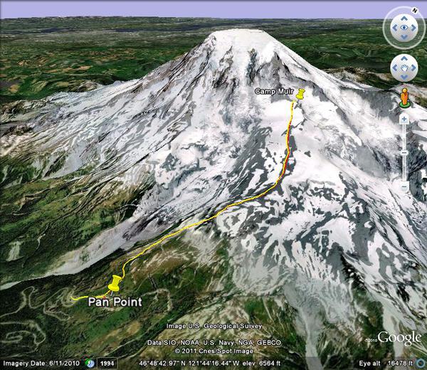
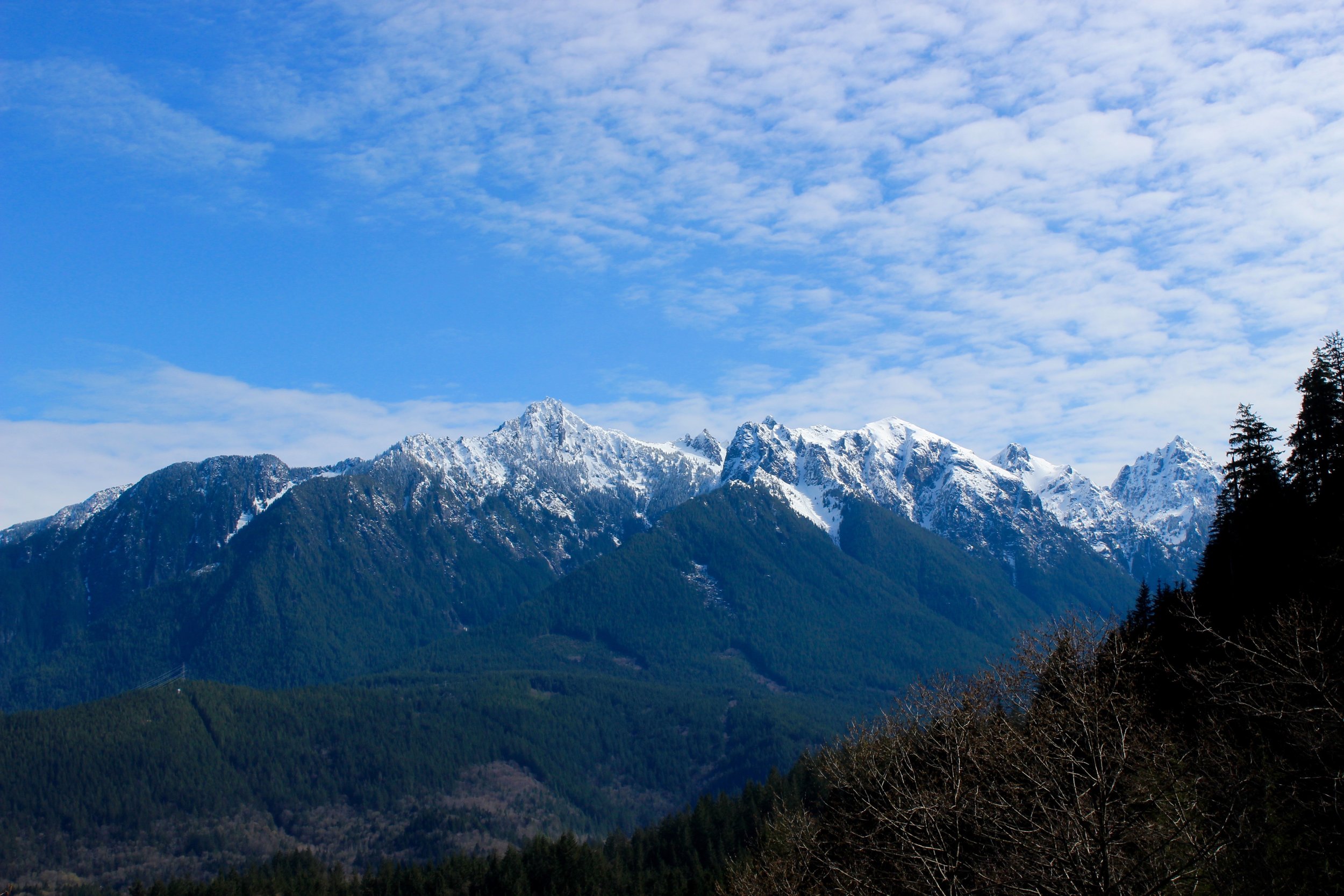
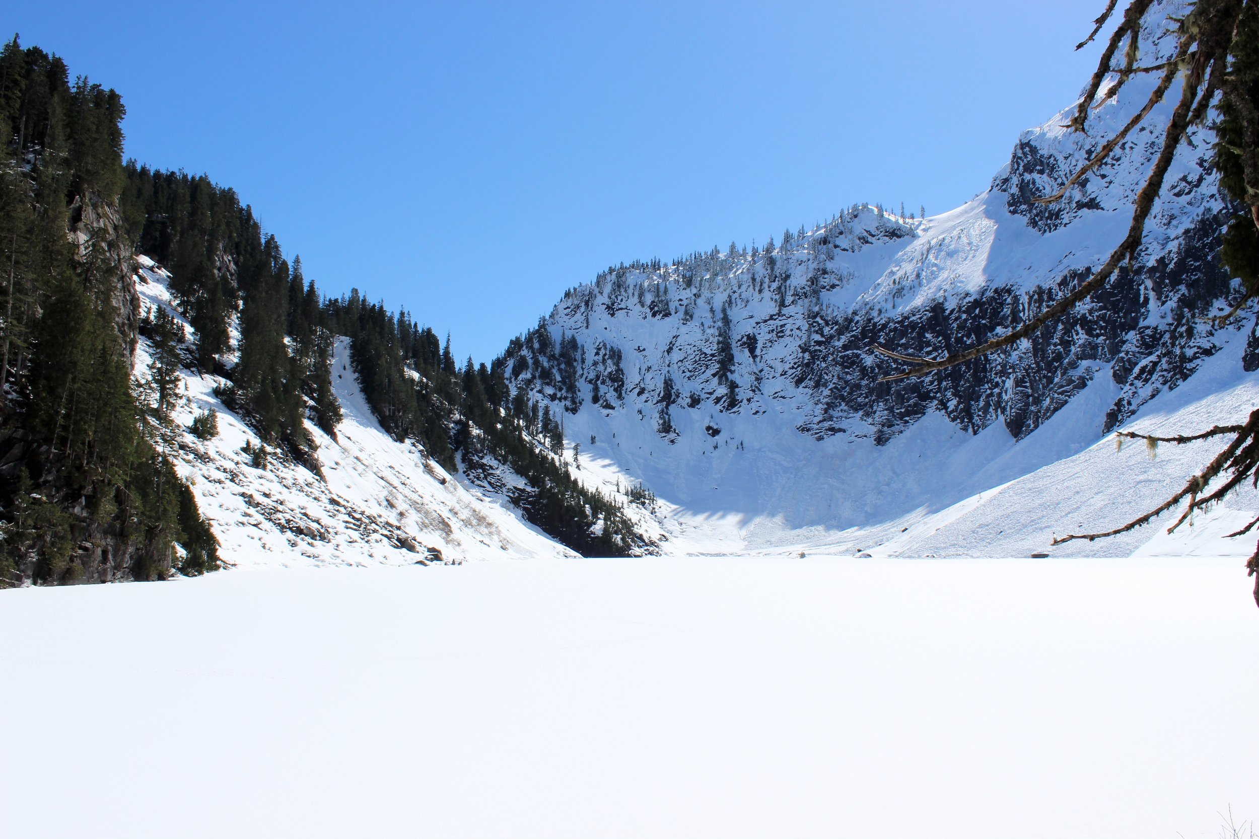
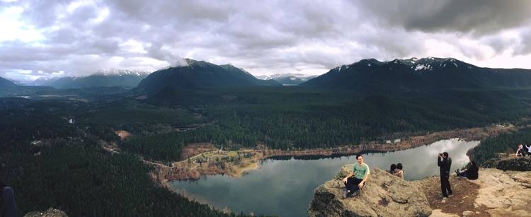
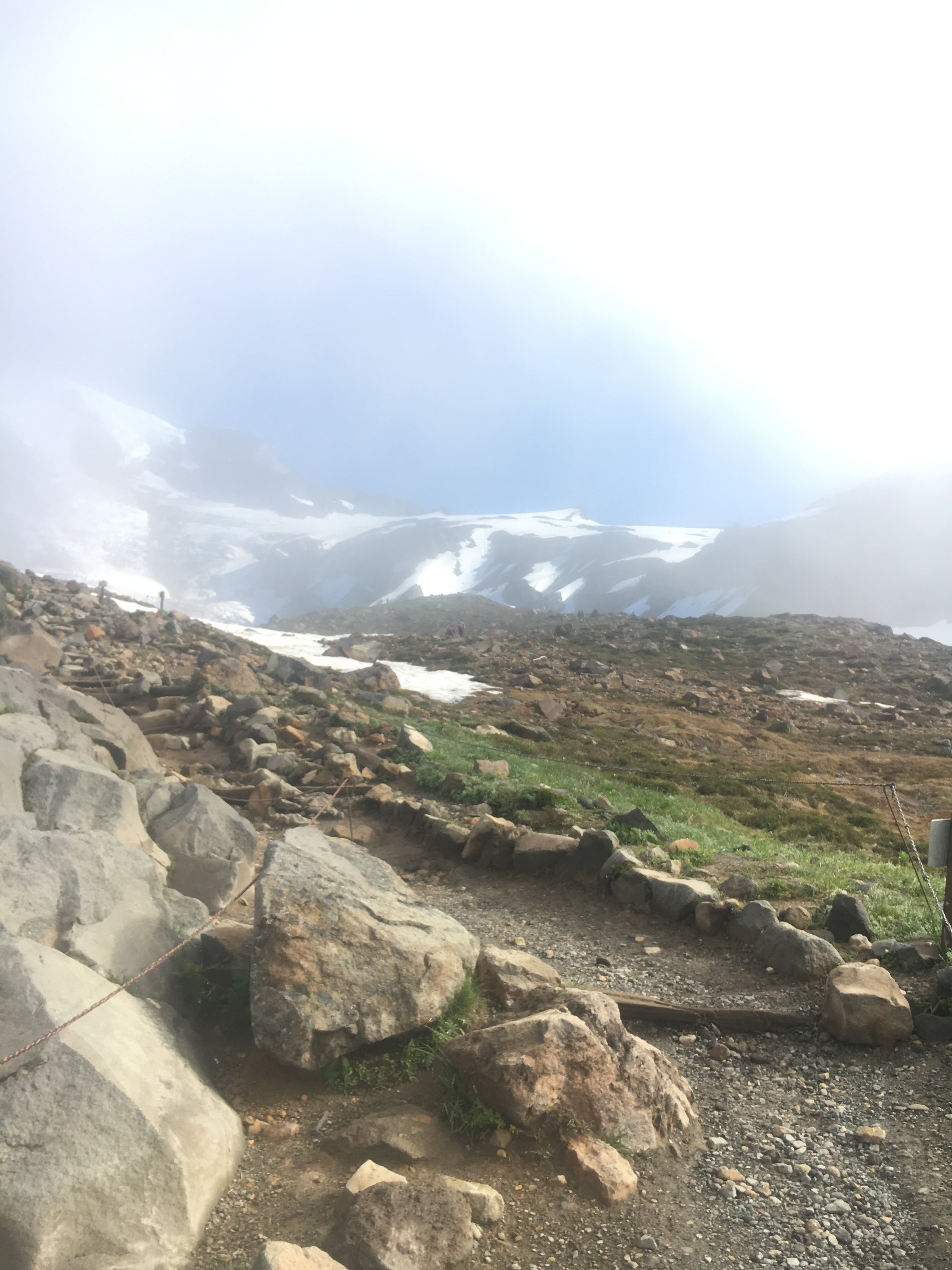
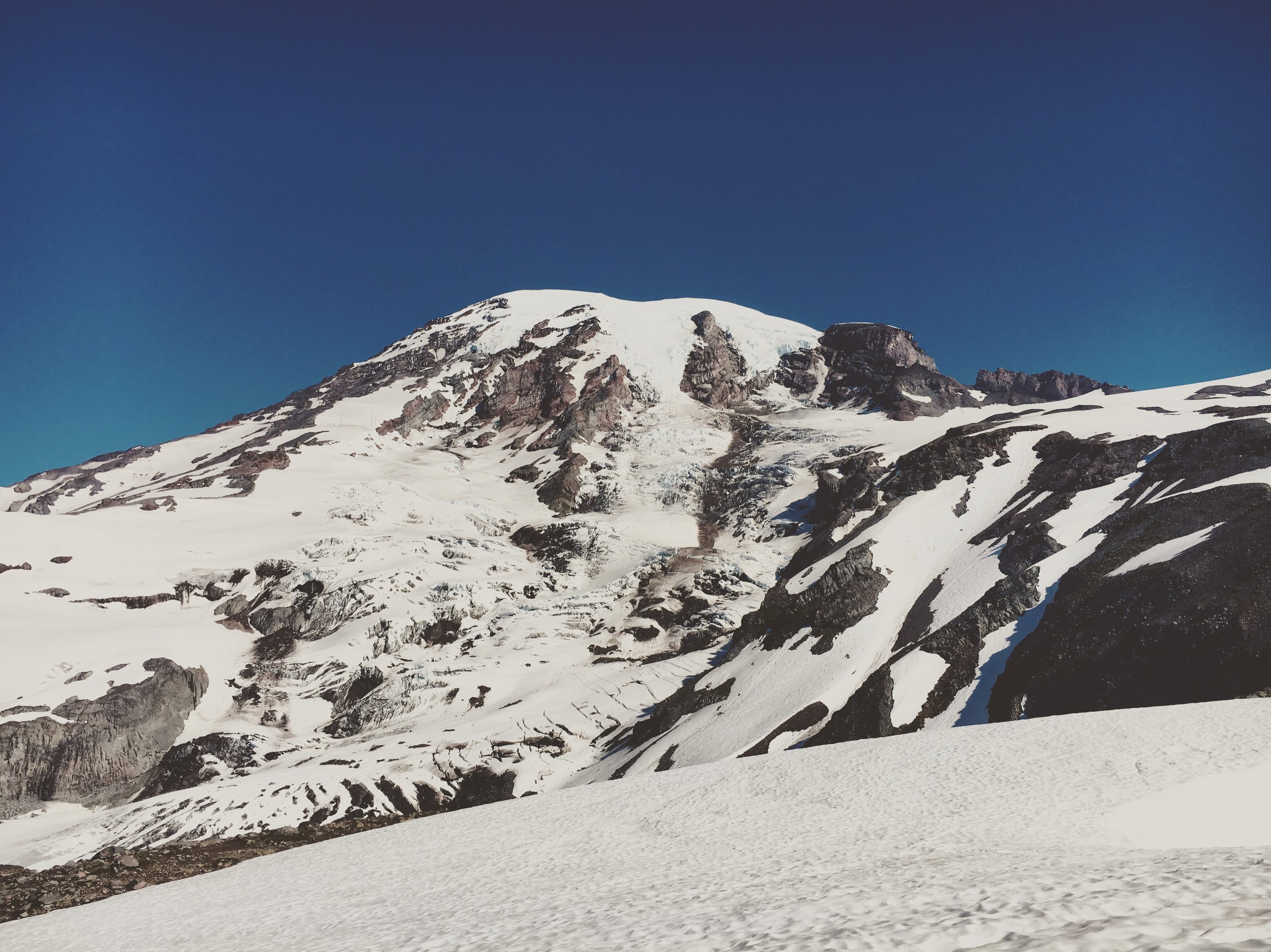
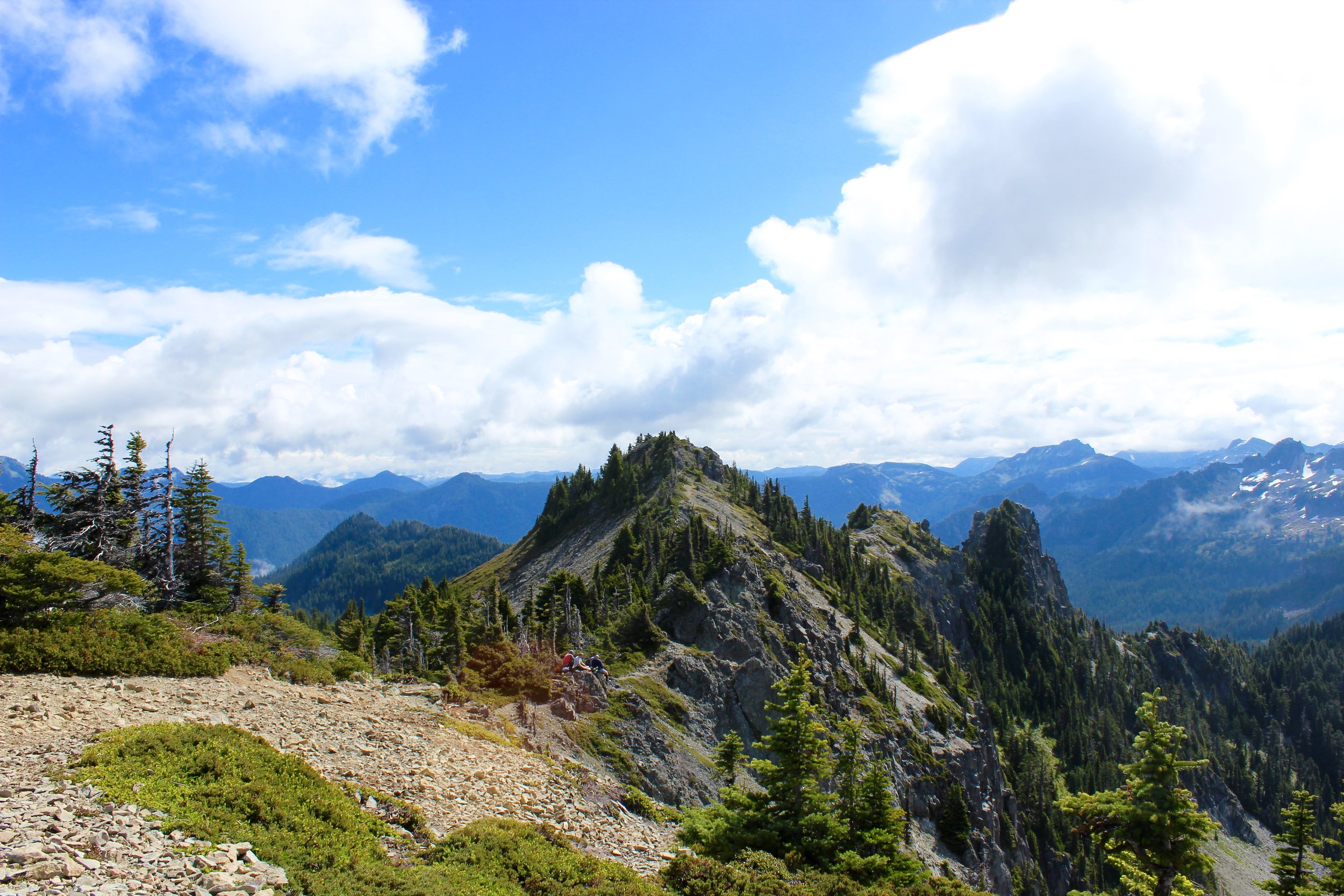
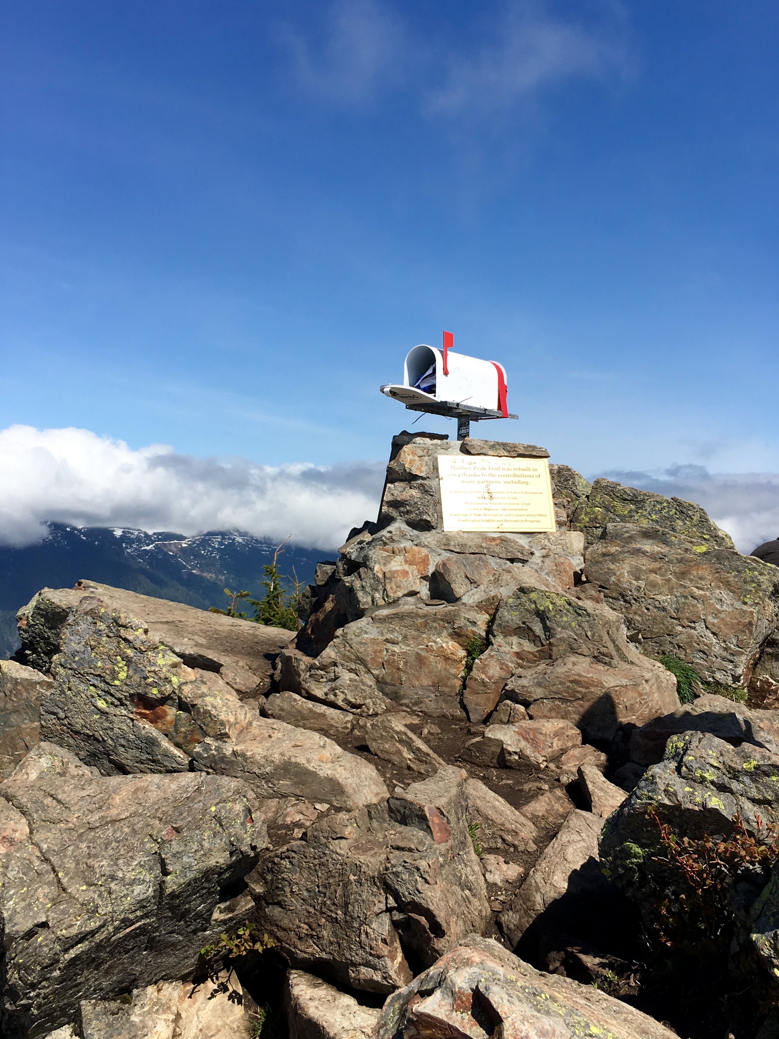
Here is some perspective of where Camp Muir lies on the mountain. It reaches 10,080 feet of the 14,416 feet.

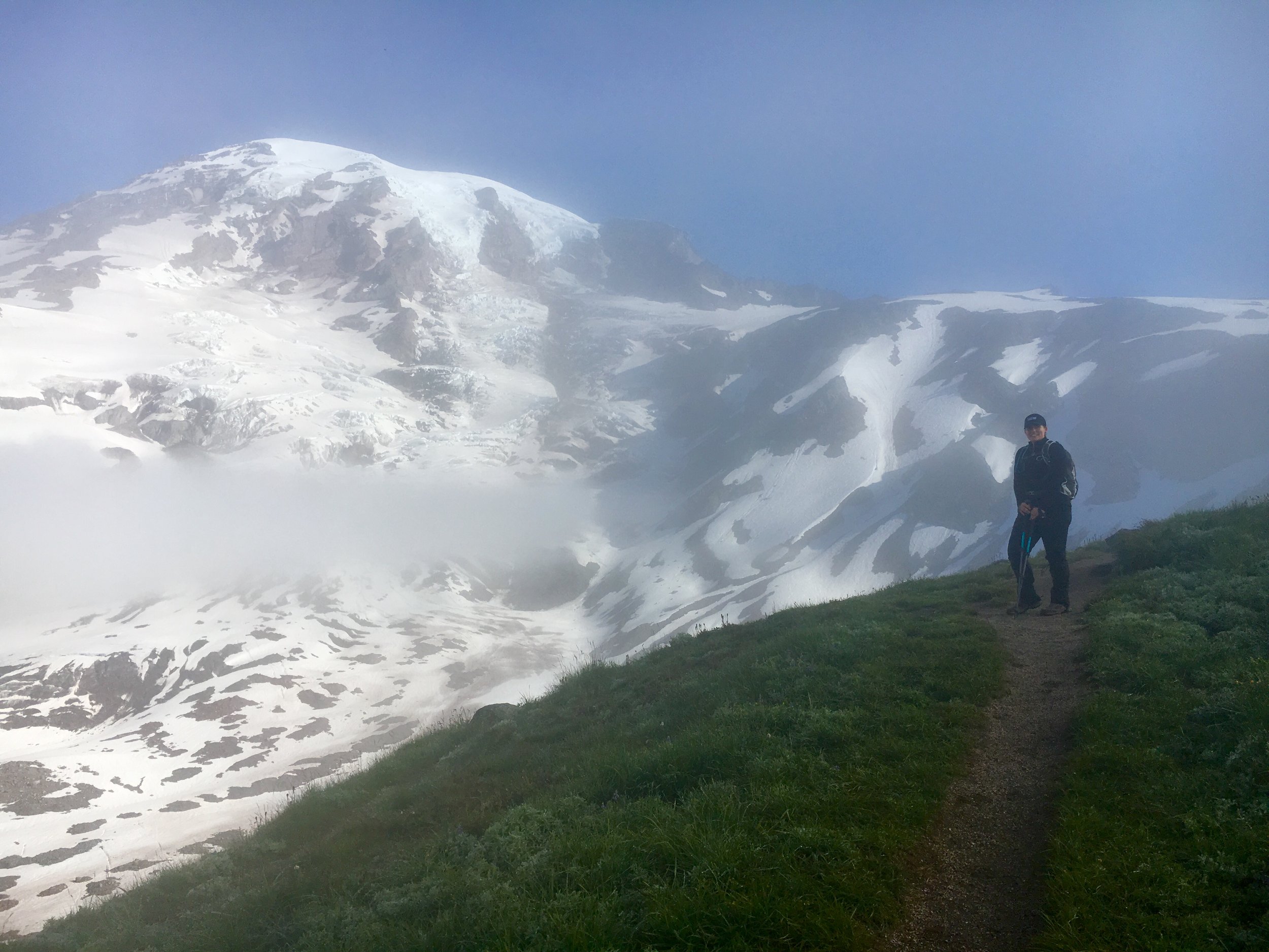
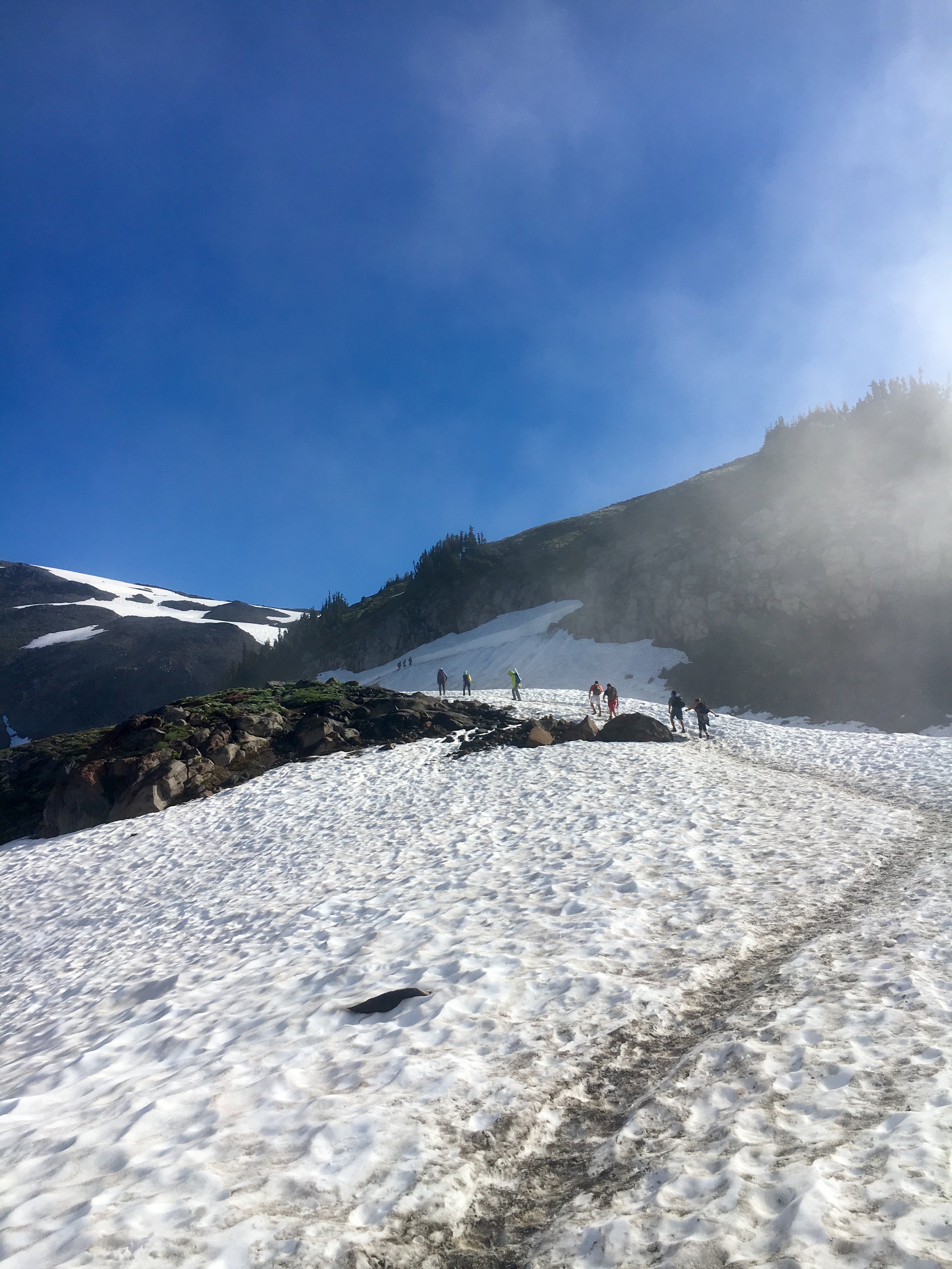
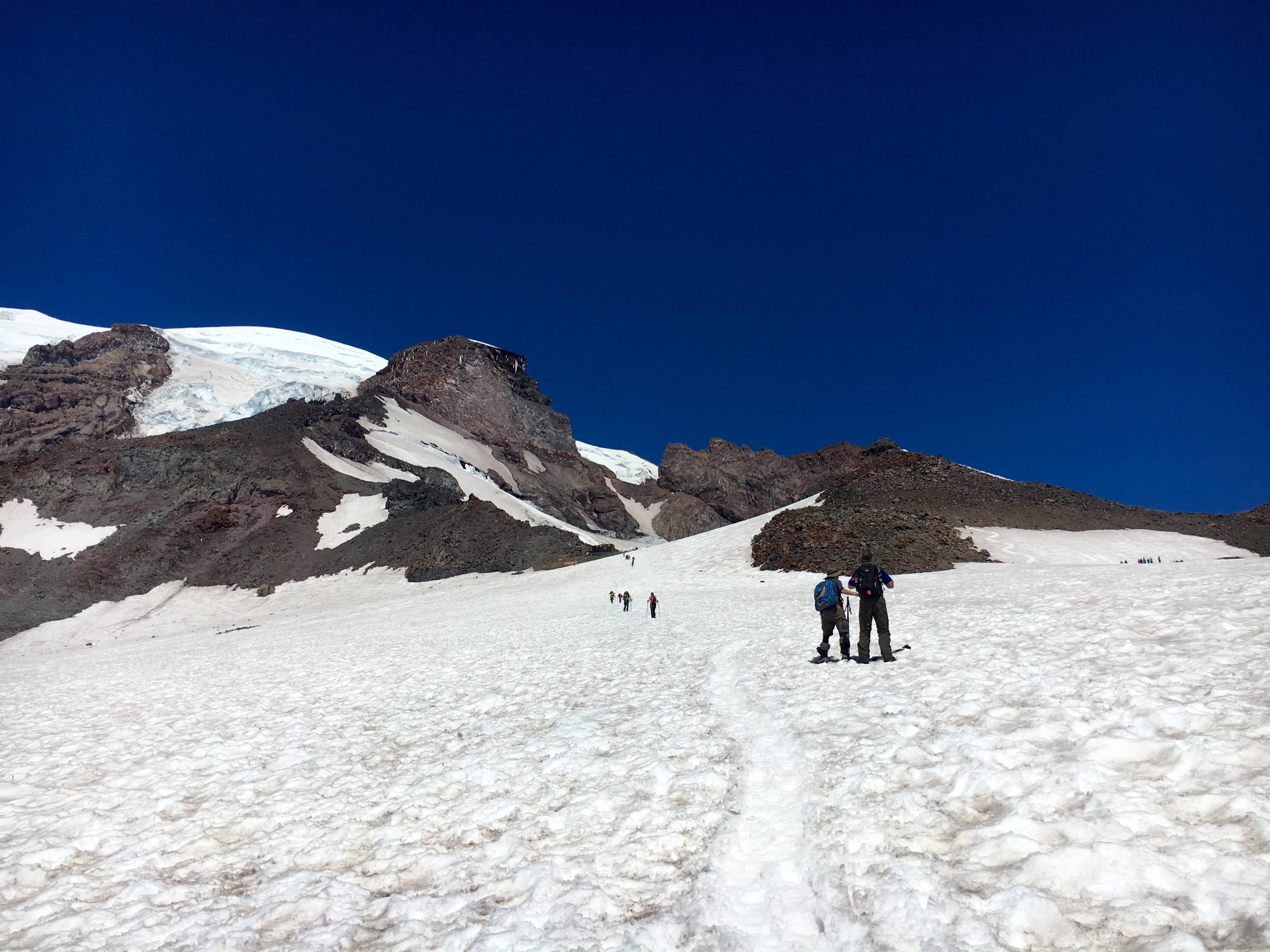
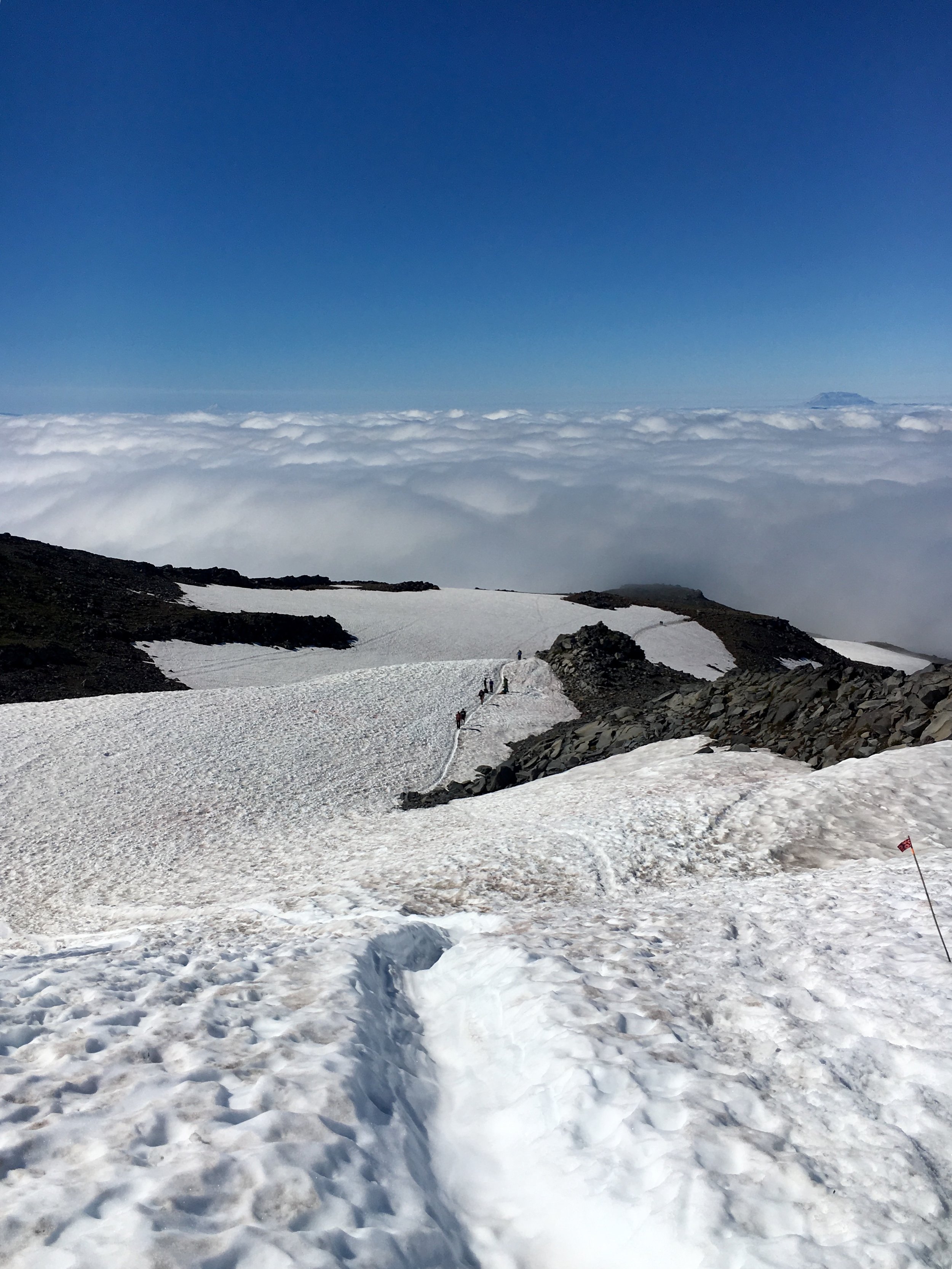
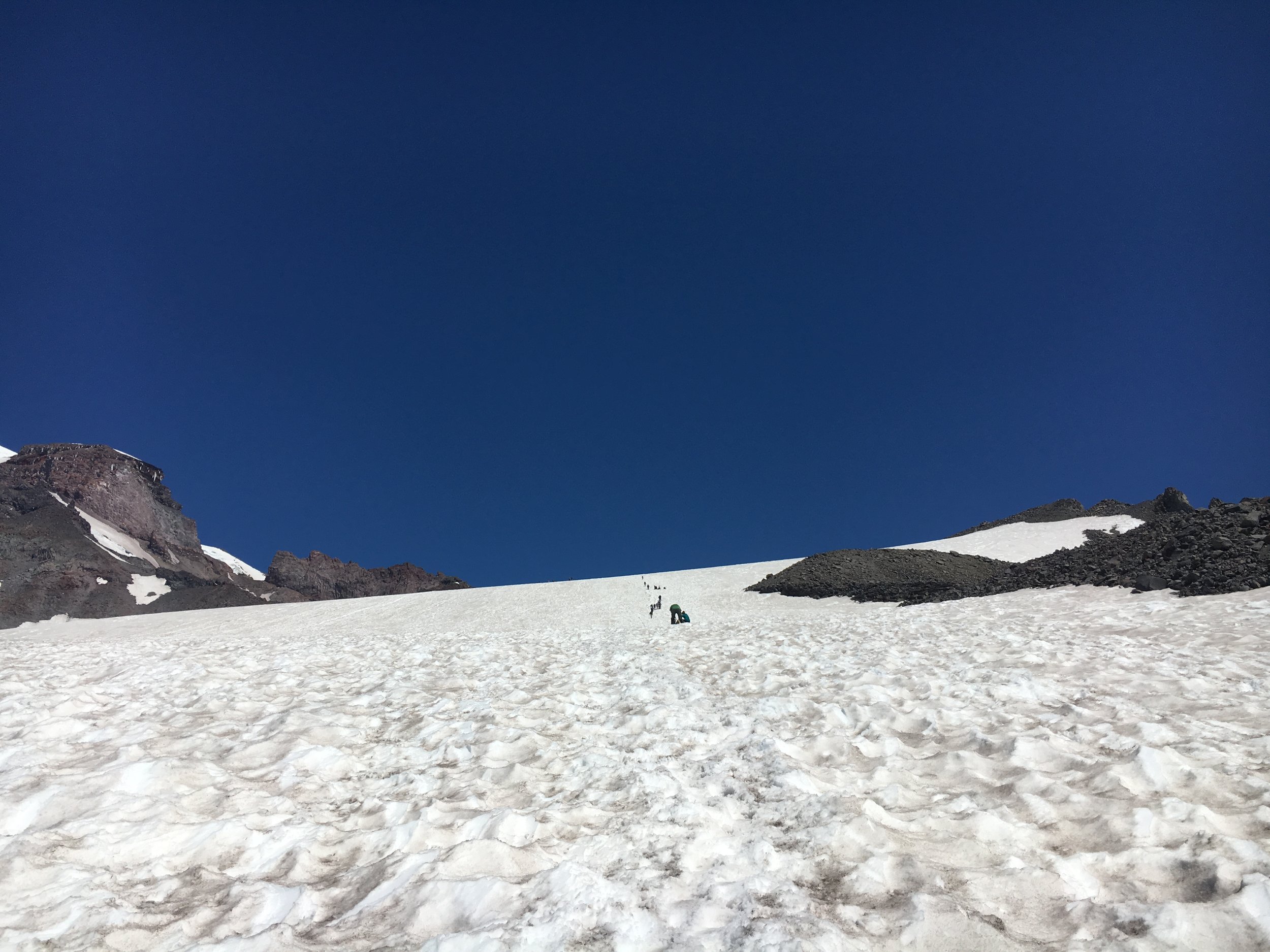
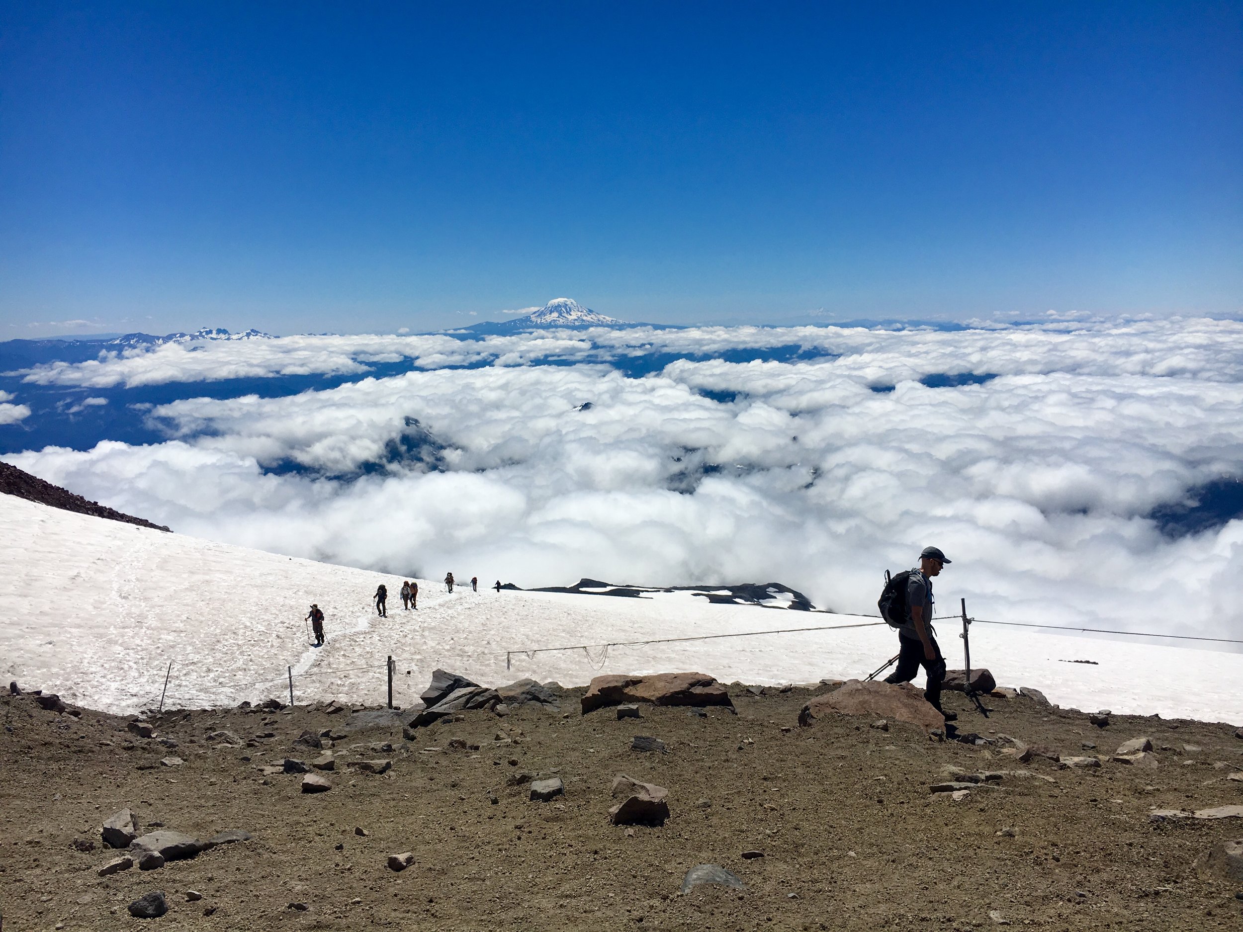
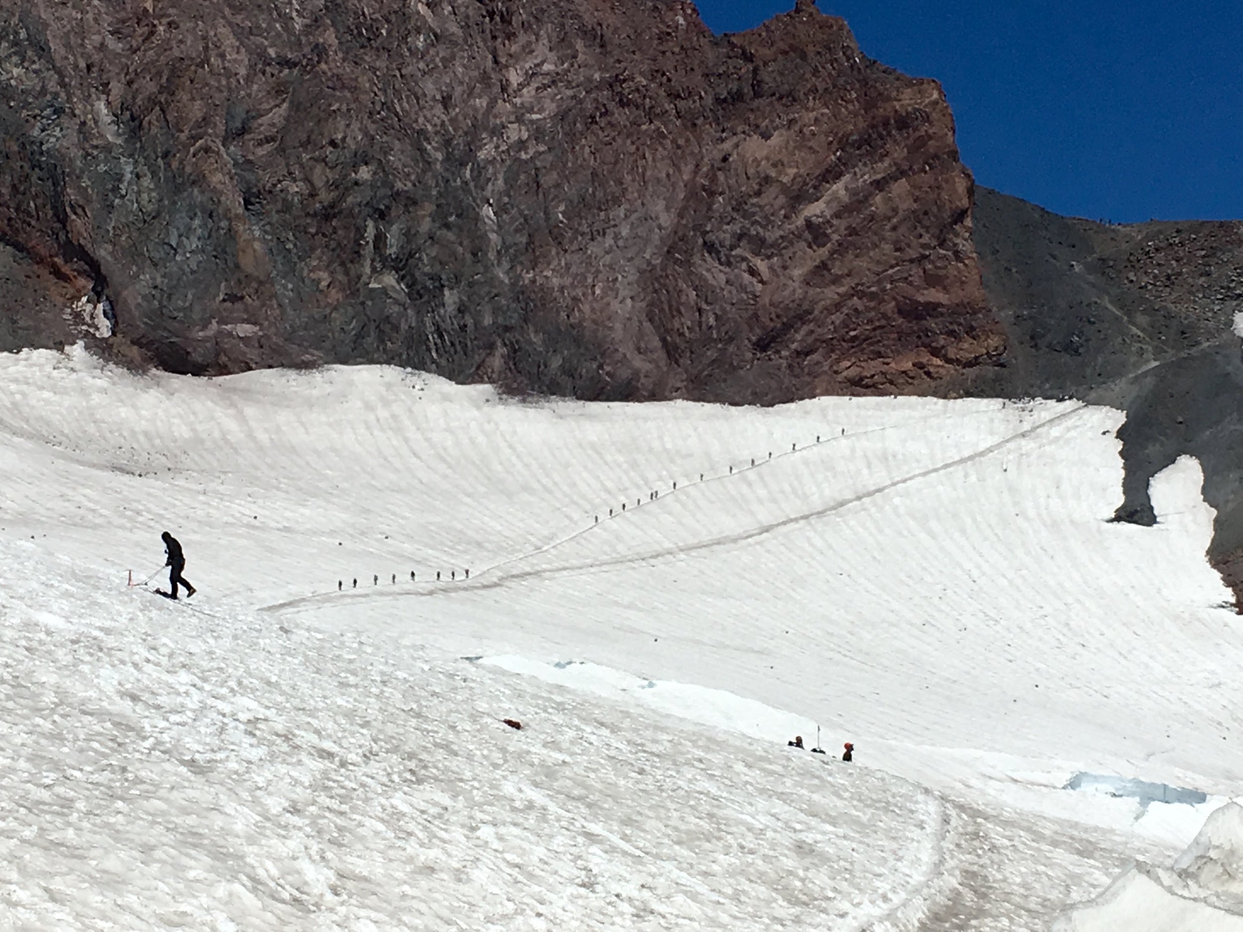
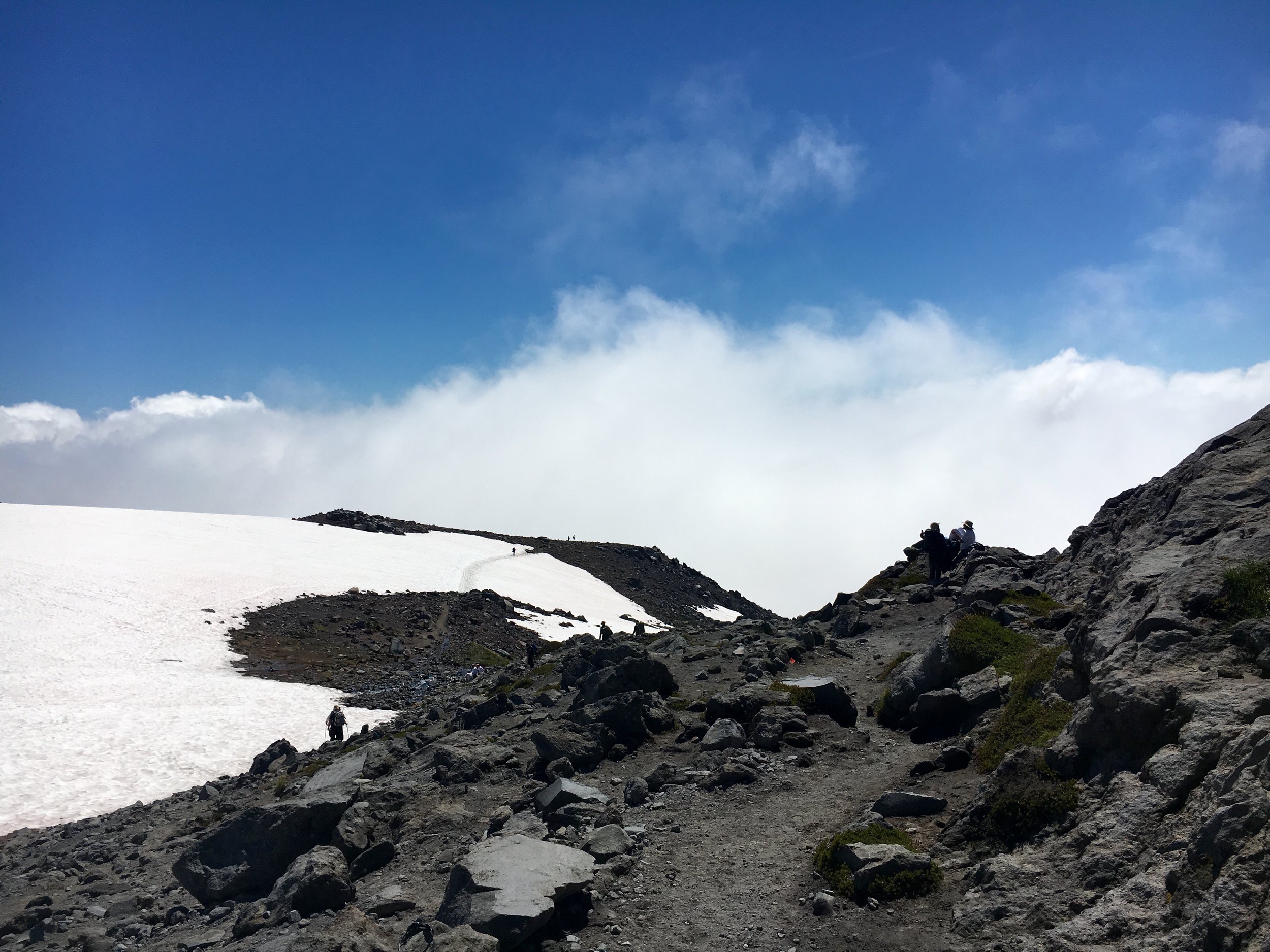
It is here the real climb began as the endless snowfields and elevation gain were ruthless. I began to feel the altitude at about 7,500 feet. It seemed my heart rate was way higher than normal (for a hike) and my head started to hurt and I started to feel a bit queasy. On paper this hike doesn't seem that bad compared to many other in the state with similar stats. What is so different is the snow fields and altitude. That alone made it 100X harder than any other hike we have done. We were slowed down a lot by this but just kept setting landmark goals. "Get to that pile of rocks or beyond that hill and then can take a break." This was really how we made it to the top. I don't think I have ever stopped more or gone more slow on a hike. The altitude sickness subsided and the thought of reaching base camp gave me the extra push I needed to keep going.

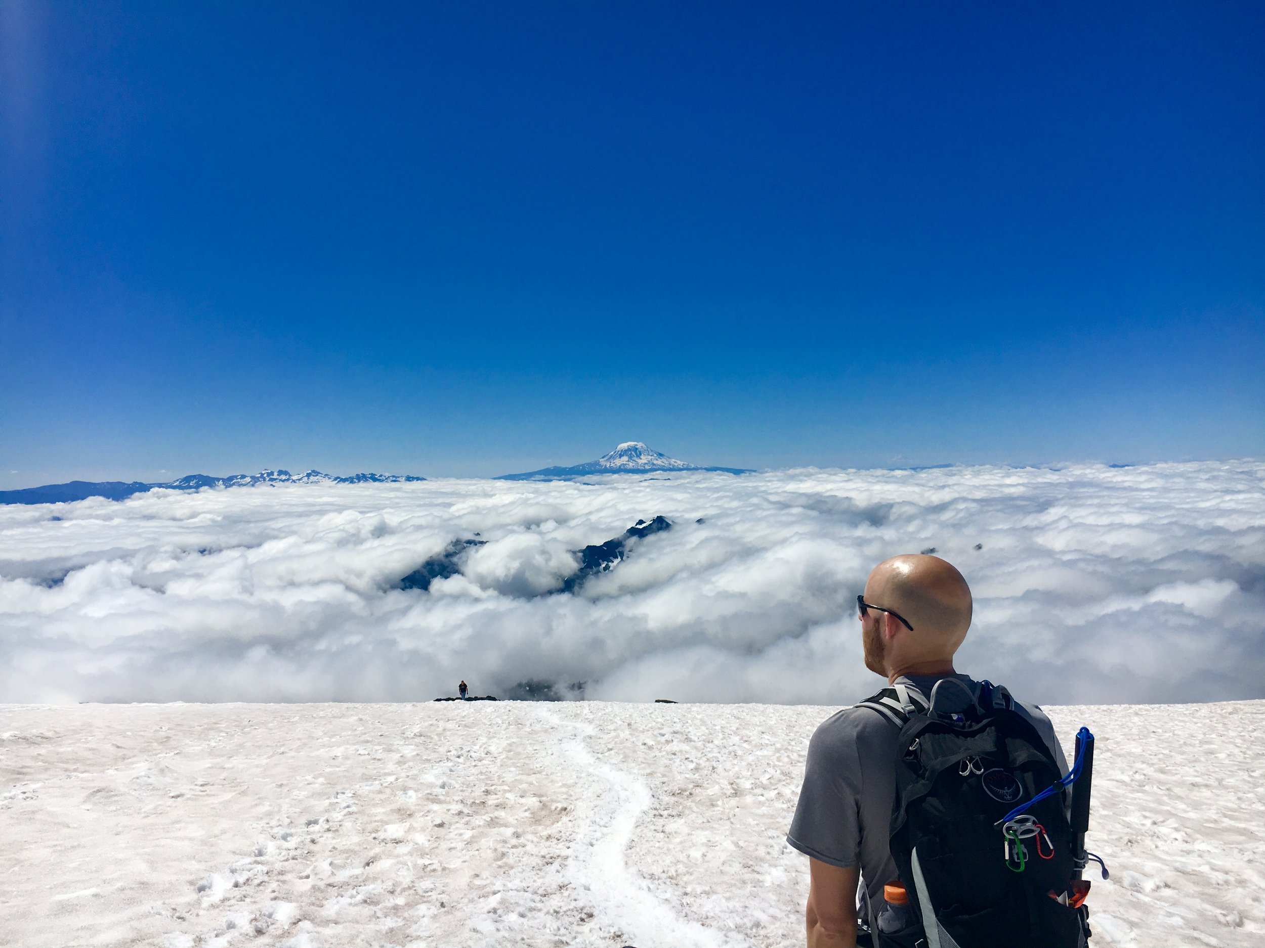
Side note- people notoriously get sunburned on this hike because of the snow reflecting back on you. We applied sunscreen religiously 3-4 times throughout the hike including sunscreen chapstick. Don't forget a had and sunglasses with good coverage.

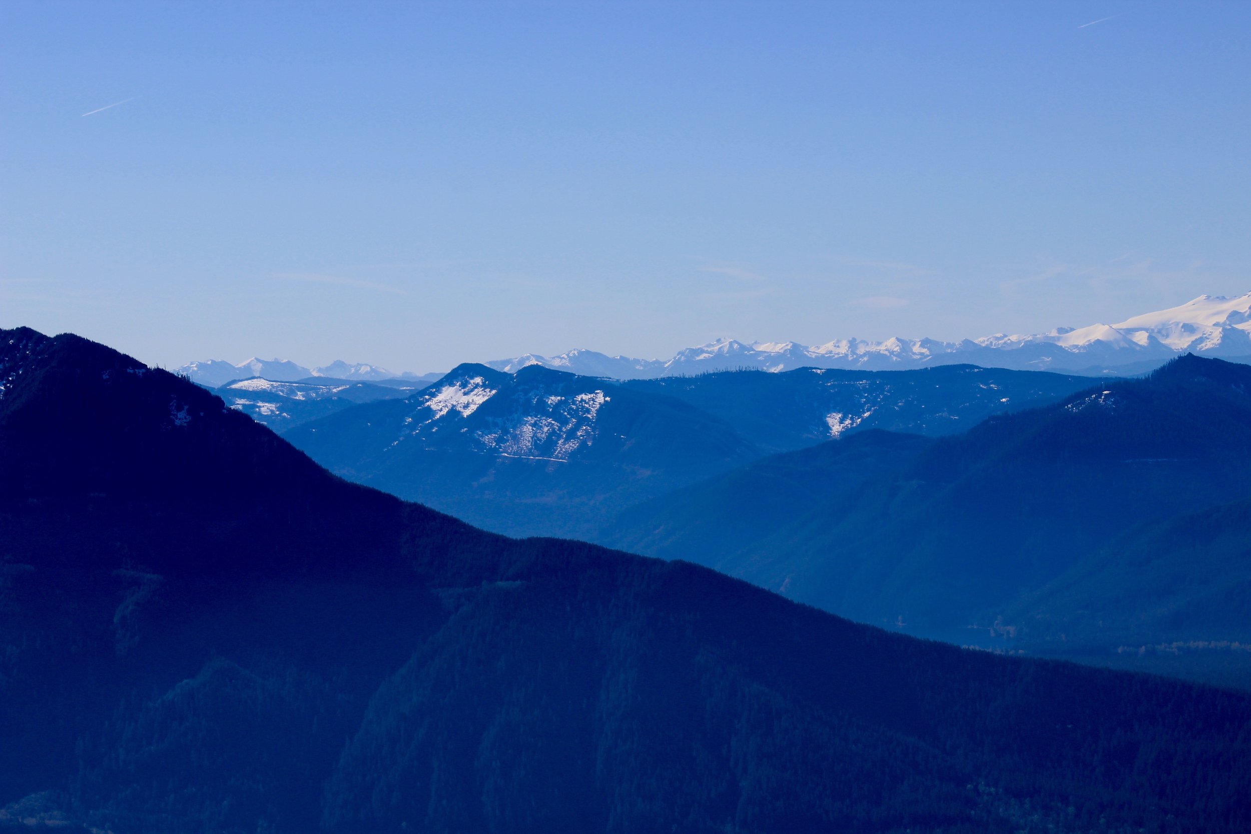
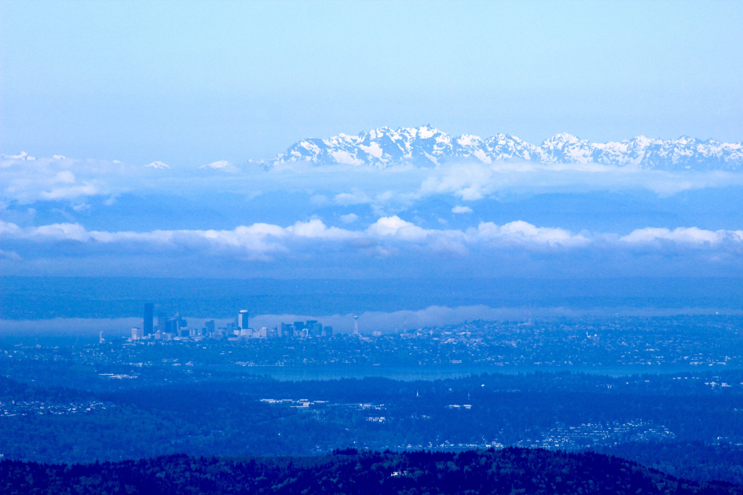
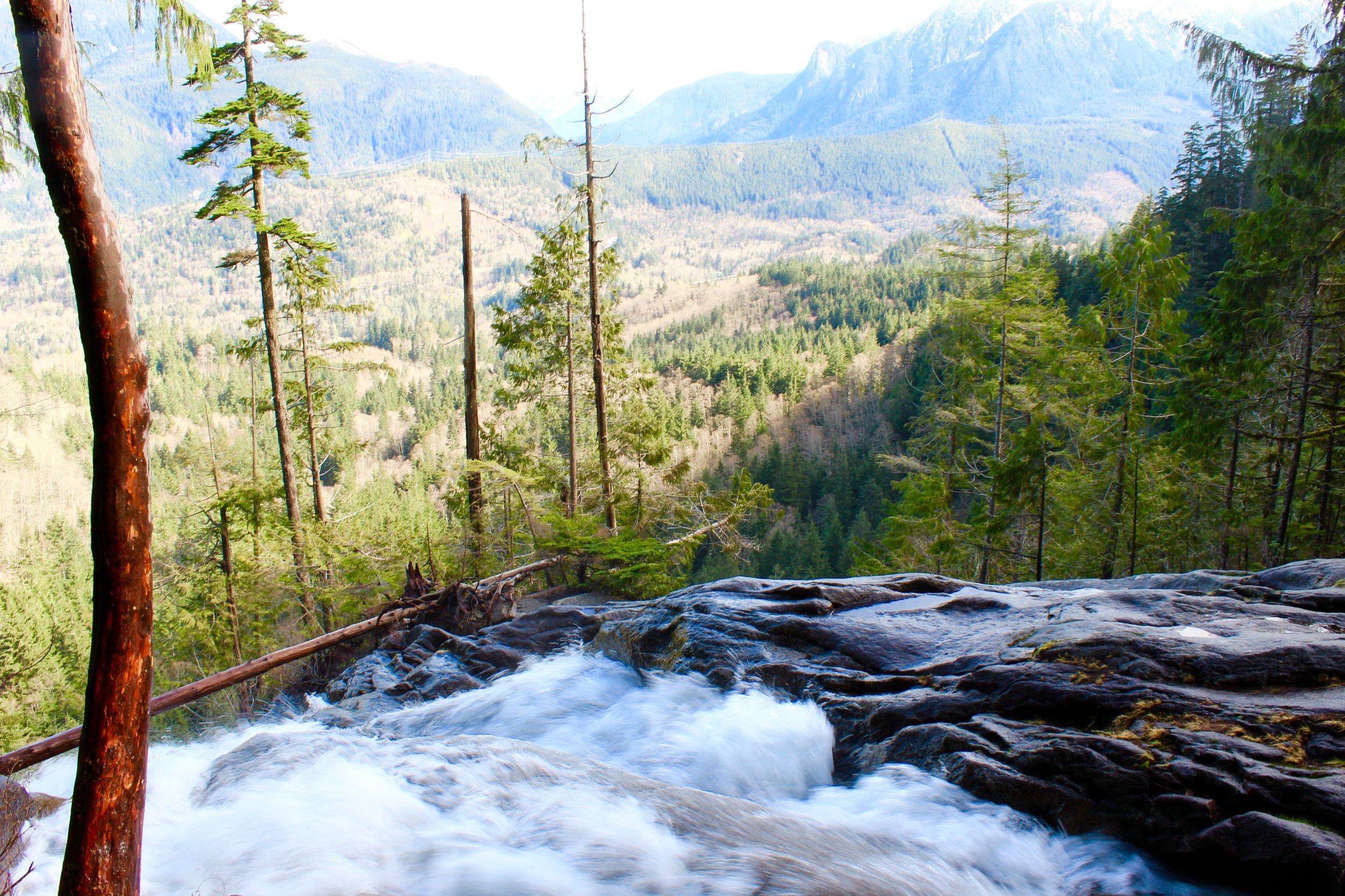
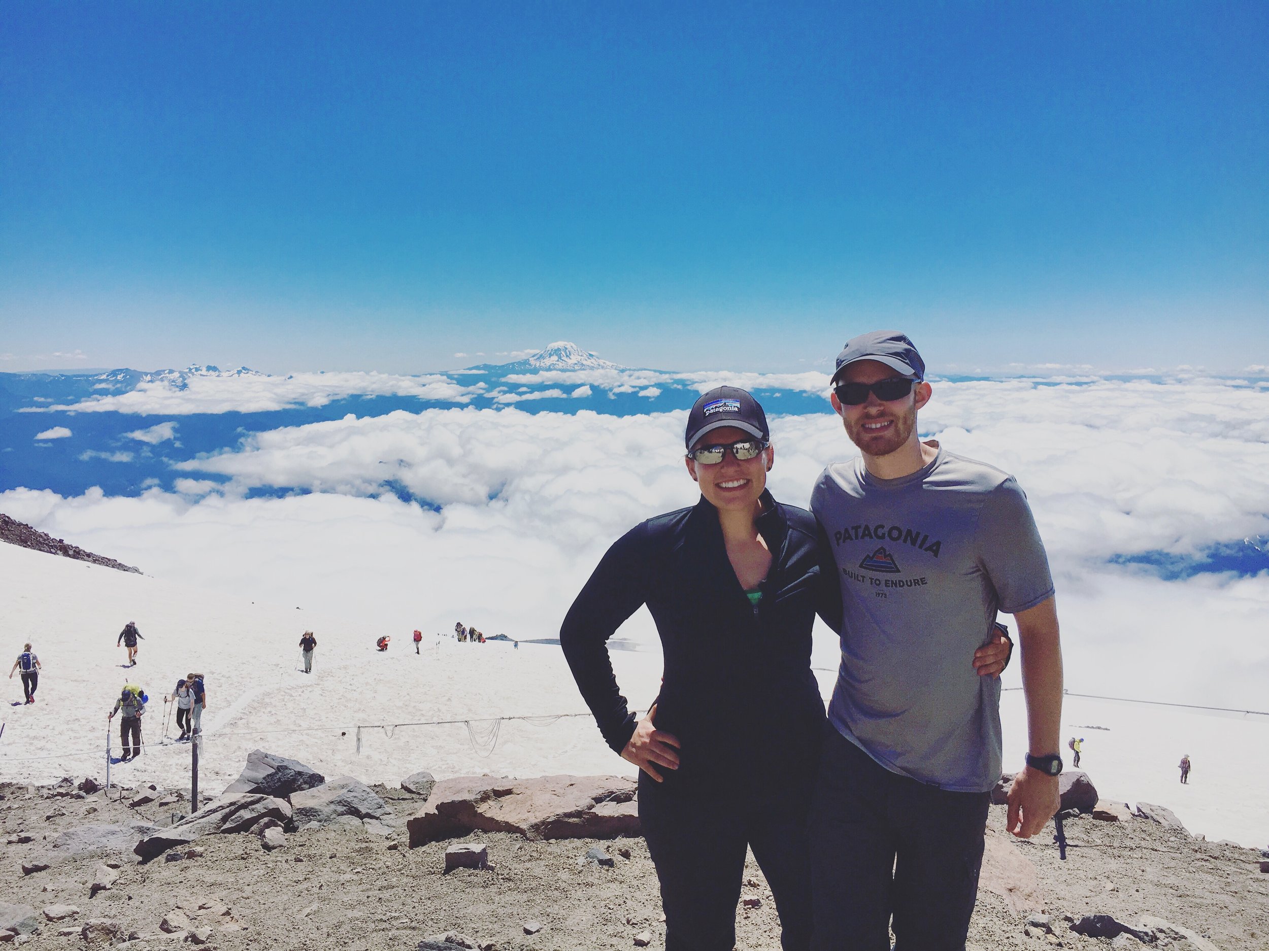
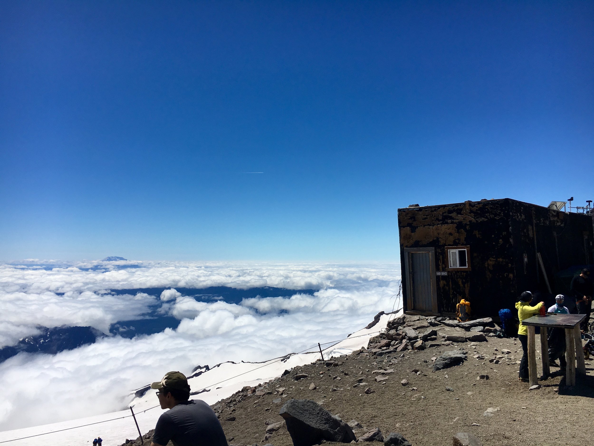
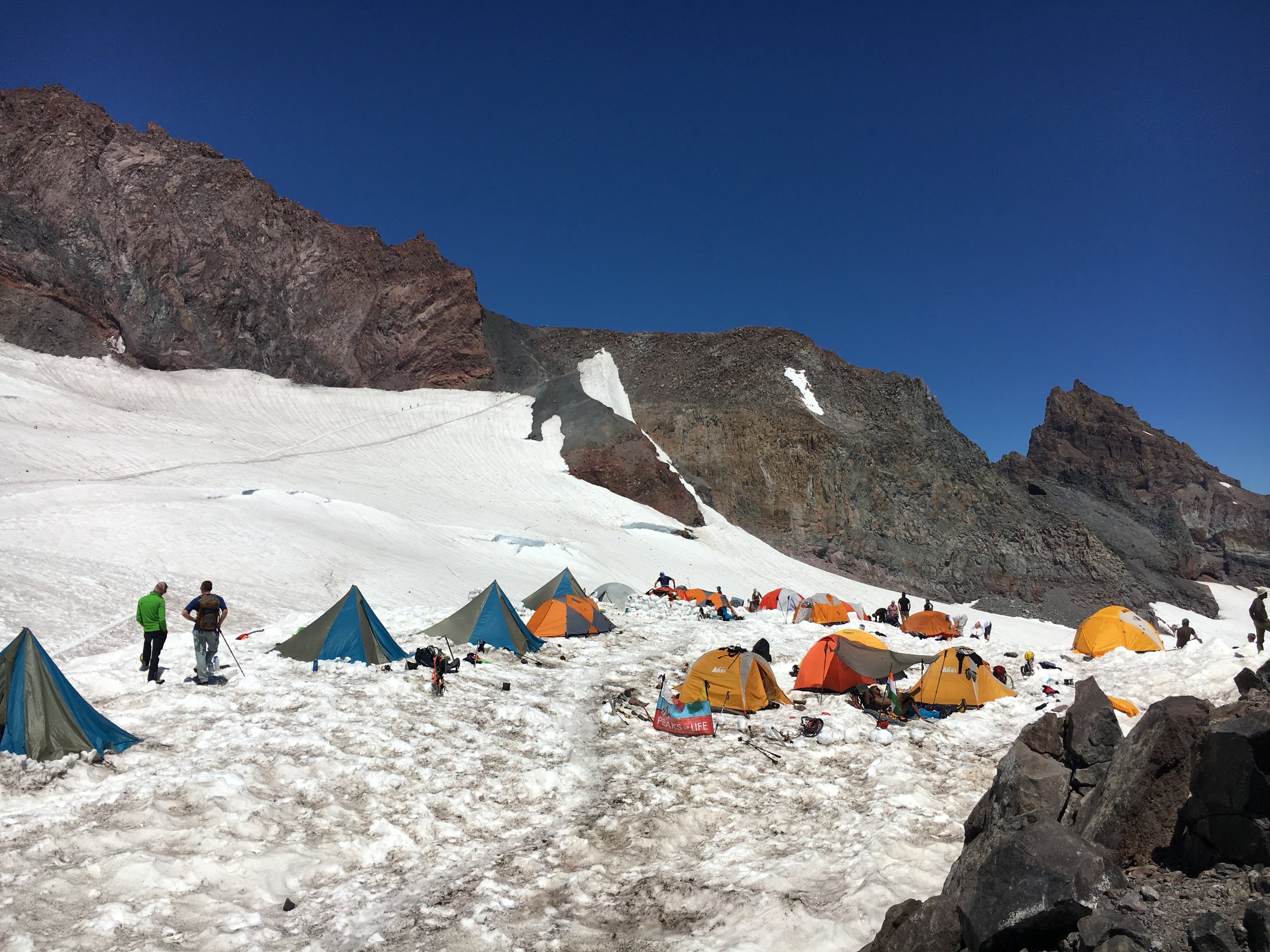
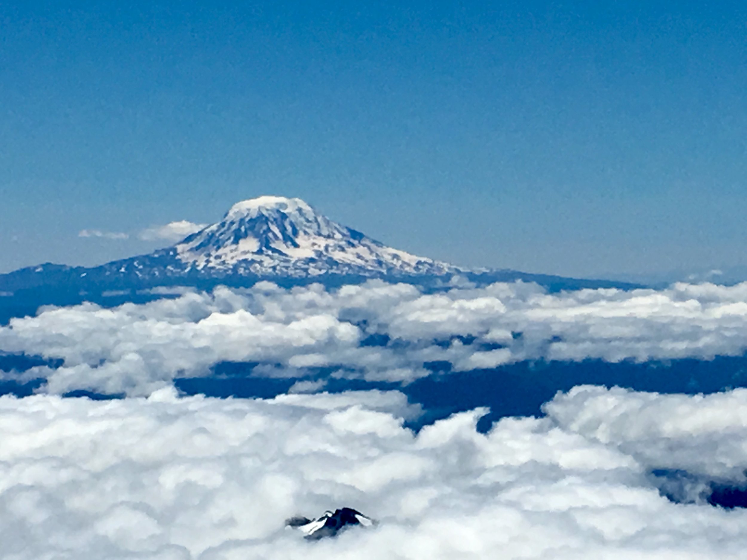
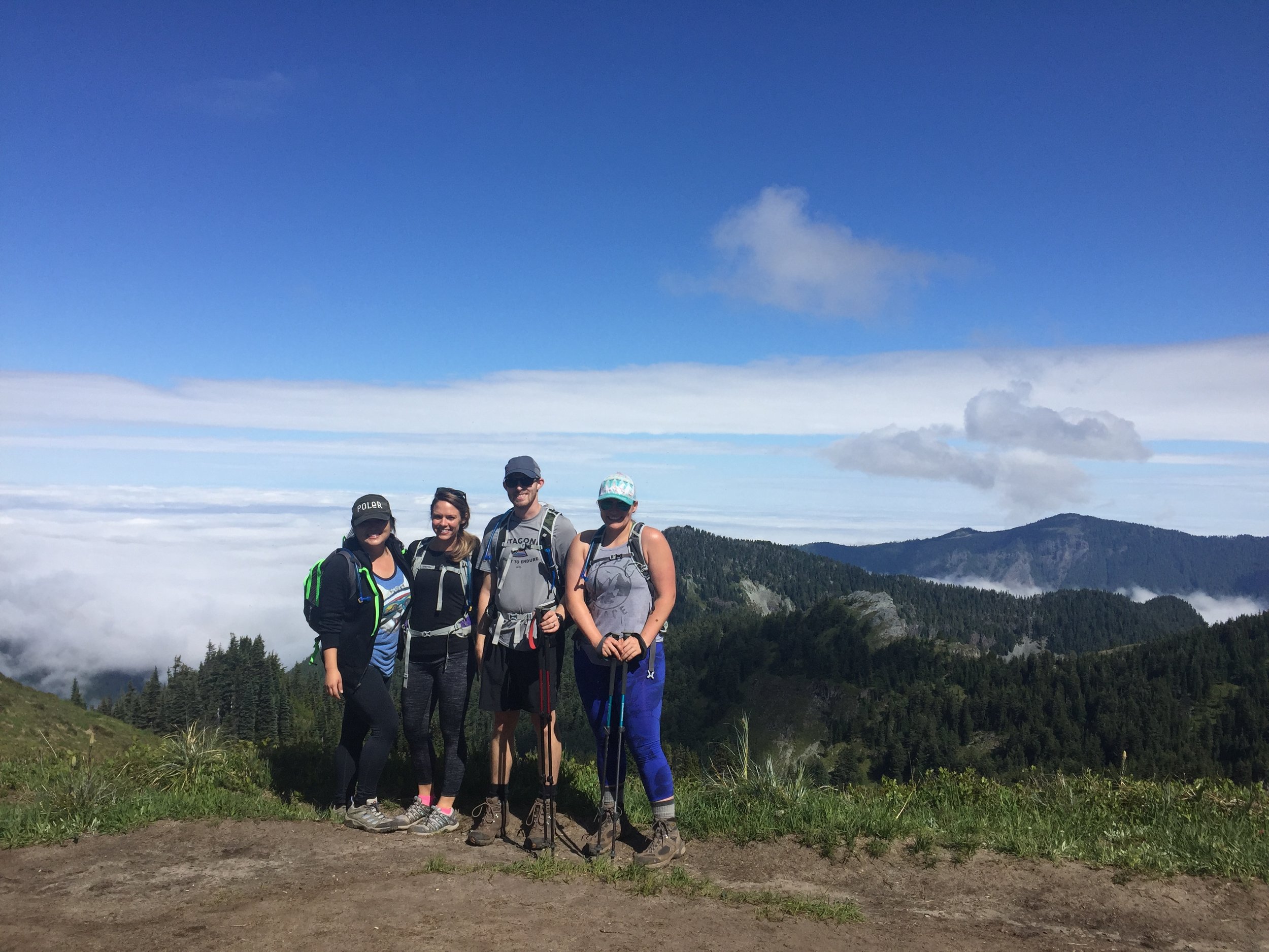
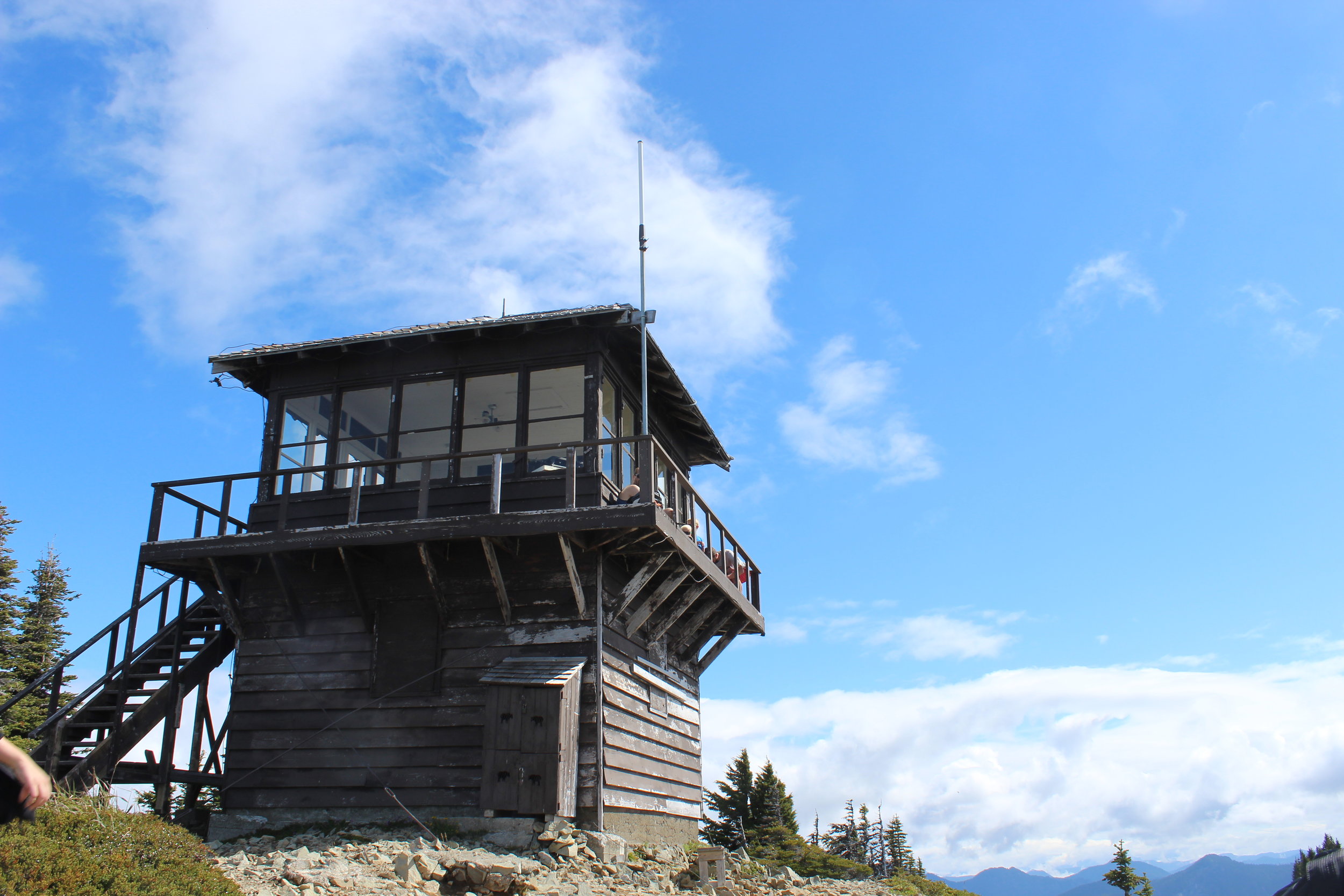
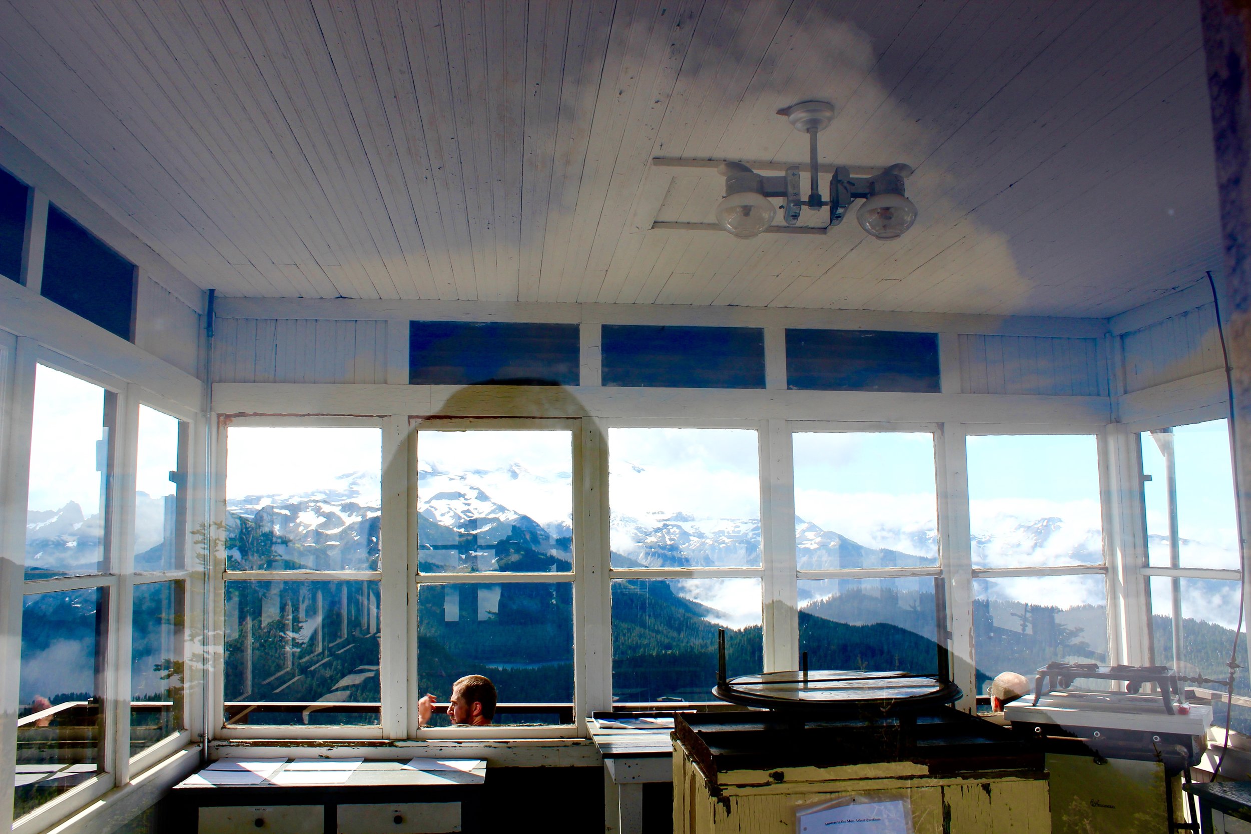
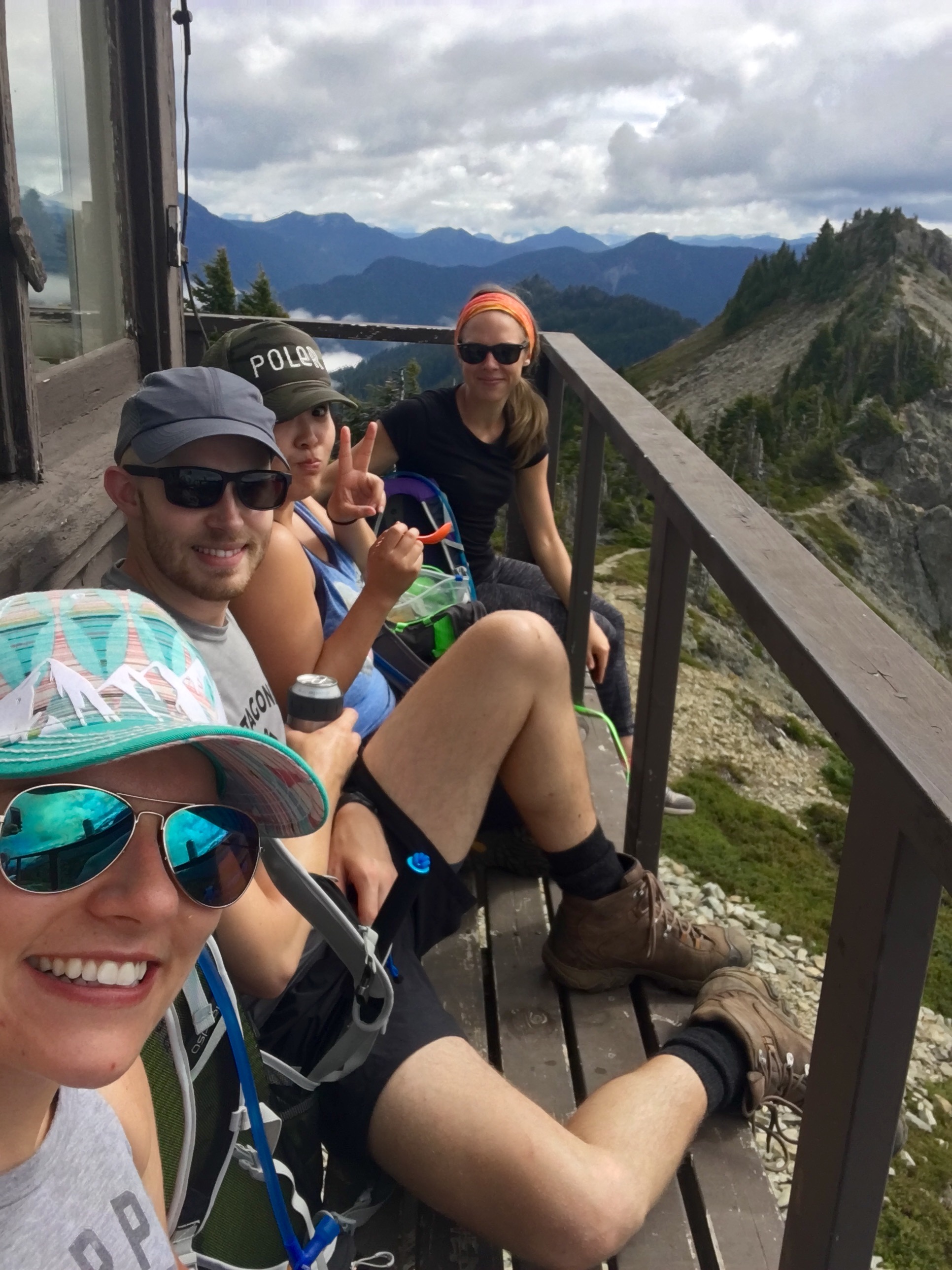
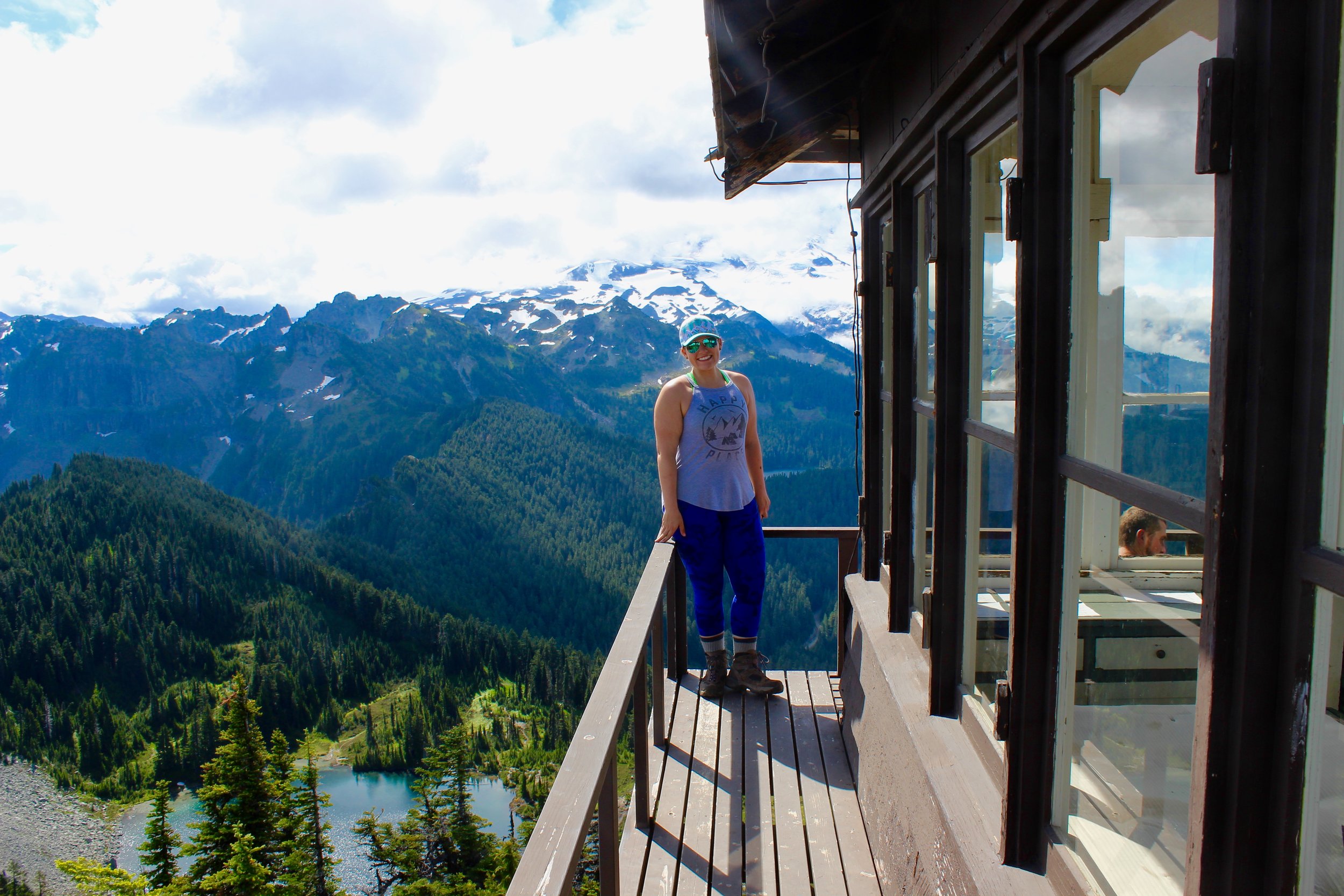
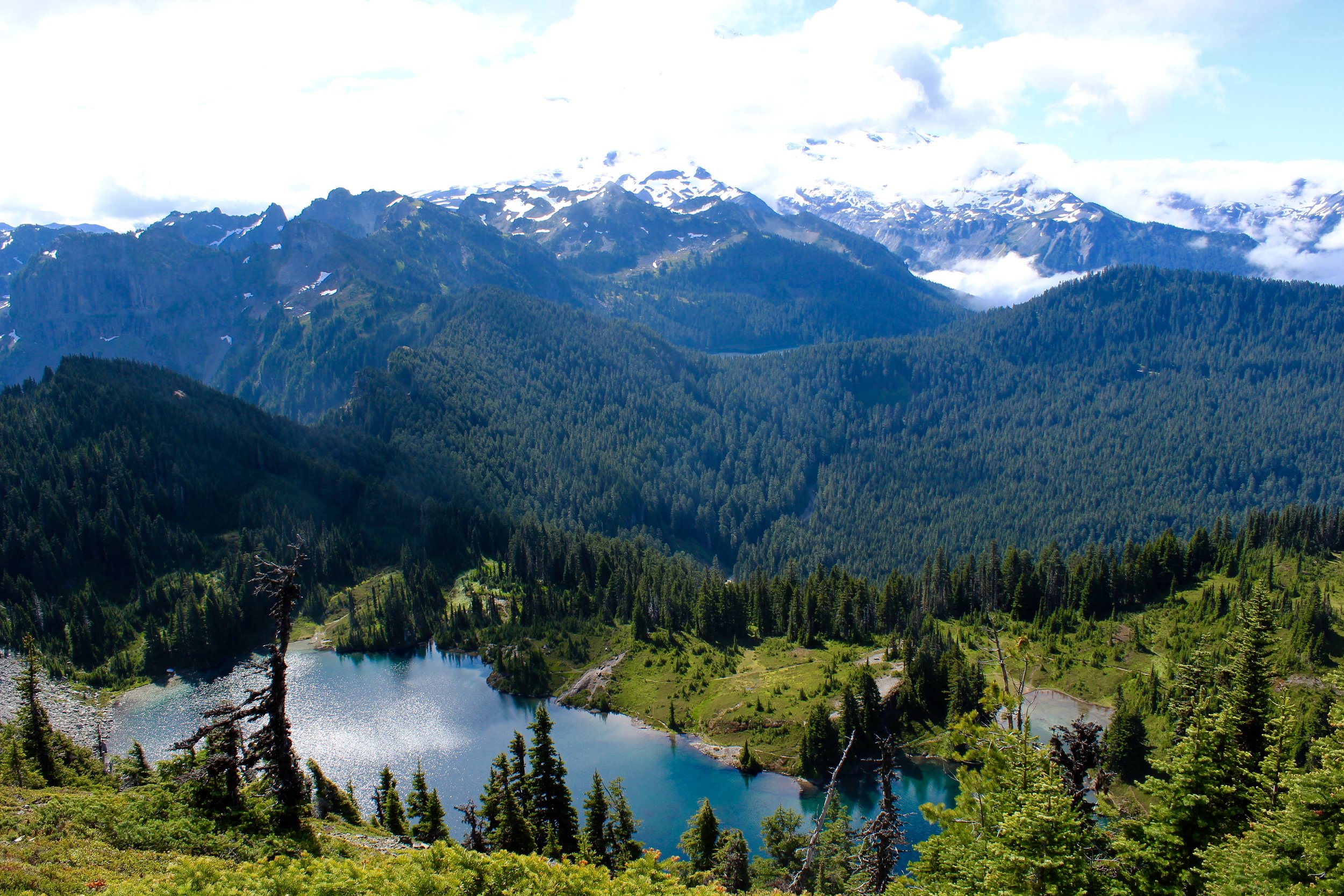
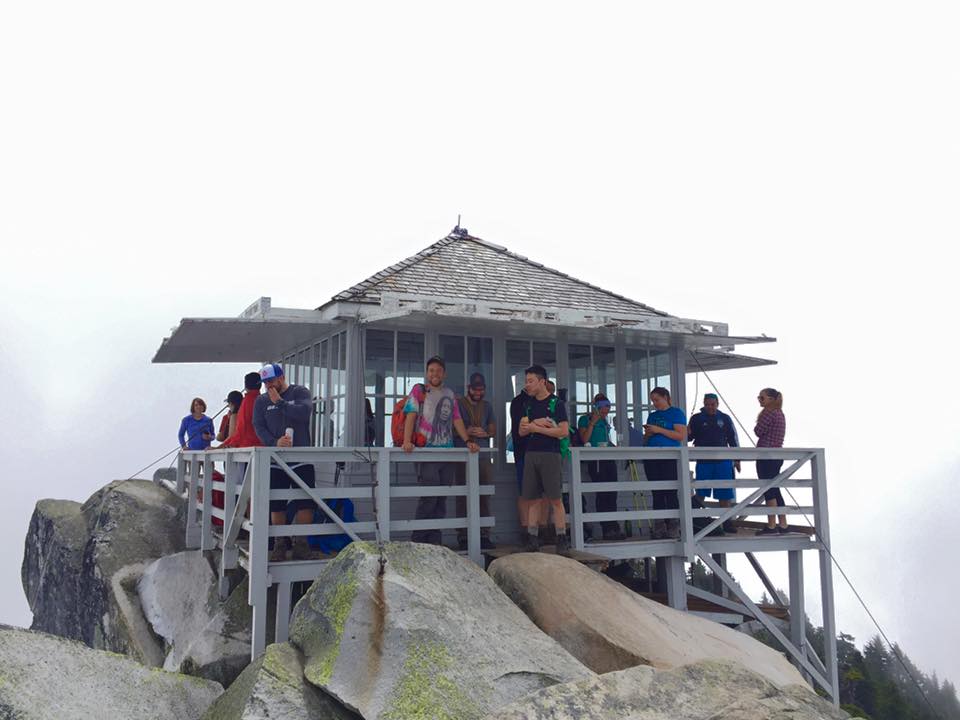
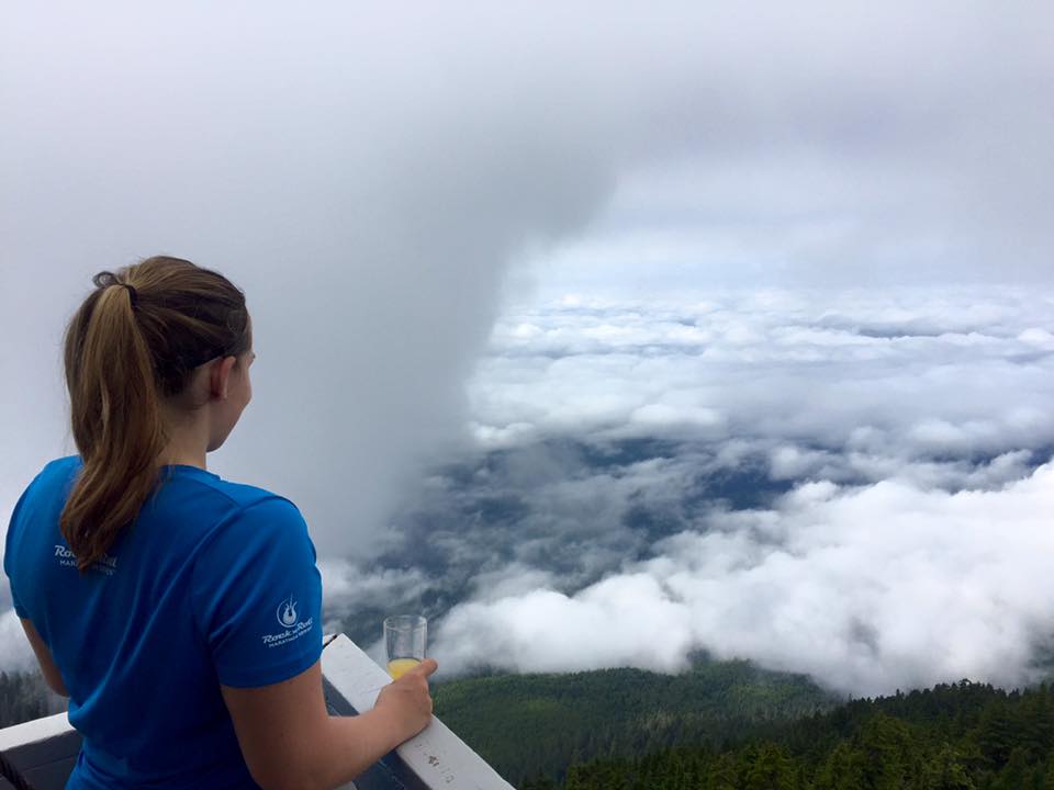
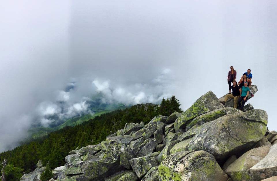
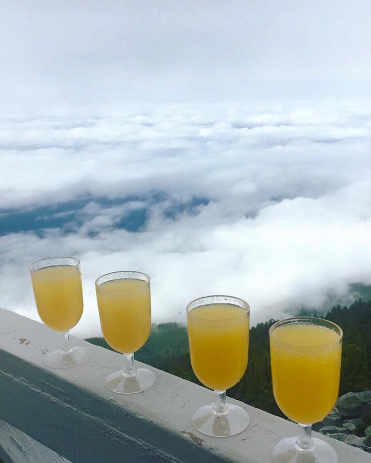
Once we were above the clouds we could see Mt. St. Helens, Adams, and even Mt. Hood in Oregon. That alone made this hike so spectacular and amazing. Every time I turned around I couldn't believe my eyes. We pressed on and set our sights on making it to 9,000 feet because then Camp Muir comes into sight. We came over a hill and I saw some wooden signs on a rock. Finally we could see the end in sight. That last 1,000 feet never seemed to end. At this time of the day the snow had become very sloppy and wet and was not fun to climb on as well. We pushed to the top and finally made it! I couldn't believe it. I was so proud of us. We actually made it to base camp of Rainier! The summit would only be 4,000 more feet. We conquered half of Rainier, it may have been the easier half, but still! We got to the top and collapsed on a rock amongst a huge party of people. It was super busy with day hikers and summiteers alike. Tents were set up everywhere for those going on to the summit the following day. There are different buildings ran by the guided groups to hold equipment and even a bunk house and toilets. The most awe inspiring was seeing the groups coming down who had just summited all roped up and filled with accomplishment. I have set my sights on summiting Rainier for awhile, but in this moment I knew that would be me. There was no question about that. If we could make it to base camp we could surly summit the whole thing (when conditioned to).

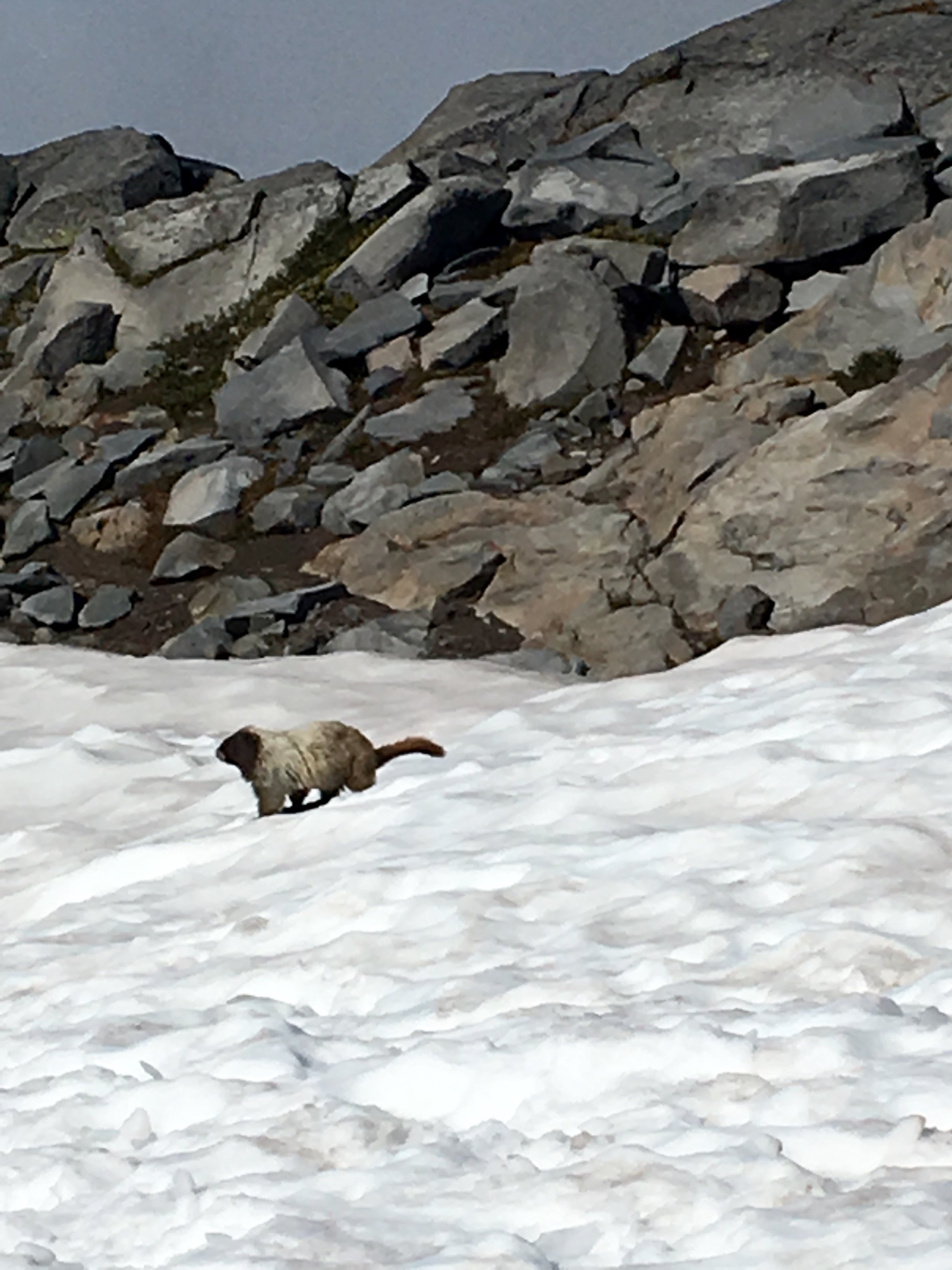
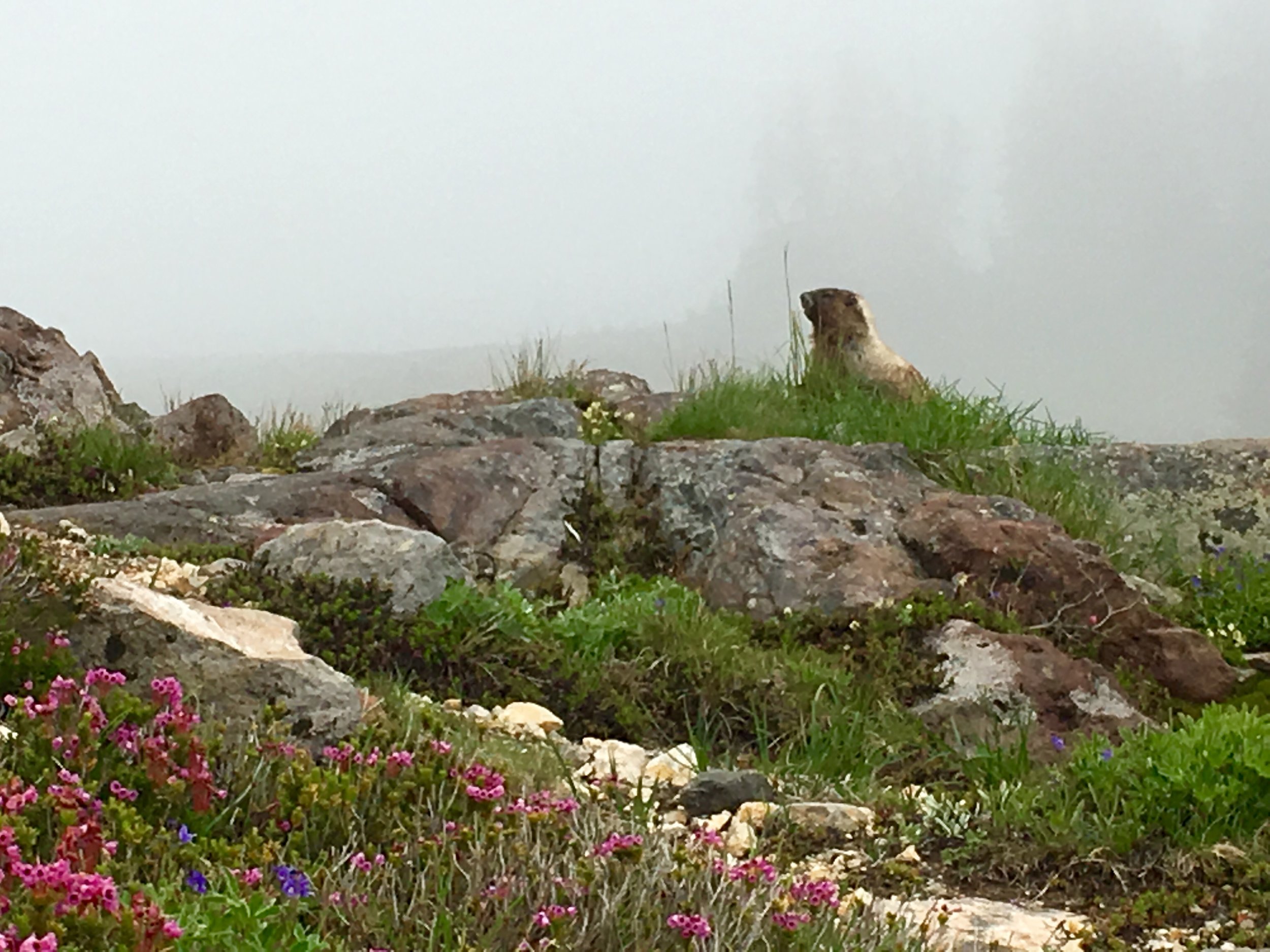
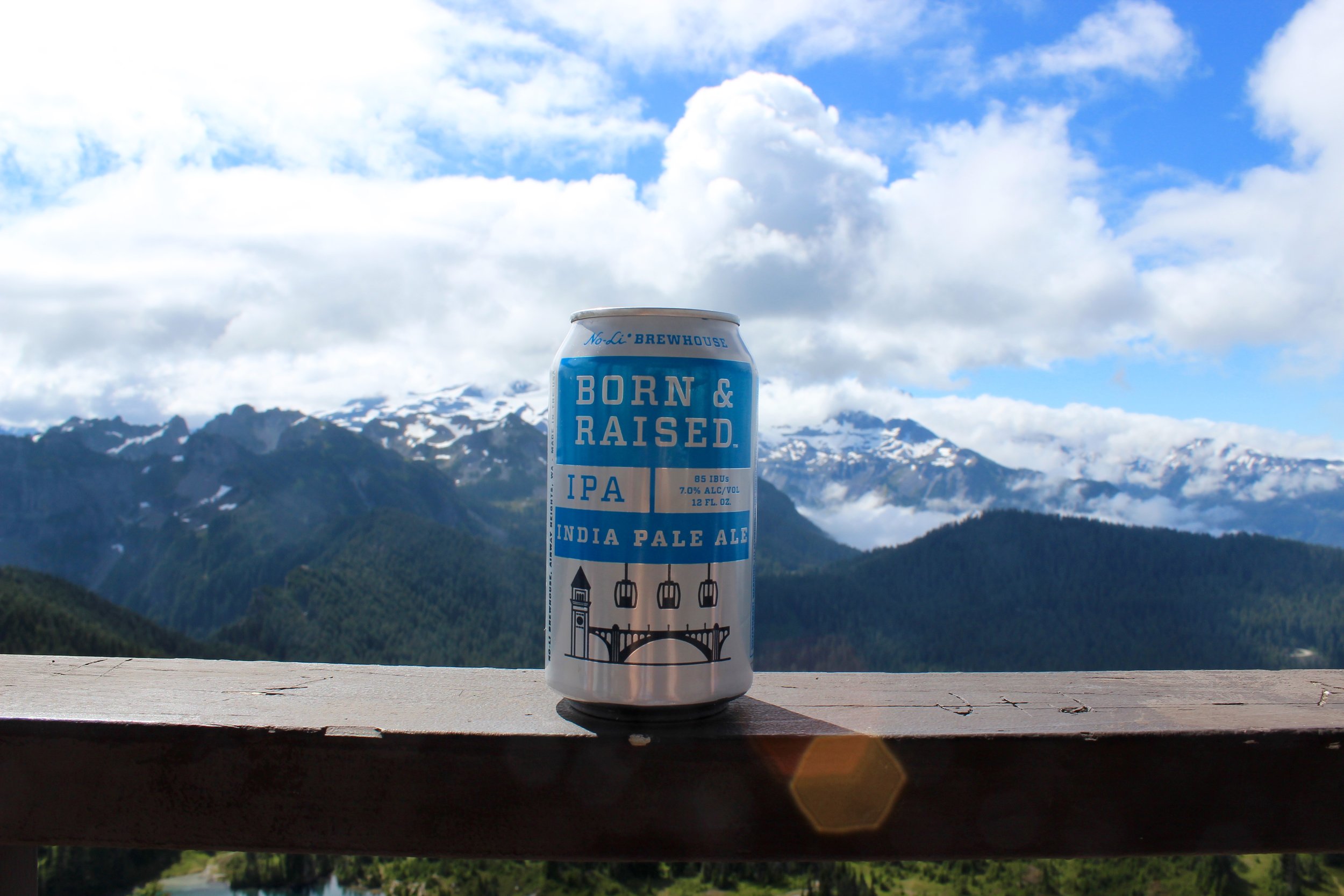
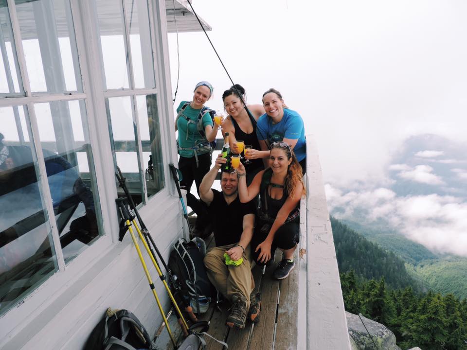
After an hour of snacking, relaxing, and soaking in the sun we decided to make the trek back down. The fastest and most optimal way to go down is to glissade. I had never done this before and looking at how steep some of the sections were I was down right scared to even try. When you are looking at these glissade shoots they are just long stretches of hollowed out snow were people have slid on their bumbs. We didn't have rain pants or garbage bags to sit on, but we sat on our rain coats and went for it. Since the snow was so wet we didn't go super fast on most of them, but we probably took 5-6 glissade shoots down and boy was it fun. New favorite way to get down a mountain! I ended up with soaking wet pants but it was worth it. We basically slipped and slidded down the mountain in seemingly no time. It was somewhere in here that I ran out of water. I had brought 2 litters and a big Gatorade. Thank goodness Ryan had a lot leftover or I would've been in big trouble. Being at high altitude dehydrates you like nothing else. We got to the lower skyline loop trail and it was packed with tourists enjoying the mountain. Oh, and we saw 4 marmots total! They are so cute and such a joy to run into. We even saw 2 of them wrestling it out. We made it to the bottom at 4:30. It took us 8 hours total with an hour at the top in there. We made it to the car and peeled all the soaking wet layers off of us.

We didn't have a campground booked for that night as they were booked up all around so we hoped to snag a last minute walk up.. I had 5 campgrounds on my list to check out going counter clockwise towards Sunrise. One after another was full and we were feeling hopeless on getting camping and the reality of just driving home was becoming clear. We were passing a sign that had a campground symbol so we pulled over fast to check it out. It said something about Horse campground meant for people with horses to camp there. This was not a campground ran by anything seemingly so we asked one of the 5 groups of campers what this was all about and if they had reservations. They said they just grabbed a sight so we did as well. We set up camp and finally relaxed with a beer after a long day. We were beyond exhausted so we went to sleep by 9PM. At about 2 AM I was abruptly woken by loud footsteps outside of our tent, a large shadow and some heavy breathing.... My heart immediately sunk as my mind went straight to BEAR. We were right outside of Mt. Rainier which has many bears and our food storage that night was not up to par at this make shift campsite. We kept our garbage bag with leftover food in our roof storage.. probably just smelly enough to lure any animal into our space. I could literally feel my pulse beating out of my chest as I panicked with what to do and if this was really happening. I woke Ryan up and whispered that I thought there was a bear outside of our tent.. his quick thinking was to set the car alarm off for about 10 seconds and then make a lot of noise after. We had the bear spray in hand and eventually took a look outside. We didn't see anything but we both had decided that we wouldn't be able to go back to sleep after that and did not want to be around when this possible bear came back to sniff around some more. We rushed and packed up the whole campsite within about 5 minutes and booked it out of there. Looking back this seems a little dramatic and we probably should've just slept in the car, but we were in bed by 4 AM so what ever. I don't play with bears. Proper food storage is very important and we learned a lesson that night.

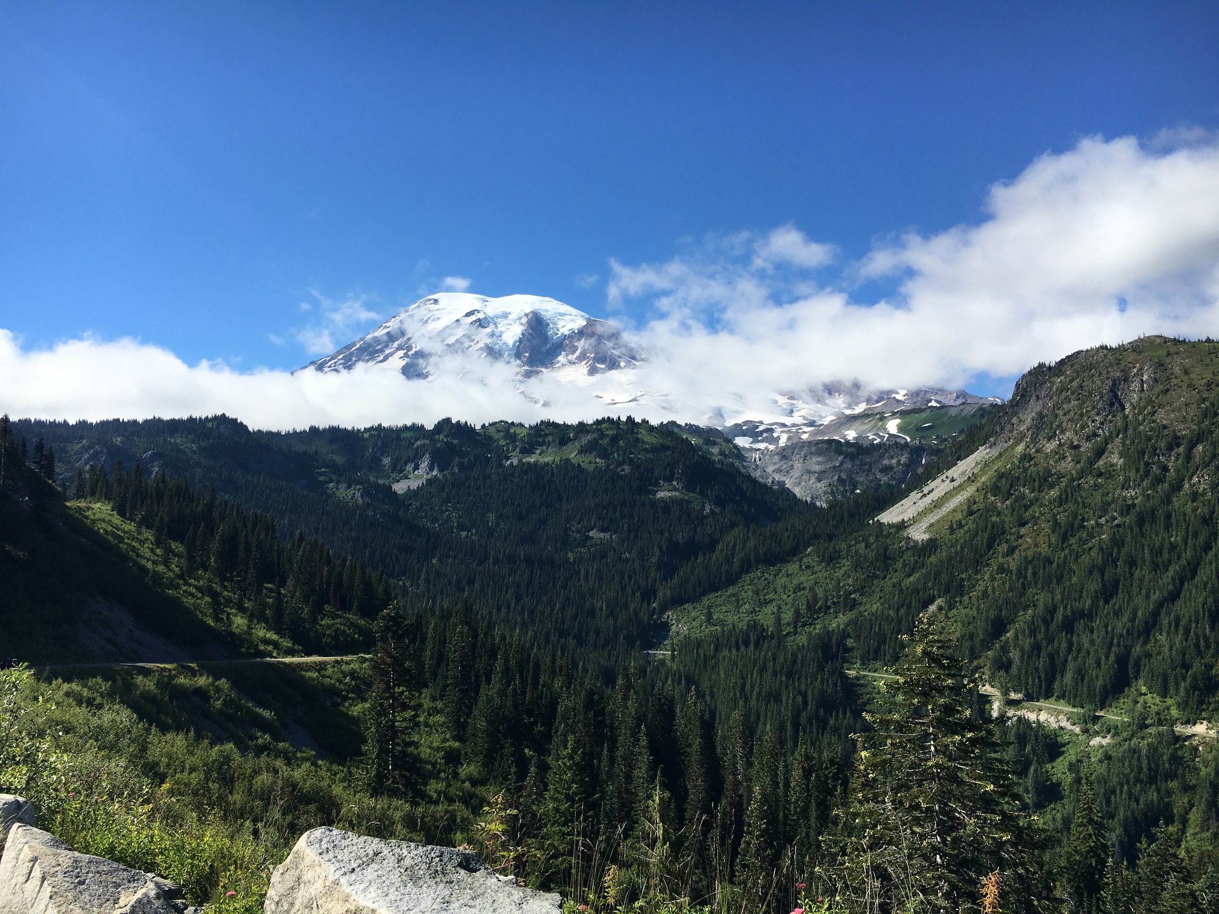
This hike left me feeling so full and inspired. Mt. Rainier will always be my favorite. I can't wait to make it up that extra 4,000 feet someday.

The mountains are calling and I must go, always.

Backpacking Packwood Lake

The trip that almost didn't happen? I say almost because the original plan was to hit the coast but the forecast called for lots of rain so that was a no go. We scoured and researched and read all the forecasts to see where in the state would be getting the lease amount of rain. Doris found Packwood Lake and the forecast didn't seem too bad so we settled on it. Packing for this trip went slightly better than the first time as I had a little more idea of what I was doing, still a newb in the world of backpacking though. I went through my list and made sure I had everything I needed. New supplies this time would be a sea to summit pillow (the best purchase ever), sawyer mini water filter, rain cover for backpack and my hammock.

We were able to get out of Seattle by 3:30 and with a few stops later made it into Packwood by 6. Grabbed some food and was to the trailhead before 7. Make sure you know your directions before getting into "desolate" places like this (no 3G service), or just rely on the locals like we did. Your call. We got everything together and hit the trail just before 7. We were both very anxious to get to the lake before dark and to not be setting up in the dark. The trail is 4.5 miles into the lake with a gentle incline most of the way. It was pretty delightful until it started raining more seriously and then we had to pull out the rain gear. We finally made it to the lake with plenty of light to spear. The lake was pretty busy with people already at their campsites up the lake. We went about a 1/2 mile up the lake and found the first decent spot to set up camp. Lesson of the day: don't set up your tent on any kind of an incline. This is probably common sense to most, but we had no option really and it didn't seem that bad at the time. Well as soon as we set up our bed I knew it would be an issue. There was no friction between my sleeping bag and the sleeping pad so I just constantly slid and always woke up in the fetal position. We woke up the next morning and decided to pack up and find a better spot for our second night. Oh, and our original plan was to go to Lost Lake the second night, 5 more mile up the trail. Thank goodness we didn't attempt that because we later heard that it was still under a lot of snow. So we went another 15-20 minutes up the lake and I spotted a camp site that we nearly missed because it was so secluded, the best kind. We set up camp yet again and set up the hammock as well. This thing is pure luxury out in the wilderness. Just a cup of tea and a good view to boot, the best. Also, I filtered water for the first time and didn't die, hooray!

Our plan for the second day was to try to hike around the lake since we had nothing else to do. We hiked about an hour up it and found out there is no trail that goes around the lake, only a trail that heads up to higher elevation. We made our way back to the campsite in mid afternoon and lounged around a bit before deciding to start a fire. We gather wood (small pieces), set up paper in it, lit match, after match, after match and nothing. Nothing would catch. Was the wood too wet? Was it too windy? Were we incompetent at starting a fire?.. Desperation came over both of us as we so badly wanted a fire but were not able to get it going. I wanted a cooked marshmallow, dammit! Well truly a gift from God, a younger man walked directly through our campsite (which no one else had and as he was still looking for a place to set up camp). Doris being braver and more exuberant than I (per usual)  asked him for help. He said sure and maybe within 20 minutes, we had a fire going. Pure trail angel right there. We would've been cold and in the dark all night if not for him. So we then spent literally 5 hours foraging for wood to keep this damn fire going. We weren't gonna let it die after all that trouble. We could only get smaller pieces of wood with no ax to chop up bigger pieces, so it was never ending. We roasted marshmallows, sipped boxed wine and enjoyed each others company for the rest of the night. Also, as far as backpacking food goes, you should definitely get Backpacker's Pantry Chicken and Dumplings. It is basically chicken pot pie, a hot meal never tasted so good.  That night was also the best night of sleep I have got backpacking yet. I will give it to a flat ground and a real pillow! The next morning we took our time getting up, eating breakfast, and soaking in the view one last time. We packed up and made our way back and within a couple hours we were back to the car.

Overall really great trip and would love to explore more of Goat Rocks Wilderness, specially high country.

The more I get into backpacking, get into the wilderness, get out of my comfort zone the more I learn. The more I grow as I person. The more I see what I am capable of and the more I fall in love with it's beckoning call.

"Earth and sky, woods and fields, lakes and rivers, the mountain and the sea, are excellent schoolmasters, and teach some of us more than we can ever learn from books."

- Sir John Lubbock

Mailbox Peak

9.4 Miles RT/ 4000ft elevation gain I had heard about mailbox before even moving to Seattle. I mean, hiking to a mailbox at a top of a mountain is pretty awesome! I had great company that day as well with 3 friends with. We set out early to conquer it, and conquer we did. I was sad that there was clouds to the south blocking views of Mt. Rainier. I guess I'll have to come back to see that another day. I also discovered from this hike that my hiking boots were not the right ones for me as they would leave me with a blister on the back of my heals. This was fixed within the next week with a trip to REI and a new pair of boots in hand.

Lake Cushman/ Staircase Rapids/ Copper Creek Trail

FullSizeRenderIMG_7720IMG_7729IMG_7757

Screen Shot 2016-04-24 at 8.26.02 PM
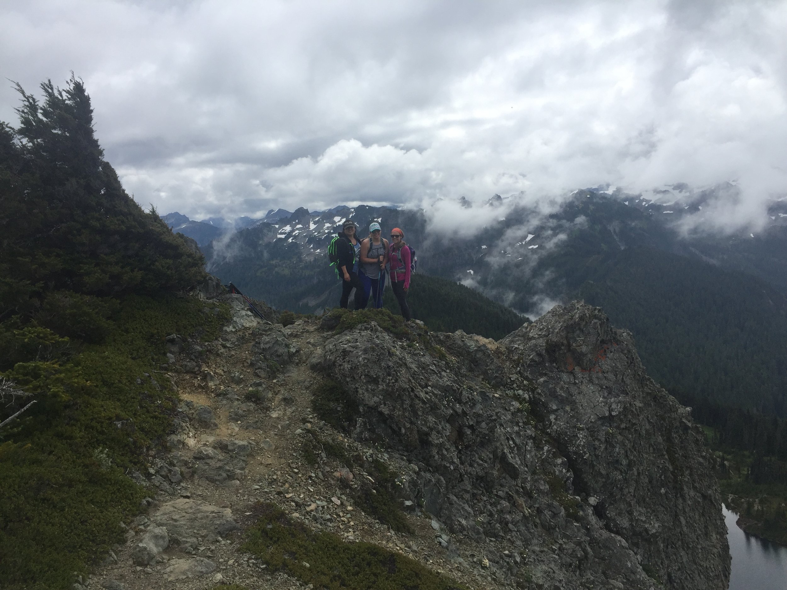
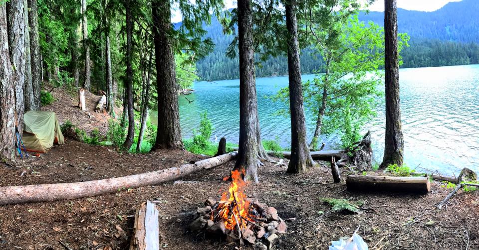
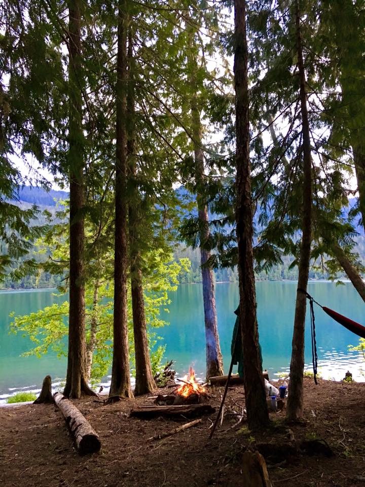
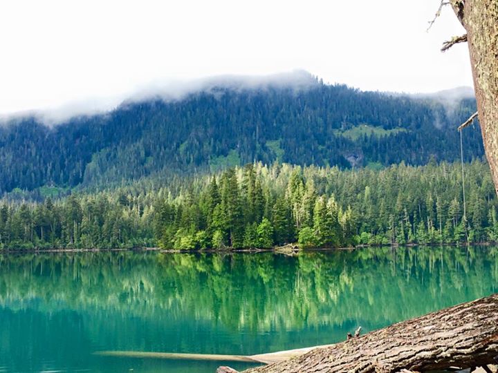
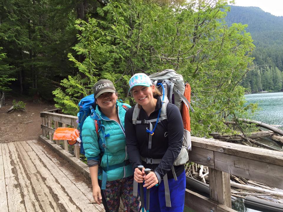
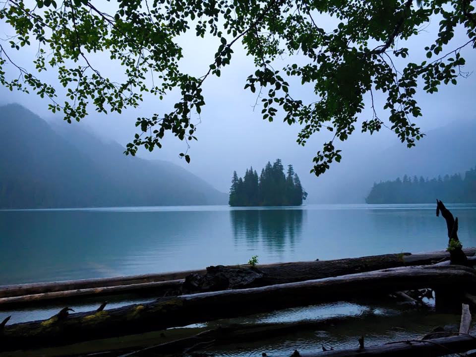
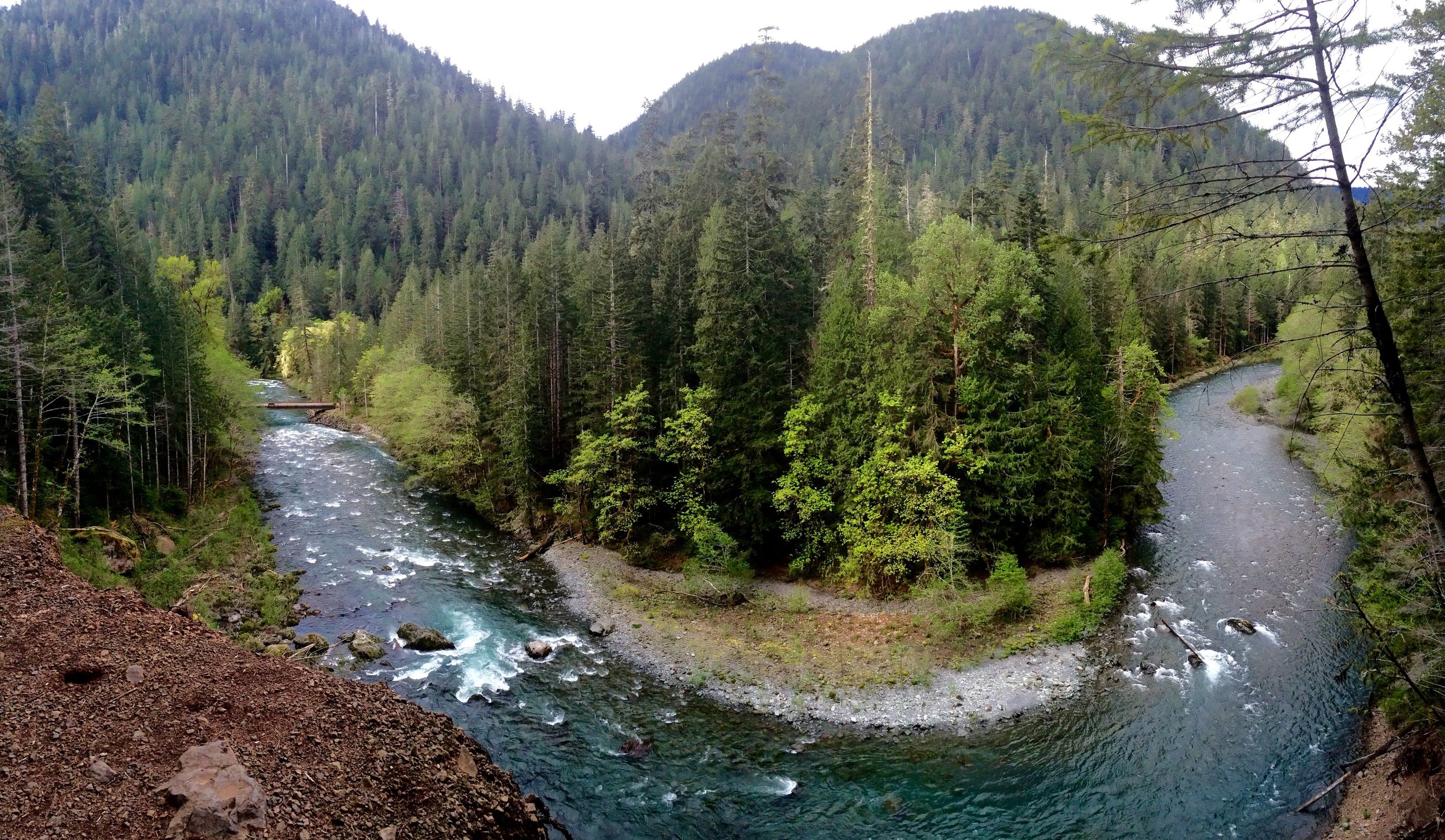
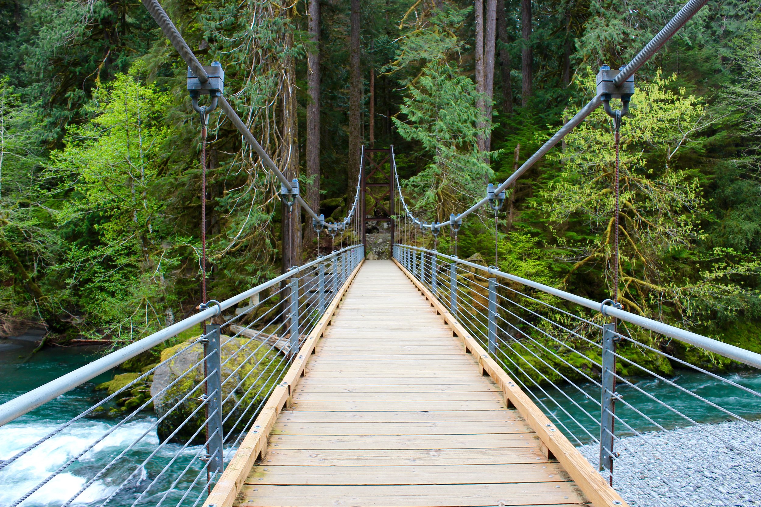
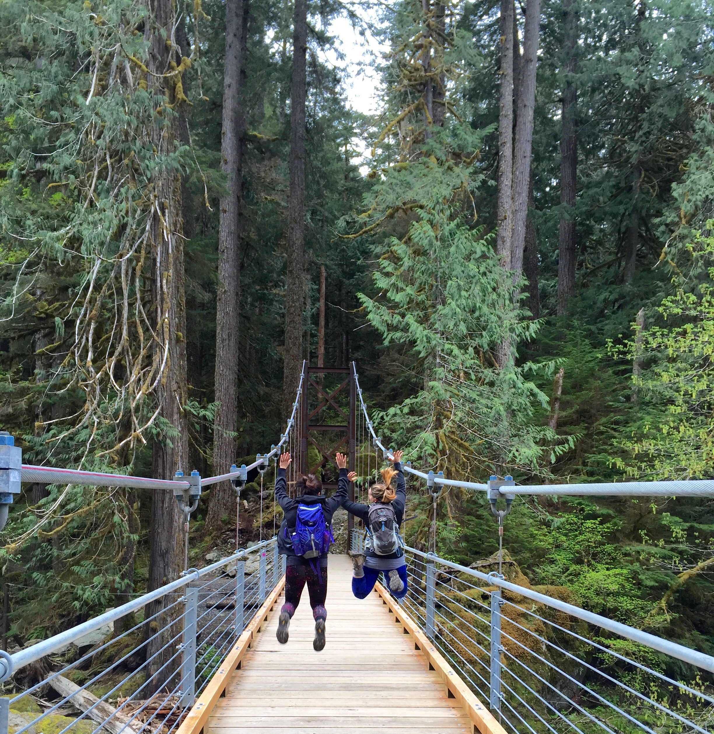
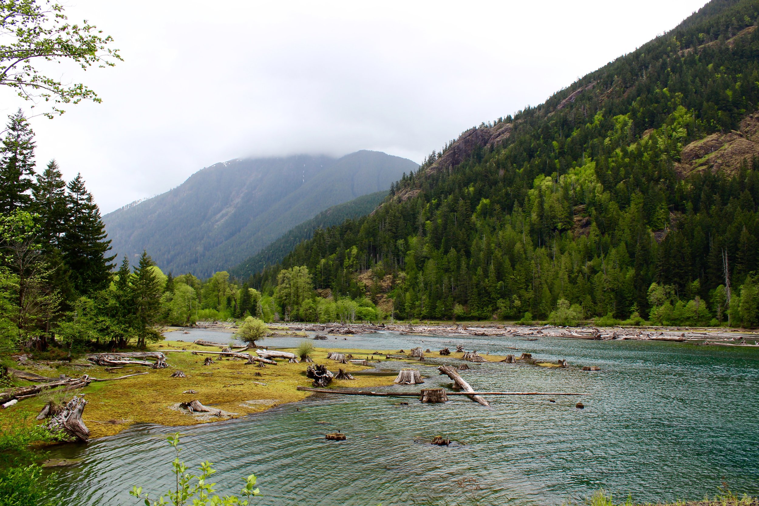
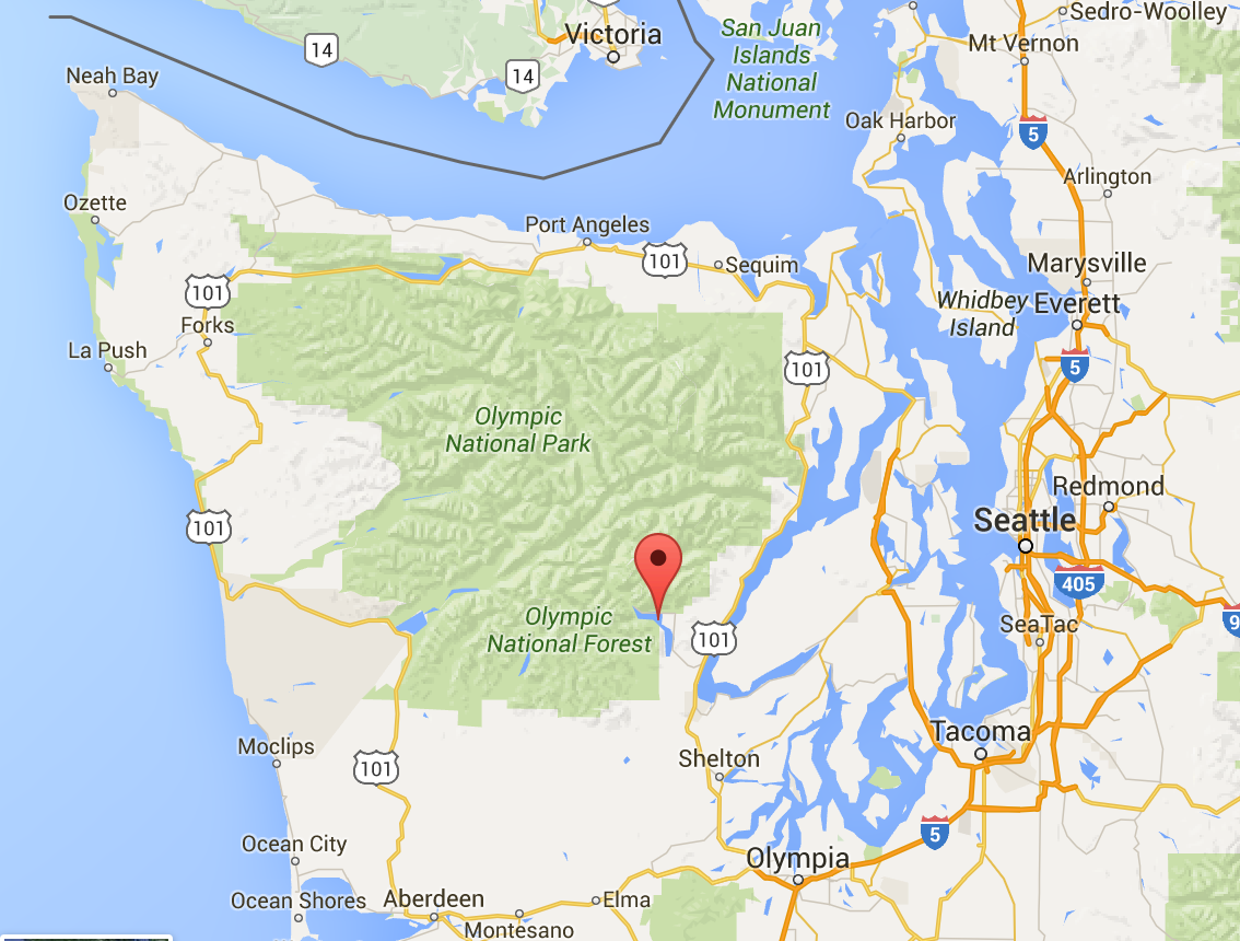
I wanted to see a different part of Olympic National Park then I had seen before, so I suggested we head over to the Lake Cushman area (indicated by the drop point above). You have to go down and around the water and go back up north to get to this area of the peninsula. It takes just a little over 2 hours from Seattle. So myself and two friends (Dorris & Amy) headed out bright and early to make this trek.

We started with the hike Staircase Rapids. I had seen many photos of this before and wanted to see it for myself. Washington Trails website says this hike is 4 miles round trip, but a sign there said 2, so we did something in-between that. Not really sure. It was a flat hike that had one major obstacle of a huge tree down that we had to navigate off path for. Then you get to this giant bridge that crosses the river. I really love bridges in forests so I was ooing and awhing over this one. The water was so blue in this area. There is a campsite right off the river that would be a lovely place to stay. We got back to the car after about an hour and a half and then headed to our next destination.

After a picnic in the car, we did Copper Creek next. There was probably a couple other options in the area but glancing at it on WTA, it seemed not too hard. Well I am still learning the ratio of elevation gain/miles and WTA said 5 miles roundtrip and 2400 elevation gain. I've done a lot of hikes comparable and didn't think anything of it. This hike was straight incline the whole time. I don't think I have done a hike that was this steep ever. We struggled hard core the whole way up. It felt like it would never end. We finally reached the top and unfortunately, there wasn't very good clearings of the views around. We saw a little section of the Olympics to our north, but I really hoped to have a good view of Lake Cushman to our south. We headed back down and over all it took us 3hr 20 minutes total.

Overall the area is gorgeous, but when I go back to visit this park I would love to go back and explore more of Hurricane ridge/ Hoh rainforest and the coast.


Mt. Si

We put our mind to doing Mt. Si this weekend, not really sure if we were ready, but went for it anyways. Mt. Si is 8 miles roundtrip and 3150 elevation gain- the most we have done yet. We knew we had to get out there early to get a parking spot and avoid a stampede of crowds. We left Seattle at 7AM and got there a little before 8. The parking lots was over half full at this point. We started the hike just around 8. The way up was a continual grade that was exhausting and difficult. The hike is rated expert. There really isn't much to see at all on the way up, no look outs at all. We stopped to rest maybe 2-3 times just to catch our breath before going on. The trail was very well maintained with no trees down or anything. 2 hours and 7 minutes later we got to the top and it was stunning. I would not recommend this hike on a cloudy day because what would be the point? Mt. Rainier will always be my favorite and this hike gave us an up close and personal view of her. We sat and adventured around the top for about an hour. I really could've stayed up there all day it was so beautiful. Oh, and we ran into a group from Minnesota and Wisconsin and one of the guys graduated in my husbands med school class and is a resident at UW. Such a small world. At the top there is a haystack that gets you 200 feet higher, but it is very advanced scrambling and we were not looking to die this day. We made our way down in 1 hour 30 minutes. After this hike we feel like we are ready for Mailbox. Won't be able to attempt it for awhile, but we're coming for ya.

Lake Serene

We left by 8:15 and got to the trail head by 9:30. I believe we took the very last spot in the parking lot. As the season goes on we are learning to leave earlier and earlier for hikes... We got on all our gear and headed on. It was a clear day which made the views along the way stunning. 2 miles in we hit our first landmark of the Bridal Veils falls. It was another half mile off the trail (and some crazy incline later) and we were there. The falls themselves are a sight to see. We stopped here for awhile and then were on our way again. The incline got pretty serious at this point and felt never ending. 2 more miles felt like an eternity. There were many streams to cross and trees to climb over/under along the way as well. I read that .5 mile from the lake the snow started, this was about accurate. We got to try our new handy dandy Yaktrax's at this point. We learned our lesson from Lake 22 and slipping and sliding everywhere. They gave us just the traction we needed + our poles and we were golden. We finally arrived at the lake and yes indeed it was serene (except for the somewhat large amount of people). We wandered around the lake a bit taking in the views and just enjoying the moment. It was at this moment where we were wishing we had a stove to make some freeze dried warm comfort food + coffee after this long trek. Our Cliff bars and jerky would have to do. Up until this point the hike had taken 4.5 hours. The trek down took about an hour and a half making for a total of 6 hours for almost 9 miles and 2000 feet of elevation gain. By the end we were wiped out, feet sore and ready to relax. Thank goodness we got to end the day by going to get ciders with new friends. Another great day in the PNW. IMG_7117IMG_7120IMG_7124IMG_7127IMG_7132IMG_7145IMG_7149IMG_7158IMG_7168IMG_7172IMG_7197IMG_7209

Franklin Falls

IMG_7015IMG_7022IMG_7027IMG_7029IMG_7036IMG_7049 (1)IMG_7069IMG_7072IMG_7074

My new friend, Doris, invited me to a hike with two other people I had never met. I jumped at the chance, of course, and we began our journey out early. We were moseying to the trail head when out of no where the road was completely blocked with snow. Our only option was to get out and walk to the trailhead. We had to walk about a mile to the trail head. The road/trail was way snowier than we expected. I did not dress appropriately for this and am slowly learning my lesson with proper clothing choices. I also should have brought my new Yak Trax's as there were some really slippery spots along the way. We got to the waterfall, finally, and it was so beautiful. We didn't stay long because it was really cold and windy down there! On our way there we saw one group of people that didn't go all the way to the falls because of the snow. On our way back we saw probably 30 people heading to the trail. I love early hikes with minimal people. This is the way to do it people. Overall a day of snow adventures, magical snow covered trees, a beautiful waterfall and 3 new friends.

Oyster Dome

We left by 9 AM to head to Oyster Dome, which is about an hour and a half north of Seattle. I read over and over again that this is an awesome winter hike, and it did not disappoint. The parking for this hike is just on the side of the road off of the trail head, so get here early as there are not many spots. We were truly blessed with a sunny, clear day. A rare gem in the PNW. We started out on the trail, and like I read, the beginning is really steep. This hike was 6.5 miles and 1900 ft elevation gain, the longest and steepest hike we've done to date. Just making our way up to longer and bigger hikes (here's looking at you Mailbox Peak) . After a mile into the trail you get a wonderful lookout point that is a taste of what is to come. We trekked the 2.25 more miles to the top over streams, rocks and steep, steep terrain. We finally made it and the view was breathtaking. It was clear, sunny and could see for miles and miles. What you are seeing in these photos are the Orcas Island, only accessible by ferry, obviously known for the Orcas whales that come up this way. Could even make out the top of the Olympic Mountains in a distance as well. We sat at the top for about 30 minutes snacking, enjoying the view and taking in the rare vitamin D. After awhile, we packed up and made our way back down in lightening time. So SO much easier with our poles on the way down helping us move a bit faster, but with some extra support not to fall (which would happen to me very easily). Overall a very beautiful hike with some amazing views. Probably a winter tradition, but save it for a sunny day!

Lake 22

We left for the hike by 9 and got to the trail head by 10:15. Learning to leave earlier and earlier for hikes as small parking lots fill up crazy fast. We put on our packs and hit the trail. It started with some easy incline for over a mile. With snow melting up the mountain, the whole trail was basically a river. Time to put the Oboz hiking boots to the test. At some points there were full on water falls to cross, but nothing impassable. We got to a clearing on the trail that turned to all very steep rock. This part was more difficult to get through and around fallen trees. Another half mile or so and we finally reached the lake. Leading to the lake was compact, slippery snow. We are learning more and more what gear we need by when we don't have the correct gear. Spikes would have been really great for this hike on the snow. We did have our trekking poles with that helped a lot. The lake was just another world, something you have to see with your own eyes to really capture the beauty of it. Snow covered mountains, a frozen lake and peace transcended the air. We hung out in the middle of the lake for awhile having a snack and savoring the beauty. We made our way down the mountain with the whole trip taking about 3 hours. Lake 22 will need to be a winter hike norm. IMG_6846IMG_6867IMG_6868IMG_6870IMG_6875IMG_6892IMG_6899IMG_6901IMG_6904 (1)IMG_6928IMG_6931IMG_6939IMG_6833

Little Si

We have some pretty big (for us) hiking goals, so slowly making our way up bigger and steeper trails. We would love to do Mt. Si, Mailbox Peak, and possibly make it to Camp Muir this summer. Getting a head start on this in February should help condition us to make it happen.

Little Si is 4.7 miles round trip and 1300 elevation gain. Mt. Si is 8 miles, 3150 elevation gain, yikes. This hike wasn't too terribly hard at all. The middle leveled out with some steepness at the end, but not unbearable. The summit was busy and over run with families and the view was alright, not as good as Rattlesnake. It was much more enjoyable without the pooch (sorry Cooper, some day you'll be ready to hike). The hiking boots are wearing in nicely and we are learning more and more each time (like needing a Discover Pass to be in a state park, hello). Our next investment is in 2 Opsprey day packs (talon 22 for him and tempest 20 for me). These should be really good 3 season, day packs. What I mean by that is being able to use it when it's cold and pack many layers with. Probably getting them within the next week to use the current REI deal. They always get us.